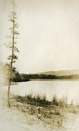
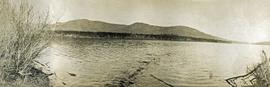
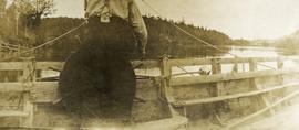
Showing 1204 results

Archival description
1071 results with digital objects Show results with digital objects
2014.10.1.179 · Item · 1911
Part of Arthur Holland Land Surveying Collection

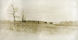
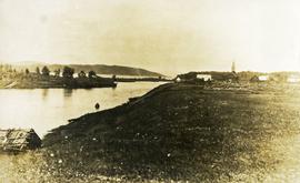
Photograph depicts a cluster of buildings near Fraser Lake. A fence and grasses in the foreground. Original photo title: "Indian Village at Fraser Lake." First Nations communities with territories overlapping Fraser Lake include Nadleh Whut'en and Stellat'en Nations.

2009.7.1.248 · Item · ca. 1880-1920
Part of Archdeacon W. H. Collison fonds

Head on shot of steam engine traveling through a pass with mountains in the background. Handwritten annotation in pen on verso reads: "First Passenger Engine to reach Prince Rupert." Annotation on recto reads: "First Passenger Engine at Prince Rupert." Photographer' stamp in bottom right corner of recto reads : "Allen Photo."

Five boats breaking ice
2014.10.1.138 · Item · 1910
Part of Arthur Holland Land Surveying Collection

Photograph depicts five long canoes with several men attending. The canoes are traveling through a narrow strip of open water. The majority of the river is covered in ice. Forested trees are on the far river shore.

Five boats breaking ice
2014.10.1.139 · Item · 1910
Part of Arthur Holland Land Surveying Collection

Photograph depicts five long canoes with several men attending. The canoes are traveling through a narrow strip of open water. The majority of the river is covered in ice. Forested trees are on the far river shore.

2006.25.1.71 · Item · Nov. 1962
Part of Al Elsey Moving Images Collection

Footage of ducks on a lake and flying away, horses in a corral, a campsite, caribou in the high country of the mountains, probably the Rainbow Mountains, a campsite where men are packing horses and game kill and their journey home in pack train.

Possible locations of filming include Anahim Lake, Chilcotin area, Holt Homestead, Rainbow Mountains, Tweedsmuir Provincial Park, or Wells Gray Provincial Park.

Fort Alexandria
2012.13.2.19.07 · File · 2007-2010
Part of J. Kent Sedgwick fonds

File consists of notes and reproductions relating to Fort Alexandria (later renamed Alexandria). Fort Alexandria was an HBC trading post, ferry site, and steamboat landing in the North Cariboo, 45 km south of Quesnel. File contains photographs depicting Fort Chilcotin, the landscape and buildings (Sept. 1983 and Aug. 2006).

Fort George Canyon
2012.13.2.03.05 · File · 1982-2007
Part of J. Kent Sedgwick fonds

File consists of notes, clippings, and reproductions relating to the Fort George Canyon. Includes: "City of Prince George" typescript letter from Kent Sedgwick to Mr. Ron Drane, Manager of Pine Centre (7 June 1984) and "Fort George Canyon Hiking Trail" pamphlet published by the Fraser-Fort George Regional Museum (July 1984). Also includes photographs depicting the Fort George Canyon and men hiking the trail (1985).

Frank Cyril Swannell
2000.23.1.097 · File · 1977-1991
Part of Audrey Smedley L'Heureux fonds

File consists of material relating to Frank Cyril Swannell, a surveyor of British Columbia. Materials include a magazine, correspondence, newspaper clippings, photograph reproductions, journal articles, and journal notes compiled by Audrey L'Heureux. Highlights include:

  • Swannell, F.C, "Report on Topographical Surveys in Omineca District", 1912 (reproduced journal article)
  • Corporation of Land Surveyors, "The Link", Vol.1 No.2 , 1977 (magazine)
  • BC Provincial Archives, "Exploring Surveyors Making Canoe Finlay River", 1913 (photograph reproduction)
  • BC Provincial Archives, "Surveying Omineca Exploration", [191-?] (photograph reproduction)
2021.06.011 · Item · [July 1930]
Part of Emil Bronlund Photograph Collection

Photograph depicts Frank 'Shorty' Weber steering a dug-out canoe on the Omineca River. The background of the photograph depicts log cabins at Old Hogem built along the shoreline of the river in front of a forest with a mountain ridge in the background.

Frank ‘Shorty’ Weber had a trapline on the upper Ingenika for over 30 years. and he was well-known in the Finlay River area.

Frank Swannell
2012.13.2.02.31 · File · 2002-2008
Part of J. Kent Sedgwick fonds

File consists of notes, clippings, and reproductions relating to Frank Swannell, who was a surveyor in British Columbia that surveyed many areas across the province between 1898 and 1908.

Fred Burden
2012.13.2.02.30 · File · 2001-2006
Part of J. Kent Sedgwick fonds

File consists of notes and reproductions relating to Fred Burden, a surveyor in British Columbia who surveyed tar sands in the Fort McMurray region and returned to Prince George in 1921 to complete a topographical survey of Prince George.

From Summit Lake
2014.10.1.121 · Item · 1910
Part of Arthur Holland Land Surveying Collection

Photograph depicts two men preparing to load a canoe on a wagon. Two blanketed horses stand nearby with one person attending. There is a lake in the background, wild grasses and brush in the foreground.