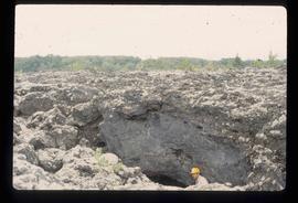
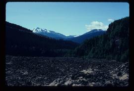
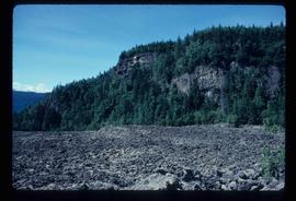
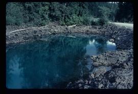
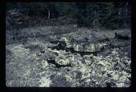
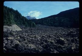
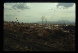
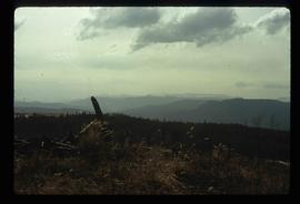
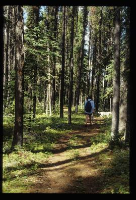
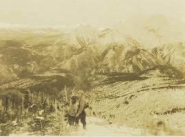
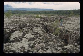
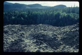
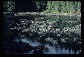
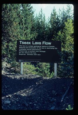
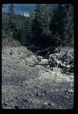
Image depicts an unknown individual standing on the Tseax Lava Flow.
Image depicts Kent Sedgwick standing in a drainage tunnel of the Tseax Lava Flow.
Image depicts the Tseax Lava Flow, with mountains in the distance.
Image depicts old lava cliffs and the Tseax Lava Flow in Nisga'a Provincial Park, near New Aiyansh, B.C.
Image depicts what appears to be a small pond near the Tseax lava flow.
Image depicts the Tseax Lava Flow. The slide is labelled "pressure ridges."
Image depicts a shallow river running over and through the Tseax lava flow.
Image depicts a sign at the Tseax Lava Flow asking people to not remove lava from the site.
Image depicts a stream running through the Tseax lava flow.
Image depicts the Tseax Lava Flow, looking up valley.
Image depicts the Tseax River.
Image depicts the Tsek'enhe cemetery at McLeod Lake.
Image depicts the Tsilcoh Falls, north of Fort St. James and somewhere near Pinchi Lake Road.
Image depicts two unknown individuals at the Tsilcoh Falls, north of Fort St. James and somewhere near Pinchi Lake Road.
Hand coloured photograph of the surrounding lands and many residential buildings encompassing the Tsimshian village of Lax Kw'alaams (previously called Port Simpson). Printed annotation on recto reads: "Indian Village, Port Simpson, B.C."
File contains slides depicting Tumbler Ridge.
Image depicts a view of the scenery in Tumbler Ridge, B.C.
Image depicts a view of Tumuch Lake Valley, south-east of Raven Peak.
Image depicts the White Pass Train entering a tunnel in the mountain side.
Image depicts a small section of Turner Lake, with what is most likely Glacier Mountain in the distance; they are located in South Tweedsmuir Park, B.C.
File contains slides depicting Turner Lake and other areas of the South Tweedsmuir Provincial Park.
Photograph depicts a view of Tutizzi Lake in the summer near Jack Baker's cabin.
File consists of the "Tweedsmuir Master Plan" prepared by the Province of British Columbia.
File consists of a book and typescript correspondences. Includes: "Tweedsmuir Provincial Park Background Document" by the Province of British Columbia (1986).
Trees on mountain base visible in background.
Image depicts two campers at an uncertain location, possibly somewhere near Meldrum Creek, B.C.
Grass in foreground, trees in background. Photograph speculated to have been taken in Nass Valley, B.C.
Image depicts two dogs and a person walking on a path through the woods somewhere in Carp Lake Provincial Park.
Photograph depicts two large snowbanks flanking a walkway with houses visible in the background.
Image depicts two men on the hiking trail near Mt. Robson.
Photograph depicts two unidentified men cooking on a fire at a camp site with a forest visible in the background.
Handwritten caption beside this photo reads: "Cutting Fire Wood". Photograph depicts two men on either side of large log using chain saw in wood clearing. A small snow-covered building can be seen in background.
Handwritten caption above this photo reads: "Cutting Fire Wood". Photograph depicts two men on either side of large log using chain saw in wood clearing. A third man is watching them from behind the saw. A wood pile and small snow-covered building can be seen in background, as well as what is believed to be a caterpillar bulldozer.
Photograph depicts two unidentified men at high elevation on mountain. Trucks and tanks visible in background, hose (possibly of air track drill) in right foreground. Mountain range in background.
Photograph depicts two unidentified men on road or mining bench at high elevation on mountain, valley in background.
Photograph depicts two unidentified men, one with binoculars in hand, stand on a snowy mountain peak in search of game. Snowy mountain peaks visible in the background.
Handwritten annotation on recto of photograph: "Bill Giachino & 'Sam' June 1970 / #4 / 74% / by Tom Kiefer".
Photograph depicts two unidentified men walking on a wooden bridge in a forest.
Photograph depicts two unidentified men on a wooden bridge that leads through a heavily wooded area.
Photograph depicts two men on horseback and a full laden pack horse riding across a grassy slope with a forested mountain range in the background. The location of photo is between Wapiti Lake and Red Deer Valley.
Photograph depicts two men on horseback and two fully laden pack horses riding across a grassy slope near a forest. In the background a mountain range is visible. The location of photo is between Wapiti Lake and Red Deer Valley.
Photograph of two men posing with large surveyor's measuring sticks in a forested area during winter.
Photograph depicts two men sitting on a staircase of a wooden walkway leading through a forest.