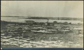
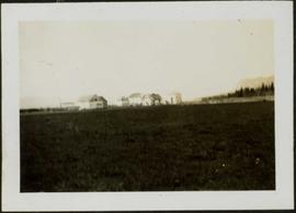
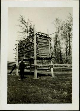
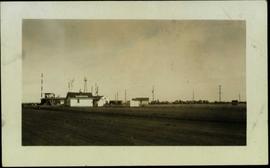
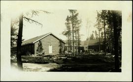
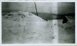
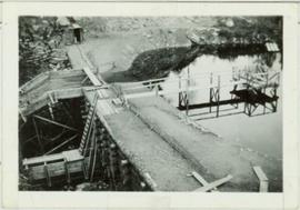
Photograph depicts snow bank between construction camp and railway tracks. Power lines and forest trees in background.
Photograph depicts a young woman believed to A.K. Bourchier's niece Jean. Young colt stands on right, picket fence and porch to wood building in background. Handwritten annotation on recto of photograph: "To my dearest Uncle Alan. This is little Betty Beauty's little colt. I broke her in to lead myself so I feel quite proud."
Photograph depicts small building speculated to be a house in a farm yard. Frozen water crosses midground, opposite shore in distance.
Photograph depicts a woman, man and young girl believed to be A. K. Bourchier's niece Jean, standing on front balcony of house.
Photograph depicts people and tree stumps in grass areas. Buildings stand on higher level in midground, forest in background. Handwritten annotation on verso of photograph: "Giscombe Portage. B.C.", on recto: "Seaback & Huble"
Photograph depicts Bob standing to right of house, holding an eagle by the wings. A very young Alan stands beside him, and younger brother Fred in front. Short wood fence crosses midground, trees in background. Typed annotation on recto of photograph: "Quesnel B.C. 1936 Northern B.C. Eagle shot at Dragon Lake, B.C. 7 ft. 6 in spread. Mounted by Jack Lestin, Prince George,"
Photograph depicts Bob holding a cat in doorway of unidentified wood building. A dog stands at his feet in walkway leading up to them in foreground. Wooden barrel and miscellaneous items stand against house in background.
Violet sits on wood ladder leaning against siding of house. She is wearing a skirt, blouse and scarf. Bottoms of windows are visible above and behind her.
Violet Baxter's younger brother Tom Taylor stands in dress suit in gateway of picket fence. Unidentified building and porch in background.
Violet (nee Taylor) Baxter and Ellen (nee Taylor) Garland stand wearing formal attire in dirt area. A lumber pile and unidentified man can be seen behind a fence that crosses the midground. Power poles and other buildings in background.
Front, left to right: Hermina Taylor, Kay (nee Irwin, wife of Arthur Taylor), Violet and Bob Baxter. Back, left to right: [Ellen?], Percy Garland (husband to Ellen Taylor), [Tom Taylor?]. Hermina holds a baby, speculated to be Ian or Jillian (children of Arthur Taylor). Houses stand in background behind road.
Annotated overview of the Quesnel Quartz Mine Camp, with buildings numbered and a corresponding legend provided. Annotation on recto of photograph states: "1. BRIDGE OVER CREEK 2. BLACKSMITH SHOP 3. POWEROUSE 4. HEADFRAME OVER 200' SHAFT 5. OFFICE 6. WATER TANKS FROM POWERHOUSE 7. BUNKHOUSE 8. TRUCK 9. COOKHOUSE BEHIND #6 CANNOT BE SEEN" Additional annotation associated with photograph states: "We were always able to find the cookhouse even though hidden in this picture. Taken about 1935 by Russell Ross Supt. Quesnel Quartz Mine"
Photograph depicts a dam and wooden spillway along a creek. Annotation on verso reads: "This is the dam and spillway about 9 miles up Hixon Creek belonging to the Hixon Creek Cariboo Gold Co. Original handwritten annotations on verso of photograph are signed by Tom Marsh and covered by mounting the photo on paper. Photograph is taped to paper. Typed annotation on recto of paper reads: “This is the dam and spillway about nine miles up Hixon Creek belonging to the Hixon Creek Cariboo Gold Co., whose main camp on Hixon Creek was at the falls. A fellow Sterling or (Bill) Tordiffe & I took a contract to cut the logs for this dam in January 1934. The first few winters Quesnel Quartz had to shut down for snow."
Photograph depicts a street scent at the corner of Laselle and Second St. in Fort George. A wagon is visible in the dirt road and wooden buildings cross the mid ground. Three unidentified men sit on the boardwalk outside Rigg's Restaurant while one man stands in the doorway of The White Laundry.
Photograph depicts a group of buildings in distance behind fenced area. Field spans foreground and stand of trees in background. Handwritten photo caption below photograph reads: "H.B.C. Fort St. James ."
Photograph depicts man standing in front of elevated, rectangular cache made of wood. Trees stand behind log fence in background. Handwritten photo caption below photograph reads: "Indian Cache." It is believed that this photograph may have been taken near Fort St. James, BC.
Photograph depicts group of buildings at Grande Prairie airstrip. The foremost building has the sign "YUKON SOUTHERN" on its roof, and the tower and admin building can be seen behind. Power poles, large trucks, and other large unidentified machinery are lined up in background on right.
Sans titreHandwritten photo album caption below this photo reads: "Barracks at Watson Lake". Photograph depicts long building built in U shape. Wood piles and miscellaneous items can be seen in foreground.
Sans titrePhotograph depicts very large snow pile in plowed yard. A small building with a log roof is semi-visible behind snow on far right.
Handwritten caption beside this photo reads: "Fred Youngstrom & Kitchen Staff. 1946." Photograph depicts Fred standing to right of three woman, a young girl, and a dog. The group is standing on the snow-covered front steps of a (kitchen?) building, lumber pile on far right. A large metal triangle is hanging behind Fred. It is believed that this photograph was taken at the camp at Summit Lake B.C. (see item 2005.3.57).
The file contains photographs originally found in an unmarked and undated black binder depicting colour-coded mill equipment and machinery. Several of these images are annotated “Bell”, “Bell Asbestos”, and “National”. It is speculated that these images originate from the underground asbestos mine in Thetford Mines, Quebec operated by Bell Asbestos Mines Ltd. and the National Mine in Quebec. One image appears to be, or looks similar to the new mill at Cassiar, built in 1971.
File contains photographs annotated Nordenham, presumably indicating that these images were taken in the Asbestos Corporation's plant in Nordenham Germany. The images depict bagging machinery in the mill, including a palletizer, automatic sewing machine, packer, shrinkwrap machine, glue applicator and cement bags. Some of the images include detailed annotations.
Handwritten photo captions below this item and item 2000.1.1.2.2.2: "ELEVATION OF SITE: 6000' " "Two views of completed Crusher Bldg." Man in white hard hat stands beside steel drums in front of garage door on side of crusher building. Mountainside road to crusher in foreground, mountain range in background.
Photograph depicts man driving bulldozer in front of framework for Crusher building, view facing into the mountain. Excavated dirt in foreground.
View facing into mountainside and showing various levels of foundations. Men can be seen working on site. Unidentified machinery and pile of long metal rods in foreground.
Photograph depicts a round bucket attached to the main hook line of a crane (crane not visible in image) suspended over building framework in crusher construction site. Four construction workers stand around the bucket. Two men can be seen on roof of long building in background believed to be the section of the crusher building which housed conveyor B. Dirt road crosses midground.
Photograph depicts one man standing on framework of crusher building and a second man leaning over on a lower level. Lumber and hose in foreground.
Handwritten caption beside this photo reads: "View of Crusher Base." Wood and metal framework throughout, lumber and scaffolding in foreground. View facing into mountainside.
View showing various levels of foundations. Men can be seen working on site. Vertically protruding planks from framework in foreground. A long building believed to be housing conveyor "B" can be seen in background, as well as the tree-covered valley.
Photograph depicts four construction workers in front of tall wood structure extending to top level of construction area. Building material and supplies cover the ground: lumber, saw horses etc. Barricades against loose rock enclose area in midground (see item 2000.1.1.2.352). Plastic-covered pile sits at top level in background.
Photograph depicts different levels of crusher foundations built into mountainside. Dirt piles and unidentified machinery in foreground, power lines and mountain range in background.
Handwritten caption beside this photo reads: "Lowering Crusher Base into place." Square crusher base in foreground is being lowered by a traveler crane on wheels. Two construction workers stand watching on left. Crane stands against mountainside in background.
Handwritten caption beside this photo reads: "Moving the sides of Bin into place. Weight nine tons". Two construction workers on right of a large steel bin side. Steel framework and sheeting in background.
Handwritten annotation on recto of photograph: "RETAINING RIBS JUNE 29/64". Photograph depicts construction workers on and near wooden framework structure extending from base of crusher building. Crane in background against mountainside. Miscellaneous construction equipment and materials throughout.
Photograph depicts large square model of the new mill building that was built at the Cassiar plant site in 1970. Model is displayed outdoors on a platform that stands on four saw horses. Machinery modeled inside the structure is colour-coded. Plant buildings and mountains in background.
Photograph depicts extreme close up of colour-coded machinery modeled inside large square model of the new mill building that was built at the Cassiar plant site in 1970.
Photograph depicts large square model of the new mill building that was built at the Cassiar plant site in 1970. Model is displayed on platform draped with green material. Machinery modeled inside the structure is colour-coded.
File contains photographs of a report completed in 1980 depicting the ambulance garage, as well as the interior and exterior of the hospital building in Cassiar, B.C. Each room is captured, as well as medical equipment such as the X-ray, audiometer, lung function apparatus, and autoclave. A doctor, two nurses, and several patients are shown. Accompanying report contains a description of the medical facilities in Cassiar including a detailed budget, description of staffing and utility requirements, and a floor plan of the facilities.
In addition there are two albums of Cassiar Hospital and Pharmacy Staff engaging in social functions. These photographs appear to be informal and depict staff parties, people at work and some of the patients, including their thank you notes to the Cassiar Hospital staff.
File contains images depicting room by room view of a house in Cassiar identified as house 288. Handwritten annotation on verso of photographs: "288 June-9-1992". Photographs originally found in file labeled "TOWN ADMINISTRATION Small Business 1981"; it is likely that these images form part of the process documentation for a small business license.
Photograph depicts the Cassiar townsite behind shadow in foreground. Plantsite can be seen including the mill, dry rock storage building, tailings pile, and many other buildings. Mountains in background. Handwritten annotation on recto: "<- 13 1/2" ->". (This photograph was made into a promotional poster.)
Photograph depicts the North peak of McDame mountain after extensive strip mining, South peak unmined in background. Old mine garage visible on right of West peak in foreground. Crusher plant partially visible on far right. Photograph believed to have been taken just prior to the development of the pit mine between the North and West peak.
Photograph depicts the Cassiar valley: town on left, plant on right, mine valley in background. Photograph was taken from above, facing north east.
Photograph depicts the Cassiar plantsite behind tailings pile in foreground. Mine road runs north though valley bellow mine, strip mining barely visible in background. Photograph was taken from above, facing north.
Photograph depicts the Cassiar valley: town in left foreground, plant and tailings pile in midground, mountains in background. Photograph was taken from the air, portion of plane visible in top left of image.
Photograph depicts the Cassiar valley: town on left, plant and tailings pile on right, mountains in background. Mine road can be seen from plant to mine valley in top left of image.
Photograph depicts the town of Cassiar, mountain base in background. Mine road visible in top right of image.
Photograph depicts the town of Cassiar, mountain base in background.
Photograph depicts the town of Cassiar in foreground, mountain base in background. Photograph was taken from the air, portion of plane visible in top left of image.
Photograph depicts view of pit mine, taken facing east. Town of Cassiar can be seen in distance at foot of south mountain range. Photograph was taken from the air, portion of plane visible in top left of image.
Photograph depicts the Cassiar valley: plant and tailings pile in left foreground, west end of town in right foreground. South mountain range stands in background.