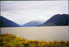
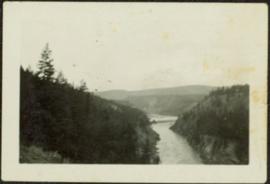
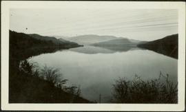
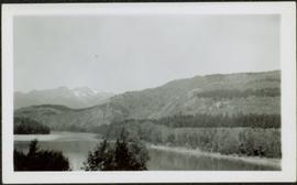
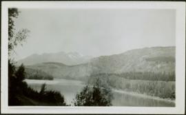
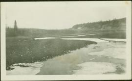
Affichage de 4134 résultats

Archival description
3619 résultats avec objets numériques Afficher les résultats avec des objets numériques
River and Mountains
2008.3.1.22.32 · Pièce · [ca. 1995]
Fait partie de Bridget Moran fonds

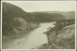
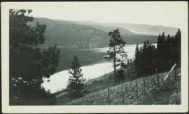
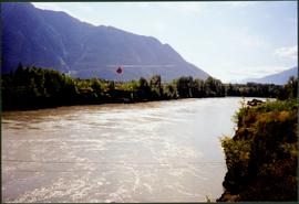
Photograph depicts wide river with forest shores on either side. Power lines in foreground, mountain in background.

Cross Country Ski Trails in Summer
2008.3.1.22.29 · Pièce · [ca. 1995]
Fait partie de Bridget Moran fonds

Photograph depicts landscape scene. Tree, bridge, and sign featuring cross country skier in foreground. Fence, hills, and forest in background.

Bridget Moran at Metlakatla Lake, BC
2008.3.1.22.12 · Pièce · [ca. 1995]
Fait partie de Bridget Moran fonds

Bridget Moran stands on road, unidentified buildings behind on either side. Lake and hills on opposite shore in background. Photo believed to be taken at Metlakatla Lake, B.C. Building on left speculated to be the St. Paul's Anglican Church Learning Centre.

Unidentified Woman at Alaska Signage
2008.3.1.22.14 · Pièce · [ca. 1995]
Fait partie de Bridget Moran fonds

Woman stands in front of sign that reads "ALASKA / STEWART 237 km / HYDER AK. 240 km / BEAR GLAC. 201 km". Second sign in background indicates restaurant, convenience store, and service centre. Car, road, and highway can be seen in midground; mountains in background. (This woman is also featured in item 2008.3.1.22.13).

Group photo of five men
2008.27.8.3 · Pièce · [ca. 1920-1930?]
Fait partie de Knox McCusker Collection

Photograph is a group photo of five men standing around a tent in a wintery wooded landscape; Knox McCusker stands first man from the right, with hands in pockets. Caption on verso reads: “Youthful K.F.McC. on the right. Probably Northern Ontario or Manitoba”.

Knox McCusker holding a fish
2008.27.8.1 · Pièce · [ca.1940?]
Fait partie de Knox McCusker Collection

Photograph depicts Knox McCusker holding a fish outside a survey camp tent. Caption on verso reads: “Well say! Betty! A Toad River Indian”. It is believed this photo was taken at Tuchadi Lake.

Sarah Glassey with Friend Named Vi
2009.5.2.294 · Pièce · 1937
Fait partie de Taylor-Baxter Family Photograph Collection

The pair stands on grassy shore, Sarah on right. Trees, water, and bridge visible in background. Handwritten annotation on recto of photograph: "Sarah + Vi." Both woman are believed to be members of group featured in items 2009.5.2.274 - 2009.5.2.291.

Sarah Glassey with Friend Named Doris
2009.5.2.293 · Pièce · 1937
Fait partie de Taylor-Baxter Family Photograph Collection

The pair stands on grassy shore, Sarah on right. Trees, water, bridge, and opposite shore visible in background. Handwritten annotation on recto of photograph: "Sarah + Doris." Both woman are believed to be members of group featured in items 2009.5.2.274 - 2009.5.2.291.

Unknown Harbour
2009.5.2.142 · Pièce · [ca. 1930?]
Fait partie de Taylor-Baxter Family Photograph Collection

Photograph depicts what appears to be a row of small canoes in still water, opposite shore visible on horizon. Another small boat rests on dock in right foreground.

Fur Farm at Red Rock Lake, BC
2009.5.2.51 · Pièce · [ca. 1910?]
Fait partie de Taylor-Baxter Family Photograph Collection

Photograph depicts two log buildings in fenced area on lake shore, forest trees in background. A man can be seen standing near docking area and small boat pier extending into water in foreground. Handwritten annotation on recto of photograph: "Fur Farm Red Rock Lake". This location is believed to at mile 27, north of Summit Lake.

Settlement on Shore
2009.5.2.136 · Pièce · [ca. 1930?]
Fait partie de Taylor-Baxter Family Photograph Collection

Photograph depicts a group of unidentified buildings in what appears to be an industrial area on opposite shore. River or lake in foreground, tree-covered hills in background.

Grotto near Atlin, BC
2009.5.2.118 · Pièce · [ca. 1935]
Fait partie de Taylor-Baxter Family Photograph Collection

Photograph depicts water flowing from ground in forest. Handwritten annotation on recto of photograph: "Atlin, The Grotto, Outlet of a subterranean stream (in limestone) on way to O'Donnell River."