Mostrando 21791 resultados

Archival description
CNR heavy duty snow plow
2013.6.36.1.109.24 · Item · [Jan. 2007]
Parte de David Davies Railway Collection

Photograph depicts a CNR heavy duty plow, built in 1939. Became property of the Kamloops Heritagae Railway Society. Image captures a close up of the coupler and moveable lower front plate.

Alberni Pacific Railway train
2013.6.36.1.136.16 · Item · [19 May 2007]
Parte de David Davies Railway Collection

Photograph depicts a train commencing its trip in its yard, not at the station, in Port Alberni. Locomotive at the lower/city end (ie formation at the end of the last trip). It, at the time, needed to get to the head-end, so it took the siding.

2023.2.2.12 · Sub-séries · 2007-2009
Parte de Dr. Paul Sanborn fonds

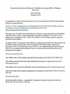
A comparative study of grassland soils at 3 sites in northwestern BC and southern Yukon was published as:
Sanborn, P. 2010. Topographically controlled grassland soils in the Boreal Cordillera ecozone, northwestern Canada. Canadian Journal of Soil Science 90: 89-101. https://doi.org/10.4141/CJSS09048

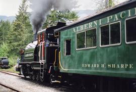
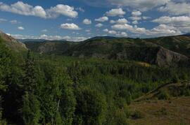
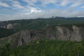
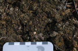
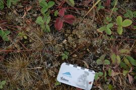
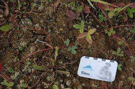
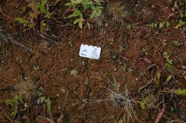
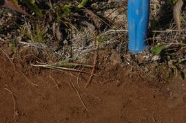
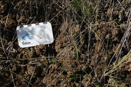
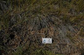
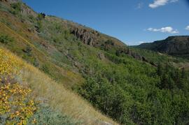
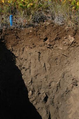
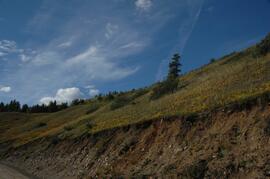
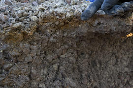
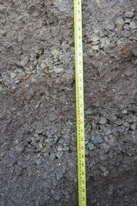
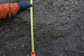
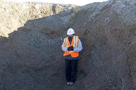
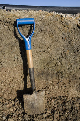
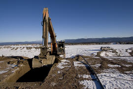
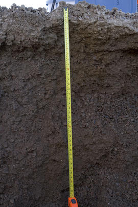
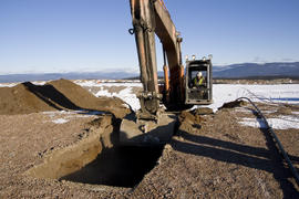
This grew out of a field trip with Ministry of Forests range personnel to the Stikine and Tuya River valleys, near Telegraph Creek BC on August 27-28, 2007. (Two pedons were sampled in 2007, BC07-03 and BC07-04, but those results were not included in the paper.)

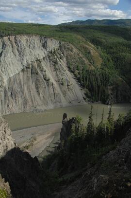
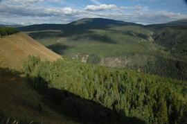
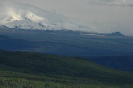
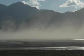
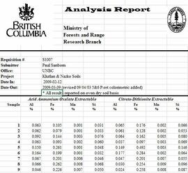
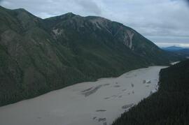
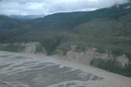
In August 2008, Dr. Paul Sanborn returned to the Stikine to sample pedon BC08-06, after field work in Yukon which collected the other two pedons used in the paper, from near Carmacks (Y08-39) and Kluane Lake (Y08-41). (An additional pedon from Kluane, Y08-43, was sampled and analyzed, but it was from a forested site and was not included in the paper.)

2023.2.2.12.5 · Dossiê · 2007-2009
Parte de Dr. Paul Sanborn fonds

File contains the following data sets:

  • BC & Yukon 2008 soils data – compiled.xls [combined chemical & physical data for BC08-06, Y08-39, Y08-41, Y08-43]
  • S925finl.xls [chemical analysis data, Ministry of Forests & Range, Analytical Chemistry Laboratory for pedons BC07-03 & BC07-04; also includes data for Y07-06 & Y07-07 (Klutlan Glacier – see associated file note)]
  • S979finl(revised) – PS edits.xls [chemical analysis data, Ministry of Forests & Range, Analytical Chemistry Laboratory for BC08-06, Y08-39, Y08-41, Y08-43]
  • S994finl_revised.xls [chemical analysis data, Ministry of Forests & Range, Analytical Chemistry Laboratory for BC07-04 (CaCO3-equiv, total & inorganic C, pyrophosphate, oxalate & dithionite extractions) & selected horizons from BC07-07 & BC07-09 (Nazko basaltic soils))
  • CANTEST lab report 91010076.pdf [particle size analyses for BC08-06, Y08-39, Y08-41, Y08-43]
  • CANTEST lab report 90206003.pdf [particle size analyses for Tuya pedons BC07-03 & BC07-04 & Klutan Glacier pedons Y07-06 & Y07-07]
Klutlan Glacier soils study data
2023.2.2.13.1 · Dossiê · 2007-2008
Parte de Dr. Paul Sanborn fonds

File contains the following data sets:

  • S925finl.xls [chemical analysis data, Ministry of Forests & Range, Analytical Chemistry Laboratory for pedons Y07-06 & Y07-07; also includes data for BC07-03 & BC07-04 (Boreal Cordillera grassland soils – see associated file note)]
  • S1007finl_revised2.xls [chemical analysis data, Ministry of Forests & Range, Analytical Chemistry Laboratory for pedons Y07-06 & Y07-07: oxalate & dithionite extractions, P retention; also includes P retention data for Nazko pedons BC07-07 & BC07-09]
  • CANTEST lab report 90206003.pdf [particle size analyses for Klutan Glacier pedons Y07-06 & Y07-07; also Tuya pedons BC07-03 & BC07-04 &]
White River, facing north downstream
2023.2.2.13.2.01 · Item · 8 Jul. 2007
Parte de Dr. Paul Sanborn fonds

This image is part of the outbound sequence of aerial images obtained on the helicopter flight to the Klutlan Glacier study site. The sequence starts from the base camp at the White River crossing on the Alaska Highway and heads south, to a point just upvalley of the debris-covered terminus (approx. 10-15 km from Alaska border), and turning back north to the landing spot on the Generc River floodplain close to the study site (see Fig. 1 in paper).

2023.2.2.13.2.03 · Item · 8 Jul. 2007
Parte de Dr. Paul Sanborn fonds

This image is part of the outbound sequence of aerial images obtained on the helicopter flight to the Klutlan Glacier study site. The sequence starts from the base camp at the White River crossing on the Alaska Highway and heads south, to a point just upvalley of the debris-covered terminus (approx. 10-15 km from Alaska border), and turning back north to the landing spot on the Generc River floodplain close to the study site (see Fig. 1 in paper).

2023.2.2.13.2.09 · Item · 8 Jul. 2007
Parte de Dr. Paul Sanborn fonds

This image is part of the outbound sequence of aerial images obtained on the helicopter flight to the Klutlan Glacier study site. The sequence starts from the base camp at the White River crossing on the Alaska Highway and heads south, to a point just upvalley of the debris-covered terminus (approx. 10-15 km from Alaska border), and turning back north to the landing spot on the Generc River floodplain close to the study site (see Fig. 1 in paper).