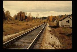
Image depicts railway tracks and buildings with a beehive burner on the left. The location is likely Sinclair Mills, B.C. Map coordinates 54°01'17.4"N 121°40'53.0"W
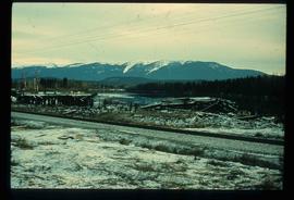
Image depicts a pile of old logs on the bank of the Fraser River with mountains in the background. In the foreground, a set of railway tracks run through an uncertain location, likely Upper Fraser, B.C.
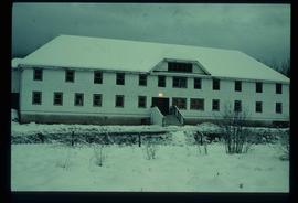
Image depicts bunkhouse, restaurant and store in Sinclair Mills, B.C. Map coordinates 54°01'17.4"N 121°40'53.0"W
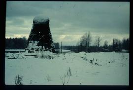
Image depicts a beehive burner covered in snow in Sinclair Mills, B.C. Map coordinates 54°01'17.4"N 121°40'53.0"W
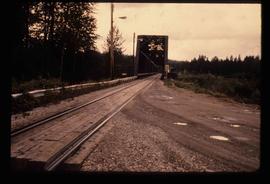
Image depicts the Hansard railroad bridge looking west. Map coordinates 54°04'37.9"N 121°50'46.3"W
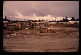
Image depicts several eighteen wheelers at the Pass Lake Road and Upper Fraser Road intersection with numerous houses and buildings in the background in McGregor, B.C. Map coordinates 54°04'38.1"N 121°50'00.1"W
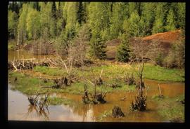
Image depicts a flooded area with an old sawdust pile in the background. Likely near McGregor, B.C.
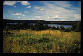
Image depicts the Fraser River, likely near the Hansard railroad bridge.
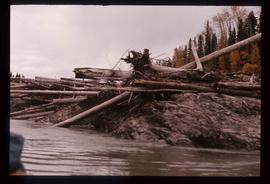
Image depicts numerous logs piled up on rocks in the Fraser River.
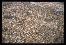
Image depicts an aerial view of a Prince George residential section between Highway 97, Carney Street and 10th Ave looking north. Map coordinates 53°54'54.0"N 122°46'00.4"W
Image depicts the Northwood Pulpmill in Prince George, B.C. taken from above the Nechako River looking east. Map coordinates 53°56'00.0"N 122°44'29.7"W
Image depicts Prince George Sawmill taken from across the Nechako River looking southwest. Map coordinates 53°56'00.0"N 122°44'29.7"W
Image depicts Prince George Sawmill taken from across the Nechako River looking southwest. Map coordinates 53°56'00.0"N 122°44'29.7"W
Image depicts downtown Prince George taken from across the Nechako River looking south. Map coordinates 53°56'00.0"N 122°44'29.7"W
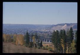
Image depicts the Grand Trunk Railway bridge across the Fraser River. Map coordinates 53°54'29.0"N 122°42'06.5"W
Image depicts the cutbanks on the other side of the Nechako, taken from the nature trail at Island Cache. Map coordinates 53°55'34.6"N 122°45'52.4"W
Image depicts the cutbanks on the other side of the Nechako, taken from the nature trail at Island Cache. Map coordinates 53°55'34.6"N 122°45'52.4"W
Image depicts the cutbanks on the other side of the Nechako, taken from the nature trail at Island Cache. Map coordinates 53°55'34.6"N 122°45'52.4"W
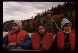
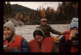
Image depicts a group of people in boats, with Ray Mueller steering one of them, on the Fraser River in the Grand Canyon, B.C.
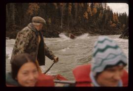
Image depicts three unknown individuals in a boat on the Fraser River; the man steering the boat is Ray Mueller.
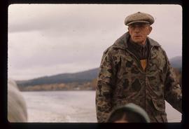
Image depicts Ray Mueller steering a boat on the Fraser River in the Grand Canyon, B.C.
Image depicts Ray Mueller steering a boat on the Fraser River in the Grand Canyon, B.C.
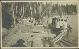
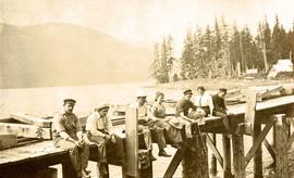
Photograph depicts men on river boat and small canoe floating just off shore. Men sit and stand on shore among square bales and large cut lumber. Forest in background. Handwritten annotations on recto of photograph: "Fort Fraser wooding up at Giscome Portage", "Chilco at Giscome Portage".
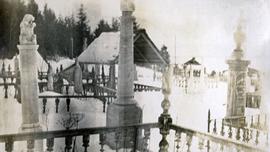
Photograph depicts a snow covered cemetery with gravestones, tombstones, and monuments.
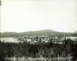
Photograph depicts the Atlin townsite, forest in foreground, hills in background. Town stands on edge of lake located in left midground. Handwritten annotation on verso of photograph: "Atlin City B.C., Sept. 3rd 1899. Copyrighted by S.A. Smythe Atlin, B.C."
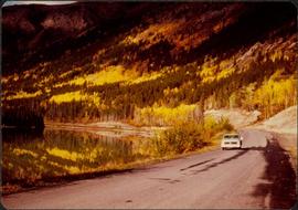
Photograph depicts a Chevrolet pickup truck on highway to right of Mud Lake, at Km 632 on the Stewart-Cassiar Highway. Forest on hillside in background.
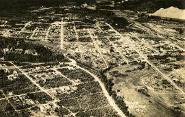
Aerial view of Prince George and surrounding forested area. Printed annotation on recto reads: "Prince George, B.C."
View of a sternwheeler in the distance making its way down Fort George Canyon. Printed annotation on recto reads: "Fort George Canyon."
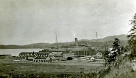
Photograph depicts a large ship behind dock buildings. Railroad crosses foreground, hills visible on shore in background.
Handwritten annotation on verso reads: "Ship in Pr. Rupert dry dock during Great War 1915?".
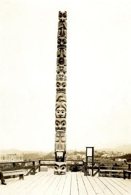
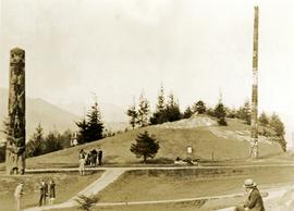
Photograph depicts a totem pole standing on what appears to be a large wooden deck or boardwalk, view of the city in background.
Handwritten annotation on verso reads: "Totem pole in park in Prince Rupert".
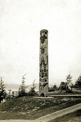
Photograph depicts a large totem pole next to groomed dirt paths. Power poles and river visible in background.
Handwritten annotation on verso reads: "Edenshaw pole in park at Prince Rupert."
Groups of men and women can be seen gathered on paths between two large totem poles.
Handwritten annotation on verso reads: "Totem Park Pr Rupert park."
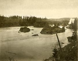
River crosses midground, hills on distant shores can be seen in background.
Handwritten annotation on verso reads: "No. 32, First Beginning Prince Rupert, showing Church Hall, with cross. Insert Page 136".
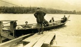
Five unidentified men sit with dog in canoe. One man stands on dock in foreground.
Handwritten annotation on verso reads: "Freighting by canoe on skeena river".
Canoe with mast floats close to shore in foreground, mountains visible across river in background.
Handwritten annotation on verso reads: "Arch. W.H. Collison & wife with native friends en route up Skeena River."
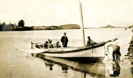
Rev. William Edwin Collison stands in centre of boat, with wife Bertha and daughters Muriel and Katherine seated behind. Unknown man and woman are also seated in boat, and an unknown man stands on shore holding rope.
Handwritten annotation on verso reads: "Will Collison with wife & children leaving Metlakatla to catch steamship en route to England (1910)".
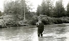
Joyce stands knee-deep in water, holding a long wrapped object, with a bundle resting on her shoulder (daughter of Archdeacon W.H. Collison's eldest son William Edwin). Trees and bushes visible on opposite shore in background.
Handwritten annotation on verso reads: "Joyce circa 1937 at Kincolith".
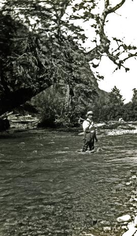
Rev. William Edwin Collison stands waist deep in water, with axe resting on shoulder (oldest son of Archdeacon W.H. Collison). Trees and hill on opposite shore visible in background.
Handwritten annotation on verso reads: "Dad at Kincolith".
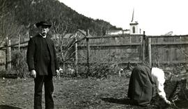
Photograph depicts Archdeacon William Henry Collison to left of wife Marion, who stands bent over garden on right. Church steeple visible behind wood fence in background. Hills can be seen in distance.
Handwritten annotation on verso reads: "Grandad & Grannie in garden at Kincolith".
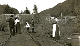
Photograph depicts Marion and William Henry Collison standing on left with shovel, Bertha Collison on right, and young Muriel and Katherine Collison in centre with shovel (eldest daughters of W.E. Collison). Wood buildings cross midground, trees and hills visible in background.
Handwritten annotation on verso reads: "Garden at Kincolith / Grandad, Grannie / Mimi, Katie / Mother".
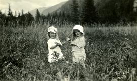
Photograph depicts two young granddaughters of Marion and W.H. Colllison, holding flowers in grassy area. Forest and hills in background.
Handwritten annotation on verso reads: "Winnie & Joyce at Kincolith". Marion Winnifred is the daughter of John Maxwell Collison, and Joyce is the daughter of William Edwin Collison.
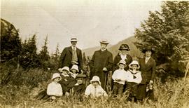
Archdeacon William Henry Collison stands with cane in centre of group, trees and hills in background.
Handwritten annotation on verso reads: "Meadow - Kincolith / Uncle Don - Grandfather, Aunt Alice, Aunt Elsie / Uncle Max + cousins". Donald Macdonald married W.H. Collison's daughter Emily.
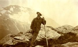
Photograph depicts Henry Alexander, son of Marion and Archdeacon W.H. Collison, leaning on walking stick on top of rocky hill. Mountains in background.
Handwritten annotation on verso reads: "Henry Collison on prospecting trip. Portland Canal."
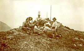
Photograph depicts the sons and daughters of Marion and Archdeacon W.H. Collison sitting on the ground with food supplies at the top of a hill. Individuals believed to be (left to right): Arthur, Elsie, Herbert, Henry (in chef's hat), unknown, William, John Maxwell ('Max').
Handwritten annotation on verso reads: "Collison family on prospecting trip up Portland Canal."
Photograph depicts the sons and daughters of Marion and Archdeacon W.H. Collison, and one unidentified man. Buildings can be seen on shore in background.
Handwritten annotation on verso reads: "Collison family at camp (Portland Canal) Max, ?, Henry, Elsie, Arthur, Alice, Herbert".
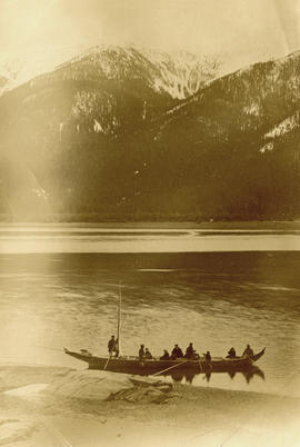
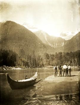
Group of five unidentified men stand on shore to right of large dugout canoe, handling their rifles. Forest and snow-capped mountains stand on opposite shore in background.
Handwritten annotation on verso reads: "Mrs Collison (wife of Arch. Collison in Canoe en route to Hazelton B.C."
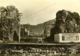
Handwritten annotation on recto of postcard reads: “Were there’s a will there’s a way, 5th Street, Prince Rupert, B.C., F. Button photo Pr. Rupert. No. 514.” Handwritten annotation in pen on verso of postcard reads: “Miss Belding, 33 Marlbro Avenue, Hull Yorkshire, England. S.S. Prince George. Dec. 1918. Dear Bertha, This is a street in the centre of the town Prince Rupert. There is a capacity list of passengers on board. The boat is registered to hold 384. We left at midnight and exped to arrive in Vancouver tomorrow at 3:30 pm. Love from Edie.”
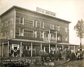
Photograph depicts two, four-horse stagecoaches laden with passengers parked outside the Hotel Northern in South Fort George. A group comprised of primarily men watch the stagecoaches from the veranda of the hotel. Handwritten annotation in bottom right corner of photograph reads: "Cariboo Stage at South Ft. George, BC. Oct 19-1911."
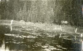
Photograph depicts two men wading and bathing in shallow water with lily pads.
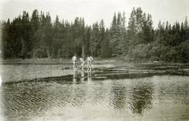
Photograph depicts three men standing on the banks of a backwater or lake, with clothing piled on the ground.
