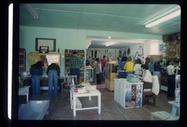
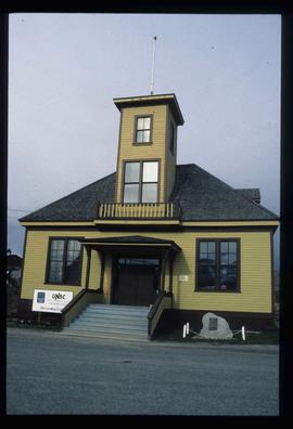
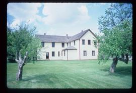
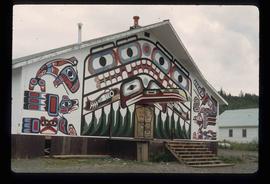
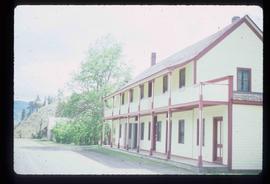
Image depicts several businesses in a small section of Chetwynd, B.C. There is a motor hotel and a half-visible sign for an Esso gas station.
Image depicts a number of townhouses in Chetwynd, B.C.
Image depicts several unidentified individuals lying on a hill outside what is most likely the W.A.C. Bennett Dam in Hudson's Hope, B.C.
Image depicts the Peace Canyon Dam and generating station under construction on the Peace River.
Image depicts several unidentified individuals standing on a bridge; it possibly crosses the peace River.
Image depicts several unidentified individuals standing in front of a store selling honey.
Image depicts the log building that acts as the public library in Hudson's Hope, B.C.
Image depicts a set of railway tracks, and a building with a sign which reads: "Telegraphs." The location is uncertain, but possibly in the Peace River Region.
Image depicts the interior of a store, possibly in Fort St. John, B.C.
Image depicts several unidentified individuals exiting a church made of logs, possibly in Fort St. John, B.C.
Image depicts a view of Fort St. John, B.C.
Image depicts two unidentified individuals in hard hats leaning against the railing of a large, open space inside an unknown concrete structure. It is possibly located in Fort St. John, B.C.
Image depicts two individuals at work inside what appears to be a piece of machinery. It is possibly located somewhere in Fort St. John, B.C.
Image depicts the interior of the Station Museum in Dawson Creek, B.C.
Image depicts an old abandoned cabin at an uncertain location.
Image depicts the small town of Fraser, B.C. Located on the Klondike Highway.
Image depicts the Caribou Hotel and the Matthew Watson General Store in Carcross, Y.T.
Image depicts the travel infocentre at the Atlin Museum. The slide labels it as having once been a school.
Image depicts the UNBC partnership campus in Atlin, B.C. The slide also labels it as being a former courthouse.
Image depicts a building which once served as the residence for two nurses in Atlin, B.C. A sign in front of the house reads: "Grateful Atlinites built this house in 1902 for their first missionary nurses, Helen Bone and Elizabeth Mitchell, who came here in 1899 and lived in a crude shack while valiantly and humanely caring for sick and dying pioneers."
Image depicts a pair of mannequins in the second story windows of a building, possibly located in Skagway, Alaska.
Image depicts the house of the owner of Gang Ranch.
Image depicts the Alkali Lake Ranch in Alkali Lake, B.C.
Image depicts a view of the Fraser River in Lillooet, B.C.
Image depicts some farmland in Lillooet, B.C.
Image depicts an old church located somewhere in Lillooet, B.C.
Image depicts a view of Lillooet, B.C.
Image depicts two bridges over the Fraser River, located somewhere in Lillooet, B.C.
Image depicts the start of Joffre Creek Road, most likely somewhere in the Joffre Lakes Provincial Park.
Image depicts the Britannia Mine, which closed in 1974 and is now a museum. "Anaconda" was the last operating owner.
Image depicts numerous power lines and a road somewhere north of Squamish.
Image depicts rail road tracks and several buildings in Pemberton, B.C.
Image depicts some power lines and mountains near Pemberton, B.C.
Image depicts what appears to be an apartment building among several others in an uncertain location.
Image depicts a lake with a "Swim at Own Risk" sign at an uncertain location.
Image depicts a building painted with First Nations art in New Aiyansh.
Image depicts several children and numerous adults inside a church in Deadman Creek, near Kamloops, B.C.
Image depicts the Ranch house on the historic Hat Creek Ranch site north of Ashcroft, B.C.
Image depicts an old barn on the historic Hat Creek Ranch site north of Ashcroft, B.C.
Image depicts the front of the ranch house on the historic Hat Creek Ranch site north of Ashcroft, B.C.
Image depicts the Lajoie Dam on the Bridge River from the upstream side.
Image depicts Bralorne, B.C.
Image depicts what is possibly an old, rundown mill in Bralorne, B.C.
Image depicts several houses in Bralorne, B.C.
Image depicts a few boarded-up buildings in Bralorne, B.C.
Image depicts an area of Barlone, B.C. surrounded by trees.
Image depicts a number of identical buildings and vehicles at "Driftwood Creek" in the Driftwood Canyon Provincial Park.
Image depicts a cabin on the "west arm" of Takla Lake.