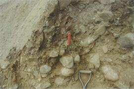
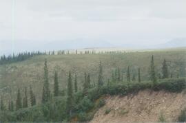
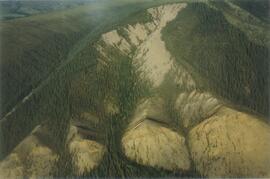
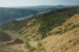
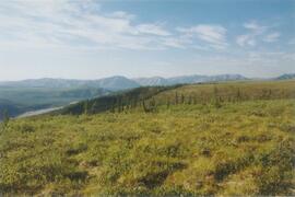
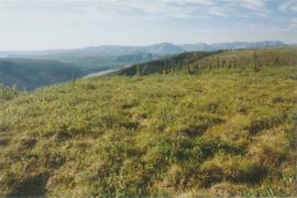
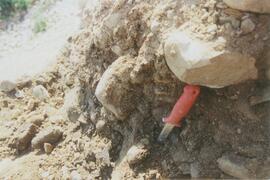
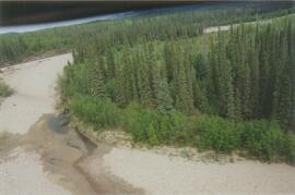
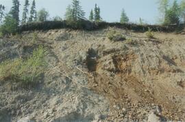
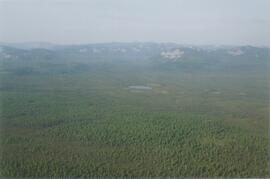
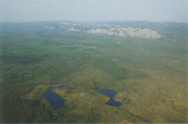
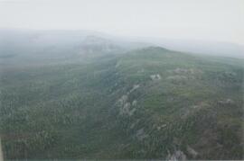
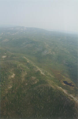
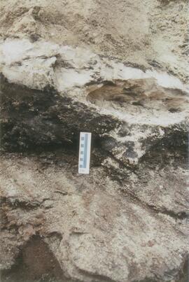
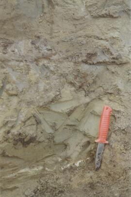
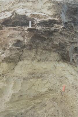
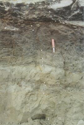
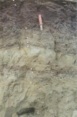
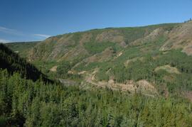
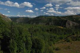
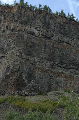
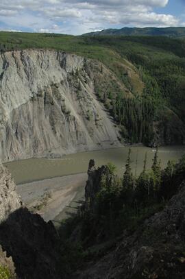
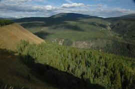
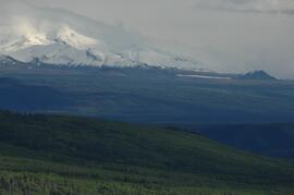
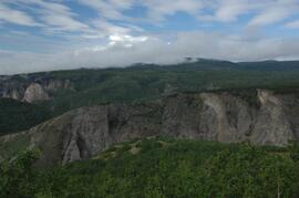
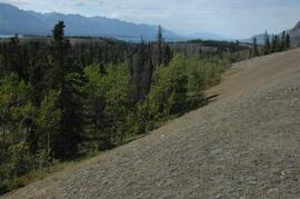
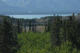
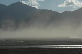
Photograph depicts the Mackenzie Valley and the Franklin Mountains.
Slide roll contains the following photographs:
Thorsen Bay
Print roll 11, #01-2A; slide roll 6, #12-10
Y04-19 (27.5 km on Cultus Bay Rd., near Thorsen Bay)
Date: July 22, 2004
Location Coordinates: 61º 12’ 3.0” N, 138º 28’ 58.3’ W, 819 m asl (± 18.9 m)
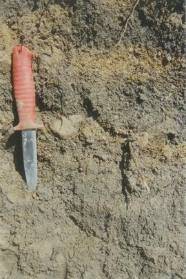
Site Description: Roadcut at base of 30º, E-facing slope. Colluviated loess overlies sandy glaciofluvial at 120 cm. Prominent paleosol with “cumulic” B horizon at 80-120 cm, with strong effervescence throughout exposure.
Slide roll 6, #9-7 (profile), #6-1 (landscape)
Corresponding prints and negatives: Print roll 11, #3A-5A (profile), #6A-10A (landscape)
Slide roll contains the following photographs:
Y04-19 (27.5 km on Cultus Bay Rd., near Thorsen Bay)
Date: July 22, 2004
Location Coordinates: 61º 12’ 3.0” N, 138º 28’ 58.3’ W, 819 m asl (± 18.9 m)
Site Description: Roadcut at base of 30º, E-facing slope. Colluviated loess overlies sandy glaciofluvial at 120 cm. Prominent paleosol with “cumulic” B horizon at 80-120 cm, with strong effervescence throughout exposure.
Sample Depths & Descriptions: Y04-19-01 – charcoal at 95 cm
Roadcut opposite ~ 30 m to NE on grassy S aspect (10° slope) with 15-20 cm of calcareous loess and sand over 2 cm White River ash; strongly effervescent throughout.
Slide roll 7, #36-35 (profile)
Corresponding prints and negatives: Print roll 11, #11A-12A (profile)
Thorsen Bay landscape
Slide roll 7, #34-32
Corresponding prints and negatives: Print roll 11, #13A-16A
Y04-20B
Date: July 22, 2004
Location Coordinates: 61º 10’ 16.5” N, 138º 26’ 18.7’ W, 797.5 m asl (± 5.9 m)
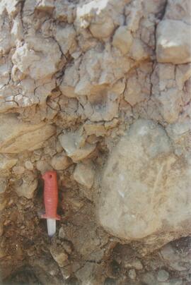
Site Description: wind-eroded Slims soil on glaciolacustrine with contorted bedding (exposed on blown-out roadcut); calcareous to surface; White R ash pockets at 10-20 cm; S aspect, 5° slope.
Slide roll 7, #31-26
Corresponding prints and negatives: Print roll 11, #17A-21A
Y04-22
Date: July 22, 2004
Location Coordinates: 61º 9’ 39.24” N, 138º 25’ 7.8’ W, 790.6 m asl (± 6.4 m)
Site Description: toe of 30° slope, W aspect (grassy slope with poplar at toe); 1.0-1.2 of colluviated loess over gravelly glaciofluvial with buried soil at 70-80 cm
Slide roll 7, #25-24
Corresponding prints and negatives: Print roll 11, #22A-24A
Cultus Bay Rd.
(landscape views looking W from road; lake is likely at ~61°4’ 10.5”N, 138°22’ 31.5”)
Slide roll 7, #23-22
Corresponding prints and negatives: Print roll 12, #0A-2A
Y04-26 (EW)
Date: July 23, 2004
Location Coordinates: 61º 1’ 59.8” N, 138º 21’ 53.6” W, 836.1 m asl (± 7.7 m)
Site Description: grassland at crest of 33° terrace scarp, S aspect.
Sample Depths & Descriptions: Y04-26-01 – 0-10 cm
Slide roll 7, #21-20
Corresponding prints and negatives: Print roll 12, #14A-15A
Y04-27
Date: July 23, 2004
Location Coordinates: 61º 2’ 0.9” N, 138º 21’ 53.6” W, 843.6 m asl (± 5.8 m) (~ 35 m N of Y04-26)
Site Description: spruce forest on terrace surface; level.
- 0-8 cm - Loess-rich forest floor; strongly calcareous.
- 8-13 cm - Bmk
- 13-15 cm - Discontinuous pockets of White R ash
- 15-35 cm - Bmk (Slims soil) – no charcoal visible
- 35-75 cm - Gray calcareous loess.
- 75 cm+ - Gravelly sandy glaciofluvial deposit.
Slide roll 7, #19-18
Corresponding prints and negatives: Print roll 12, #16A-17A
Y04-28 (EW)
Date: July 23, 2004
Location Coordinates: 61º 2’ 34.4” N, 138º 21’ 57.0” W, 820.2 m asl (± 6.1 m)
Site Description: grassland on esker crest W of Jenny L; 30° slope, SW aspect
Sample Depths & Descriptions: Y04-28-01: 0-10 cm
Slide roll 7, #17-16
Corresponding prints and negatives: Print roll 12, #18A-19A
Y04-30 (between eskers, W of Jenny Lake)
Date: July 23, 2004
Location Coordinates: 61º 2’ 31.6” N, 138º 21’ 52.3’ W, 817.6 m asl (± 6.1 m)
Site Description: Level (base of saddle). Colluviated loess to 90 cm+, with White River tephra at 15-17 cm, brownish paleosol at 17-35 cm, underlain by turbated Bmku with multiple charcoal-rich bands.
Sample Depths & Descriptions:
- Y04-30-01 – charcoal at 13 cm (above WR tephra)
- Y04-30-02 – charcoal at 22 cm (below WR tephra)
- Y04-30-03 – charcoal at 75 cm
Slide roll 7, #15-13
Corresponding prints and negatives: Print roll 12, #20A-22A
Y04-31 (EW)
Date: July 23, 2004
Location Coordinates: 61º 3’ 9.2” N, 138º 21’ 30.3’ W, 837.2 m asl (± 6.4 m)
Site Description: crest of N-S esker ridge
Sample Depths & Descriptions: Y04-31-01: 0-10 cm
Slide roll 7, #12-11
Corresponding prints and negatives: Print roll 13, #1-3
Y04-32
Date: July 23, 2004
Location Coordinates: 61º 3’ 7.4” N, 138º 21’ 27.7’ W, 823.7 m asl (± 13.7 m)
Site Description: toeslope on NE side of same ridge as for Y04-31; 20° slope, NE aspect; Cryosol with permafrost at 34 cm; 30 cm of forest floor organic horizons; abundant charred wood fragments at top of mineral soil & in lowest part of organic horizon.
Slide roll 7, #10-9
Corresponding prints and negatives: Print roll 13, #4-5
Y04-34
Date: July 23, 2004
Location Coordinates: 61º 3’ 47.7” N, 138º 21’ 2.5’ W, 838 m asl
Site Description: Toe of 30º, W-facing grassland slope. Colluviated loess with White River tephra at 8-9 cm, brownish paleosol (9-35 cm), overlying sandy glaciofluvial at 35-70 cm+.
Sample Depths & Descriptions: Y04-34-01: charcoal at 34 cm
Slide roll 7, #8-7
Corresponding prints and negatives: Print roll 13, #6-7
Y04-35 (EW)
Date: July 23, 2004
Location Coordinates: 61º 3’ 49.9” N, 138º 21’ 1.1” W, 854.4 m asl (± 6.3 m)
Sample Depths & Descriptions: Y04-35-01: 0 – 10 cm
Slide roll 7, #6-5
Corresponding prints and negatives: Print roll 13, #8-10
(Location not recorded: Print roll 13, #11-12)
Y04-36
Date: July 23, 2004
Location Coordinates: 61º 8’ 11.5” N, 138º 25’ 50.8” W, 825.6 m asl (± 14.5 m)
Site Description:
- 10-0 cm - LF
- 0-15 cm - Bmk1 (7.5YR 4/6 m)
- 15-28 cm - Bmk2 (2.5Y 4/3 m)
- 28-48 cm - Ck
- 48-55 cm+ - IICk (sandy gravelly glaciofluvial)
- No charcoal visible in mineral horizons
Slide roll 7, #4-3
Corresponding prints and negatives: Print roll 13, #13-14
Y04-37
Date: July 23, 2004
Location Coordinates: (roadcut adjacent to Y04-36)
Site Description: multiple colour bands in Slims soil; some charcoal blobs (not sampled) which are right size to have been roots.
Slide roll 7, # 2-1
Corresponding prints and negatives: Print roll 13, #15-19
File consists of proceedings and abstracts for conferences and workshops attended by Paul Sanborn.
Includes the following items:
Alloway, B.V., D.G. Froese, and J.A. Westgate (eds.) 2005. Proceedings of the International Field Conference and Workshop on Tephrochronology & Volcanism: Dawson City, Yukon Territory, Canada, July 31st – August 8th, 2005.
BC Forestry Continuing Studies Network. 1994. Workshop proceedings: Grasses and legumes in forestry - A forum for discussing the economic and ecological costs and benefits of using grass and legume species in all phases of northern forest management. Prince George, BC: April 6-7, 1994.
Canadian Quaternary Association. 2001. Canadian Quaternary Association Meetings, 2001: Program and Abstracts. Occasional Paper in Earth Sciences No. 1. Heritage Branch, Government of the Yukon. http://emrlibrary.gov.yk.ca/Tourism/canadian-quaternary-association-meetings-program-and-abstracts-2001.pdf
Enhanced Forest Management Pilot Project. 2000. Proceedings of the March 30-31 Information Session. Robson Valley Forest District. [9 extended abstracts & full articles]
Society for Ecological Restoration. 1995. Taking a broader view: 1995 international conference. September 14-16, 1995. University of Washington, Seattle WA, USA. [program & abstracts]
During Dr. Sanborn's years with the Ministry of Forests research program (1991-2002), he worked on forest fertilization research with silviculturist Rob Brockley (retired; formerly at Kalamalka Research Station, Vernon, BC). Brockley’s work in the 1980s and early 1990s had documented the widespread pattern of sulphur deficiencies across the BC interior, and the superior response of managed stands to fertilization treatments involving sulphur (S) and nitrogen (N) rather than nitrogen alone.
To progress farther, different methods for understanding the fate of sulphur fertilizers in forests and soils were needed. Sanborn contacted the stable isotope group at the University of Calgary which had done important work on the fate of pollutant sulphur emitted by oil and gas extraction and processing in Alberta, using natural abundances of sulphur stable isotopes as a tracer. This was the beginning of a collaboration with Dr. Bernhard Mayer of the University of Calgary, and also with his German soil scientist colleague, Dr. Joerg Prietzel (Munich Technical University).
The research team engaged in the Cluculz retrospective study (E.P. 886.10) for the BC Ministry of Forests.
An ancillary project involved resampling (2002 - foliage, 2003 - soil) of a previously fertilized (1990) installation (E.P. 886.10) south of Cluculz Lake in order to compare the longer-term effects of different fertilizer sulphur forms on soil and foliage chemical properties. Results were published as a journal article and a Ministry of Forests Extension Note:
Sanborn, P.T., J. Prietzel, R.P. Brockley. 2005. Soil and lodgepole pine foliar responses to two fertilizer sulphur forms in the Sub-Boreal Spruce zone, central interior British Columbia. Can. J. For. Res. 35 (10): 2316-2322. https://cdnsciencepub.com/doi/abs/10.1139/x05-138
Sanborn, P. and R. Brockley. 2005. Sulphur deficiencies in lodgepole pine: occurrence, diagnosis, and treatment. Ext. Note 71. B.C. Min. For., Res. Br., Victoria, B.C. https://www.for.gov.bc.ca/hfd/pubs/docs/en/En71.pdf
In the mid-1990s, Dr. Paul Sanborn worked with Dr. Lito Arocena of UNBC to assemble and interpret basic physical, chemical, and mineralogical data for typical soils at important long-term forestry research sites in central and northeastern BC. The key results were published as:
J.M. Arocena and P. Sanborn. 1999. Mineralogy and genesis of selected soils and their implications for forest management in central and northeastern British Columbia. Canadian Journal of Soil Science 79: 571-592. https://doi.org/10.4141/S98-07
Nine pedons were involved, with 7 located at the sites of 4 Ministry of Forests Experimental Projects (E.P.), and 2 at the Aleza Lake Research Forest.
Data sets associated with the Arocena & Sanborn 1999 regional soil mineralogy study:
- S234FINL.XLS [data report for mineral horizons from MoF Analytical Chemistry Laboratory, June 20 1996]
- S235FINL.XLS [data report for organic horizons from MoF Analytical Chemistry Laboratory, June 20 1996]
- SAMPLIST.XLS [conversion table for sample numbers used in MoF lab data reports]
- Fe Al extractions.xlsx [assembled from lab data report by L. Arocena for oxalate & dithionite extractions; pyrophosphate extraction data from MoF lab]
- MINSTUDY.XLS [consolidated lab data for organic & mineral horizons, except for BaCl2 exchangeable cations]
- MINCEC.XLS [BaCl2 exchangeable cations & Morgan’s extraction for organic & mineral horizons]
Sanborn, P. and R. Brockley. 2005. Sulphur deficiencies in lodgepole pine: occurrence, diagnosis, and treatment. Ext. Note 71. B.C. Min. For., Res. Br., Victoria, B.C.
The eastern flank of the Mackenzie Mountains has a complex history of multiple glaciations by both the Laurentide and Cordilleran ice sheets, recorded in thick sequences of glacial sediments that were documented at 3 locations (Katherine Creek, Little Bear River, Inlin Brook) by:
Duk-Rodkin, A., R.W. Barendregt, C. Tarnocai, and F.M. Phillips. 1996. Late Tertiary to late Quaternary record in the Mackenzie Mountains, Northwest Territories, Canada: stratigraphy, paleosols, paleomagnetism, and chlorine-36. Canadian Journal of Earth Sciences 33 (6): 875-895. https://doi.org/10.1139/e96-066
Of the 3 sites, the exposure on Inlin Brook, a tributary of the Keele River, was the least well-documented, so in summer 2004 Dr. Paul Sanborn joined a field party of the Geological Survey of Canada (GSC) based at Tulita, NWT, and was given helicopter support to visit Inlin Brook (August 5-8). A brief visit was also made to the Little Bear River site.
On August 9-10, Sanborn joined Alejandra Duk-Rodkin (GSC) and Rene Barendregt (U Lethbridge) in helicopter-assisted field work at sites in the Franklin Mountains and elsewhere east of the Mackenzie River.
This document file "Cluculz Creek Fertilization Research Site.pdf" contains a field description and basic characterization data for a representative pedon at the E.P. 886.10 site.
Data sets associated with the Cluculz retrospective study (E.P. 886.10):
- 082036.xls -- Elemental analysis (XRF) for mineral horizon samples from profile at Cluculz EP 886.10 site
- CLUCINC.xls -- Summary chemical properties for composite samples in aerobic incubation
- Cluculz Ck 2002 Foliar Analysis.xls -- Analyzed for individual single-tree plots
- Cluculz Ck 2002 Forest Floor.xls -- Forest floor mass data
- Cluculz composite list (2003 samples).xls -- Composite groups (3 original samples in each) used for organic & mineral soils
- Cluculz composite list (incubation experiment).xls -- Composite groups (3 original samples in each) used for organic & mineral soils
- Cluculz composite list for incubations (2003 samples).xls -- Composite groups (3 original samples in each) used for organic & mineral soils
- Cluculz Creek S mineralization - initial fractions (2).xls -- S fractions - organic & mineral soil composites
- Cluculz Creek S mineralization - initial S fractions.xls -- S fractions - organic & mineral soil composites
- Cluculz Creek S mineralization (IC).xls -- S mineralization data for aerobic incubation - organic & mineral soils
- Cluculz foliar and soil data.xls -- Chemical properties of foliage, composite forest floors, composite mineral soils
- Cluculz pH.xls -- pH - organic & mineral soil composites
- Cluculz S fraction graphs.xls -- S fractions - organic & mineral soil composites
- Elemental Analysis of Standard by XRF (2005).xls -- Published & XRF analysis of CANMET TILL-1 soil standard (used in Cluculz XRF analysis)
Unpublished results for the Sulphur stable isotope tracer study (E.P. 886.15) were presented in annual reports to the funding agencies, including this "Sulphur Fertilization of Lodgepole Pine: A Stable Isotope Tracer Study (Ministry of Forests E.P. 886.15) - Project Y051210 - Technical Report" from April 2005.
This document provides study descriptions, lab data, and images for sites Y04-01 to Y04-04 for the paleosols at the Goldbottom site study.
This born-digital document is an unpublished report to the Geological Survey of Canada on field work data and interpretations of Inlin Brook paleosols.
As part of a multidisciplinary team led by Grant Zazula (then a Ph.D. student at Simon Fraser University; later a palaeontologist with the Government of Yukon) and Duane Froese (Professor, University of Alberta), Dr. Paul Sanborn examined a set of buried paleosols (fossil soils) preserved in frozen sediments exposed by placer mining in the spring of 2004.
The findings were published in:
Zazula, G.D., D.G. Froese, S.A. Elias, S. Kuzmina, C. La Farge, A.V. Reyes, P.T. Sanborn, C.E. Schweger, C.A.S. Smith, and R.W. Mathewes. 2006. Vegetation buried under Dawson tephra (25,300 14C yr BP) and locally diverse late Pleistocene paleoenvironments of Goldbottom Creek, Yukon, Canada. Palaeogeography, Palaeoclimatology, Palaeoecology 242: 253–286.
https://doi.org/10.1016/j.palaeo.2006.06.005
