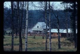
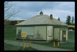
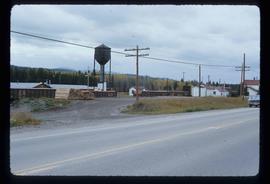
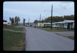
Image depicts the Crosina Store at 153 Mile House.
Image depicts the wall of a chasm full of trees at an unknown location.
Image depicts numerous buildings in Hendrix Lake, B.C.
Image depicts the Bohanon House in Quesnel, B.C.
Image depicts the Cottonwood Canyon.
Image depicts a forest and river in Soda Creek, B.C.
Image depicts the old jail house in Soda Creek, B.C.
Image depicts an old building located somewhere are the Pickard farm north of Soda Creek, B.C.
Image depicts the old school at 150 Mile House, with what is likely the modern school visible in the background.
Image depicts the Flying U Ranch at 70 Mile House, B.C.
Image depicts a view of Francois Lake.
Image depicts a barn with large, Harvestore Systems. It is possibly located on one of the many farms near Vanderhoof, B.C.
Image depicts numerous unknown individuals searching through a fossil bed, possibly in the Bulkley Valley.
Image depicts a fossil bed, possibly somewhere in the Bulkley Valley.
Image depicts an individual opening the gate at Nautley in Fort Fraser, B.C.
Image depicts the entrance of the Nautley River in Fort Fraser, B.C.
Image depicts an old, collapsing house at the Nautley site in Fort Fraser, B.C.
Image depicts a general store in Quick, B.C.
Image depicts Skeena Crossing, B.C.
Image depicts a man, possibly Kent Sedgwick, leaning against a sign forbidding public traffic on the Stewart Access Road from between 5 am to 8 pm. Located in Hazelton, B.C.
Image depicts a stretch of road somewhere at Burns Lake, B.C.
Image depicts a boat on Babine Lake, taken from Granisle, B.C.
Image depicts a large, electric shovel at a mine site somewhere in Granisle, B.C.
Image depicts a number of people standing at what appears to be a farm fishery [?] on the Fulton River.
Image depicts the Fulton River.
Image depicts the entrance of the Fulton River.
Image depicts a large gathering of people in the interior of a First Nations' longhouse located in the historical village of 'Ksan in Hazelton, B.C.
Image depicts a valley of fossil beds, possibly the Bulkley Valley.
Image depicts a view of Bulkley Valley.
Image depicts the 'Ksan historical village in Hazelton, B.C.
Image depicts a train passing through Endako, B.C.
Image depicts a row of houses in Fraser Lake, B.C.
Image depicts a couple of houses in Fraser Lake, B.C.
Image depicts numerous totem poles in Kispiox, B.C.
Image depicts the entrance to the historical village of 'Ksan in Hazelton, B.C.
Image depicts the historical village of 'Ksan in Hazelton, B.C.
Image depicts the dock for ferries in Isle Pierre, B.C.
Image depicts a church on a hill in Hagwilget, B.C.
Image depicts a church on a hill in Moricetown, B.C.
Image depicts a view of the forest surrounding Francois Lake.
Image depicts the interior of the ferry at Southbank, B.C.
Image depicts the welcome sign in Burns Lake, B.C.
Image depicts the cemetery in Hazelton, B.C.
Image depicts a turbine on the back of an industrial vehicle, located somewhere in Fort St. John, B.C.
Image depicts a view of the Fraser Lake.
Image depicts the Tsilcoh Falls, north of Fort St. James and somewhere near Pinchi Lake Road.
Image depicts Nautley and the Nautley River near Fraser Lake, B.C.