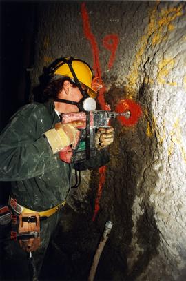
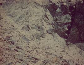
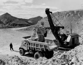
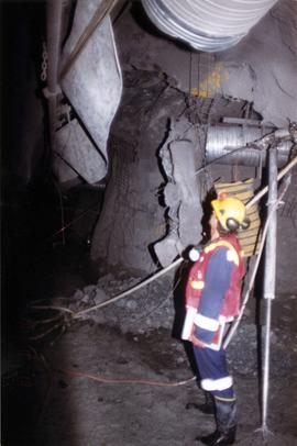
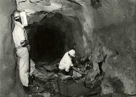
Handwritten caption beside this photo reads: "Elaborate barricades required due to amount of loose rock falling continuously". Three men work in area confined by barricades made of vertical metal rods and horizontal wood planks. Miscellaneous building material and supplies cover the ground. Rock pile in foreground on right.
Photograph depicts a construction worker carrying a plank of lumber across a higher level area of the construction site, semi-constructed walls below him. Barricades against loose rock are semi-visible in foreground (see item 2000.1.1.2.352).
Three men work in area confined by barricades made of vertical metal rods and horizontal wood planks (see item 2000.1.1.2.352). Two ladders in foreground, (one being used by construction worker). Lumber and semi-finished walls can be seen at higher level of elevation in background.
Stick, boom, and bucket of a "NORTHWEST" cable shovel excavator can be seen left of a steep wall of earth in lower level of construction area. Construction worker is partially visible in foreground on far right. Building materials in background.
Handwritten caption beside this photo reads: "View of completed building." Large door on side of building, offering view of interior. Miscellaneous material in snowy foregrounded area: tractor equipment, steel drum, lumber etc.
Handwritten annotation on recto of photograph: "FORMING FOOTING RETAINING WALL JULY 4/64." Photograph depicts construction workers
standing in forms for cement laid against mountain wall on high elevation of construction site. A retaining structure made with wood planks and rebar separates mountainside dirt from cement forms. A front end loader can be seen in midground, near unidentified building. Mountain range in background.
Handwritten annotation on recto of photograph: "POURING FOOTING RETAINING WALL JULY 4/64." Photograph depicts construction workers manually pouring cement into forms laid against mountain wall on high elevation of construction site. Cement is being transported by wheelbarrow. A retaining structure made with wood planks and rebar separates mountainside dirt from cement forms. A bulldozer can be seen in background, as well as a front end loader and back hoe tractor. Building at crusher site also in background.
Handwritten annotation on recto of photograph: "RETAINING WALL POUR JULY 9/64." Photograph depicts large unidentified machinery in front of the retaining wall under conveyor of crusher building. Boom of crane can be seen in midground on right. Crusher building in background, dirt road in foreground.
Handwritten annotation on recto of photograph: "FORMING FOOTING FOR TRANSFORMER HOUSE AUG 20/64." Photograph depicts construction workers standing in forms made of wood and rebar for cement footings. Lumber scattered throughout, mountain range in background.
Photograph depicts large square model of the new mill building that was built at the Cassiar plant site in 1970. Model is displayed on green material set on a platform in snowy area. Machinery modeled inside the structure is colour-coded. Mountain in background.
Photo depicts workers at construction site of Cassiar's new mill building.
Photograph depicts the Cassiar townsite in foreground. Mill, dry rock storage building, and tailings pile can be seen in background. Handwritten annotation on verso of photograph: "1958 [1961 crossed through]."
Photograph depicts the Cassiar plantsite in foreground, including the mill, dry rock storage building, tailings pile, and many other buildings. Townsite in midground, mountains in background. Handwritten annotation on recto of photograph: "Cassiar."
Photograph depicts the mine road in valley below bulldozer parked on edge of mountain. Cassiar plant and town visible in distance, south mountains behind them in background. Photo also depicts what appears to be a cloud rising from the tailings pile in plantsite.
Photograph depicts the primary crushing plant in foreground. Mine road can be seen below, and plant is visible in distance. South mountains in background. Handwritten annotation on recto of photograph: "1961-1962".
Photograph depicts the mine road in valley bellow mine. Cassiar plant and tailings pile in foreground. Handwritten annotation on recto of photograph: "Oct. 25 / 65 4:25 PM."
Photograph depicts the Cassiar mine after extensive strip mining. It is believed that the North and South peak stand in background, and the West peak in foreground. Handwritten annotation on recto of photograph: "1971".
Photograph depicts the Cassiar valley: town in foreground, plant and tailings pile in background. Mountain range visible in distance. Photograph was taken from above, facing east.
Photograph depicts the Cassiar valley: plant and tailings pile on left, town on right. Mountain range visible in distance. Photograph was taken from above, facing south.
Photograph depicts the Cassiar mine. North peak featured in left background, South peak in right background, and West peak in right foreground. Area to left of the mining pit and West peak was called the "cirque waste dump." Mountain range visible in distance.
Photograph depicts the town of Cassiar behind plant and tailings pile in foreground. Mountain range in background.
Photograph depicts the town of Cassiar in distance behind pit mine in foreground. South mountain range in background. Photograph was taken from the air, portion of plane visible in top left of image.
Photograph depicts the pit mine, and road in valley below. Town of Cassiar can be seen in distance at foot of south mountain range.
Photograph depicts the Cassiar mine, switchback road in foreground, mountain range in background. Pit is visible behind the West peak. The new mine garage can be seen on West peak just above "#7 switchback" in centre of image. Photograph was taken from the air, portion of plane visible in top left of image.
Photograph depicts the Cassiar mine in mountain range. Crushing plant and tramline station visible in foreground, and new mine garage can be seen on West peak on far left.
Photograph depicts the Cassiar mine in foreground, north east mountain range in background. Tramline station and crushing plant visible in foreground in front of pit. Photograph was taken from the air, portion of plane visible in top left of image.
Photograph depicts the Cassiar mine in foreground, north east mountain range in background. Tramline station and crushing plant visible in foreground, west of pit. Photograph was taken from the air, portion of plane visible in top left of image.
File contains portraits and sample photographs of exposed asbestos fibre: in veins of rock outcrops, and loose in talus on McDame Mountain (location of Cassiar mine). Some photographs were printed in Cassiar's Annual Reports, with labels and descriptions.
Photograph depicts a pick hammer hanging from outcrop. Annotations on note glued to recto of photograph: "ASBESTOS"; "Outcrop of fibre bearing serpentine about centre of deposit and vertically over 300 adit on western slope." Areas of image have been labeled "A" and "B". Photo caption under printed copy of image in 1952 Annual Report: "A - indicates asbestos talus. B - indicates asbestos veinlets."
Photograph depicts exposed asbestos fibre in talus and outcrop.
Photograph depicts two unidentified men on road or mining bench at high elevation on mountain, valley in background.
Photograph depicts shovel loading Kenworth haul truck in mine. Unknown man stands on left, mountain range in background.
Photograph depicts cable-operated shovel loading two Kenworth haul trucks on road in mine area at high elevation. Three unidentified men are gathered around truck in foreground. Valley and mountain range in distance.
Photograph depicts dump truck under power lines and tramlines on gravel road. Buckets hang on line, mountains in background.