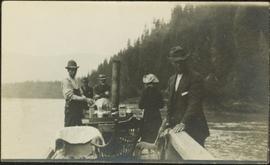
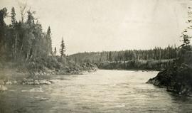
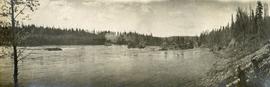
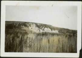
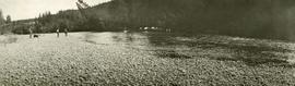
Wide angle photograph of a sparsely forested area with Prince/Fort George in the background. Printed annotation on recto reads: "Fort George, B.C."
Photograph depicts the early settlement of Fort George. The buildings to the left of the fence are believed to be owned by the Hudson's Bay Company. The land to the right of the fence belonged to the Fort George Reserve, the home of today's Lheidli T'enneh Band who relocated to a reserve at Shelley when this reserve was sold in 1912. Handwritten annotation on verso and recto of this photograph reads: "Fort George from opposite side of Fraser River".
Photograph depicts a view of the rocky shores of Fort George Canyon from the deck of a steamship.
Photograph depicts a view of the swirling waters of Fort George Canyon from the deck of a steamship.
Photograph depicts a view of Fort George Canyon.
Photograph depicts a view of Fort George Canyon from the shore. A steamship is in the centre of the river.
File consists of notes, clippings, and reproductions relating to the Fort George Canyon. Includes: "City of Prince George" typescript letter from Kent Sedgwick to Mr. Ron Drane, Manager of Pine Centre (7 June 1984) and "Fort George Canyon Hiking Trail" pamphlet published by the Fraser-Fort George Regional Museum (July 1984). Also includes photographs depicting the Fort George Canyon and men hiking the trail (1985).
Image depicts Fort George Canyon.
File contains slides depicting images of the Fort George Canyon from 1984.
Photograph depicts misty waters and small islands in the river.
Photograph depicts Fort George Canyon from a lofty view. A small building is situated on the river's edge.
Item is a photocopied 1944 map depicting Fort George, published by British Columbia Department of Lands.
Item is a photocopied 1944 map depicting Fort George, published by the British Columbia Department of Lands.
Colour-coded map depicting surveyed lands alienated, available for purchase or lease under Land Act, and available for pre-emption. Depicts land districts, land recording districts, provincial forests, parks, game reserves, communities, bodies of water, transport routes, communication lines, and triangulation stations.
Colour-coded map depicts surveyed lands alienated, available for purchase or lease under Land Act, or available for pre-emption. Depicts land districts, land recording districts, provincial forests, parks, game reserves, communities, bodies of water, transport routes, communication lines, triangulation stations, and government reserves.
The Fort Fraser Historical Photograph Collection consists of 1 photograph album featuring 86 black and white photographs of Fort Fraser and area during the pre World War I era.
Item is a photocopied 1915 map depicting the Fort Fraser Division, published by the British Columbia Department of Lands.
File consists of notes and reproductions relating to Fort Alexandria (later renamed Alexandria). Fort Alexandria was an HBC trading post, ferry site, and steamboat landing in the North Cariboo, 45 km south of Quesnel. File contains photographs depicting Fort Chilcotin, the landscape and buildings (Sept. 1983 and Aug. 2006).
Handwritten annotation on recto of photograph: "FORMING FOOTING RETAINING WALL JULY 4/64." Photograph depicts construction workers
standing in forms for cement laid against mountain wall on high elevation of construction site. A retaining structure made with wood planks and rebar separates mountainside dirt from cement forms. A front end loader can be seen in midground, near unidentified building. Mountain range in background.
Image depicts the former location of the Giscome mill foreman's house on the hill with Eaglet Lake in the background. Map coordinates 54°04'28.0"N 122°22'05.8"W
Image depicts the former location of employee houses on mill site in Giscome, B.C. Map coordinates 54°04'23.4"N 122°22'16.9"W
Photograph depicts one woman with her back turned, and four men standing on scow next to chairs and table adorned with food. Trees on shore in background. Handwritten annotation on recto of photograph reads: "Bourchier Scow".
Photograph depicts men on river boat and small canoe floating just off shore. Men sit and stand on shore among square bales and large cut lumber. Forest in background. Handwritten annotations on recto of photograph: "Fort Fraser wooding up at Giscome Portage", "Chilco at Giscome Portage".
Image depicts a view of a forested valley in the mountains somewhere along the White Pass railway.
Image depicts a view of a forested, mountainous area and a river, somewhere along the White Pass railway. The slide is labelled "begin climb," suggesting the image was taken at the beginning of the White Pass Train's ascent into the mountains.
Image depicts a forested mountain side somewhere along the White Pass railway. The thin ridge along the mountain side is possibly either a highway or part of the railway.
Image depicts a trail through the forest somewhere on Haida Gwaii.
Image depicts a trail through the forest somewhere in or near Seton Portage, B.C.
Colour-coded topographic map depicts forest stands of different heights.
Image depicts a forested mountain side somewhere near Murray Ridge.
Image depicts a forested area located somewhere near the Tseax Lava Flow.
Item is a photograph of a forested area southwest of Chittagong, Bangladesh close to the border with Burma.
Image depicts a group of trees in the Cottonwood Park, with a sign which reads: "This is the primary plantation for the 'Forest for the World' project. These trees were planted on August 5, 1985, commemorating Prince George's 70th birthday by the citizens of Prince George & Expo 86'."
Photograph depicts the location of the proposed powerhouse on Klemtu Lake.
Image depicts a view of a forest and river somewhere along the White Pass railway. The thin line in the mountain side is possibly a highway.
Item is a photograph of a forested area with a partially frozen river, exact location unknown.
Photograph depicts mountain range in distance, forest in foreground. Area speculated to be near Atlin, B.C.
Photograph depicts thick forest in foreground, cliffs in distance.
Image depicts a few unknown individuals walking through the forest at Cheslatta.
Image depicts a forest, possibly somewhere near Woodpecker, B.C.
Image depicts a forest somewhere on Haida Gwaii.
Image depicts a view of the forest in the Fort George Canyon Provincial Park, B.C.
Photograph of several men traveling across a river. Printed annotation on recto reads: "Fording The Nelson River Going to the Naas #93."
Photograph depicts three men and a dog on the streambank, several horses loaded with packs on the opposite bank.
Handwritten annotation on recto of photograph: "FORMING FOOTING FOR TRANSFORMER HOUSE AUG 20/64." Photograph depicts construction workers standing in forms made of wood and rebar for cement footings. Lumber scattered throughout, mountain range in background.
Image depicts an esker at the Foothills Boulevard in Prince George, B.C.
Image depicts a narrow footbridge suspended over a river at an uncertain location.