File consists of a single slide depicting people on tour at the McGregot Model Forest.
Fonds consists of the research and professorial records of Dr. Joselito Arocena, a founding faculty member of UNBC. Arocena was an internationally-recognized soil scientist and UNBC’s first Canada Research Chair. His records demonstrate his accomplishments as an academic and researcher, as well as his many and varied interdisciplinary research endeavours. Also included are selections from Arocena’s extensive photographic slide collection which illustrate his teaching, research projects, and personal interests.
Sin títuloFile consists of:
- David Mills, "Aleza Lake Research Forest Historical Internship Summary" (2 Jan. 2007), 26 p. - In print and original digital .doc file
- David Mills, "Aleza Lake Forest Experiment Station Socio-Economic Time Line 1905-1937" (2007), 68 p. - In print and original digital .doc file
- ALRFS employment paperwork for David Mills, the ALRFS Natural Resource History Intern
- Research notes, including a copy of a map of the town of Aleza Lake in the 1920s
File consists of memoranda from Per Saxvik to Bell-Irving regarding "Fraser River Flow Analysis with Reference to Fish Passage Capacity through the Main Fishways at Hell's Gate". Also includes a "Fraser River Canyon Fish Passage Summary Report (June 1988) Updated October 1989" by Per Saxvik of SEP Engineering.
Image depicts a fossilised mammoth tooth found by Ray Mueller. Photograph taken at map coordinates 54.014188, -121.676973
Image depicts numerous piles of logs, and two unidentified individuals operating an excavator with a "thumb" attachment during the demolition of the Upper Fraser town site. Map coordinates 54°06'51.6"N 121°56'26.3"W
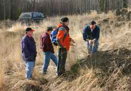
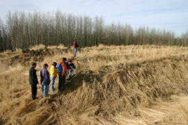
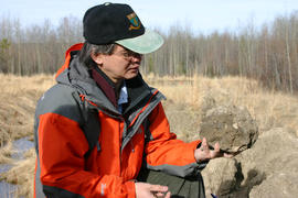
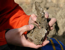
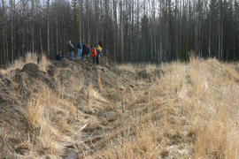
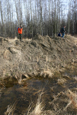
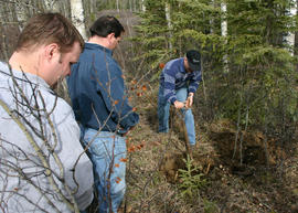
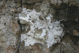
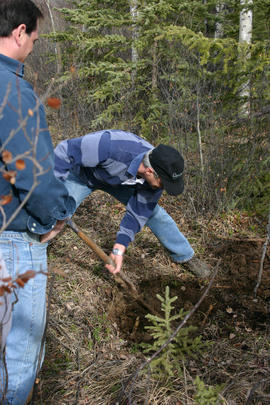
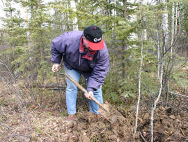
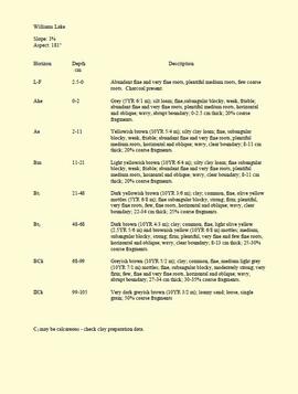
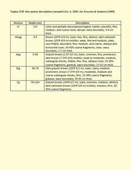
During a year away from studies in 1987-88, Dr. Paul Sanborn developed a successful grant proposal to the Science Council of BC (SCBC) to pursue a postdoctoral project with Dr. Tim Ballard in relation to sulphur-deficient soils in BC and prescribed fire. This project built on an existing broadcast burning study conducted by Macmillan Bloedel Ltd. near Port Alberni on Vancouver Island, led by Bill Beese (later at Vancouver Island University). Dr. Sanborn's work addressed sulphur forms and amounts in the soils at these sites, and the chemical processes influencing sulphur availability in relation to prescribed fire.
Only one part of this work was eventually published:
Sanborn, P.T. and T.M. Ballard. 1991. Combustion losses of sulphur from conifer foliage: Implications of chemical form and soil nitrogen status. Biogeochemistry 12: 129–134.
https://doi.org/10.1007/BF00001810
The remainder of the work was documented in this Project Completion Report to SCBC, dated February 28, 1990, and entitled "Effects of Prescribed Fire on Sulphur in Forest Soils".
Sanborn, P. and R. Brockley. 2005. Sulphur deficiencies in lodgepole pine: occurrence, diagnosis, and treatment. Ext. Note 71. B.C. Min. For., Res. Br., Victoria, B.C.
Unpublished results for the Sulphur stable isotope tracer study (E.P. 886.15) were presented in annual reports to the funding agencies, including this FRBC 2001 Preliminary Final Report from April 2002.
Unpublished results for the Sulphur stable isotope tracer study (E.P. 886.15) were presented in annual reports to the funding agencies, including this FII Final Report from April 2003.
Unpublished results for the Sulphur stable isotope tracer study (E.P. 886.15) were presented in annual reports to the funding agencies, including this "Sulphur Fertilization of Lodgepole Pine: A Stable Isotope Tracer Study (Ministry of Forests E.P. 886.15) - Project Y051210 - Technical Report" from April 2005.
Unpublished results for the Sulphur stable isotope tracer study (E.P. 886.15) were presented in annual reports to the funding agencies, including this Final Technical Report from April 2007.
Document is a BC Ministry of Forests update on proposed research for the Sulphur stable isotope tracer study (E.P. 886.15) from March 1998.
Document is a research installation layout map for the Holy Cross Creek site of the Sulphur stable isotope tracer study (E.P. 886.15).
Document is a research installation layout map for the Kenneth Creek site of the Sulphur stable isotope tracer study (E.P. 886.15).
"Mineralogy of clay and sand fractions of soils developed from till, glaciofluvial and glaciolacustrine deposits in central interior British Columbia" was a preliminary internal report that provides some background to Arocena and Sanborn's regional soil mineralogy study, as well as a compilation of the mineralogical data.
The key results from this work were later published as:
J.M. Arocena and P. Sanborn. 1999. Mineralogy and genesis of selected soils and their implications for forest management in central and northeastern British Columbia. Canadian Journal of Soil Science 79: 571-592. https://doi.org/10.4141/S98-07
This Ministry of Forests internal memorandum of 30 June 1997 from Paul Sanborn to Regional & Research Branch soil scientists provides comparison of Morgan's extractant and BaCl₂ for cations, using the 57 samples from the regional soil mineralogy study.
The key results from the study were later published as:
J.M. Arocena and P. Sanborn. 1999. Mineralogy and genesis of selected soils and their implications for forest management in central and northeastern British Columbia. Canadian Journal of Soil Science 79: 571-592. https://doi.org/10.4141/S98-07
This "Soil Profile Description: Kiskatinaw LTSP Site" document provides a description of Kiskatinaw pedon.
The key results from the regional soil mineralogy study were later published as:
J.M. Arocena and P. Sanborn. 1999. Mineralogy and genesis of selected soils and their implications for forest management in central and northeastern British Columbia. Canadian Journal of Soil Science 79: 571-592. https://doi.org/10.4141/S98-07
This born-digital "Lucille Mountain soils" document provides a description and basic data for the Lucille Mt. pedon.
This born-digital "Profile Descriptions" document provides descriptions of Williams Lake (Skulow Lake), Aleza 1 & 2, Log Lake, and Lucille Mountain pedons.
This born-digital document provides a description of the Topley LTSP site pedon.