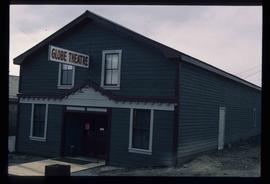
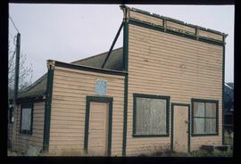
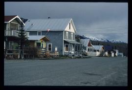
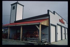
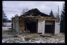
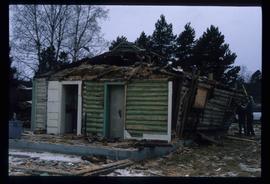
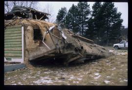
Image depicts a back street in Atlin, B.C.
Image depicts the fire hall in Atlin, B.C.
Image depicts an old building undergoing a restoration process, possibly in Atlin, B.C.
Image depicts the Europe Hotel in Prince George prior to its demolition in the 1980s; however, the slide itself was only made in 1999 and the date of the photo is otherwise unknown, but most likely around 1979.
Image depicts a house in the process of being demolished in Prince George, B.C.
Image depicts a row of houses in Upper Fraser, B.C. Map coordinates 54°06'51.6"N 121°56'26.3"W
Image depicts a railway bridge, possibly in the small town of Fraser, located on the Klondike Highway in B.C.
Image depicts the train station in Carcross, Y.T.
Image depicts old machinery, at the Atlin Museum in Atlin, B.C.
Image depicts Atlin Lake as well as a small section of Atlin, B.C. The mountain is possibly Atlin Mountain.
Image depicts what appears to be a small community on the shore of a lake. The location is uncertain.
Image depicts Atlin Lake.
Image depicts the Globe Theatre in Atlin, B.C.
Image depicts numerous graves in the Atlin Cemetery.
Image depicts the Robert Lowe Bridge, built in 1922, in the Miles Canyon near Whitehorse Y.T.
Image depicts the restored White Pass Snow Plow No.1 in Skagway, Alaska.
Image depicts the White Pass Train crossing over a railway bridge at an uncertain location.
Image depicts another train on the White Pass railway along a forested mountain side.
Image depicts the White Pass Train entering a tunnel in the mountain side.
Image depicts a patch of snow-covered ground with a sign that reads "Trail of 98," somewhere along the White Pass railway.
Image depicts the White Pass Train crossing over a railway bridge at an uncertain location in the mountains.
Image depicts a snow sculpted fire place and couch on a skating rink, possibly during the Winter City Conference, in Prince George, B.C. Taken at the Prince George Civic Center. Map coordinates 53°54'45.6"N 122°44'59.6"W
Image depicts a snow sculpture of the Mr. P.G. lounging on a couch, possibly during the Winter City Conference, in Prince George, B.C. Taken at the Prince George Civic Center. Map coordinates 53°54'45.6"N 122°44'59.6"W
Image depicts a house in the process of being demolished in Prince George, B.C.
Image depicts a boat on the Nechako Reservoir at Kenny Dam.
Image depicts a boat dock on the Nechako Reservoir at Kenny Dam.
Image depicts a playground in Willow River, B.C. The slide labels it as being a "former hotel site." Map coordinates 54°04'23.7"N 122°28'26.9"W
Image depicts a row of houses in Upper Fraser, B.C. Map coordinates 54°06'51.6"N 121°56'26.3"W
Image depicts the Duchess engine, which was built in 1878 and taken out of service in 1919. It was part of a matched set with the Duke and is now a tourist attraction in Carcross, Y.T.
Image depicts the Pine Tree Restaurant in Atlin, B.C. It is possibly part of the Atlin Museum.
Image depicts the Moose Hall in the Atlin Museum. A sign above the door reads: "In 1905 this building was the new Arctic Brotherhood Hall in Discovery. Some years later it was hauled here in two parts by horses to become the Moose Lodge and Community Hall."
Image depicts the government liquor store in Atlin, B.C.
Image depicts a house with stairs up to a small patio area on its roof in Atlin, B.C.
Image depicts the bus depot in Skagway, Alaska (USA).
Image depicts one of the main streets, Broadway, in Skagway, Alaska.
Image depicts the old railroad building in Skagway, Alaska.
Image depicts a snow sculpture of a man with a shovel, possibly during the Winter City Conference, in Prince George, B.C. Taken at the Prince George Civic Center. Map coordinates 53°54'45.6"N 122°44'59.6"W
Image depicts the Northwood Bridge in Prince George, B.C.
Image depicts what appears to be a footbridge at an uncertain location.
Image depicts a dock on the shore of Atlin Lake, as well as a building that may have once been a hospital. The slide is simply labelled "hospital."
Image depicts a sign in the Atlin Cemetery, it reads: "In 1898, Fritz Miller and Kenny McLaren found gold on nearby Pine Creek, triggering British Columbia's last placer gold rush. The boom subsided by 1908, but gold has kept Atlin alive. Now Miller and McLaren lie here among hard-bitten prospectors, young miners, northern aviators, brave women and new-born infants, all part of Atlin's pioneer heritage R.I.P."
Image depicts a memorial plaque which reads: "In memory of the Atlin men who gave their lives for their country in World War II," and then proceeds to list several individuals.
Image depicts the original steam engine for the White Pass Train, located in Skagway, Alaska.
Image depicts an old trestle along the White Pass railway.
Image depicts Nautley and the Nautley River near Fraser Lake, B.C.
Image depicts a section of land on the east end of Francois Lake. The lake is visible in the distance.
Image depicts Nautley and the Nautley River near Fraser Lake, B.C.