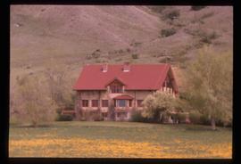
Showing 4312 results

Archival description
3025 results with digital objects Show results with digital objects
2012.13.2.02.43.02 · Stuk · [2006?]
Part of J. Kent Sedgwick fonds

The item is a photograph and negative of a survey map of the Prince George townsite South of the Nechako River and West of the Fraser River.

2012.13.2.02.43.20 · Stuk · [2006?]
Part of J. Kent Sedgwick fonds

The item is a photograph negative of a man and woman sitting in front of a house. They are dressed in formal attire and are drinking what appears to be a glass of wine.

"Situating PG"
2012.13.5.07.1 · Stuk · 26 Mar. 2006
Part of J. Kent Sedgwick fonds

The item is a CD-R containing 36 jpg. photographs relating to Kent Sedgwick's guest lecture on Prince Gorge geography and development.

Soda Creek
2012.13.1.50.139 · Stuk · 2006
Part of J. Kent Sedgwick fonds

Image depicts rail road tracks through a forest, as well as a river; located in Soda Creek, B.C.

4555 Marston Road
2012.13.2.15.02.08 · Stuk · 2006
Part of J. Kent Sedgwick fonds

The photograph depicts a white duplex on Marston Road. The address on the duplex reads 4555.

2012.13.2.02.43.19 · Stuk · [2006?]
Part of J. Kent Sedgwick fonds

The item is a photograph negative of a man and woman sitting in front of a house. They are dressed in formal attire and are drinking what appears to be a glass of wine.

2012.13.3.1.26.1 · Stuk · 2006
Part of J. Kent Sedgwick fonds

The item is a photograph depicting a house at 1705 Fir Street, Prince George. Annotation on the back of the photograph states, "1705 Fir St. - N. of F-C school at 17th. 1st Cath. Church off reserve Sept. 13? Rev. Rivet."

Moffat (Gunn) farm
2012.13.3.1.55.1 · Stuk · 10 May 2006
Part of J. Kent Sedgwick fonds

The item is a photograph depicting the exterior of old damaged buildings on the Moffat farmland. There is a fence at the entrance to the driveway with an address sign that reads "1820." Annotation on the back of the photograph states, "Moffatt (Gunn) farm 2005."

Moffat (Gunn) farm
2012.13.3.1.55.2 · Stuk · 10 May 2006
Part of J. Kent Sedgwick fonds

The item is a photograph depicting the exterior of old damaged buildings on the Moffat farmland. There is a fence at the entrance to the driveway with an address sign that reads "1820."