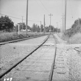
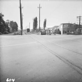
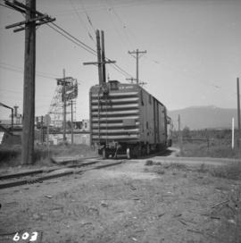
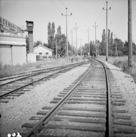
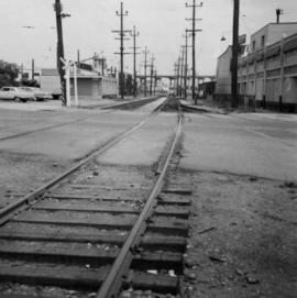
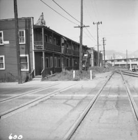
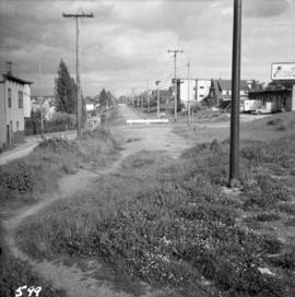
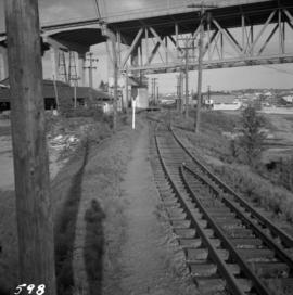
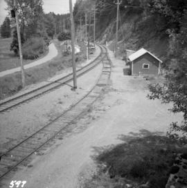
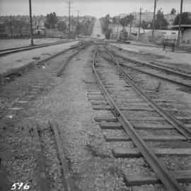
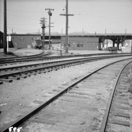
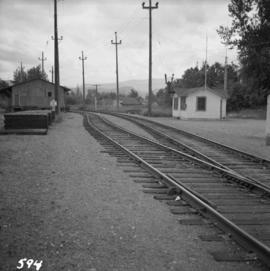
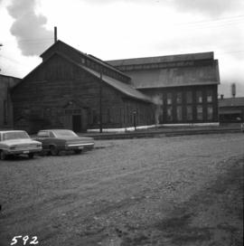
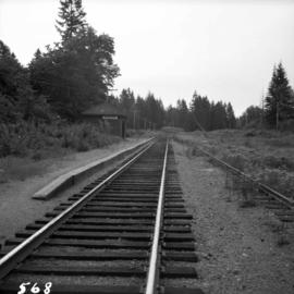
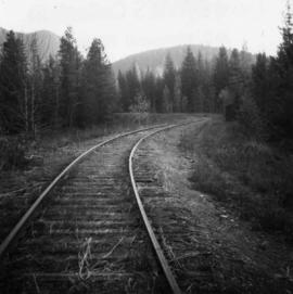
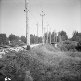
Photograph depicts the B.C. Electric Railway turning east at Glover Rd., south of Fort Langley.
Photograph depicts a passing spur on the B.C. Electric Railway at Kennedy Station, 4 miles south of New Westminster. The view is looking north.
Photograph depicts the electricity station at Coghlan on the B.C. Electric Railway, which is 9 rail miles east of Langley in the Fraser Valley. The view is looking east.
Photograph depicts the B.C. Electric Railway, looking east from the depot at Cloverdale.
Photograph depicts the B.C. Electric Railway crossing at Serpentine Creek, 2 miles west of Cloverdale. The view is looking north.
Photograph depicts ten ballast cars of the B.C. Electric Railway on newly laid industrial spur on the northeast side of the Langley depot.
Photograph depicts the B.C. Electric Railway crossing on Main St. in Langley, looking southwest.
Photograph depicts a B.C. Electric Railway locomotive #902 and boxcar entering the Kitsilano yards and crossing 2nd Ave., near Fir St. in Vancouver.
Photograph depicts the B.C. Electric Railway in Langley, looking northeast from town grade crossing.
Photograph depicts the site of the former Marpole inter-urban depot, looking east.
Photograph depicts the B.C. Electric Railway crossing 3rd Ave. with the first intersection at the immediate left. Note the abandoned double trackage at left. The view is looking north.
Photograph depicts the commencement of the B.C. Electric Railway right-of-way at Commercial Dr. and near 22nd Ave. in Vancouver. It was built in 1891. The view is looking southeast towards New Westminster.
Photograph depicts the north end of the False Creek trestle, looking east towards the C.P.R. yards in Vancouver.
Photograph depicts a view looking northeast of the B.C. Electric Railway from the abandoned Sumas substation at Vedder Mountain.
Photograph depicts B.C. Electric Railway trackage being removed to approaches of locomotive house in New Westminster. The view is looking northeast, probably up 14th St.
Photograph depicts the B.C. Electric Railway workshops at the south end of the Burrard bridge in Vancouver. The view is looking west and depicts caboose A10 in the background.
Photograph depicts the B.C. Electric Railway depot at Huntingdon and Sumas, about 20 ft from the U.S.-Canadian border. The view is looking southeast.
Photograph depicts the C.P.R. yards just west of downtown passenger station and in front of Pier B, owned by the C.P.R. The view is looking northwest from Burrard St.
Photograph depicts the west side of the C.P.R. engineering shops at Revelstoke. The building appeared to house a machine shop and had no cars or locomotives inside.
Photograph depicts the middle section of C.P.R. Pier A1 at the foot of Thurlow St., which was built in 1890. The pier is in regular use though its seaward face is in very poor shape.
Photograph depicts the C.P.R. yards in Vancouver, just west of railway station in the downtown area. The view is looking east from Burrard St.
Photograph depicts the C.P.R. engineering shops at Revelstoke. The view is looking north, with the line from Arrowhead behind the camera.
Photograph depicts a general view of switch detail at the C.P.R. False Creek yards in Vancouver.
Photograph depicts a steam or air engine used for turning locomotive table at the Coquitlam yards.
Photograph depicts a tower controlling the C.P.R. grade crossing at Alexander St. in Vancouver, B.C.
Photograph depicts the C.P.R. summit of the southern transcontinental C.P. line at Crowsnest Pass on the Alberta-B.C. border. The roundhouse is disused. Four men are working on the turntable; it is unclear whether they are rebuilding its eastern face or demolishing it by breaking down one wall to get at the table. The site is 4,453 ft. above sea level and the view is looking south.
Photograph depicts a turntable outside a disused roundhouse at the C.P.R. yards in Coquitlam. The turntable is still in use.
Photograph depicts a full but unused water tank at Duncan Station on the Esquimalt and Nanaimo Railway on Vancouver Island.
Photograph depicts a water tower beside a rail line.
Photograph depicts a C.P.R. grade crossing warning device at Haney.
Photograph depicts a water tower.
Photograph depicts equipment on a rail line.
Photograph depicts the C.P.R. Pritchard depot, 25 miles east of Kamloops. The passenger turnstile is unusual though found elsewhere in this area. The depot is long unused for passengers and is now used by a permanent way gang.
Photograph depicts the C.P.R. depot at Kimberley. It is in the center of the town, looking up towards the Kimberley mine which is 1 mile away. The last passenger service (1 coach) between Kimberley and Cranbrook ran about 1955.
Photograph depicts a C.P.R. rail car slip at Slocan City, on the south end of Slocan Lake, on the line between Slocan and South Slocan. The view is looking north.
Photograph depicts the C.P.R. Michel Station between Crow's Nest and Fernie. The view is looking west towards the only working colliery left in the district. The station is disused but in good repair.
Photograph depicts a C.P.R. barge on Slocan Lake, travelling north just after leaving Slocan. It holds a complete train including a locomotive, eight cars, and a caboose.
Photograph depicts the C.P.R. depot at Slocan City. At the left beyond the photo is the ferry slip on Slocan Lake.
Photograph depicts the Malahat Station on the Esquimalt and Nanaimo Railway on Vancouver Island. The view is looking south towards Victoria.
Photograph depicts the C.P.R. Cowichan depot on Vancouver Island. The view is looking south.
Photograph depicts sheds and repair center of the C.P.R. at Victoria, near Lime Bay. The rail-liner just came in from the daily run to Courtenay.
Photograph depicts the C.P.R. depot at Goldstream on Vancouver Island. The view is looking towards Victoria.
Photograph depicts the C.P.R. depot at Duncan on Vancouver Island, with a view looking northeast.
Photograph depicts the C.P.R. line at New Denver. Formerly there was a railroad between Kaslo and Nakusp, via New Denver. The section between 1 mile out of Kaslo and 1 mile east of New Denver was lifted in the 1950s. This is the most easterly section of track at New Denver and oil trains back up to it to get into an oil depot and a run-around loop. This section was the start of a stiff grade into the mountains.
Photograph depicts the C.P.R. rail line.
Photograph depicts the C.P.R. station at Kaslo on Kootenay Lake and the beginning of the steep grade of the former Kaslo-New Denver Railway. The line on the left leads to the Kaslo depot and ferry slip, and that on the right goes another 200 yards to an oil depot. All trains did and do a reverse at the foot of grade at the left behind the photo.
Photograph depicts the C.P.R. train station at Kaslo. At one time the line ran between Kaslo and Nakusp, via New Denver. It was lifted in 1915-1920. The trackage now consists of Kootenay Lake slip and about 1 mile of sidings. It is used mainly for oil (incoming) and lumber (outgoing).
Photograph depicts the grade of a former railway between Kaslo and New Denver, just on the east side of the summit at Retallack.
Photograph depicts the C.P.R. wharf at Kaslo on Kootenay Lake. The wharf is used to load/unload cars from vehicles or lake scows. The ferry slip itself is beyond the tank cars, at the center middle distance of the photo.