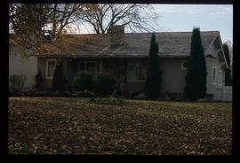
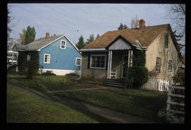
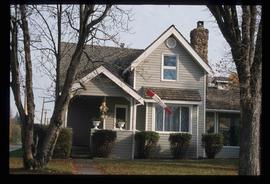
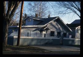
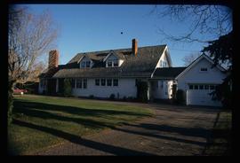
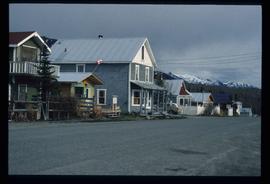
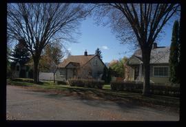
Image depicts 1465 Elm Street, 1445 Elm Street, and 1425 Elm Street in the Millar Addition neighbourhood of Prince George, B.C.
Image depicts 1425 Taylor Drive in Prince George, B.C.
Image depicts 1650 Dogwood Street and 1670 Dogwood Street in the Millar Addition neighbourhood in Prince George, B.C.
Image depicts a property given to the Veterans of the Second World War, located on the corner of 15th Avenue and Elm Street in Prince George, B.C.
Image depicts 1510 Fir Street in Prince George, B.C.
Image depicts 1590 Fir Street in Prince George, B.C.
Image depicts 135 Patricia Boulevard in Prince George, B.C.
Image depicts the Giscome mill site in Giscome, B.C. The bunkhouse is in the background on the left and the school is in the foreground on the right. Map coordinates 54°04'04.8"N 122°22'04.7"W
Image depicts the Giscome mill site in Giscome, B.C. The bunkhouse is the large building with many windows. A train and railroad tracks are in the foreground. Map coordinates 54°04'17.6"N 122°22'06.1"W
Image depicts employee houses on mill site in Giscome, B.C. Tug boats are in the foreground on the right. Map coordinates 54°04'23.4"N 122°22'16.9"W
Image depicts a street of houses in Giscome, B.C. Map coordinates 54°04'20.9"N 122°21'53.1"W
Image depicts numerous old buildings on a main street in Atlin, B.C.
Image depicts a pyramid shaped house, possibly located in Atlin, B.C.
Image depicts what is possibly Atlin Lake, with numerous mountains in the distance and Atlin Mountain visible on the right of the image.
Image depicts the grave of John Wolters in the Atlin Cemetery. It reads: "Born in Kent, England, Jan 16 1857. Died Sept. 21 1905."
Image depicts a river in the Miles Canyon near Whitehorse Y.T.
Image depicts a river in the Miles Canyon near Whitehorse Y.T. The Robert Lowe Bridge, built in 1922, can be seen over the canyon.
Image depicts a lake and a cabin at an uncertain location.
Image depicts a bear, possibly a grizzly. The location is uncertain.
Image depicts a sign, labelled "The White Pass Snow Fleet," which details the history of the fleet; it is located in Skagway, Alaska.
Image depicts two merging railway tracks, and what appears to be a frozen river, somewhere near the summit of a mountain.
Image depicts a view over a forested, mountainous area and a river towards the vicinity of Skagway, Alaska.
Image depicts a grave somewhere along the White Pass railway.
Image depicts the Northwood Bridge in Prince George, B.C.
Image depicts the Prince George Sawmill from the Northwood Bridge.
Image depicts two unknown individuals at the Tsilcoh Falls, north of Fort St. James and somewhere near Pinchi Lake Road.
Image depicts a field along Telegraph Road, south-west of Vanderhoof, B.C.
Image depicts Telegraph Road, south-west of Vanderhoof, B.C.
Image depicts a field along Telegraph Road, south-west of Vanderhoof, B.C.
Image depicts Francois Lake.
Image depicts a section of land on the east end of Francois Lake. The lake is visible in the distance.
Image depicts four individuals sitting on a log, possibly somewhere near the Hansard Bridge, B.C. The individuals are UNBC faculty members Gail Fondahl, Tracey Summerville, Greg Halseth and an unidentified individual. The slide is labelled: "Hansard Bridge UNBC." Map coordinates 54°04'37.7"N 121°50'39.9"W
Image depicts the office at the Northwood Upper Fraser Saw Mill and a sign which reads "Have a safe, quality day." Map coordinates 54.117916, -121.943351
Image depicts an Anglican Church at the Atlin Museum.
Image depicts a back street in Atlin, B.C.
Image depicts the fire hall in Atlin, B.C.
Image depicts an old building undergoing a restoration process, possibly in Atlin, B.C.
Image depicts the Europe Hotel in Prince George prior to its demolition in the 1980s; however, the slide itself was only made in 1999 and the date of the photo is otherwise unknown, but most likely around 1979.
Image depicts a house in the process of being demolished in Prince George, B.C.
Image depicts a row of houses in Upper Fraser, B.C. Map coordinates 54°06'51.6"N 121°56'26.3"W
Image depicts the road to Skagway, Alaska. Possibly located on the Klondike Highway in British Columbia with Tutshi Lake on the left.
Image depicts a railway bridge, possibly in the small town of Fraser, located on the Klondike Highway in B.C.
Image depicts the train station in Carcross, Y.T.
Image depicts old machinery, at the Atlin Museum in Atlin, B.C.
Image depicts Atlin Lake as well as a small section of Atlin, B.C. The mountain is possibly Atlin Mountain.