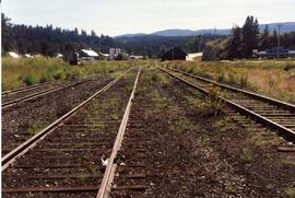
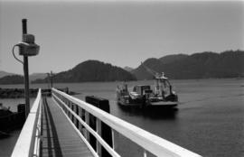
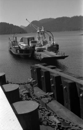
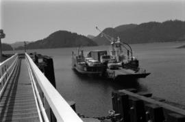
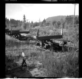
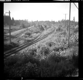
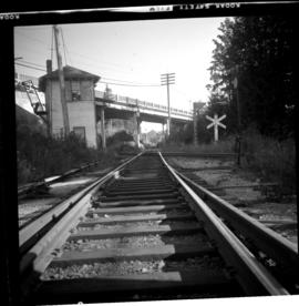
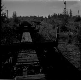
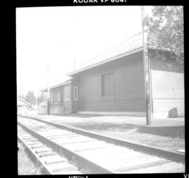
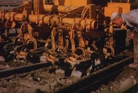
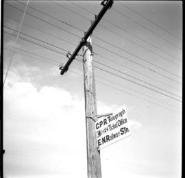
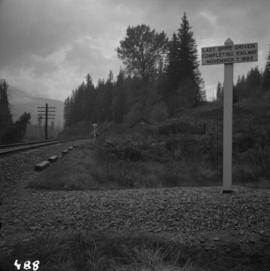
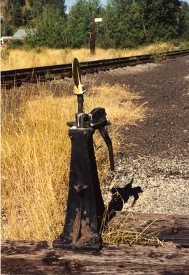
Photograph depicts details of a switch stand.
Photograph taken looking west towards the depot in Princeton on mile 70.5.
Photograph depicts an open space where former yards of the KVR were located. Visible is a 2 stall engine shed, a turning ballon (in place of a wye), and the connection with the 14 long Copper Mountain Bracnch which conveyed copper concentrate and closed in 1957. Just out of view, on the right, was the Princeton Tunnel built by the GNR in 1910.
File consists of documentary photographs taken by David Davies of restoration the Kettle Valley Railway near Summerland in British Columbia.
Image depicts the Kwinitsa CNR station in Kwinitsa, along the Skeena River.
Image depicts the Kwinitsa CNR station, which is Prince Rupert's railway museum.
Photograph depicts the "Kwuna" Ferry from the wharf at Sandspit, Queen Charlotte Islands.
Photograph depicts the "Kwuna" ferry coming in to dock at the landing at Sandspit, Queen Charlotte Islands.
Photograph depicts the "Kwuna" ferry about to dock at the landing at Sandspit, Queen Charlotte Islands.
Photograph depicts the "Kwuna" ferry coming in to the landing at Sandspit, Queen Charlotte Islands.
Photograph depicts an island and ferry at the "Kwuna" ferry landing at Sandspit, Queen Charlotte Islands.
Subseries contains timecards, labour records, and employee documents.
Photograph depicts the a sign about 200 yards away from depot aadjacent to the Island highway. It was probably erected within the last 9 months as a result of the Canadian Transport Commission's investigation of the Esquimalt & Nanaimo Railway in late 1970. Amongst the other structures there is a lack of sign posting, dirty and unkept stations, and active discouragement of passenger traffic.
Photograph depicts disused cars on the CPR spur just north of the crossing between the Esquimalt & Nanaimo Railway and Comox Logging and Railway Company (Division of Crown Zellerbach Canada Ltd.)
Photograph depicts the Ladysmith diamond crossing, looking north from the highway. Esquimalt & Nanaimo Railway is visible on the right and in the centre. On the left are the Comox Logging and Railway Company lines. Strings of disused log cars are on the centre tracks and are owned by CPR.
Photograph depicts the crossing between the Esquimalt & Nanaimo Railway (the camera is facing these tracks) and Comox Logging and Railway Company. The guard tower was manned at 7:00 p.m. and had its roof recently reshingled. It faces southward.
Photograph depicts disused log cars standing on spurs immediately north of the crossing between Esquimalt & Nanaimo Railway and Comox Logging and Railway Company. Both track cars are owned by CPR. Note: protection signals are located on the right. The camera is aimed towards the north.
Photograph depicts Lake Cowichan. Trackage that is unconnected is visible in the foreground. Depot itself is a house and a rail museum combined. It was closed at the same time as the Honeymoon Bay mill. Permission was given to close the 18 mile brand line on November 13, 1984. Track lifting commenced on November 20, 1984.
Postcard depicts the Lake Louise CPR depot.
Image depicts a camper on the shore of what is possibly Melita Lake, near the Tseax Cone.
Photograph depicts a replica of the "SS Beaver" built by the RCN in Esquimalt and moored in Vancouver, open to the public. The original ship left Gravesend on August 29, 1935 and reached Fort Vancouver (Oregon) on April 10. 1936.
Photograph depicts a lake steamer called "Proctor." It was a wood hull steam vessel that was built in Nelson in 1900 and was owned by the CPR. It worked on Kootenay Lake till 1904 and then transferred to Trout Lake. The vessel was sold by the CPR in 1917 when they quit the service and ran privately till it was laid up in 1921.
File consists of a duotang containing a typescript essay titled "Land Speculation and the Railway Station in Prince George" by Alistair Mcvey for a geography class.
Photograph depicts "Landing Craft #10," of the B.C. Provincial Forestry Service.
Photograph depicting a landscape with a lake and a mountain in the background.
File contains images depicting various landslides near Cassiar BC. Set of 20 photographs (with 9 corresponding negative strips) date stamped June 1987 depict landslide near creek and dirt road with a Cassiar company truck. Set of 5 black and white photographs found in envelope marked "D. Stewart" are likely from 1988-1989 and depict a rockslide on the south western side of the pit mine, near the tramline. Album entitled “6200 DUMP SLIDE / SPRING, 1979” contains 34 photographs depicting aerial shots of a massive rockslide on the eastern slope of McDame Mountain, originating from the mine waste dump. Several images from album show greenish water pooling in the toe of the slide.
Photograph depicts long bridge over river. Closest pier in left foreground, opposite shore in background.
Image depicts a large building with numerous vehicles in the foreground.
Large crowd is gathered around main building in a harbor. Many boats visible in foreground. Smoke from tugboat partially obscures the scene. Annotation on recto reads: "Prince Rupert BC. Photo by MCrae Bros."
Photograph depicts large fish laid next to a metal L ruler. Fish rests on dark wood speculated to be inside of boat or box of truck. It is believed this photo was taken at Summit Lake, B.C.
View from of a large ship in dry dock surrounded by water. Printed annotation on recto reads: “G.T.P. Dry dock Prince Rupert B.C. McRae.”
Photograph depicting a large stone surrounded by trees in an unknown location.
Photograph depicting a large stone surrounded by trees and two people sitting on top of it.
Photograph depicts a large wave breaking over the bow end of a weather ship.
Photograph depicts the last spike at Craigellachie, 15 miles northeast of Sicamous, looking southwest.
Photograph depicts men standing on different deck levels of conveyor on the Fraser River. Wood planks built into shore in foreground, trees on opposite shore in background. Handwritten annotation on verso of photograph reads: "Launching Conveyor", on recto: "Launching the rebuilt steamer Conveyor at Tete Jaune 1912".
Dock in foreground, ship in water, mountain in background. Unidentified men partially visible in foreground. Printed annotation on recto reads: “Launching of Canadian Scottis –CGM.M. 5500, ton ship at Prince Rupert B.C.”
This clip of original film footage depicts Pacific Great Eastern Railway (PGE) track laying in Northern British Columbia.
Image depicts numerous boats docked by the Prince Rupert Fishermen's Co-operative Association from the deck of a ferry, possibly as it's leaving Prince Rupert, most likely for Haida Gwaii.
Image depicts several individuals seated on a ferry as it possibly departs from a dock somewhere in Prince Rupert, B.C. It is most likely headed for Haida Gwaii, B.C.
Image depicts a building, possibly an office building, next to a set of rail road tracks in Leo Creek, B.C. An unknown individual is present, and a number of barrels and culverts are visible in the foreground.
Front of engine reads "BRITISH COLUMBIA, CANADA". Building and construction area visible in background.
Front of engine reads "BRITISH COLUMBIA, CANADA", "2860". Decorated building stands in left background. A man with large video camera and an RCMP officer in a red serge can be seen standing in crowd. Mountain peak visible in distance.
Image depicts numerous vehicles and individuals outside a hotel in Likely, B.C.
Image depicts a hotel in Likely, B.C.
Photograph depicts the the Lillooet River Bridge north of Pemberton, BC. Mt. Currie is visible in the background.
Photograph depicts a car crossing the Lillooet Suspension Bridge (also known as the Lillooet Old Bridge) over the Fraser River.
Photograph depicts a line of cabooses on the caboose track at Revelstoke. There are rumours that the vehicles are to become obsolete by replacing them with a monitoring device attached to the last car of a train.
The last spike ceremony was held on April 7, 1914 one mile east of Fort Fraser, BC.