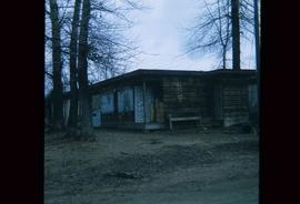
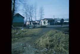
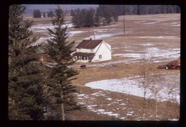
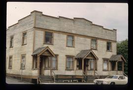
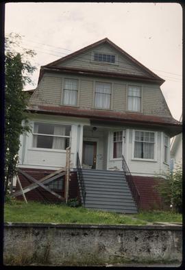
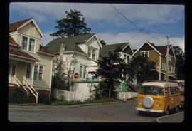
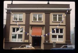
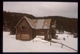
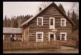
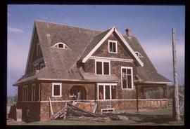
File contains slides depicting places in the area around Williams Lake, Clinton, and the Fraser Canyon.
Image depicts a number of small houses at Island Cache.
Image depicts a stand of trees and a shed at Island Cache.
Image depicts what is likely an outhouse at Island Cache.
Image depicts a clearing at Island Cache.
Image depicts a grocery store at Island Cache.
Image depicts a house in Island Cache. There are several cars parked outside it.
Image depicts a boarded up building in Island Cache.
Image depicts two children standing near an old car in Island Cache.
Image depicts a number of sheds in Island Cache.
File contains slides depicting Wells, B.C.
File consists of notes, clippings, and reproductions relating to South Fort George. Includes: "South Fort George - A trip to the past" heritage brochure produced by South Fort George Community Association (1987) and "B.C. Express Co. Heritage Site" typed document prepared by the Heritage Advisory Committee (Feb. 1994). Also includes photographs depicting various buildings from old South Fort George.
Image depicts a snow gauge at an uncertain location.
File contains slides depicting places in and between McBride and the Yellowhead Pass via the Yellowhead Highway.
Image depicts an old beehive burner at an uncertain location.
Image depicts an old and abandoned cabin with ivy growing up the side. The location is uncertain.
Image depicts the CN Station in Penny B.C. A woman, possibly Sue Sedgwick, is sitting against the outside wall.
Image depicts the CN Station in Penny B.C.
File contains slides depicting numerous recreational locations from various places in Canada.
Image depicts a snow-covered cabin and a mountain in the distance. It is located somewhere near Birken, B.C.
File contains slides depicting various types of instruments at various locations, including Willow River.
File contains slides depicting a caving group in various places in West Virgina, USA.
The item is a blueprint depicting proposed floor extensions for Walter Blaufuss. Plans are for Northern Upholstery on the ground floor and a residential penthouse above the commercial space. Building address was 535 Dominion Street, Prince George. The architect is W. Ralph Brownlee and drawn by E. O. E. Blueprints indicate it is designated as "job 5304" and "sheet W.2."
The item is a blueprint depicting proposed floor extensions for Walter Blaufuss. Blueprints originally drawn in April 1953 and include revisions made on 29 April 1953 and 2 May 1953. Blueprints are for a basement and stairs. Building address was 535 Dominion Street, Prince George. The architect is W. Ralph Brownlee and drawn by E. O. E. Blueprints indicate it is designated as "job 5304" and "sheet W.1."
The item is a blueprint depicting proposed floor extensions for Walter Blaufuss. Blueprints depict the exterior of the building. Building address was 535 Dominion Street, Prince George. The architect is W. Ralph Brownlee and drawn by E. O. E. Blueprints indicate it is designated as "job 5304" and "sheet W.3." Notes attached to the blueprint state, "Acme Electric adjacent on north" and "w. side of."
File consists of architectural drawings done by J.F. Watson and W. Ralph Brownlee for Prince George buildings. Includes: "Addition to Goglin building 4th Ave" architectural drawing by J.F. Watson (Oct. 1952); "Floor and roof plans" architectural drawing by W. Ralph Brownlee depicting proposed floor extensions for Walter Blaufuss (May 1953); and "Found plan & sects". architectural drawing done by W. Ralph Brownlee depicting proposed store extensions for Walter Blaufuss (Apr.-May 1953).
The item is a blueprint depicting interior additions to the Goglin building on 4th Avenue, Prince George. Blueprints are for Cariboo Motors and indicate it is "sheet No. 1 of Two." The architect is J. F. Watson and plans were drawn by J. H.
The item is a blueprint depicting exterior additions to the Goglin building on 4th Avenue, Prince George. Blueprints are for Cariboo Motors and indicate it is "Sheet 2 of Two." The architect is J. F. Watson and plans were drawn by J. H. Annotation on back of blueprint states, "GOGLIN BLDG." Notes attached to the blueprint state, "Goglin Bldg. for Cariboo Motors" and "S. side 4th Ave."
Subseries contains material created over the course of Kent Sedgwick’s involvement with the Prince George Heritage Commission between 1978 and 2006. The files include correspondence, meeting minutes, typed documents, and research materials collected for heritage projects. Some of the heritage projects Kent Sedgwick was involved in include the creation of a heritage inventory record, particularly heritage houses; developing L.C. Gunn Park; and creating interpretive signage for historic locations throughout Prince George.
File consists of notes, clippings, and reproductions relating to Third Avenue in Prince George. Includes: "Pioneer background profile" typescript document (2002) and "Permit to Erect, Alter, Add to, Repair, or Move a Building or to Install Plumbing" application to the Province of British Columbia (1950-1952). Also includes photographs depicting Third Avenue in Prince George (2002).
File consists of notes, clippings, and reproductions relating to the Ritts-Kiffer Hall on George Street in Prince George. Includes "..Dance.". program pamphlet (17 Mar. 1915) and various clipped articles from the Prince George Citizen newspaper.
File contains slides depicting the growth of Prince George.
Image depicts Pineview on Buckhorn Lake Road, Prince George, B.C.
Image depicts a house at an unknown location. It is possibly an old, Australian styled home.
Image depicts an old theatre owned by Paul Aivazoff in Prince Rupert, B.C. It opened in 1935 and was closed in 1981; it has since been renovated for retail use.
Image depicts a condominium, possibly in Prince Rupert, B.C.
Image depicts a house which is possibly in Prince Rupert, B.C.
Image depicts a row of houses; it is possibly in Prince Rupert, B.C.
Image depicts the rail yards in Prince Rupert.
Image depicts an old building with a sign labelling it as a "Dining Lounge," it is possibly in Prince Rupert, B.C.
Image depicts the historic Lightening Inn in Stanley, B.C.
Image depicts a street in Wells, B.C. The Wells Hotel is present in the image.
Image depicts the Wells Museum in Wells, B.C.
Image depicts the Cariboo Road passing through the Cottonwood House Historic Site.
Image depicts the Cottonwood House.
Image depicts the Watson Mansion.
Image depicts the post office in Wells, B.C.