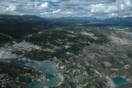
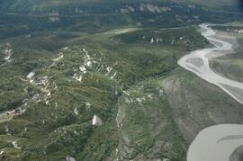
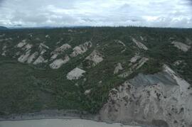
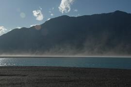
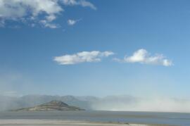
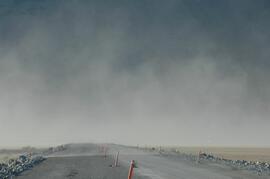
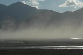
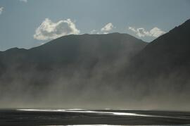
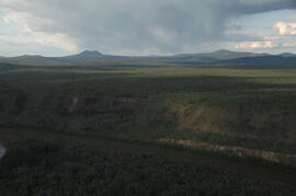
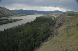
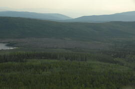
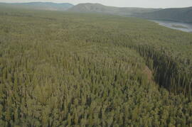
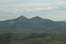
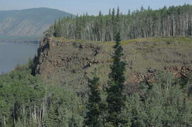
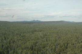
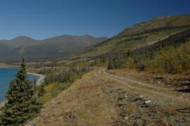
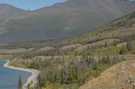
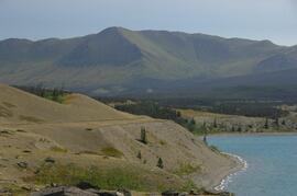
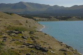
This image is part of the return trip sequence of aerial images obtained on the helicopter flight leaving the Klutlan Glacier study site. On the return leg at the end of the day, the flight initially went upvalley to pick up another party. This image was taken after the helicopter turned north to return to base camp.
This image is part of the return trip sequence of aerial images obtained on the helicopter flight leaving the Klutlan Glacier study site. On the return leg at the end of the day, the flight initially went upvalley to pick up another party. This image was taken after the helicopter turned north to return to base camp.
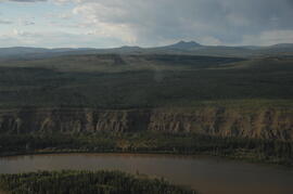
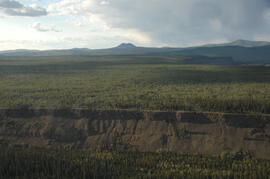
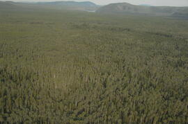
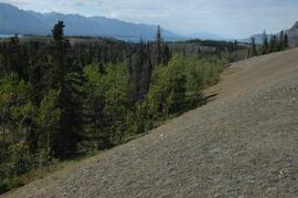
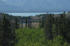
This image is part of the outbound sequence of aerial images obtained on the helicopter flight to the Klutlan Glacier study site. The sequence starts from the base camp at the White River crossing on the Alaska Highway and heads south, to a point just upvalley of the debris-covered terminus (approx. 10-15 km from Alaska border), and turning back north to the landing spot on the Generc River floodplain close to the study site (see Fig. 1 in paper).
Annotation on slide: "Decay in subalpine fire scarred by 1955 stand entry (logged w 91/92), Summit Lake Trial".
Annotation on slide: "Summit defective cull, Marked-to-cut swept log, Summit Lake selection trial".
Six metal storage cases containing primarily slides depicting drill core sections in wooden storage trays. Cases contain inventories of slide images as well as annotations which document the year, drill hole number, and the length along the drill hole from which core sections are taken. In addition to the documentation of drill core sections, the cases contain slides depicting the following subjects: “Representative samples” of drill core fragments, drill core fragments in perspective, “physical characteristics” of the drill cores and the storage trays, the pit mine, a worker in a plaid shirt, close up shots of the geology of the working face, and images annotated “SHOTS OF JADE BOULDER CORE J5-J1”. Five slides originally filed separately and stamp dated “Jul. ‘73” depict what is speculated to be employees working on the diamond drilling project include 2 images annotated ‘R. Dickin Aug ‘72’, ‘I. Oliver Aug ‘73’, ‘S. Zimmer Aug ‘73’, and ‘core shack ’73’. The cases contain 234 7x7cm slides and at least 8 5x5 cm slides which are duplicates of the remaining images. The file also contains a slide strip containing several 7x7 cm slide images.
File consists of digital photographs from Dr. Joselito Arocena's external hard drives. Images depict a variety of subjects, including research imagery, photographs from Arocena's travels, UNBC, the construction of the UNBC Northern Medical Program building, Prince George, and the Northern BC region.
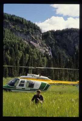
Image depicts the "Divides Lake Waterfall" as well as a man in front of a helicopter in the foreground.
Fonds consists of the research and professorial records of Dr. Joselito Arocena, a founding faculty member of UNBC. Arocena was an internationally-recognized soil scientist and UNBC’s first Canada Research Chair. His records demonstrate his accomplishments as an academic and researcher, as well as his many and varied interdisciplinary research endeavours. Also included are selections from Arocena’s extensive photographic slide collection which illustrate his teaching, research projects, and personal interests.
Arocena, JoselitoFonds consists of the research records of Dr. Paul Sanborn, a University of Northern British Columbia faculty member in the Department of Ecosystem Science and Management.
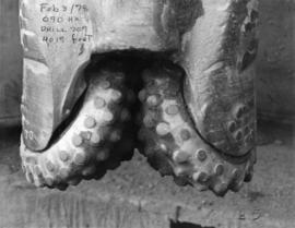
Sanborn, Paul ThomasFile contains photographs depicting close view of drill bits used in the Cassiar mine. The photos were taken for documentary purposes during an evaluation procedure in which the bits were tested and compared. 32 of the photos are adhered to three reports containing detailed analysis of the condition and function of the drill bits used. Reports were addressed to "E. Komperdo / Assist. Mine Superintendent, Production," and were sent by "Bob Clark / Industrial Engineer" and "E. Isaaks / Engineer Trainee." All of the photos are heavily annotated on verso and recto, often documenting the date, bit number, drilling depth, and notes on general condition.
Photograph depicts dump truck under power lines and tramlines on gravel road. Buckets hang on line, mountains in background.
Series contains material relating to Ainley's personal projects and research and professional projects. The material consists of transcribed copies of Ainley's early articles; drafts of sections, notes, research material and correspondence relating to "Creating Complicated Lives: Women and Science at English-Canadian Universities, 1880-1980"; conference proceedings, research material, notes and correspondence relating to her research project, "Re-explorations: new perspectives on gender, environment and the transfer of knowledge in 19th and 20th century Canada and Australia"; material, predominately course descriptions and syllabi, relating to administering the Women's Studies Program at the University of Northern British Columbia; and photographs and slides relating to both her research and her personal life and hobbies. Series also contains conference proceedings, research notes, bibliographies, curricula vitae and other material.
Images contain technical engineering drawings from the Asbestos Mining Corp. Drawings are primarily of plant buildings and mining and milling equipment, but also include drafts of town site and utilities, (extensive images of water and sewer pipes and septic systems). Microfiche slides are 4.6cm x 3.5cm mounted on 8.3 x 18.2 cm paper cards with systematic puncture marks, presumed to be an antiquated form of computer memory. Slides are numbered ranging from 1001 to 1549 and a drawing number ranging from 1006 to 8008, generally in the format “2017/02/02”. Microfiche are dated 1950- 1976, several are dated “OLD”, and several are undated. All microfilm reels are annotated “CASSIAR ENGINEERING DRAWINGS”.
File consists of photographic prints and slides depicting partial-cutting and select logging during the EP 1162 Summit Lake research project.
File consists of slides depicting research samples and sites, possibly relating to "ESSF 96, SBS 95".
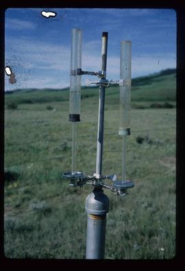
Image depicts an atmometer. According to the slide, it is being used for measuring the rate of water evaporation "from carborundum stone." The location is uncertain.
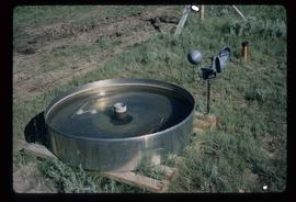
Image depicts an evaporation pan for water evaporation measurements. The location is uncertain.
EP 660 was a conventional silvicultural trial established in 1967 which involved single species plantings of lodgepole pine (Pl), white spruce (Sw), and Douglas-fir (Fd) at different spacings. Three installations were established in the Prince George - Vanderhoof area: Buckhorn Ridge, Bobtail Road, and Chilco Creek.
General details on EP 660 are given by:
Coopersmith, D., M. McLellan, and J. Stork. 1997a. Experimental Project 660 overview of three experimental installations – a 30-year progress report. B.C. Min. For., Prince George For. Reg., Res. Note #PG-12.
Details on the Buckhorn installation are given by:
Coopersmith, D., M. McLellan, and J. Stork. 1997b. Experimental Project 660 30-year progress report: Buckhorn Installation. B.C. Min. For., Prince George For. Reg., Res. Note #PG-12-1.
File contains 8 slides from 2 rolls, taken August 1997:
Roll 1 - Buckhorn Ridge:
- Slide 31 – Fd (2 x 2 m) – stand view
- Slide 32 – Fd (2 x 2 m) – forest floor view
- Slide 33 – Pl (2x 2 m) – stand view
- Slide 34 – Pl (2 x 2 m) – forest floor view
Roll 2 – Bobtail Road: - Slide 20 – Pl (2 x 2 m) – east plot, stand view
- Slide 21 – Pl (2 x 2 m) – east plot, stand view
- Slide 22 – Fd (2 x 2 m) – east plot, stand view
- Slide 23 – Sw (2 x 2 m) – stand view
File consists of UNBC publications on First Nations cooperation in forestry in BC and a thesis on the Nle?kepmx, or Thompson, First Nation fiber technology. File also includes a photograph of a kangaroo and a computer disk consisting of text files including backup and excerpts of "Complicated Lives" and interviews with Virginia Douglas, Elspeth Baugh, Glenda Prkachin, Sylvia Fedoruk, and Anne Underhill. Disk also includes work on Ikawa-Smith and Kartzmark.
Slide depicts a heavily forested area with fallen logs, likely at the Aleza Lake Experiment Station.
In July 2009, Dr. Paul Sanborn undertook the first soils field research at the Fort Selkirk volcanic field in central Yukon, with helicopter support and funding from the Yukon Geological Survey. This file includes digital photographs of the 2009 field work at the Ft. Selkirk site. Some of the digital photographs have been annotated as PDFs.
- Ft Selkirk 110114069.xls [particle size analysis data, CANTEST]
- S1090final.xlsx [chemical analysis data, Ministry of Forests & Range, Analytical Chemistry Laboratory]
- S1112final.xlsx [chemical analysis data, Ministry of Forests & Range, Analytical Chemistry Laboratory]
- Ft Selkirk 2009 soils data (updated Sept 15, 2010 and April 10, 2023).xls [consolidated lab data for all 2009 samples]
For July 1-7, 2009, Dr. Paul Sanborn did the first soils field research at the Fort Selkirk volcanic field in central Yukon, with helicopter support and funding from the Yukon Geological Survey.
Initial findings were published in the 2009 edition of Yukon Exploration and Geology, but this paper did not include most of the laboratory data:
Sanborn, P., 2010. Soil reconnaissance of the Fort Selkirk volcanic field, Yukon (115I/13 and 14). In: Yukon Exploration and Geology 2009, K.E. MacFarlane, L.H. Weston and L.R. Blackburn (eds.), Yukon Geological Survey, Whitehorse, Yukon. pp. 293-304. https://emrlibrary.gov.yk.ca/ygs/yeg/2009/2009_p293-304.pdf [Note that in Fig. 1, the labels for Camp 1 and Camp 2 on map are transposed; Camp 1 should be to the east of Camp 2.]
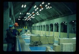
Image depicts two unidentified individuals in hard hats leaning against the railing of a large, open space inside an unknown concrete structure. It is possibly located in Fort St. John, B.C.
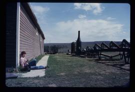
Image depicts numerous pieces of what appears to be old farming equipment. There is also an unidentified individual sitting aginst the side of a building. The location is possibly Fort St. John, B.C.
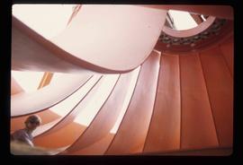
Image depicts an unknown individual standing next to a turbine located somewhere in Fort St. John, B.C.
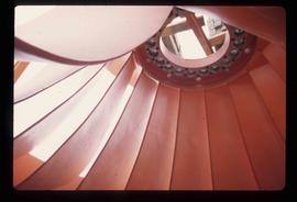
Image depicts a turbine located somewhere in Fort St. John, B.C.
