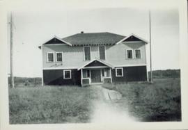
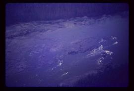
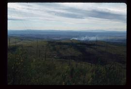
Closeup of Giscome School. Handwritten annotation in pen on verso reads: “Our school. This is my 0 room – the back of it.”
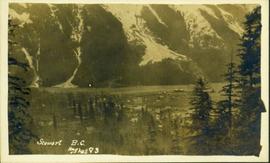
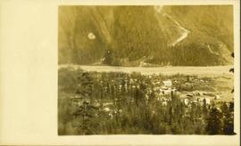
Photograph of Stewart BC taken from a distance. Trees in the foreground slightly obscure the village, and a large mountain is visible in the background. Printed annotation on recto reads: "Stewart B.C. Hughes 93."
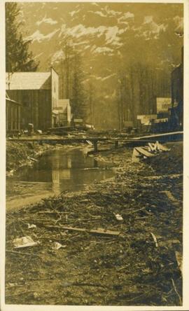
Street view of downtown Stewart, BC. Photograph shows boards propped up over the swampy area of the future road. Wood debris litters the foreground.
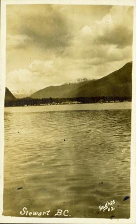
Distant photograph taken from the water of Stewart, BC. Several mountains are visible in the background. Printed annotation on recto reads: "Stewart B.C. Hughes #2."
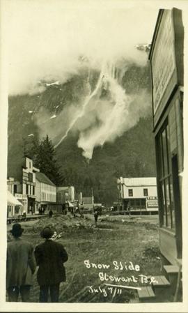
Street view photograph of two individuals watching the snow slide down one of the mountains surrounding Stewart, BC. Printed annotation on recto reads: "Snow Slide Stewart B.C. July 7/11."
Overhead photograph of a forested area, with Stewart, BC visible in the distance.
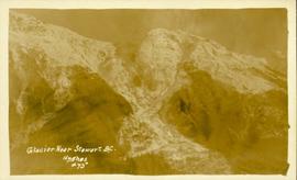
Photograph of a large glacier. Printed annotation on recto reads: Glacier Near Stewart B.C. Hughes #75."
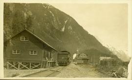
Side perspective photograph of a train stopped at the Stewart railroad station. Another train can be seen arriving in the distance.
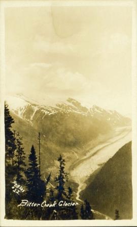
Wide angle perspective of the Bitter Creek glacier, with trees visible in the foreground. Printed annotation on recto reads: "Hughes #22 Bitter Creek Glacier."
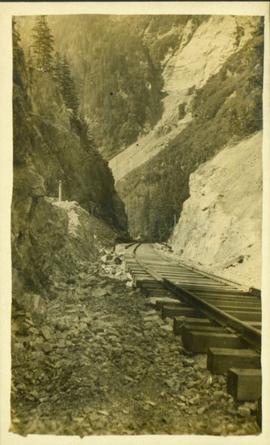
Photograph is a printed postcard depicting a section of railroad track going through a mountain pass. Possibly near Stewart B.C.
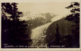
Photograph is a printed postcard depicting a glacier and mountain top near Stewart B.C.
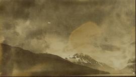
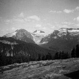
Photograph depicts view of snow capped mountains possibly near Stewart B.C.
Photograph depicts view a panoramic view of Stewart B.C.
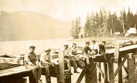
Photograph depicts the sons and daughters of Marion and Archdeacon W.H. Collison, and one unidentified man. Buildings can be seen on shore in background.
Handwritten annotation on verso reads: "Collison family at camp (Portland Canal) Max, ?, Henry, Elsie, Arthur, Alice, Herbert".
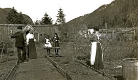
Photograph depicts Marion and William Henry Collison standing on left with shovel, Bertha Collison on right, and young Muriel and Katherine Collison in centre with shovel (eldest daughters of W.E. Collison). Wood buildings cross midground, trees and hills visible in background.
Handwritten annotation on verso reads: "Garden at Kincolith / Grandad, Grannie / Mimi, Katie / Mother".
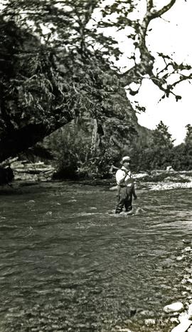
Rev. William Edwin Collison stands waist deep in water, with axe resting on shoulder (oldest son of Archdeacon W.H. Collison). Trees and hill on opposite shore visible in background.
Handwritten annotation on verso reads: "Dad at Kincolith".
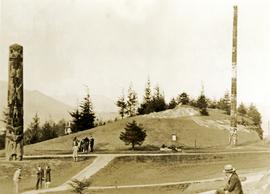
Groups of men and women can be seen gathered on paths between two large totem poles.
Handwritten annotation on verso reads: "Totem Park Pr Rupert park."
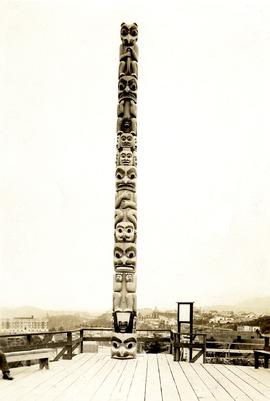
Photograph depicts a totem pole standing on what appears to be a large wooden deck or boardwalk, view of the city in background.
Handwritten annotation on verso reads: "Totem pole in park in Prince Rupert".
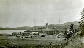
Photograph depicts a large ship behind dock buildings. Railroad crosses foreground, hills visible on shore in background.
Handwritten annotation on verso reads: "Ship in Pr. Rupert dry dock during Great War 1915?".
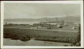
Photograph depicts a large ship behind dock buildings. Railroad crosses foreground, hills visible on shore in background.
Handwritten annotation on verso reads: "Pr. Rupert Drydock".
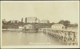
Photograph depicts large buildings on shore. Three unidentified individuals can be seen walking on dock in foreground.
Printed on image: "METLAKATLA B.C. / McRAE BROS"; handwritten annotation on verso reads: "A section of Metlakahtla, showing Church & Schoolhouse." See also item 2009.7.1.58 for similar image also featuring the new church building at Metlakatla, B.C.
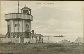
Photograph depicts a man and woman standing on steps to a round tower in fenced area. Roofs of other buildings can be seen below on right; water and shore visible in background.
Printed on image: "Indian Jail, Metlatkla".
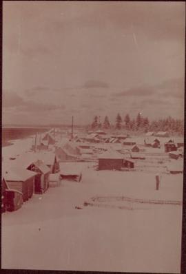
Photograph depicts village buildings along shore.
Handwritten annotation on verso reads: "Massett in Winter dress."
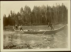
Handwritten annotation on verso reads: "Poling supplies up Nass River".
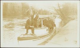
Group of six men sit and stand on small boat close to shore. Rev. W.E. Collison stands on far right (son of Marion and Archdeacon W.H. Collison).
Handwritten annotation on verso reads: "Dr. Macdonald Med officer (Kincolith) / Dr. [McQuarrie?] Med officer Victoria / Steven Clayton Native boat owner / Capt. Bary - Insp. of Indian Schools / W.E. Collison Indian agent. / Inspection trip to villages of upper Nass River".
Tugboat appears to be towing a long line of small boats.
Handwritten annotation on verso reads: "Fishing fleet coming home Nass River B.C."
Handwritten annotation on verso reads: "Canyon on Nass River". Forest and mountains visible on shore in distance.
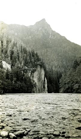
Photograph features a steep cliff across water, rocky shore in foreground.
Handwritten annotation on verso reads: "Up the 'Big Creek' at Kincolith B.C. Rock face called 'the place of echoes' by the Indian people."
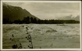
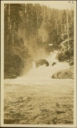
Photograph features rapids in foreground, trees and rocks in background.
Handwritten annotation on verso reads: "A waterfall on American side of the Canal. Chapt. XXVI Waterfall on Alaskan side of Portland Inlet."
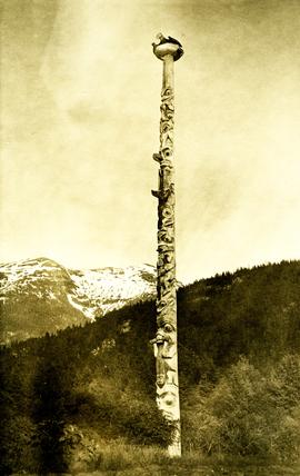
Totem pole stands alone against a mountainous background.
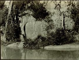
Petroglyphs featuring coppers painting onto a rock face next to a lake.
Handwritten annotation in pencil on verso reads: “As seen from the R.R. track. By Harlan I. Smith. 4 poles E of 92 mile or about 1 ½ meter E. of Tyce, B.C., Red Pictograph, Note: head above and to the right at the left of log top in shadow of cedar.” Stamped annotation on verso reads: “Department of Mines Geological Survey Photographic Division, January 21 1926” – in pen above this stamped date is written “7-10-1925”.
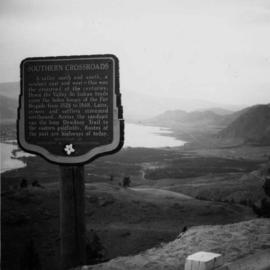
Photograph depicts a view looking northwest at Osoyoos Lake, B.C.
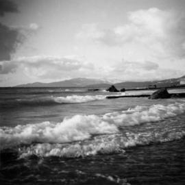
Photograph depicts Beach Ave. in Vancouver, with the photo taken near the swimming pool and looking west. Photo was taken after a storm.
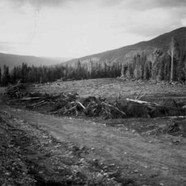
Photograph depicts land clearance between Monashee Pass and Lumby, B.C.
Photograph depicts the view looking north from Diamond Head Lodge in Garibaldi Park, about 20 miles northeast of Squamish. Believed to be "Bookworm range" at 7910 ft.
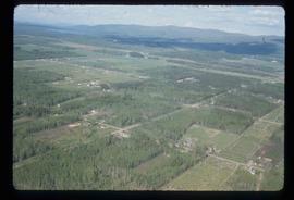
Image depicts a clearing in Prince George, B.C.
Image depicts Tabor Mountain from the airport in Prince George, B.C.
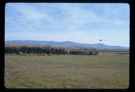
Image depicts natural meadows, possibly east of Prince Georg, B.C.
Image depicts Fort George Canyon.
Image depicts a view of Prince George from Gunn Point in the L.C. Gunn Park looking north. Map coordinates 53°54'26.2"N 122°43'35.8"W.
Image depicts a view of Prince George from Gunn Point in the L.C. Gunn Park looking north. Map coordinates 53°54'26.2"N 122°43'35.8"W.
Image depicts a view of Prince George from Gunn Point in the L.C. Gunn Park looking north. Map coordinates 53°54'26.2"N 122°43'35.8"W.
Image depicts a view of Prince George from Gunn Point in the L.C. Gunn Park looking north. Map coordinates 53°54'26.2"N 122°43'35.8"W.
Image depicts a view of Prince George from Gunn Point in the L.C. Gunn Park looking north. Map coordinates 53°54'26.2"N 122°43'35.8"W.
Image depicts a view of Prince George, from Gunn Point in the L.C. Gunn Park.
Image depicts an aerial view of Fort George Park.
Image depicts the cutbanks on the other side of the Nechako, taken from the nature trail at Island Cache. Map coordinates 53°55'34.6"N 122°45'52.4"W
Image depicts a view of Blackburn Schools, possibly taken from Tabor Mountain.
Image depicts Prince George, possibly with the Northwood Pulpmill in the background.
Image depicts downtown Prince George taken from across the Nechako River looking south. Map coordinates 53°56'00.0"N 122°44'29.7"W
