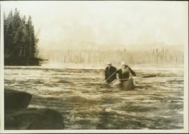
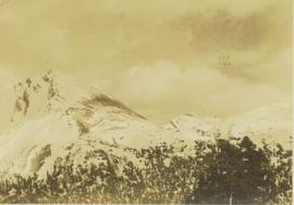
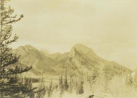
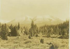
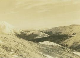
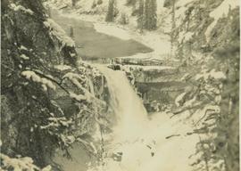
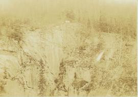
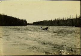
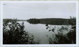
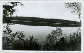
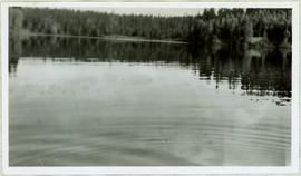
Item is a photograph of the coffer dam built to isolate the construction site for the W.A.C. Bennett Dam.
Item is a photograph of the Bennett Dam.
Item is a photograph of Mr. Williston and his son Dr. Hubert Williston in May 1967 canoeing down the Parsnip / Peace system before the W.A.C. Bennett Dam flooded the area.
Item is a photograph of the women and children on Rathrevor Beach.
Item is a photograph of a forested area southwest of Chittagong, Bangladesh close to the border with Burma.
Item is a photograph of a self-dumping log barge in action.
Item is a photograph of Ray Williston and Bruce Brown with a bicycle.
Photograph depicts a snow-covered mountain slope with trees at the base of the mountain.
Photograph depicts one unidentified man surveying a landscape from a snowy mountain peak with other mountain ranges in the background.
Photograph depicts snow covered mountain peaks seen through a mountain pass near Jasper Park.
Photograph depicts Roche Myette along Davona Creek near a campsite.
Photograph depicts a Rocky Mountain vista seen across a forested plateau.
Photograph depicts a vista from the Canadian Rockies with patches of snow.
Photograph depicts a mountain goat standing at the edge of the striated and deeply cut banks of an unseen river with a forested area in the background.
Photograph depicts a river leading into a waterfall amidst snow-covered trees.
Photograph depicts a mountain goat walking along a steep precipice.
Photograph depicts a craggy mountain peak covered with coniferous trees and snow.
Photograph depicts the Peace River Canyon with the Peace River in the foreground and rocky, tree-lined cliffs flanking the river. In the background a forested mountain base is visible.
Photograph depicts the main street of Rolla with a dirt street and wooden sidewalks, tethered horses, and the storefront of H.G. Atkinson General Merchants. Three people are visible walking through the streets.
File consists of research material relating to the Omineca Gold Rush which was a gold rush in British Columbia in the Omineca region of the Northern Interior of the province. Gold was first discovered there in 1861, but the rush didn't begin until late in 1869 with the discovery at Vital Creek. There were several routes to the goldfields: two were from Fort St. James, one of which was a water route through the Stuart and Tachie Rivers to Trembleur Lake to Takla Lake and the other was overland, called the Baldy Mountain route. A third route came in overland from Hazelton on the Skeena River and a fourth route used the Fraser River and crossed over the Giscome Portage to Summit Lake, through McLeod Lake, and up the Finlay River to the Omineca River. Materials include one large photograph from the BC Provincial Archives of Machanry of the SS Enterprise at Tremblay Lake in June 7th, 1913. Other materials include newspaper clippings and two photographic negatives of the machinery of the SS Enterprise.
File consists of material relating to the Yukon Telegraph. Materials include newspaper clippings, correspondence, a magazine, pamphlets, a newspaper, and reproductions of articles. Highlights include:
- Beautiful British Columbia Magazine, Vol. 32 No. 2 , 1990
- Ministry of Lands, Parks, and Housing, "Provincial Parks of British Columbia Map", 1980 (pamphlet)
- Telegraph Trail Preservation Society, "Telegraph trail Hiking & Recreational Guide", [198-?] (pamphlet)
- BC Provincial Archives, "Atlin- Quesnel Telegraph Line", [191-?] (photograph reproduction)
- BC Provincial Archives, "Pack Train Atlin Quesnel Telegraph Line", [191-?] (photograph reproduction)
- BC Provincial Archives, "Cooking at Teamsters Camp Atlin Quesnel Telegraph Line", [191-?] (photograph reproduction)
- Original photographic slides from 1981 depicting Sinkut Lake Ranch and Nulki Lake Resort south of Vanderhoof
Photograph landscape shot of Prince George
Photograph depicts two houses with snow-covered mountains in the background and a grassy yard in the foreground.
Photograph depicts a landscape shot of a body of water with mountains in background and forested shore in midground.
Photograph depicts a landscape shot of rushing water with a forested area in the background.
Photograph depicts a waterfall in a forested area with a riverbank in the foreground.
Photograph depicts four men in a boat on a lack with a waterfall in the background running through a forest into the lake. Annotation on verso of photograph states: "The water fall + flume for Brown's sawmill Hoscall River BC"
Photograph depicts piles of wood planks and log booms in the foreground with a waterfall in the background.
The Fort Fraser Historical Photograph Collection consists of 1 photograph album featuring 86 black and white photographs of Fort Fraser and area during the pre World War I era.
Photograph album contains 86 black and white photographs depicting various aspects of life and construction in Fort Fraser in the pre World War I era.
Typed annotation on recto: "Sunset at Stuart Lake, B.C." Hills on shore in midground, sun behind clouds reflected in rippled water.
Typed annotation on recto: "Tachi River, Stuart Lake, B.C." Man in tall hat, smoking from a pipe, and standing on shore with fishing rod extended over water. Tree-covered banks in background.
Typed annotation on recto: "Rainbow Trout fishing (Fly fishing) Tachi River - Stuart Lake, B.C." Two men fishing in a canoe with rope tied to another object, and one fish caught in net. Trees on shore in background.
Typed annotation on recto: "Stuart Lake B.C." Man standing in water close to cliff which is reflected in water on right. Hills on opposite shore can be seen in background.
Typed annotation on recto: "Camping at Stuart Lake - B.C." Two men and one woman kneeling among miscellaneous equipment on ground in front of small tent on the lake side. Large tree and bushes behind tent, hills in distance.
Typed annotation on recto: "Stuart Lake Scene - British Columbia." Man stands in water close to cliff which is reflected in water on right. Hills on opposite shore can be seen in background.
Typed annotation on recto: "Cottonwood dugout on Tachi River Stuart Lake Section of B.C." Two people sit in dugout canoe, tree-covered banks in background.
Typed annotation on recto: "Fishing action - Stuart Lake, B.C." Two men fishing in a canoe, with one fish caught in net. Hillside in background. It is speculated that the seated man with fish may be Vivian Grey.
Typed annotation on recto: "Stuart Lake - British Columbia." The hills on left, cliff on right, and two small islands on horizon are reflected in the lake.
View of summit lake from above, many small tree-covered islands and peninsulas visible. Handwritten caption beside this photo reads: "Sumit Lake".
Handwritten caption beside this photo reads: "I built this boat." Photograph depicts canoe and paddles afloat in water, grassy shore in foreground. A pair of pants can be seen in boat, as well as wood planks, box, and rope on shore.
Large tree trunk and smaller saplings silhouetted against Summit Lake, forest visible on opposite shore. Handwritten caption beside this photo reads: "Sumit Lake."
Handwritten caption beside photograph reads: "Sumit Lake." Branches of trees in foreground, forest on opposite shore reflected in water.
Handwritten caption above this photo reads: "Sumit Lake." Photograph depicts man sitting facing lake among branches of trees in foreground, forest on opposite shore reflected in water.
View of Summit Lake with sun at horizon reflected in water and dark clouds above. Part of a man's head is silhouetted in the foreground. Handwritten caption above this photo reads: "Sumit Lake."
View of ripples in lake. Forest on opposite shore is reflected in water. It is believed this photograph was taken at Summit Lake, B.C.