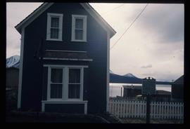
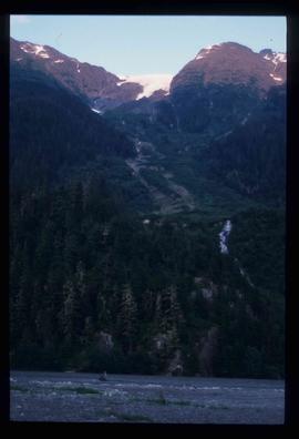
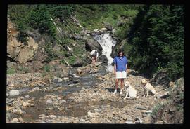
Image depicts a mountain, possibly Atlin Mountain.
Image depicts Bennett Lake near Carcross, Y.T.
Image depicts a river at an uncertain location, but possibly in Miles Canyon near Whitehorse, Y.T.
Image depicts numerous trees on the bank of a river, possibly in Miles Canyon near Whitehorse, Y.T. The slide is labelled "canyon city."
Image depicts numerous unidentified individuals getting off a boat which bears the name "Schwatka." It is located somewhere in Miles Canyon.
Image depicts the Robert Lowe Bridge, built in 1922, in the Miles Canyon near Whitehorse Y.T.
Image depicts a van on a highway with mountains in the distance; the location is uncertain, though it is possibly along the Alaska Highway.
Image depicts the White Pass Train crossing over a railway bridge at an uncertain location.
Image depicts a view over a forested, mountainous area and a river somewhere in the area of Skagway, Alaska.
Image depicts a mountain side somewhere along the White Pass railway. The thin ridge along the mountain side is possibly either a highway or part of the railway.
Image depicts an old trestle along the White Pass railway.
Image depicts an old trestle along the White Pass railway, and the White pass Train on the left of the image.
File consists of aerial photographs depicting the Fraser River Big Bend, where the Fraser River changes direction from westbound to southbound at its "Big Bend" near the Huble Homestead Historic Site, 45 km north of Prince George, British Columbia.
Image depicts a train on the Hansard Bridge across the Fraser River looking west. Map coordinates 54°04'37.7"N 121°50'39.9"W
Image depicts the small town of Fraser, B.C. Located on the Klondike Highway.
Image depicts half of a ship, which is named the Tutshi, in Carcross, Y.T.
Image depicts the Caribou Hotel and the Matthew Watson General Store in Carcross, Y.T.
Image depicts a building which once served as the residence for two nurses in Atlin, B.C. A sign in front of the house reads: "Grateful Atlinites built this house in 1902 for their first missionary nurses, Helen Bone and Elizabeth Mitchell, who came here in 1899 and lived in a crude shack while valiantly and humanely caring for sick and dying pioneers."
File consists of notes and reproductions relating to Kent Sedgwick's guest lecture for UNBC course "GEOG 200 Geography of British Columbia".
File consists of notes and reproductions relating to the East Line Section of the Grand Trunk Pacific Railway in Central British Columbia.
File consists of notes, clippings, and reproductions relating to contemporary and historical land surveying in British Columbia, includes material on Hunter Joseph who surveyed Quesnel to Salmon River in 1874; F.P. Burden and the surveying of the Cariboo District; and Mr. J.D. Pemberton, the colonial surveyor in 1851. File primarily consists of Kent Sedgwick's handwritten notes on land surveying in British Columbia and printed search results for the College of New Caledonia and BC Archives on land surveying. Includes: "Owning land: what you should know" pamphlet published by The Canadian Council of Land Surveyors (2004) and "Survey Systems in BC" email chain between Kent Sedgwick and John Whittaker, a B.C. Land Surveyor, discussing past land survey systems and surveyed areas in British Columbia (6 Oct. 2009).
Image depicts a Prince George residential area from the viewpoint of the Ginter Property.
Image depicts the Ginter Property in Prince George, B.C.
File consists of notes and reproductions for use by Kent Sedgwick for lectures. Includes: "Annual Meeting Western Division Canadian Association of Geographers" conference program and abstracts (7-8 Mar. 1997).
File contains slides depicting Sechelt, B.C.
Item is an original 1996 folding brochure map depicting circle tours in the Prince George area. The map was published by the Prince George Region Development Corporation.
File consists of notes and reproductions relating to Brett & Hall landscape architecture and urban planning in Canada. File predominantly consists of photocopies of articles relating to urban planning, including "The Influence of Thomas Adams and the British New Towns Movement in the Planning of Canadian Resource Communities" by Oiva Saarinen; "Thomas Adams and the Commission of Conservation" by Alan H. Armstrong; "The Laying Out of Towns" by W.H. Dorsey; "The Relation of the City Engineer to Public Parks" by John C. Olmsted; "The Planning of Company Communities in the Lake Superior Mining Region" by Arnold R. Alanen; and "Planning the Canadian Environment" by L.O. Gertler.
File consists of notes and reproductions relating to Foley's Cache (later Island Cache and now Cottonwood Island Nature Park) in Prince George. Includes: "Foley's Cache" typed document by Kent Sedgwick (2 Feb. 1996). Includes photographs depicting a sign describing Foley's Cache and historical photographs of Foley's Cache.
File consists of notes, clippings, and reproductions relating to the City Beautiful movement across North America. File predominantly consists of photocopied articles: "The City Beautiful" by Fredrick Law Olmsted, Jr.; "The Plan of Chicago 1909" by Amy Diadamo; "Vancouver and the City Beautiful Movement" by Rodger Todhunter; "The Urbanization of America" by Blake McKelvey; and "The Rise of Modern Urban Planning" by Anthony Sutcliffe. File also includes an issue of the "Journal of the Society for the Study of Architecture in Canada", Vol. 32 No. 1 (2007).
File consists of notes and reproductions relating to the Nechako cutbanks in Prince George. Includes: "The Cutbanks" typed document by Kent Sedgwick (1 Feb. 1996). File also includes a photograph depicting heritage river trail signs erected at the cutbanks and describing the significance of the cutbanks in Prince George (1996).
Image depicts what is possibly the Nass River.
Image depicts an unidentified individual diving into a pool of water at an uncertain location.
Image depicts a small waterfall at an uncertain location.
Image depicts a small section of the Bear Glacier.
Image depicts what is possibly Bear River in the Bear Glacier Provincial Park.
Image depicts what is possibly Bear River, flowing out from an opening in the Bear Glacier.
Image depicts a mountain somewhere in Bear Glacier Provincial Park.
Image depicts what is possibly Bear River flowing past what is likely a section of the Bear Glacier.
Image depicts the Bear Glacier stretching through a mountain range.
Image depicts a totem pole at an uncertain location, possibly in Gitwinksihlkw, B.C.
Image depicts a few unidentified individuals fishing in a river at an uncertain location.
Image depicts the North end of Portage Lake.
Image depicts two individuals and two dogs standing by a stream at an uncertain location, possibly somewhere in Bear Glacier Provincial Park. The woman in purple is possibly Sue Sedgwick.
Image depicts Sue and Kent Sedgwick with two dogs, standing with the Bear Glacier in the background.
Image depicts what is possibly Bear River in the Bear Glacier Provincial Park.