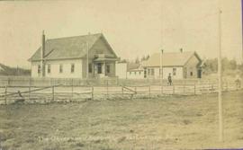
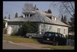
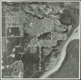
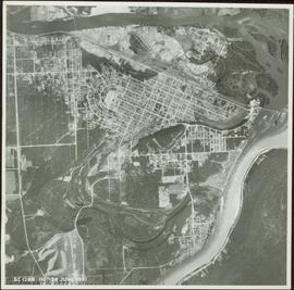
Image depicts 1566 Ingledew Street in Prince George, B.C.
Image depicts Ash Street and Patricia Boulevard in Prince George, B.C.
Photograph depicts a large white building surrounded by a fence.
Photograph depicts Lheidli T'enneh Nation burial grounds in foreground, Hudson Bay Company buildings in background.
Photograph depicts six adults and three or more children sitting on the ground with a log cabin in the background. Snow scatters the ground in small patches.
Photograph depicts twenty-eight or more people standing on the river's edge, a stack of wood is ready for loading on the steamer that is anchored near the shore.
Photograph depicts several people in a large field. There are buildings and trees in the background.
Photograph depicts a tarp spread out on the grass, two men sit nearby the tarp. There is a canvas tent in the background with a man standing beside it. Behind the tent is a low hill with a fence bordering the top of the hill. There are blankets drying on the fence.
Photograph depicts a view from a high hill, looking down on the Nechako river. There is forest and low rolling hills in the background.
Photograph depicts a view from a hill of a river winding through the forest with marshlands nearby.
Photograph depicts a view from a hill of a river winding through the forest with marshlands nearby. This may be a double exposure and there is an indiscernible image in the center of the photo.
Photograph depicts a man bathing himself while standing in a small metal tub. Photograph description in album notes this as "His 'Semi Annual'" [bath]. On the left is a log structure, presumably a cache building. A large clearing surrounds the building and bathing man. There is a forest and bluff in the background. Possibly located near Giscome Portage.
Photograph depicts four men pulling a long canoe across a clearing on a wheeled trailer.
Map reproduction of the Sinclair Spruce Lumber Co. Ltd. T.S.H.L. A01848 C.P. 310 cutting area, likely in the Aleza Lake Research Forest.
Photograph depicts a view of the city of Prince George looking west from the east hill. The confluence of the Fraser River and Nechako River is visible to the right. The Grand Trunk Pacific Railway bridge is visible at centre. The current location of where this photograph may have been taken is likely somewhere near where Highway 16 rises on the hill past the correctional centre (jail).
Map reproduction depicts major areas of the Aleza Lake Experiment Forest.
Slide depicts a black bear eating garbage by wooden outbuildings, possibly at the Aleza Lake Experiment Station.
Slide depicts a detonation in an area of cleared ground in a forested area, likely the Aleza Lake Experiment Station. Work may have been undertaken for roadbuilding activities at the Experiment Station.
Slide depicts a cleared area at the Aleza Lake Experiment Station with plant regeneration.
Item is a hand drawn and coloured map by the City of Prince George Planning Department depicting zoning proposed by the Prince George City Planner for the VLA neighbourhood.
Item is a map depicting the Vancouver Carney study neighbourhood area in Prince George.
Item is the Proposed Land Use Map, 1978-2012, referred to in By-law No. 3138, the City of Prince George Official Community Plan. The original draft of this map was completed on October 24, 1977. This version of the map was amended in July 1982.
This map is part of Schedule B of the 1993 Official Community Plan, Bylaw No. 5909 for the City of Prince George. This particular map depicts the east area of the City of Prince George, including the Prince George Airport (YXS) and the Blackburn area.
This map is the Schedule A accompanying map for the City of Prince George's Soil Removal and Deposit Bylaw No. 7022 of 1999. It depicts designated soil removal areas and M.O.T.H. gravel reserves.
This map is Schedule C of the 2001 Official Community Plan, Bylaw No. 7281 for the City of Prince George. This Schedule C map shows the long range land use for the City of Prince George.
Item is a photograph of Prince George taken from the air.
Item is a photograph of Mr. Williston with the teaching staff of the Prince George Junior Senior High School in 1946. Mr. Williston is seated front row centre.
Item is a photograph of Mr. Williston washing dishes with Mrs. Evelyn Yost, Dormitory Matron, and Mrs. Houghtaling, Chief Cook, in the kitchen of the renovated army barracks which became the Prince George School’s first dormitory. The dormitory was the first of its kind in B.C.
Item is a photograph of Ray Williston and John Liersch in a small wood area southwest of Prince George.
The CN Rail Bridge is a truss bridge over the Fraser River. It was built in 1914 by the Grand Trunk Pacific Railway and is therefore also known as the "GTP Bridge". The Canadian National (CN) Railway Company took over the Grand Trunk Pacific Railway in 1919.
The road north to Salmon River is visible in the upper right corner.
In 1936 a flood covered CN tracks in the Prince George area.
Man in suit and hat is believed to be R.A. Harlow
Cane floats in flooded area of camp, tent buildings and forest trees in background. It is believed that this photograph may depict the Island Cache in flood, at Prince George, BC.
Violet (nee Taylor) Baxter and Ellen (nee Taylor) Garland stand wearing formal attire in dirt area. A lumber pile and unidentified man can be seen behind a fence that crosses the midground. Power poles and other buildings in background.
Stamped annotation on verso reads: "MAY 1994".
Photograph taken in the Geoffrey R. Weller Library at the University of Northern British Columbia in Prince George, B.C. Officer in uniform stands in background.
Handwritten annotation on verso reads: “Aug 17 - 1994, Opening Day, UNBC, Library".
Photograph depicts pier under construction, workers, buildings smokestacks and river with chunks of ice. Handwritten annotation in pencil on recto reads: “S. FT. GEORGE G.T.P. BRIDGE”.
Lofty view of South Fort George, river and treed hills in the background. Printed annotation on verso reads: “South Fort George - 1913.” Handwritten message on recto is addressed to “Ethel M. Heurris Norton Maps Bristol County" reads: "11-1-13 an excellent view of south Fort George taken recently. Power Station at cross near water. This does not give all the south residence view. Population approx 1500”.
Photo of buildings behind street, fenced on either side. Man and horse can be seen on street. Printed annotation on verso reads: “The Government buildings Fort George B. C.” Handwritten annotation on recto reads: “This is the place I receive my patent from next June.”
View of 5 buildings and 4 tents on land that has been cleared to stumps. Printed annotation on verso reads: “HAMILTON AVE. FORT GEORGE”, added handwritten annotation in ink reads: “1910”.
View of Cluster of buildings with treed hill in the background. Printed annotation on verso reads: “NEAR FORT GEORGE B.C.”
River in foreground, railroad and city in mid ground and hill in background. Printed annotation on recto reads: “Prince George. B.C. 1924”