The Archdeacon W.H. Collison fonds consists of textual materials, maps, published materials and photographs all documenting Collison’s life and work with North Coastal First Nations communities in British Columbia. Types of records found within this fonds include manuscripts, sermon notes, correspondence, oral history summaries, monographs, cartographic items, photographs and postcards. The Collison fonds also includes some records created by his children and grandchildren as well as a family tree created in 1986. The Collison fonds has been divided into four series.
Collison, W.H. (Archdeacon)This fonds illustrates the writing career of Canadian author Ann Walsh. Types of records included in this fonds include: published and unpublished short stories, manuscripts, correspondence, grant applications, photographs, audio and video recordings, contracts, book reviews, plotting notes, speaking notes, promotional materials and workshop materials.
Walsh, AnnConsists of the records of the Allied Rivers Commission and the Rivers Defense Coalition.
The Aleza Lake Research Forest Society (ALRFS) records encompass material that was created or collected by the Society over its existence (2001-present). Records created by the ALRFS consist of administrative and operational records, as well as publications from the Society. Collected records include historical records relating to the Aleza Lake Experiment Forest gifted to the Society or its members. These include maps, photographs, reference material, and documents. Members and associates of the ALRFS also documented the history of the forest through the creation of oral history recordings and written histories such as John Revel's "Devil's Club, Black Flies, and Snowshoes".
The fonds includes a significant amount of reproduced archival material about Aleza Lake from other institutions, such as BC Archives, the Canadian Forest Service, and the BC Forest Service. Many of these reproductions were created as part of the 2006 ALRFS Natural Resources History Internship in an effort to compile the history of the research forest.
Also included are cartographic and photographic materials that depict the Aleza Lake Research Forest and surrounding areas.
Contains significant materials covering a wide range of topics related to forestry research and forest management practices in Central British Columbia from the 1920s to the 1980s with the bulk of the materials dating from 1924 to 1963. Includes early surveys and descriptions of the Upper Fraser area, early maps and plans of the Research Forest, and historical meteorological registers from the area. Also includes unpublished scientific reports, communications, administrative and technical reports, timber sale records, and general forestry related reports and publications. Photographs include images of the Experimental Station dating from its inception and images of the Young Men's Forestry Training Program situated at Aleza Lake in 1936. Research records include experimental plot files that contain field notebooks dating from 1928 to 1958 which note locations of the experimental plots as well as sample plots from the surrounding areas of Hutton, Penny, and Foreman. The field notebooks also record growth and mortality data of white spruce balsam from 1928 to 1958 and soil types. The fonds also contains some records related to the re-emergence of the Aleza Lake Research Forest (ALRF) in the 1980s and 1990s.
Aleza Lake Research ForestThe Alexander Manson Mining Collection consists of 133 loose photographs documenting various aspects of the mining industry in Northern British Columbia between 1930-1940. Photographs show images of Manson Creek and Germansen Landing.
Manson, AlexanderCollection consists of material collected by Wallace (Wally) Bergen during his involvement with the Alexander Mackenzie Trail Association. The association was renamed in 1994 to Alexander Mackenzie Voyageur Association. Includes association newsletters, brochures, news releases, a patch, a published map, and a published report.
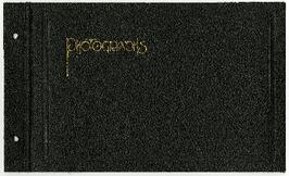
Alexander Mackenzie Voyageur AssociationALASKAN HIGHWAY PHOTOGRAPH ALBUM. British Columbia: N.D. [ca 1945]. 10 1/4" x 13 1/4" in thick green embossed boards, with title (Photographs) in gilt and tied at spine with green cord. Photo album contains 172 original photographs and 27 real photo postcards. Photographs measure 5 3/4" x 3 1/2," with a majority captioned in manuscript. Through these photos one has visual journey of travel on the newly constructed Alaskan Highway through British Columbia and into the Yukon. The travelers set off from Fort Saint John, passing through Fort Nelson, and seeming to go as far as Watson Lake, just across the border into the Yukon Territory. Along the way, they drove through the Trout River Valley, Steamboat Mountain, Muncho Lake, and many other impressive features of the landscape. The final section of images comprise home photos of the family that made the trip and some photos taken earlier.
Photograph album contains 134 snapshots showcasing building activity, equipment, logging, and airplanes in British Columbia and the Yukon, taken during the building of the Alaska Highway in 1942. The photographer is unknown. Many of the photographs depict Fort St. John and Fort Nelson.
Some of the photographs are captioned as follows:
- Looking north at Fort St. John, B.C.
- P.R.A. Bellanea and Army Norseman sea-planes on Charley Lake near Fort St. John, B.C.
- Looking toward outlet of Muncho Lake from Float Plane
- Fort St. John, British Columbia. Canada
- Colonel Ingalls’ bridge across Liard River
- Post Office & Government Telegraph Office
- P.R.A. Camps at Fort St. John, B.C. looking N.E.
- Post Office & Government Telegraph Office - Fort St. John - 1942
- Army Ferry on Peace River near Taylor's Flats
- Looking west on Main Street, Fort St. John, B.C. May - 1942
- Looking southwest across Summit Lake
- Public Roads Administration Headquarters Buildings. Fort St. John, B.C. - April - 1942
- Looking southwest from south bank of Peace River from Old Highway near Taylor Flats, B.C.
- First Army Headquarters - Fort St. John, B.C. - 1942
- Beginnings of Fort Alcan - May 1942 - Fort St. John, B.C.
- Road between 101 and 157
- Other side Muncho Lake
- Big Black Bear
- Liard River, Canada
- Dog Sled. Muskwa River
- Temporary Bridge at Muskwa, B.C.
- Another bridge in British Columbia
- Above Fort Nelson, B.C. White spot in picture is the “moon”
- Mountains N-106
- Coughlin’s equipment at work west of Fort Nelson - Nov. - 1942
- Near Mile Post 175-N descending to shore of Muncho Lake
- First Fairbanks sign erected in Fort St. John. Apr. 1942
- Boat used to cross the Fort Nelson River at Fort Nelson
- Typical P.R.A. Engineers Camp at Mile 84-N
- Fort Alcan - near St. John. British Columbia. “1942.”
- Captain Hinze and Army beachcraft used on Army reconnaissance surveys for Alaska Highway
- Small single motored aircraft used by P.R.A. on Alaska Highway Reconnaissance flights forced down on Gravel Bar on the Laird [sic] River near Mile 313-N
- Near Mile 173-N looking at outlet of Muncho Lake
- Near Mile 145 N. Toad River looking downstream
- Looking southwest at Muncho Lake at Army operations on shore Pioneer Road. First tote road may be seen above.
- Hudson Bay Store at Dease Lake, end of truck portage from Telegraph Creek + Wrangell. Beginning of boat freighting to lower port
- Mile 104 n. Sugarfoot Lake
- Mile 104 N. Sugarfoot Lake
- Looking north from Mile 140 N. at Folding Mountains - approx. 8,000 ft high
- Army forces along Muncho Lake
- Malamute sled dog at Fort Nelson
- P.R.A. location. Engineers’ Camp near Mile 165-N
- Few miles west of Ft. St. John looking downstream at Peace River. Old Fort St. John. Buildings on near shore
- British Columbia Police Plane in Fort Nelson River at Fort Nelson, B.C.
- Few miles west of Fort St. John - Looking across Toad River at Little Folded Mountain near Mile 141
- Looking northwest at P.R.A. an Oakes Camp and Alcan Highway.
- Clouds after a rainstorm over Teslin Lake, Yukon Territory between Watson Lake and Whitehorse.
- Toad River and Big Folded Mountain near Mile 142 N
- Teslin Lake between Watson Lake & Whitehorse Y.K. The lake is 72 miles long
- Whitehorse, Yukon Territory
- Dept. of Transport Ferry on Peace River near Taylor Flats.
- Foothills east of Rocky Mountains between Watson Lake & Whitehorse, Yukon Territory
- Public Roads Administration (P.R.A.) Camp at Whitehorse, Y.K.
- Whitehorse end of the White Pass and Yukon Railway from Skagway, Alaska to Whitehorse, Y.K.
- Husky sled dog. Ft. St. John, B.C.
- Mile 103 N. Looking east at Army Camp at Mile 102 N. - Summit Lake
- Opening of new bridge on Sikanni River
- Peace River Bridge has now replaced this “Ferry” - Fort St. John, B.C
- Muskwa River new Fort Nelson, B.C.
- Bridge across the Muskwa River.
- View of mountains across flat between 101 - and 157
- Plane at Fort Nelson - Ft. Nelson River
- Moose Calves
- Suicide Hill - J 108. Now eliminated from Alaskan Highway
- Road Construction Equipment Center Boom - Bulldozer and Side Boom
- Center Boom. Taken at Water Line
- Early stages of road construction
- Bulldozing for the Highway
- Clearing the tinder for the Highway
- Convoy of trucks on Alaskan Highway
- Repair Camps off Highway
- Mud - Mud - Mud - Mud!
Collection contains a signed Spruce Kings hat, a signed game puck and a letter to Al Lefebvre of UNBC.
Fonds consists of original, silent 16mm reels that portray the natural, social and land use history of the Bella Coola and Chilcotin regions named the "Natural and Guiding History of the Bella Coola and Chilcotin Regions".
Possible locations that Al Elsey filmed include: Bella Coola, Bella Bella, Anahim Lake, Alert Bay, Nimpo Lake, Bulkey Valley, the Rainbow Mountains, Tweedsmuir Provincial Park, Dean River, Bella Coola River, Tchaha Lake, the Chilcotin region, the Ulkatcho Mountains, Lassard Lake, Fenton Lake, Atnarko River, Wells Gray Park, and Holt Homestead.
This fonds consists of the administrative and business papers of Mr. Adam Zimmerman during his tenure as a senior level executive with Noranda Inc., Noranda Mines Ltd, and Macmillan Bloedel Ltd., particularly in Ontario, Quebec, and British Columbia with the majority of these records relating to the senior level operations of these companies. It includes textual records relate to the creation and development of Northwood Pulp & Timber Ltd. in Prince George including all aspects of its regional operations throughout Northcentral BC). The fonds also includes records related to Noranda Inc.’s successful and unsuccessful attempts at business acquisitions in both forestry and mining operations internationally, particularly in Mexico, Brazil, the Netherlands and Tasmania.
The fonds also contains textual records generated by Zimmerman in his directorship and chairman positions on various forest industry association boards. It includes his notes, general correspondence, minutes, as well as booklets and brochures notably from the Canadian Forest Industries Council, the Canadian Pulp and Paper Association, the Forest Sector Advisory Council and other similar industry associations. Much of this material relates to the issue of the softwood lumber dispute and Zimmerman’s involvement in the lobbying efforts regarding Canada/U.S. Free Trade issues and includes bound reports, agreements, and publications as well as correspondence to/from Zimmerman and his handwritten notes within the files. The fonds also includes general business information (annual reports, brochures, publications) pertaining to other Canadian forestry and mining companies.
The fonds also contains Adam Zimmerman’s speeches and correspondence related to his involvement in numerous charities, foundations and corporate fundraising initiatives with numerous Canadian educational institutions, non-profit societies and federal election campaigns.
Business records of Noranda Inc. are extensive and include administrative, business, personnel, financial and legal records. Record types include correspondence, memos, handwritten notes, business proposals and meeting notes, merger proposals and notes, prospectuses, board meeting agendas and minutes, annual reports, financial statements, resumes, portfolios, printed brochures, publications and other ephemera related to the business operations of Noranda Inc., Noranda Mines and MacMillan Bloedel [during Noranda Mines take-over of MB] all during Zimmerman’s tenure as Chair and/or CEO. The fonds includes correspondence, financial reports, legal testimony transcripts resulting from the Gaspe Copper Mine labour strike in Quebec in 1957 and the subsequent Gaspe Law Suit of 1960 between Noranda and the United Steel Workers of America. The fonds also includes extensive correspondence between Zimmerman and various levels of government regarding the lobbying of government on forestry policy and correspondence with various environmental lobbying groups in the 1980s including correspondence with well-known environmentalist David Suzuki.
Subjects include all facets of business operations pertaining to Canadian forestry and mining sectors including labour issues, environmental impacts of industrial developments, industry and effects on the Canadian economy, the free trade debate, the softwood lumber issue etc.
The fonds provides a detailed archival record of Mr. Zimmerman’s contribution to the building of Noranda Forest in Canada, Northwood Pulp & Timber in BC and Noranda Inc. as a resource-based conglomerate. Many records were utilized by Mr. Zimmerman in the writing of his book, Who’s in Charge Here, Anyway?: reflections from a life in business, (Don Mills, Ontario: Stoddart; Distributed in Canada by General Distribution Services), 1997.
Zimmerman, AdamCollection consists of eight interviews with experts reviewing A Guidebook for Improving Aboriginal Participation in Forest Management Decision-Making, later published with the title The Aboriginal Forest Planning Process: A Guidebook for Identifying Community-Level Criteria and Indicators by Melanie Karjala, Erin Sherry, and Stephen Dewhurst in 2003. The reviewers were chosen based on their expertise and interest in Aboriginal participation in forest management decision-making. They were asked to provide their opinions on issues related to Aboriginal participation in decision-making processes in BC, as well as feedback on the Aboriginal Forest Planning Process (AFPP) Guidebook. Reviewers had the option to make their review confidential resulting in the return or destruction of the interview. Eight of the original twenty-nine interviews are archived in this collection; the remainder are no longer extant.
The Aboriginal Forest Planning Process: A Guidebook for Identifying Community-Level Criteria and Indicators can be found:
- Online at www.for.gov.bc.ca/hfd/library/documents/bib95274.pdf
- UNBC Library, call number: SD146.B8 K37 2003.


