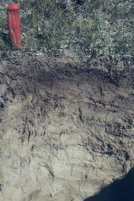
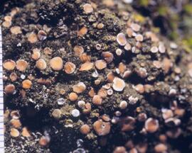
2023.2.2.7.4.024
·
Item
·
2009
Parte de Dr. Paul Sanborn fonds
317 resultados com objetos digitais
Mostrar resultados com objetos digitais
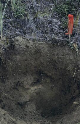
2023.2.2.7.4.028
·
Item
·
2009
Parte de Dr. Paul Sanborn fonds
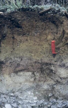
2023.2.2.7.4.035
·
Item
·
2009
Parte de Dr. Paul Sanborn fonds
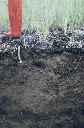
2023.2.2.7.4.037
·
Item
·
2009
Parte de Dr. Paul Sanborn fonds
2023.2.2.7.4.038
·
Item
·
2009
Parte de Dr. Paul Sanborn fonds
2023.2.2.7.4.039
·
Item
·
2009
Parte de Dr. Paul Sanborn fonds
2023.2.2.7.4.040
·
Item
·
2009
Parte de Dr. Paul Sanborn fonds
2023.2.2.7.4.041
·
Item
·
2009
Parte de Dr. Paul Sanborn fonds

2023.2.2.7.4.043
·
Item
·
2009
Parte de Dr. Paul Sanborn fonds
2023.2.2.7.4.045
·
Item
·
2009
Parte de Dr. Paul Sanborn fonds
2023.2.2.7.4.049
·
Item
·
2009
Parte de Dr. Paul Sanborn fonds
2023.2.2.7.4.055
·
Item
·
2009
Parte de Dr. Paul Sanborn fonds
2023.2.2.7.4.063
·
Item
·
2009
Parte de Dr. Paul Sanborn fonds
2023.2.2.7.4.064
·
Item
·
2009
Parte de Dr. Paul Sanborn fonds

2023.2.2.7.4.065
·
Item
·
2009
Parte de Dr. Paul Sanborn fonds
2023.2.2.7.4.069
·
Item
·
2009
Parte de Dr. Paul Sanborn fonds
2023.2.2.7.4.070
·
Item
·
2009
Parte de Dr. Paul Sanborn fonds
2023.2.2.7.4.071
·
Item
·
2009
Parte de Dr. Paul Sanborn fonds
2023.2.2.7.4.072
·
Item
·
2009
Parte de Dr. Paul Sanborn fonds
2023.2.2.7.4.073
·
Item
·
2009
Parte de Dr. Paul Sanborn fonds
2023.2.2.7.4.078
·
Item
·
2009
Parte de Dr. Paul Sanborn fonds
2023.2.2.7.4.084
·
Item
·
2009
Parte de Dr. Paul Sanborn fonds
2023.2.2.7.4.085
·
Item
·
2009
Parte de Dr. Paul Sanborn fonds
2023.2.2.7.4.097
·
Item
·
2009
Parte de Dr. Paul Sanborn fonds
2023.2.2.7.4.101
·
Item
·
2009
Parte de Dr. Paul Sanborn fonds
2023.2.2.7.4.103
·
Item
·
2009
Parte de Dr. Paul Sanborn fonds
2023.2.2.7.4.108
·
Item
·
2009
Parte de Dr. Paul Sanborn fonds
2023.2.2.7.4.111
·
Item
·
2009
Parte de Dr. Paul Sanborn fonds
2023.2.2.7.4.117
·
Item
·
2009
Parte de Dr. Paul Sanborn fonds
2023.2.2.8.05
·
Item
·
Feb. 2009
Parte de Dr. Paul Sanborn fonds
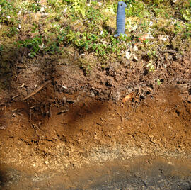
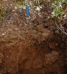
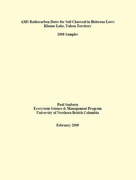
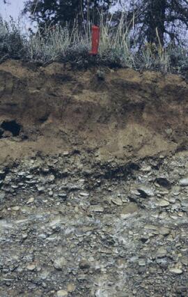
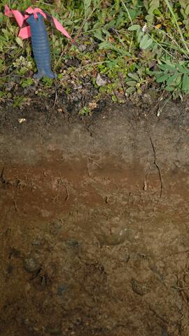
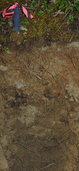
This PDF contains site location data, annotated soil profile photographs, and AMS radiocarbon dates for 2008 soil charcoal samples collected at Kluane Lake, Yukon Territory.
2023.2.2.8.07.11
·
Item
·
2003
Parte de Dr. Paul Sanborn fonds
2023.2.2.8.07.12
·
Item
·
2003
Parte de Dr. Paul Sanborn fonds
2023.2.2.8.08
·
Dossiê/Processo
·
2003
Parte de Dr. Paul Sanborn fonds
Slide roll contains the following photographs:
Y03-06
Date: August 10, 2003
Location Coordinates: 61° 4’ 1.5” N, 138° 21’ 57.4” W, 825.3 m asl (± 9.5 m)
Site Description: top of slope, E aspect
Sample Depths & Descriptions:
- Y03-06-01 - Crust
- Y03-06-02 - 0-6 cm - Ahk (10YR 3/2 m; strongly effervescent)
- Y03-06-03 - 6-14 cm - Bmk (2.5Y 3/3 m; strongly effervescent)
- Y03-06-04 - 14 cm+ - IICk (strongly effervescent)
Slide roll 3 #36-35 (corresponding prints and negatives: Print roll 4, #1-2)
Y03-07 (peninsula near Kluane visitor centre, Sheep Mt.)
Date: August 11, 2003
Location Coordinates: 61° 1’ 42.8” N, 138° 29’ 36.2” W, 786.7 m asl (± 5.7 m)
Site Description:
- recent (?) landslide with loess accumulation in pockets, thinner on boulder surfaces, dominated by dark cyanobacteria crusts
- limited loess accumulation due to exposure of site
- crust is calcareous at surface
Sample Depths & Descriptions: - Y03-07-01 - Crust
- Y03-07-02 - 0-6 cm - Ck
- Y03-07-03 - 6-9 cm - Ahkb
- Y03-07-03 - 9 cm+ - Rock
Slide roll 3 #34-30 (corresponding prints and negatives: Print roll 4, #3-10)
Lower Slims River (lookout knoll at parking lot N of visitor centre)
Date: August 11, 2003
Location Coordinates: 60° 59’ 56.4” N, 138° 33’ 36.4” W, 844.8 m asl (± 7.3 m)
Site Description: some fire disturbance, but lower slopes have more intact crusts on loess (calcareous to surface)
Slide roll 3 #29-26 (corresponding prints and negatives: Print roll 4, #11-17)
Lower Slims R (lowest bench below lookout knoll)
Date: August 11, 2003
Location Coordinates: 60° 59’ 51.8” N, 138° 33’ 36.2” W, 814.3 m asl (± 7.9 m)
Site Description: not burned; good intact crust; vegetation: A. frigida, Calamogrostis purpurea, Erigeron caespitosus, Linnaea, Carex filifolia (sparse cover ~ 50%)
Slide roll 3, #25-23 (corresponding prints and negatives: Print roll 4, #18-20)
Slims Soil
(Holocene paleosol with well-developed B horizon under Neoglacial calcareous loess – location not recorded, but likely from roadcut exposure along main Slims R trail)
Slides roll 3, #22 (corresponding prints and negatives: Print roll 4, #21)
Lower end of Sheep Creek
Date: August 11, 2003
Misc. views of grassland vegetation and landscape (locations not recorded)
Slides roll 3, #21-18 (corresponding prints and negatives: Print roll 4, #26-33)
Overlook at lower end of Sheep Creek canyon
Date: August 11, 2003
Location Coordinates: 60° 59’ 42.2” N, 138° 34’ 38.1” W, 878.0 m asl (± 9.5 m)
Site Description: heavy use by sheep (abundant droppings) but still has ~ 50% crust coverage
Slides roll 3, #17-16 (corresponding prints and negatives: Print roll 4, #34-35)
Slims River delta
Date: August 11, 2003
(location not recorded)
Slides roll 3, #15-14: salt efflorescences (corresponding prints and negatives: Print roll 5, #1-3)
Y03-08 (Cultus Bay Rd. – at top of switchbacks)
Date: August 12, 2003
Location Coordinates: 61° 3’ 43.1” N, 138° 21’ 4.0” W, 833.8 m asl (± 5.1 m)
Site Description: good exposure of loess (35 cm) with Slims Soil over glaciofluvial terrace – pinches out downslope [note: this site was sampled because of development of buried paleosol, and was not part of biological crust study by Marsh et al. (2006)]
Sample Depths & Descriptions:
- Y03-08-01 - 45-48 cm - Ahkb (7.5YR 3/3 d; strongly effervescent)
- Y03-08-02 - 48-56 cm - Bmkb (7.5YR 4/3 d; strongly effervescent)
- Y03-08-03 - 56-70 cm - Ccab (2.5Y 5/2 d; strongly effervescent)
- (not sampled) - 70 cm+ - IICca (glaciofluvial; strongly effervescent)
- Intact sample: 56-36 cm - depth (including Slims Soil)
Slides roll 3, #13-11, 5-4 (corresponding prints and negatives: Print roll 5, #8-10, 17-18)
Y03-09 (cliff top on E. shore of Kluane L. at Christmas Bay)
Date: August 12, 2003
Location Coordinates: 61° 4’ 0.0” N, 138° 22’ 35.3” W, 828.3 m asl (± 7.3 m)
Site Description: ~ 60 cm loess over glaciofluvial gravels
Sample Depths & Descriptions:
- Y03-09-01 - Nostoc crust
- Y03-09-02 - Tortula ruralis – Cetraria crust
- Y03-09-03 - 0-14 cm - ACk (10YR 3\2 d)
- Y03-09-04 - 14-16 cm - Ahkb1 (10YR 2/2 d)
- Y03-09-05 - 16-18 cm - Ck1 (10YR 4/3 d)
- Y03-09-06 - 18-20 cm - Ahkb2 (10YR 3/2 d; discontinuous)
- Y03-09-07 - 20-27 cm - Bmkb1 (10YR 4/3 d)
- Y03-09-08 - 27-33 cm - Bmkb2 (7.5YR 4/3 d)
- Y03-09-09 - 33-46 cm - Bmkb3 (10YR 4/3 d)
- Y03-09-10 - 46-55 cm - Ck2 (2.5Y 5/3 d)
- (not sampled) - 55-60 cm+ - IICk (glaciofluvial gravels)
Slide roll 3, #10-6 (corresponding prints and negatives: Print roll 5, #11-15)
Y03-10 (shore bluff N. of Silver City)
Date: August 12, 2003
Location Coordinates: 61° 2’ 55.0” N, 138° 23’ 17.2” W, 806.7 m asl (± 7.3 m)
Site Description: 70% slope, SW aspect; vegetation: Elymus, Carex, Artemisia, Erigeron
Sample Depths & Descriptions:
- Y03-10-01 - Crust
- Y03-10-02 - 0-18 cm - ACk (10YR 4/2 m; strongly effervescent)
- Y03-10-03 - 18-25 cm - Ahkb(?) (10YR 4/2 m; strongly effervescent)
- Y03-10-04 - 25-40 cm - Ck (2.5Y 5/2.5 m; strongly effervescent)
- (not sampled) - 40 cm+ - IICk (glaciofluvial gravels; strongly effervescent)
Slide roll 3, #3-1 (corresponding prints and negatives: Print roll 5, #19-22)
2023.2.2.8.08.03
·
Item
·
2003
Parte de Dr. Paul Sanborn fonds
2023.2.2.8.08.05
·
Item
·
2003
Parte de Dr. Paul Sanborn fonds
2023.2.2.8.08.09
·
Item
·
2003
Parte de Dr. Paul Sanborn fonds
2023.2.2.8.08.12
·
Item
·
2003
Parte de Dr. Paul Sanborn fonds
2023.2.2.8.08.24
·
Item
·
2003
Parte de Dr. Paul Sanborn fonds
2023.2.2.8.08.35
·
Item
·
2003
Parte de Dr. Paul Sanborn fonds
2023.2.2.8.08.36
·
Item
·
2003
Parte de Dr. Paul Sanborn fonds

2023.2.2.8.11.22
·
Item
·
2003
Parte de Dr. Paul Sanborn fonds
2023.2.2.8.13
·
Dossiê/Processo
·
2003
Parte de Dr. Paul Sanborn fonds
File consists of Kluane Lake photographs from 2003 in digital format.
2023.2.2.8.13.04
·
Item
·
2003
Parte de Dr. Paul Sanborn fonds
2023.2.2.8.18
·
Dossiê/Processo
·
2004
Parte de Dr. Paul Sanborn fonds
This file contains the following photographs in both print photograph and negative format:
Cultus Bay Rd.
(landscape views looking W from road; lake is likely at ~61°4’ 10.5”N, 138°22’ 31.5”)
Print roll 12, #0A-2A
Corresponding slides: Slide roll 7, #23-22
Keyhole Pond (landscape views)
Print roll 12, #3A-4A
Y04-23 (Saddle W of Keyhole Pond)
Date: July 22, 2004
Location Coordinates: 61º 4’ 46.5” N, 138º 22’ 32.2’ W, 828 m asl (± 8.0 m)
Site Description: 7º, NW-facing slope. Cumulic profile in colluviated loess with White River tephra at 10 cm, brownish paleosol at 23-27 cm, glaciofluvial sand at 50 cm.
Sample Depths & Descriptions: Y04-23-01 – charcoal at 23-27 cm, immediately above paleosol
Print roll 12, #5A-6A
(Location not recorded: Print roll 12, #7A-8A)
Y04-24 (W side of Rat Lake)
Date: July 22, 2004
Location Coordinates: 61º 9’ 54.6” N, 138º 25’ 41.6” W, 807.7 m asl (± 13.5 m)
Site Description: 23° slope, NE aspect; cumulic profile with White R ash at 20 cm; no obvious charcoal bands.
Print roll 12, #9A-10A (9A print is missing)
"Ian's Lake"(W of NW corner of Rat Lake)
Location Coordinates: 61º 10’ 1.4” N, 138º 25’ 47.7” W, 773.4 m asl (± 9.8 m) (coordinates are for ridge crest on NE side of lake)
Site Description: basal date 700 BP in terrestrial sediments; NE side has grassy 30°slope
Print roll 12, #11A
Y04-25 (S shore of “Ian’s Lake”, NW of Rat Lake)
Date: July 22, 2004
Location Coordinates: 61º 10’ 0.7” N, 138º 25’ 49.2” W, 781.8 m asl (± 8.8 m)
Site Description: 35 cm of colluviated loess over gravelly sandy glaciofluvial; no visible charcoal bands; buried soil at 25-35 cm; White R ash at 6-8 cm.
Print roll 12, #12A-13A
Y04-26 (EW)
Date: July 23, 2004
Location Coordinates: 61º 1’ 59.8” N, 138º 21’ 53.6” W, 836.1 m asl (± 7.7 m)
Site Description: grassland at crest of 33° terrace scarp, S aspect.
Sample Depths & Descriptions: Y04-26-01 – 0-10 cm
Print roll 12, #14A-15A
Corresponding slides: Slide roll 7, #21-20
Y04-27
Date: July 23, 2004
Location Coordinates: 61º 2’ 0.9” N, 138º 21’ 53.6” W, 843.6 m asl (± 5.8 m) (~ 35 m N of Y04-26)
Site Description: spruce forest on terrace surface; level.
- 0-8 cm - Loess-rich forest floor; strongly calcareous.
- 8-13 cm - Bmk
- 13-15 cm - Discontinuous pockets of White R ash
- 15-35 cm - Bmk (Slims soil) – no charcoal visible
- 35-75 cm - Gray calcareous loess.
- 75 cm+ - Gravelly sandy glaciofluvial deposit.
Print roll 12, #16A-17A
Corresponding slides: Slide roll 7, #19-18
Y04-28 (EW)
Date: July 23, 2004
Location Coordinates: 61º 2’ 34.4” N, 138º 21’ 57.0” W, 820.2 m asl (± 6.1 m)
Site Description: grassland on esker crest W of Jenny L; 30° slope, SW aspect
Sample Depths & Descriptions: Y04-28-01: 0-10 cm
Print roll 12, #18A-19A
Corresponding slides: Slide roll 7, #17-16
Y04-30 (between eskers, W of Jenny Lake)
Date: July 23, 2004
Location Coordinates: 61º 2’ 31.6” N, 138º 21’ 52.3’ W, 817.6 m asl (± 6.1 m)
Site Description: Level (base of saddle). Colluviated loess to 90 cm+, with White River tephra at 15-17 cm, brownish paleosol at 17-35 cm, underlain by turbated Bmku with multiple charcoal-rich bands.
Sample Depths & Descriptions:
- Y04-30-01 – charcoal at 13 cm (above WR tephra)
- Y04-30-02 – charcoal at 22 cm (below WR tephra)
- Y04-30-03 – charcoal at 75 cm
Print roll 12, #20A-22A
Corresponding slides: Slide roll 7, #15-13
Jenny Lake (landscape views)
Print roll 12, #23A-24A
2023.2.2.8.19
·
Dossiê/Processo
·
2004
Parte de Dr. Paul Sanborn fonds
This file contains the following photographs in both print photograph and negative format:
Y04-31 (EW)
Date: July 23, 2004
Location Coordinates: 61º 3’ 9.2” N, 138º 21’ 30.3’ W, 837.2 m asl (± 6.4 m)
Site Description: crest of N-S esker ridge
Sample Depths & Descriptions: Y04-31-01: 0-10 cm
Print roll 13, #1-3
Corresponding slides: Slide roll 7, #12-11
Y04-32
Date: July 23, 2004
Location Coordinates: 61º 3’ 7.4” N, 138º 21’ 27.7’ W, 823.7 m asl (± 13.7 m)
Site Description: toeslope on NE side of same ridge as for Y04-31; 20° slope, NE aspect; Cryosol with permafrost at 34 cm; 30 cm of forest floor organic horizons; abundant charred wood fragments at top of mineral soil & in lowest part of organic horizon.
Print roll 13, #4-5
Corresponding slides: Slide roll 7, #10-9
Y04-34
Date: July 23, 2004
Location Coordinates: 61º 3’ 47.7” N, 138º 21’ 2.5’ W, 838 m asl
Site Description: Toe of 30º, W-facing grassland slope. Colluviated loess with White River tephra at 8-9 cm, brownish paleosol (9-35 cm), overlying sandy glaciofluvial at 35-70 cm+.
Sample Depths & Descriptions: Y04-34-01: charcoal at 34 cm
Print roll 13, #6-7
Corresponding slides: Slide roll 7, #8-7
Y04-35 (EW)
Date: July 23, 2004
Location Coordinates: 61º 3’ 49.9” N, 138º 21’ 1.1” W, 854.4 m asl (± 6.3 m)
Sample Depths & Descriptions: Y04-35-01: 0 – 10 cm
Print roll 13, #8-10 (Location not recorded: Print roll 13, #11-12)
Corresponding slides: Slide roll 7, #6-5
Y04-36
Date: July 23, 2004
Location Coordinates: 61º 8’ 11.5” N, 138º 25’ 50.8” W, 825.6 m asl (± 14.5 m)
Site Description:
- 10-0 cm - LF
- 0-15 cm - Bmk1 (7.5YR 4/6 m)
- 15-28 cm - Bmk2 (2.5Y 4/3 m)
- 28-48 cm - Ck
- 48-55 cm+ - IICk (sandy gravelly glaciofluvial)
- No charcoal visible in mineral horizons
Print roll 13, #13-14
Corresponding slides: Slide roll 7, #4-3
Y04-37
Date: July 23, 2004
Location Coordinates: (roadcut adjacent to Y04-36)
Site Description: multiple colour bands in Slims soil; some charcoal blobs (not sampled) which are right size to have been roots.
Print roll 13, #15-19
Corresponding slides: Slide roll 7, # 2-1
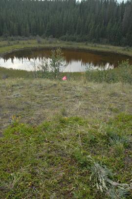
2023.2.2.8.20.04
·
Item
·
2009
Parte de Dr. Paul Sanborn fonds
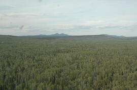
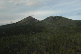
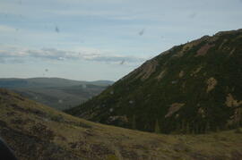
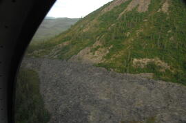
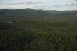
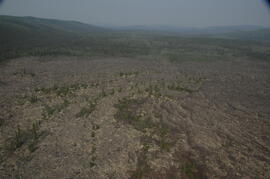
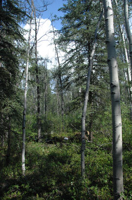
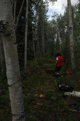
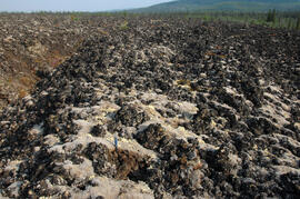
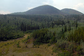
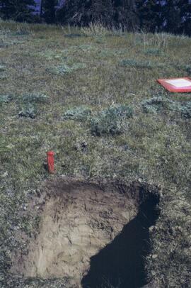
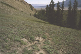
Photograph depicts a Kluane Lake transect 1 location.
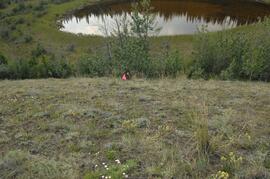
2023.2.2.8.20.05
·
Item
·
2009
Parte de Dr. Paul Sanborn fonds
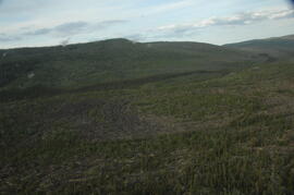
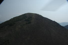
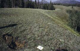
Photograph depicts a Kluane Lake transect 1 location.
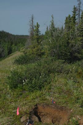
2023.2.2.8.20.09
·
Item
·
2009
Parte de Dr. Paul Sanborn fonds
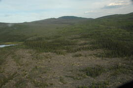
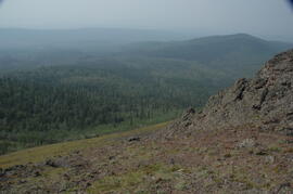
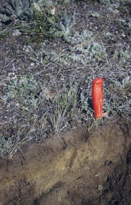
Photograph depicts a Kluane Lake transect 1 location.
2023.2.2.8.20.10
·
Item
·
2009
Parte de Dr. Paul Sanborn fonds
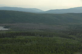
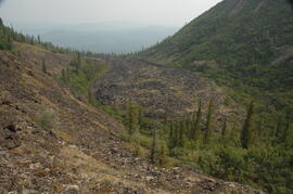
Photograph depicts a Kluane Lake transect 1 location.
2023.2.2.8.20.13
·
Item
·
2009
Parte de Dr. Paul Sanborn fonds
Photograph depicts a Kluane Lake transect 1 location.