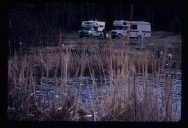
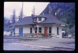
Image depicts numerous vehicles and individuals outside a hotel in Likely, B.C.
Image depicts the townsite of Keithley Creek, B.C.
Image depicts a view of Giscome with a train passing through.
Image depicts numerous docked boats, as well as many houses on the shore in the background; located in Kitimat, B.C.
Image depicts a hotel in Likely, B.C.
Image depicts the site of Giscome's first quarry, with a train passing by and Eaglet Lake located in the foreground.
Image depicts a blue truck and a camper in the wooded area surrounding the townsite of Keithley Creek, B.C.
Image depicts the dirt road leading to Keithley Creek.
Image depicts a bridge over the McGregor River. A sign in the image reads: "Danger. The river is not navigable for any type of boat. Down stream falls and rapids impassible!"
Image depicts numerous docked boats in Kitimat, B.C.
Image depicts a bridge over the McGregor River.
Image depicts a camper on the shore of what is possibly Melita Lake, near the Tseax Cone.
Image depicts two men in the cabin of a boat somewhere near Kitimat, B.C.
Image depicts several individuals seated on a ferry as it possibly departs from a dock somewhere in Prince Rupert, B.C. It is most likely headed for Haida Gwaii, B.C.
Image depicts numerous boats docked by the Prince Rupert Fishermen's Co-operative Association from the deck of a ferry, possibly as it's leaving Prince Rupert, most likely for Haida Gwaii.
Image depicts the train tracks at the old Dunster Station in Dunster, B.C.
Image depicts a man attaching a logging trailer to a crane on a wooden structure to stack the trailer on the truck. A Crestbrook Forest Industries sawmill is located in the background.
Image depicts a logging truck with its trailer being attached on top of it. A Crestbrook Forest Industries sawmill is located in the background.
Image depicts a ferry docked at Haida Gwaii, B.C.
Image depicts a vehicled parked on the side of the road, with a view of the coast of Haida Gwaii in the background.
Image depicts two trains in Prince George, B.C.
Image depicts a road somewhere in Tumbler Ridge, B.C. There are three bush planes in the image.
File contains slides depicting images of the Grand Trunk Pacific railway roundhouse in Prince George, B.C.
Image depicts numerous campers and other vehicles in Tumbler Ridge, B.C.
Image depicts a road somewhere in Tumbler Ridge, B.C. There are numerous construction vehicles present.
Image depicts numerous campers and other vehicles in Tumbler Ridge, B.C.
File consists of an exhibit brochure titled "Grand Trunk Pacific: The transcontinental line" prepared by the Fraser-Fort George Museum.
File consists of a duotang containing a typescript essay titled "Land Speculation and the Railway Station in Prince George" by Alistair Mcvey for a geography class.
Image depicts two campers at an uncertain location, possibly somewhere near Meldrum Creek, B.C.
Image depicts a camper and a man and woman at an uncertain location, possibly somewhere near Meldrum Creek, B.C. The woman in the image is Sue Sedgwick.
Image depicts the W.A.C. Bennett Dam on the Peace River in Hudson's Hope, B.C.
File consists of a special edition of the Prince George Citizen newspaper titled "70 years of Rail!" (27 Jan. 1984).
Image depicts the Kwinitsa CNR station in Kwinitsa, along the Skeena River.
Image depicts the Kwinitsa CNR station, which is Prince Rupert's railway museum.
Image depicts a ferry on a river, possibly the Fraser River in the Lillooet area.
Image depicts a close-up of the carriage step. It is possibly located in Kamloops, B.C.
File includes calendars depicting historical Prince George that were published by the Fort George Museum. Includes the following calendars published by the Fraser-Fort George Museum: "1985 Calendar" (1985); "The arrival of the steel" (1983); "Transportation" (Jan 1986-June 1987); and "Prince George: old & new" (1980).
Image depicts the McBride CNR station.
Image depicts a red carriage labelled in yellow "B.C. Express Co. No. 20." It is possibly located in Kamloops, B.C.
Image depicts the road leading to the historic Hat Creek Ranch site north of Ashcroft, B.C. Several individuals are sitting on the front porch of the Ranch house.
Image depicts the McBride CNR station.
File consists of a "BC Rail" special edition of the Prince George Citizen newspaper celebrating 75 years of railway (21 May 1987).
Image depicts a ferry entering Horseshoe Bay in the Howe Sound region.
File consists of notes and reproductions relating to a brochure about the Fort George Railway and the "Little Prince" 24? gauge steam engine. Includes: "Fort George Railway" brochure prepared by Kent Sedgwick (May 1988); "Fort George Railway Society" typescript letter to George Finsterle from Kent Sedgwick (1 May 1989); and "Fraser-Fort George Regional Museum" brochure (1988).
Image depicts the "Divides Lake Waterfall" as well as a man in front of a helicopter in the foreground.
File consists of notes, clippings, and reproductions relating to sternwheelers. Includes material regarding Pacific Great Eastern sternwheelers on the Fraser River; the B.X. sternwheeler; Trelle Morrow's book "Sternwheelers on the Upper Fraser" published in 2009; and sternwheeler travel on the Fraser River. Includes: "The Pirates of South Fort George" clipped article from Today's Consumer magazine (April 1989).
File consists of reproductions and typescript documents relating to the "From Trail to Rail" book written by Audrey L'Heureux and promotion of the book at the Alexander Mackenzie Trail Association annual meeting in 1989.