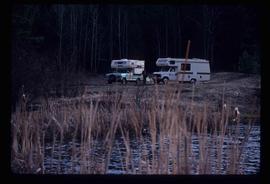
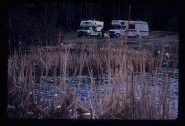
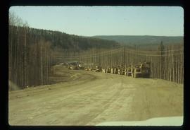
Image depicts the old Kettle Valley Rail Road.
Image depicts two campers at an uncertain location, possibly somewhere near Meldrum Creek, B.C.
Image depicts a camper and a man and woman at an uncertain location, possibly somewhere near Meldrum Creek, B.C. The woman in the image is Sue Sedgwick.
Image depicts numerous docked boats, as well as many houses on the shore in the background; located in Kitimat, B.C.
Image depicts a truck parked on the side of the Cassiar Highway.
Image depicts a hotel in Likely, B.C.
Image depicts numerous vehicles parked outside a building with a sign which reads "Mackenzie Centre;" it is possibly the mall in Mackenzie, B.C.
Image depicts numerous vehicles in the parking lot of a mall in Mackenzie, B.C.
Image depicts the gas station at Manson Creek, B.C.
Image depicts the site of Giscome's first quarry, with a train passing by and Eaglet Lake located in the foreground.
Image depicts the Skeena River alongside Highway 16 en route to Prince Rupert, B.C.
Image depicts a mountain located somewhere along the Skeena River, and a road alongside it.
Image depicts several ships on the water in Prince Rupert, B.C.
Image depicts a steep mountain road somewhere in the area of Seton Portage, B.C.
Image depicts a section of road running through the Bear River Gorge.
Image depicts numerous campers and other vehicles in Tumbler Ridge, B.C.
Image depicts a road somewhere in Tumbler Ridge, B.C. There are numerous construction vehicles present.
Image depicts an aerial view of Highway 97 just north of Williams Lake, B.C.
Image depicts a rail road bridge, possibly the Cottonwood Bridge, at an uncertain location.
Image depicts the Cottonwood Bridge.
Image depicts the train station in Quesnel, B.C.
File contains slides depicting Highway 16 West, from Isle Pierre to Hazelton.
Image depicts a drill for blasting holes at a mine site somewhere in Granisle, B.C.
Image depicts numerous bags of blasting powder at a mine site somewhere in Granisle, B.C.
Image depicts the dock for ferries in Isle Pierre, B.C.
Image depicts a road and field somewhere near Grassy Plains, B.C.
Image depicts a turbine on the back of an industrial vehicle, located somewhere in Fort St. John, B.C. The slide is labelled "Site one dam; turbine prop. (Russian.)"
Image depicts a boat on the Nechako Reservoir at Kenny Dam.
Image depicts a boat dock on the Nechako Reservoir at Kenny Dam.
Image depicts numerous old buildings on a main street in Atlin, B.C.
Image depicts two merging railway tracks, and what appears to be a frozen river, somewhere near the summit of a mountain.
Image depicts the cableway in Willow River, B.C.
Image depicts two unidentified individuals examining a thick log still attached to the machine that cut it down. It is located somewhere in Prince George, B.C.
Image depicts several pieces of heavy machinery used in forestry. The Coast Inn of the North is seen in the background.
Image depicts a piece of heavy machinery lifting numerous logs off the back of a logging truck. It is likely located in Prince George, B.C.
Photograph depicts a wooden building presumably at the Fort St. James historic site.
Photograph depicts a wooden and abandoned building, the roof caving in and the sides tarnishing. Photograph taken in an unknown location.
Photograph depicts a section of railway trackage, presumed to be located within or nearby Sinclair Mills, BC.
Photograph depicts a section of railway trackage, presumed to be located within or nearby Sinclair Mills, BC. There is a man on the other side of the railway tracks.
Photograph depicts a post office, presumably in Sinclair Mills.
Photograph depicting a large stone surrounded by trees in an unknown location.
Photograph depicting a landscape with a lake and a mountain in the background.
Photograph depicting a large stone surrounded by trees and two people sitting on top of it.
Photograph depicting a log house, presumably in the campground in Quesnelle Forks.
Photograph depicting a small log cabin with a front porch and a sign reading "Happy 150th Anniversary Cariboo Gold Rush 1859-2009", presumably taken in Quesnelle Forks.
Image depicts a road near or on Gang Ranch in the Upper Fraser Canyon.