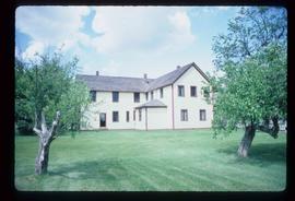
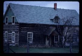
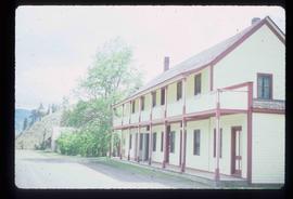
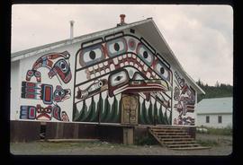
Image depicts a building painted with First Nations art in New Aiyansh.
Image depicts several children and numerous adults inside a church in Deadman Creek, near Kamloops, B.C.
Image depicts the Ranch house on the historic Hat Creek Ranch site north of Ashcroft, B.C.
Image depicts an old barn on the historic Hat Creek Ranch site north of Ashcroft, B.C.
Image depicts the front of the ranch house on the historic Hat Creek Ranch site north of Ashcroft, B.C.
Image depicts the Lajoie Dam on the Bridge River from the upstream side.
Image depicts Bralorne, B.C.
Image depicts what is possibly an old, rundown mill in Bralorne, B.C.
Image depicts several houses in Bralorne, B.C.
Image depicts a few boarded-up buildings in Bralorne, B.C.
Image depicts an area of Barlone, B.C. surrounded by trees.
File contains slides depicting images of areas around Dease Lake, B.C.
Image depicts a number of identical buildings and vehicles at "Driftwood Creek" in the Driftwood Canyon Provincial Park.
Image depicts a cabin on the "west arm" of Takla Lake.
Image depicts a few piles of culverts in Leo Creek, B.C.
Image depicts a building, possibly an office building, next to a set of rail road tracks in Leo Creek, B.C. An unknown individual is present, and a number of barrels and culverts are visible in the foreground.
File contains slides depicting places in and around the Junction Sheep Range Provincial Park south-west of Williams Lake.
Image depicts a sign titled "Chilcotin Wildlife Management Area" somewhere near Riske Creek, B.C. It reads: "This trail has been provided by the Fish and Wildlife Branch in co-operation with Riske Creek Ranching Ltd., as access to the Chilcotin Wildlife Management Area. Please do not leave the the trail as the surrounding land is private property."
Image depicts a ranch house in Meldrum Creek, B.C.
Image depicts two women at a table; the one on the right is possibly Sue Sedgwick. The image may have been taken in Meldrum Creek, B.C.
Image depicts the interior of an old, abandoned church at an uncertain location; possibly somewhere between Lillooet and Kamloops.
Image depicts three picnic tables, one of which is occupied with three unknown individuals, on a beach somewhere in Kitimat, B.C.
Image depicts the Alcan smelter in Kitimat, B.C.
Image depicts numerous docked boats in Kitimat, B.C.
Image depicts a view of the area surrounding Kitimat, with power-lines in the foreground the city partially visible in the distance.
Image depicts numerous houses in Kitwancool, B.C.
Image depicts an old Hudson Bay Company house in Kitwanga, B.C.
Image depicts an old Hudson Bay Company house, with a totem pole in the foreground, in Kitwanga, B.C.
Image depicts a south-west view of the Nass Valley.
Image depicts several individuals looking down into a closed off section of a river in Meziadin Lake Provincial Park. They are counting fish.
File contains slides depicting places in and around the areas of Likely and Horsefly, B.C.
Image depicts numerous old and ruined cabins in Quesnelle Forks.
Image depicts a view of Quesnelle Forks and the nearby river.
Image depicts numerous abandoned and ruined cabins at Quesnelle Forks.
Image depicts a trailer park in Mackenzie, B.C.
Image depicts several apartment buildings and the sign for a Gulf Gas Station in Mackenzie, B.C.
Image depicts the Germansen Landing Trading Post.
Image depicts a bridge over the McGregor River.
Image depicts a farm in Giscome, B.C.
Image depicts a bridge over the McGregor River.
Image depicts a view of Terrace, B.C.
Image depicts a rail road bridge located somewhere near Terrace, B.C.
Image depicts a view of what is possibly a shipping yard in Prince Rupert, B.C. The slide is labelled "superport."
Image depicts the ferry to Alaska in the port of Prince Rupert, B.C.
Image depicts numerous boats docked by a buildings identified as the "Prince Rupert Fishermen's Co-operative Association."
Image depicts a grain elevator in Prince Rupert, B.C.
Image depicts numerous docked boats somewhere in Prince Rupert, B.C.
Image depicts a pulp mill in Port Edward, B.C.