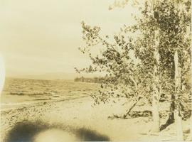
Image depicts several individuals seated on a ferry as it possibly departs from a dock somewhere in Prince Rupert, B.C. It is most likely headed for Haida Gwaii, B.C.
Image depicts numerous boats docked by the Prince Rupert Fishermen's Co-operative Association from the deck of a ferry, possibly as it's leaving Prince Rupert, most likely for Haida Gwaii.
File consists of a photocopy of a Canadian Journal of Fisheries and Aquatic Sciences (vol. 50) article by Ray Hilborn and John Winton entitled "Learning to Enhance Salmon Production: Lessons from the Salmonid Enhancement Program".
File consists of notes, reproductions, and letters relating to L.C. Gunn Park in Prince George. Includes: "Signage for Gunn Park" letter from Kent Sedgwick to the Mayor and Council (21 Dec. 1989); "L.C. Gunn viewpoint a proposal" documents within a duotang (1987); and "Donation to the City of Prince George" typescript letter from Graham Farstad to the Administration Committee ( 1 June 1988). Includes photographs depicting the opening of L.C. Gunn Park and the sign unveiling (3 Oct. 1988).
File consists of transcribed correspondence between Lawrence and Speirs on a variety of personal and ornithological topics as well as some of Ainley
File contains correspondence that appears to have been selected for inclusion in "A Special Affinity: The Correspondence of Louise de Kiriline Lawrence and Doris Huestis Speirs." It consists of photocopies and some handwritten copies of correspondence between Speirs and Lawrence, most of which relates to birding and ornithology projects carried out by Speirs and Lawrence.
Handwritten annotation on verso reads: "Lava plain Upper Nass River". Forest and hills visible in distance across plain.
Image depicts a formation of rock; presumably solidified lava, as the slide is simply labelled "lava." The location of the image is uncertain.
Photograph depicts a large wave breaking over the bow end of a weather ship.
Large crowd is gathered around main building in a harbor. Many boats visible in foreground. Smoke from tugboat partially obscures the scene. Annotation on recto reads: "Prince Rupert BC. Photo by MCrae Bros."
Image depicts a large building with numerous vehicles in the foreground.
Footage of what appears to be a large Pelican beside a lake.
The lake is believed to be either Anahim or Ulkatcho Lake.
Image depicts the canoe group at the Turner Creek Cabin by Lanezi Lake.
Image depicts a cirque in the mountains surrounding Lanezi Lake. Two individuals can also be seen canoeing on the lake.
Image depicts the snow still remaining from an avalanche at Lanezi Lake. Two people are also seen canoeing on the lake.
File contains images depicting various landslides near Cassiar BC. Set of 20 photographs (with 9 corresponding negative strips) date stamped June 1987 depict landslide near creek and dirt road with a Cassiar company truck. Set of 5 black and white photographs found in envelope marked "D. Stewart" are likely from 1988-1989 and depict a rockslide on the south western side of the pit mine, near the tramline. Album entitled “6200 DUMP SLIDE / SPRING, 1979” contains 34 photographs depicting aerial shots of a massive rockslide on the eastern slope of McDame Mountain, originating from the mine waste dump. Several images from album show greenish water pooling in the toe of the slide.
Image depicts what is possibly the remaining traces of a small land or rock slide; located somewhere near Bralorne, B.C.
Photograph depicts a landscape perspective of Moberly River with a grassy shoreline in the foreground and a tree-covered mountainous environment in the background.
Photograph depicts a landscape perspective of a grassy plateau with a mountain range in the background.
Photograph depicts an unidentified landscape view of the top of a forested area. Landscape is perhaps in the Moberly area.
Footage of the landscape around Tweedsmuir Lodge in Tweedsmuir Provincial Park.
Photograph depicts a flat, sandy shoreline along the Peace River with steep cliffs rising up in the distance. A steep island with trees on top is seen rising out of the Peace River.
Landscape with stumps, and roadbed with small (railroad?) track in foreground. River crosses midground, trees and sky in background. Men can be seen standing on far right on raised roadbed.
Image depicts the rolling hills of the Chilcotin Wildlife Area.
Image depicts a view of a mountainous landscape, possibly near the Fraser River.
Image depicts an aerial view of the land near the Fraser River. The Fraser River is barely visible on the right side of the image.
Image depicts an aerial view of the land near the Fraser River.
Image depicts an aerial view of a landscape at an uncertain location.
Image depicts a view of a mountainous landscape at an uncertain location.
Image depicts a view of the landscape in an uncertain location, though possibly somewhere near the Fraser River.
Image depicts a view of the landscape of the Chilcotin Wildlife Area.
Image depicts a view of the landscape in an uncertain location.
Photograph depicts land clearance between Monashee Pass and Lumby, B.C.
Image depicts a small section of the area surrounding Lamming Mills, B.C.
Image depicts a Yellowhead Realty sign in Lamming Mills, B.C. It reads: "For Sale, entire community, 50 buildings, 60 acres."
Image depicts what appears to be the old, abandoned mill in Lamming Mills, B.C.
Image depicts what appears to be a part of the old, abandoned mill in Lamming Mills, B.C.
Image depicts several old houses and an old, yellow pick-up in Lamming Mills, B.C.
Image depicts several boarded-up houses in Lamming Mills, B.C.
Image depicts the old, boarded-up community hall in Lamming Mills, B.C.
Image depicts an old, boarded-up store/office in Lamming Mills, B.C.
Image depicts a boarded-up house in Lamming Mills, B.C.
Photograph depicts a rocky lakeshore at Moberly Lake with leafy trees in the foreground.
Image depicts a large group of people enjoying the Mount Layton Hot springs in the Lakelse Lake Provincial Park north of Kitimat, B.C.
Image depicts the Lakeland Sawmill in Prince George, B.C, identified by the beehive burners; the one with white smoke belonged to Pas Lumber Co. which was bought out by Lakeland in 1987.