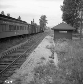
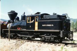
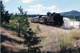
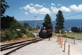
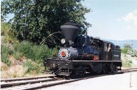
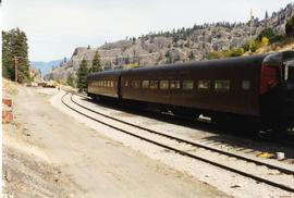
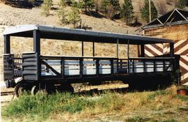
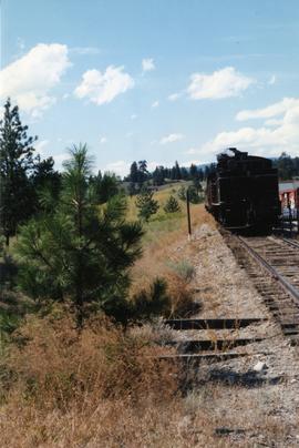
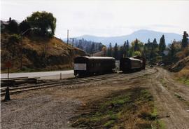
Photograph depicts a car (at the left) which is an office and on display. The car on the right was operating equipment. Photograph taken at the KVR Historical Society headquarters.
Photograph depicts a train that was reconditioned at the Forestry Museum in Duncan in 1995/6. At that location, Davies had seen its fire box being rebricked.
Photograph depicts 2 cars in use between Summerland and Trout Creek bridge.
File consists of documentary photographs taken by David Davies of the dismantling of the KVR line from Princeton to Jura, British Columbia.
Photograph depicts a terminus of a boundary Subdivision on mile 126.6 from Nelson.
Photograph depicts KVR (CPR) trackage between Boundary Falls and Midway. The line had not yet been officially abandoned, but it was little used, if not at all.
File consists of documentary photographs taken by David Davies of Kettle Valley Railway and current Burlington Northern Railroad trackage in Grand Forks and Greenwood, British Columbia.
Photograph depicts the Kelowna Pacific Ralway yard in Vernon, near the CNR Okanagan Subdivision.
Photograph depicts Koksilah depot of the Esquimalt and Nanaimo Railway on Vancouver Island. It is 2 miles south of Duncan and the view is looking north.
Photograph depicts Knox McCusker’s pack train traversing across an unidentified mountain ridge, ca. 1930. Caption on verso reads: “Knox McCusker’s pack train, ‘30’s”.
Image depicts the CN Rail station located in Kitwanga, B.C.
Image depicts a harbour in Kitimat, B.C.
Image depicts numerous docked boats in Kitimat, B.C.
Image depicts numerous docked boats, as well as many houses on the shore in the background; located in Kitimat, B.C.
Postcard depicts Kicking Horse Pass, Golden B.C.
Postcard depicts Kicking Horse Canyon, Field, A.B.. on the CPR line.
Postcard depicts Kicking Horse Canyon, Field, BC on the CPR line.
Postcard depicts Kicking Horse Canyon in the Canadian Rockies.
Postcard depicts the Kicking Horse Canyon. As seen from the Golden-Field Highway. Along the CPR line.
Postcard depicts Kicking Horse Canyon.
Image depicts a van on a narrow road, likely the Kettle Valley Trail.
Image depicts a woman walking along a trail somewhere in Kettle Valley, B.C.
Photograph depicts a home built open car of the Kettle Valley Steam Railway.
Photograph depicts a locomotive belonging to the Kettle Valley Railway Heritage Society in Summerland.
Photograph taken at the temporary upper terminus at the Prairie Valley station (near the Rodeo Grounds). The tourist train originally started with 4 kilometers of track, but in September 1996, it increased to 10 kilometers by continuing past Summerland to the Rodeo Grounds. Turn-around siding was also installed beyond the new terminus. The first train went over the new track on August 22, 1996. Summerland was down grade to the right of the photo.
Photograph depicts a shay rounding around its train at the temporary south terminus at Canyon View Road Crossing, 200 yards from Trout Creek Bridge.
Photograph taken from a grade crossing that went into the Rodeo Grounds in Summerland. Locomotive belonged to the Kettle Valley Railway Heritage Society.
Technical drawing of Kettle Valley Railway depicts trackage and a gradient profile for the line.
File consists of documentary photographs taken by David Davies of the Kettle Valley Railway line from Merritt to Midway, British Columbia.
File consists of documentary photographs taken by David Davies of Kettle Valley Railway equipment found in Brookmere, British Columbia.
Image depicts a view of Kettle Valley, with a bridge of the old Kettle Valley Rail Road visible on a slope.
Image depicts a woman walking along the trail of the Kettle Valley Rail Road.
Image depicts the trail of the old Kettle Valley Rail Road.
Image depicts a man standing on the old Kettle Valley Rail Road.
Image depicts the old Kettle Valley Rail Road.
Image depicts several unknown individuals standing on the old Kettle Valley Rail Road.
Image depicts the Okanagan Kettle Valley, with the Kettle Rail Road faintly visible among the trees
Image depicts the trail of the old Kettle Valley Rail Road.
Image depicts a woman standing on the old Kettle Valley Rail Road.
Photograph taken at Kettle River Bridge. Immediately on the far side of the river, the track did a sharp turn to the side of Christina Lake.
Photograph taken at the Kettle River Bridge on the former Boundary Subdivision about 12 miles due east of Grand Forks. Visible is a deck truss and dock plate girder spans that were believed to have originally a covered bridge.
Photograph depicts ore haul truck at dump in mine, driver visible, mountain range in background. Handwritten annotation on recto of photograph: "Kenworth - Model 802 dumping stripping waste at 6565 Elevation", on verso: "1961".
Image depicts a boat dock on the Nechako Reservoir at Kenny Dam.
Image depicts a boat on the Nechako Reservoir at Kenny Dam.
Map depicts the city of Kelowna and area. Annotated by Davies to emphasize rail lines.
Map depicts area around Kelowna, with annotated Kettle Valley Railway Carmi subdivision line, Hydraulic Lake, and McCulloch.