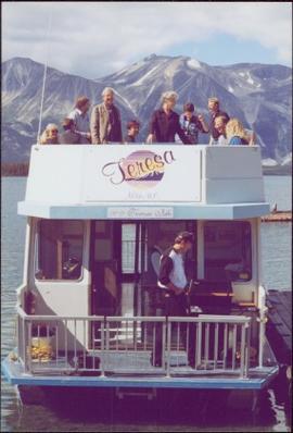
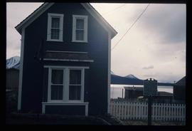
Image depicts one of the main streets, Broadway, in Skagway, Alaska.
Image depicts the Pack River outlet at McLeod Lake.
Image depicts what appears to be a footbridge at an uncertain location.
Image depicts a boat named "the Tarahne," which is located in Atlin, B.C. Atlin Lake and Mountain are visible in the background.
Image depicts a dock on the shore of Atlin Lake, as well as a building that may have once been a hospital. The slide is simply labelled "hospital."
Image depicts a boat named "the Tarahne," which is located in Atlin, B.C. Atlin Lake and Mountain are visible in the background.
Image depicts an old boat on the shore of Atlin Lake.
Image depicts a small section of the Alaska Highway somewhere near Whitehorse, Y.T. The slide also appears to be labelled "army washing" for unknown reasons.
Image depicts what appears to be an eroding rock face. The slide itself is labelled "ash loger at top" for unknown reasons. Possibly located somewhere near Whitehorse, Y.T.
Image depicts a forested mountain side somewhere along the White Pass railway. The thin ridge along the mountain side is possibly either a highway or part of the railway.
Image depicts a mountain side somewhere along the White Pass railway. The thin ridge along the mountain side is possibly either a highway or part of the railway.
Image depicts an old trestle along the White Pass railway.
Image depicts the Tsilcoh Falls, north of Fort St. James and somewhere near Pinchi Lake Road.
Image depicts Nautley and the Nautley River near Fraser Lake, B.C.
Image depicts a section of land on the east end of Francois Lake. The lake is visible in the distance.
Image depicts Kenny Dam, south of Francois Lake, and southwest of Vanderhoof, B.C.
Image depicts McLeod lake.
Image depicts Nautley and the Nautley River near Fraser Lake, B.C.
Image depicts a stretch of land; the photo was taken from the top of Kenny Dam, south of Francois Lake.
Image depicts the post office in Atlin, B.C.
Image depicts a lake somewhere along what is possibly the Atlin Road to Atlin, B.C.
Image depicts what is possibly Atlin Road. Numerous mountains are visible in the distance.
Image depicts a mountain, possibly Atlin Mountain.
Image depicts Bennett Lake near Carcross, Y.T.
Image depicts a river at an uncertain location, but possibly in Miles Canyon near Whitehorse, Y.T.
Image depicts numerous trees on the bank of a river, possibly in Miles Canyon near Whitehorse, Y.T. The slide is labelled "canyon city."
Image depicts numerous unidentified individuals getting off a boat which bears the name "Schwatka." It is located somewhere in Miles Canyon.
Image depicts the Robert Lowe Bridge, built in 1922, in the Miles Canyon near Whitehorse Y.T.
Image depicts a van on a highway with mountains in the distance; the location is uncertain, though it is possibly along the Alaska Highway.
Image depicts the White Pass Train crossing over a railway bridge at an uncertain location.
Image depicts a view over a forested, mountainous area and a river somewhere in the area of Skagway, Alaska.
Image depicts a mountain side somewhere along the White Pass railway. The thin ridge along the mountain side is possibly either a highway or part of the railway.
Image depicts an old trestle along the White Pass railway.
Image depicts an old trestle along the White Pass railway, and the White pass Train on the left of the image.
Image depicts a train on the Hansard Bridge across the Fraser River looking west. Map coordinates 54°04'37.7"N 121°50'39.9"W
Image depicts the small town of Fraser, B.C. Located on the Klondike Highway.
Image depicts half of a ship, which is named the Tutshi, in Carcross, Y.T.
Image depicts the Caribou Hotel and the Matthew Watson General Store in Carcross, Y.T.
Image depicts a building which once served as the residence for two nurses in Atlin, B.C. A sign in front of the house reads: "Grateful Atlinites built this house in 1902 for their first missionary nurses, Helen Bone and Elizabeth Mitchell, who came here in 1899 and lived in a crude shack while valiantly and humanely caring for sick and dying pioneers."
This map depicts the City of Prince George's plan for soil removal and deposit.
File consists of the following materials:
- Letter to Vernon C. Brink from the National Archives of Canada re: Knox McCusker holdings (March 1, 1999)
- Photocopy of article: "Living Landscapes: Exploring the wilds of northeaster BC" by Ross Peck and Brian Apland
- Some materials for an article on Knox McCusker, D.L.S.
- Material about the life of Knox Freeman McCusker
- Letter to Mrs. Rutherford (Oct. 5, 1999) re: access to interview of Knox McCusker by Frank Willis
- Accession information print-out re: interview of Knox McCusker by Frank Willis in 1954
- National Archives of Canada accession information print-out re: Dominion Land Surveyor Diaries, 1881-1930
- Mary Henry / Knox McCusker "Team" (April 19, 1998)
- Letter to Mrs. Rutherford from George Ungar re: background information on Knox McCusker
This map is part of Schedule B of the 1993 Official Community Plan, Bylaw No. 5909 for the City of Prince George. This particular map reflects the 1998 amendment to the Official Community Plan.
Image depicts a Prince George residential area from the viewpoint of the Ginter Property.
Image depicts the Ginter Property in Prince George, B.C.
Left to right: Deborah Poff, Dennis Macknak, Charles Jago, an unidentified woman, Iona Campagnolo, an unidentified man, Ellen Facey, and an unidentified woman. Unknown man stands on lower deck in foreground. Mountains visible in background. Photograph taken during the Chancellor's 1996 regional tour through Atlin and Whitehorse; see also items 2009.6.1.578 - 2009.6.1.581.
Handwritten annotation on verso reads: "#3 Chancellor's Tour".
Left to right: Deborah Poff, Dennis Macknak, Charles Jago, an unidentified woman, Iona Campagnolo, Ellen Facey, Nick Petraryszak, an unidentified man, and an unidentified woman. Unknown man stands on lower deck in foreground. Mountains visible in background. Photograph taken during the Chancellor's 1996 regional tour through Atlin and Whitehorse; see also items 2009.6.1.578 - 2009.6.1.580.