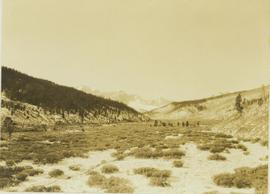
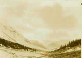
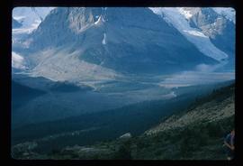
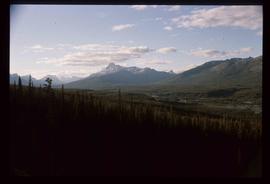
Showing 3305 results

Archival description
3025 results with digital objects Show results with digital objects
View from the Peace River
2000.19.2.8 · Item · 29 Aug. 1927-26 Sept. 1927
Part of Prentiss Gray Collection

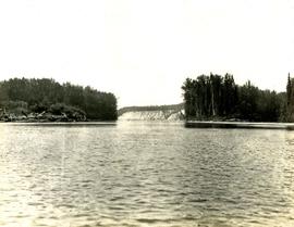
Photograph depicts a view of the Peace River leading into a strait flanked by two forested shorelines. In the background a rocky cliffside is visible.

View from Gunn Point
2012.13.1.3.060 · Item · Nov. 1979
Part of J. Kent Sedgwick fonds

Image depicts a view of Prince George from Gunn Point in the L.C. Gunn Park looking north. Map coordinates 53°54'26.2"N 122°43'35.8"W.

View from Gunn Point
2012.13.1.3.061 · Item · Nov. 1979
Part of J. Kent Sedgwick fonds

Image depicts a view of Prince George from Gunn Point in the L.C. Gunn Park looking north. Map coordinates 53°54'26.2"N 122°43'35.8"W.

View from Gunn Point
2012.13.1.3.059 · Item · Nov. 1979
Part of J. Kent Sedgwick fonds

Image depicts a view of Prince George from Gunn Point in the L.C. Gunn Park looking north. Map coordinates 53°54'26.2"N 122°43'35.8"W.

View from Gunn Point
2012.13.1.3.064 · Item · Nov. 1979
Part of J. Kent Sedgwick fonds

Image depicts a view of Prince George from Gunn Point in the L.C. Gunn Park looking north. Map coordinates 53°54'26.2"N 122°43'35.8"W.

View from Gunn Point
2012.13.1.3.065 · Item · Nov. 1979
Part of J. Kent Sedgwick fonds

Image depicts a view of Prince George from Gunn Point in the L.C. Gunn Park looking north. Map coordinates 53°54'26.2"N 122°43'35.8"W.

View from Gunn Point
2012.13.1.3.058 · Item · Nov. 1979
Part of J. Kent Sedgwick fonds

Image depicts a view of Prince George from Gunn Point in the L.C. Gunn Park looking north. Map coordinates 53°54'26.2"N 122°43'35.8"W.

View from Gunn Point
2012.13.1.3.062 · Item · Nov. 1979
Part of J. Kent Sedgwick fonds

Image depicts a view of Prince George from Gunn Point in the L.C. Gunn Park looking north. Map coordinates 53°54'26.2"N 122°43'35.8"W.

View from Gunn Point
2012.13.1.3.063 · Item · Nov. 1979
Part of J. Kent Sedgwick fonds

Image depicts a view of Prince George from Gunn Point in the L.C. Gunn Park looking north. Map coordinates 53°54'26.2"N 122°43'35.8"W.

View from Gunn Point
2012.13.1.3.066 · Item · Nov. 1979
Part of J. Kent Sedgwick fonds

Image depicts a view of Prince George from Gunn Point in the L.C. Gunn Park looking north. Map coordinates 53°54'26.2"N 122°43'35.8"W.

View from Gunn Point
2012.13.1.3.067 · Item · Nov. 1979
Part of J. Kent Sedgwick fonds

Image depicts a view of Prince George from Gunn Point in the L.C. Gunn Park looking north. Map coordinates 53°54'26.2"N 122°43'35.8"W.

2000.1.1.3.14.03 · Item · 1952
Part of Cassiar Asbestos Corporation Ltd. fonds

Handwritten annotation on recto of photograph: "ASBESTOS FIBRE VEINS AS THEY OCCURR IN A ROCK FACE". Photo caption under printed copy of image in 1952 Annual Report: "North Wall of adit approximately 225 feet from portal showing asbestos veinlets."

Vegetation
2012.13.1.131 · Subseries · [between 1966 and 1978]
Part of J. Kent Sedgwick fonds

File contains slides depicting vegetation and a few maps.

Varves
2012.13.1.124.16 · Item · Oct. 1975
Part of J. Kent Sedgwick fonds

Image depicts an example of varves, an annual layer of sediment or rock, with a pipe used for reference size. It is possibly located at the airport in Prince George, B.C.

Varves
2012.13.1.124.15 · Item · Oct. 1975
Part of J. Kent Sedgwick fonds

Image depicts an example of varves, an annual layer of sediment or rock, possibly located at the airport in Prince George, B.C.

Valley
2012.13.1.56.57 · Item · 1973
Part of J. Kent Sedgwick fonds

Image depicts a view of a small valley in Mt. Robson Provincial Park.

Valley?
2012.13.1.59.13 · Item · July 1980
Part of J. Kent Sedgwick fonds

Image depicts a river running through a valley-like area somewhere near Bralorne, B.C.

Valemount - Reservoir
2012.13.1.85.24 · Item · [1976?]
Part of J. Kent Sedgwick fonds

Image depicts a distant view of what appears to be a body of water, with numerous mountains in the background. The slide is labelled "Valemount reservoir."

Valemount - Mountains
2012.13.1.85.21 · Item · 1976
Part of J. Kent Sedgwick fonds

Image depicts a view of a mountain range near Valemount, B.C. Valemount is barely visible among the trees on the right side of the image.

Valemount
2012.13.1.85.25 · Item · [1976?]
Part of J. Kent Sedgwick fonds

Image depicts a view of Valemount, with numerous mountains in the background.

Uprooted Tree?
2012.13.1.78.19 · Item · 1982
Part of J. Kent Sedgwick fonds

Image depicts an individual standing next to what appears to be the base of a very large, uprooted tree, located somewhere in the coastal forest of Haida Gwaii, B.C.

Upper Fraser Road in Winter
2012.13.1.89.016 · Item · Feb. 1973
Part of J. Kent Sedgwick fonds

Image depicts several unidentified individuals walking along the snow-covered Upper Fraser Road with numerous buildings on either side. Map coordinates 54°07'05.7"N 121°56'38.9"W

2012.13.1.87.041 · Item · [between 1975 and 1995]
Part of J. Kent Sedgwick fonds

Image depicts the Upper Fraser Road running through Upper Fraser, B.C. A beehive burner is seen in the background on the left and the mill office is seen on the right. Map coordinates 54°07'05.7"N 121°56'38.9"W

Upper Fraser Mill
2012.13.1.87.044 · Item · [between 1975 and 1995]
Part of J. Kent Sedgwick fonds

Image depicts entrance to mill yard for Upper Fraser mill in Upper Fraser, B.C. Map coordinates 54°07'10.8"N 121°56'51.7"W

Upper Fraser Mill
2012.13.1.87.046 · Item · [between 1975 and 1995]
Part of J. Kent Sedgwick fonds

Image depicts Upper Fraser mill yard with log deck and beehive burner in silhouette across railroad tracks. Located in Upper Fraser, B.C. Map coordinates 54°07'01.5"N 121°56'29.6"W

Upper Fraser Mill
2012.13.1.87.064 · Item · [between 1975 and 1995]
Part of J. Kent Sedgwick fonds

Image depicts numerous log decks at the Upper Fraser sawmill. Map coordinates 54°07'10.8"N 121°56'51.7"W

Upper Fraser Mill
2012.13.1.87.062 · Item · [between 1975 and 1995]
Part of J. Kent Sedgwick fonds

Image depicts the entrance to the Upper Fraser mill yard in Upper Fraser, B.C. Map coordinates 54°07'10.8"N 121°56'51.7"W

Upper Fraser General Store
2012.13.1.87.043 · Item · [between 1975 and 1995]
Part of J. Kent Sedgwick fonds

Image depicts the Upper Fraser General Store in Upper Fraser, B.C. Two other signs indicate that it is also a post office and a place that offers propane refills. Map coordinates 54°07'10.8"N 121°56'51.7"W