Map reflects forest type boundary line, bogs and swampy non-forested areas, creeks, lakes, rivers, tree species labels of spruce, balsam, and birch, stand descriptions, historical timber sale boundaries, stand history symbol, gravelled secondary roads, unimproved old roads, management compartment boundary, research forest boundary, ecological reserve boundary, and old growth emphasis areas.
Mylar map is a plot map of a research plot at the Aleza Lake Research Forest. Provides date the plot was established, the harvest history, the silviculture history, remeasurement history, and information about individual trees.
Map reflects forest type boundary line, bogs and swampy non-forested areas, creeks, lakes, rivers, tree species labels of spruce, balsam, and birch, stand descriptions, historical timber sale boundaries, stand history symbol, gravelled secondary roads, unimproved old roads, management compartment boundary, research forest boundary, ecological reserve boundary, and old growth emphasis areas.
Item is a reproduced map of Aleza Lake annotated to show a 1994 RFP study area.
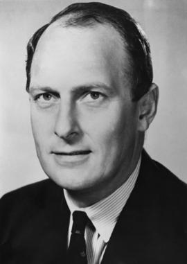
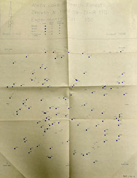
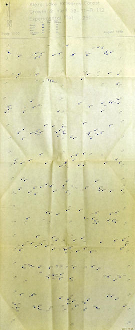
This fonds consits of the administrative and business papers of Mr. Adam Zimmerman during his tenure as a senior level executive with Noranda Inc., Noranda Mines Ltd, and Macmillan Bloedel Ltd., particularly in Ontario, Quebec, and British Columbia with the majority of these records relating to the senior level operations of these companies. It includes textual records relate to the creation and development of Northwood Pulp & Timber Ltd. in Prince George including all aspects of its regional operations throughout Northcentral BC). The fonds also includes records related to Noranda Inc.’s successful and unsuccessful attempts at business acquisitions in both forestry and mining operations internationally, particularly in Mexico, Brazil, the Netherlands and Tasmania.
The fonds also contains textual records generated by Zimmerman in his directorship and chairman positions on various forest industry association boards. It includes his notes, general correspondence, minutes, as well as booklets and brochures notably from the Canadian Forest Industries Council, the Canadian Pulp and Paper Association, the Forest Sector Advisory Council and other similar industry associations. Much of this material relates to the issue of the softwood lumber dispute and Zimmerman’s involvement in the lobbying efforts regarding Canada/U.S. Free Trade issues and includes bound reports, agreements, and publications as well as correspondence to/from Zimmerman and his handwritten notes within the files. The fonds also includes general business information (annual reports, brochures, publications) pertaining to other Canadian forestry and mining companies.
The fonds also contains Adam Zimmerman’s speeches and correspondence related to his involvement in numerous charities, foundations and corporate fundraising initiatives with numerous Canadian educational institutions, non-profit societies and federal election campaigns.
Business records of Noranda Inc. are extensive and include administrative, business, personnel, financial and legal records. Record types include correspondence, memos, handwritten notes, business proposals and meeting notes, merger proposals and notes, prospectuses, board meeting agendas and minutes, annual reports, financial statements, resumes, portfolios, printed brochures, publications and other ephemera related to the business operations of Noranda Inc., Noranda Mines and MacMillan Bloedel [during Noranda Mines take-over of MB] all during Zimmerman’s tenure as Chair and/or CEO. The fonds includes correspondence, financial reports, legal testimony transcripts resulting from the Gaspe Copper Mine labour strike in Quebec in 1957 and the subsequent Gaspe Law Suit of 1960 between Noranda and the United Steel Workers of America. The fonds also includes extensive correspondence between Zimmerman and various levels of government regarding the lobbying of government on forestry policy and correspondence with various environmental lobbying groups in the 1980s including correspondence with well-known environmentalist David Suzuki.
Subjects include all facets of business operations pertaining to Canadian forestry and mining sectors including labour issues, environmental impacts of industrial developments, industry and effects on the Canadian economy, the free trade debate, the softwood lumber issue etc.
The fonds provides a detailed archival record of Mr. Zimmerman’s contribution to the building of Noranda Forest in Canada, Northwood Pulp & Timber in BC and Noranda Inc. as a resource-based conglomerate. Many records were utilized by Mr. Zimmerman in the writing of his book, Who’s in Charge Here, Anyway?: reflections from a life in business, (Don Mills, Ontario: Stoddart; Distributed in Canada by General Distribution Services), 1997.
Zimmerman, AdamMylar map is a plot map of a research plot at the Aleza Lake Research Forest. Provides date the plot was established, the harvest history, the silviculture history, remeasurement history, and information about individual trees.
Mylar map is a plot map of a research plot at the Aleza Lake Research Forest. Provides date the plot was established, the harvest history, the silviculture history, remeasurement history, and information about individual trees.
Map depicts historical timber sales areas and permanent sample plots (PSPs) at the Aleza Lake Research Forest. This map may be a guide (or otherwise related) to maps 2006.18.5.43-59.
Item is a photocopied Aleza Lake Forest map with forest cover labels, annotated to show 1995 sample transects.
File contains drafts of management and working plan for the period of 1992 to 2002, the final draft for the management and working plan, and related correspondence between Mike Jull and those involved with the Aleza Lake Research Forest.
Item is a photocopied map of the Aleza Lake area annotated to show transects.
Item is Map 3 of a group of five maps relating to a City of Prince George Study of Construction Aggregates by the firm Willis, Cunliffe, Tair & Company Limited. Map 3 shows geology of the Prince George area and known sources of construction aggregates.
Item is Map 2 of a group of five maps relating to a City of Prince George Study of Construction Aggregates by the firm Willis, Cunliffe, Tair & Company Limited. Map 2 shows development areas and aggregate requirements for 1984 and 1994. As the map is undated, it is unclear whether the 1984 and 1994 dates are future estimates.
Item is Map 5 of a group of five maps relating to a City of Prince George Study of Construction Aggregates by the firm Willis, Cunliffe, Tair & Company Limited. Map 5 shows drill hole locations.
Item is Map 1 of a group of five maps relating to a City of Prince George Study of Construction Aggregates by the firm Willis, Cunliffe, Tair & Company Limited. Map 1 shows development areas and population for 1984 and 1994. As the map is undated, it is unclear whether the 1984 and 1994 dates are future estimates.
Item is Map 4 of a group of five maps relating to a City of Prince George Study of Construction Aggregates by the firm Willis, Cunliffe, Tair & Company Limited. Map 4 shows development areas, aggregate sources, and requirements for 1984 and 1994. As the map is undated, it is unclear whether the 1984 and 1994 dates are future estimates.
Map accompanies “Aleza Lake Research Forest Management and Working Plan #2 Draft #3”.
File contains original and photocopied drafts of working plans and drafts, planning projects, original amendments to special use permits, handwritten notes, related correspondence, and photocopied maps.
File contains information, including diagrams, measurement charts, and a map, for experimental plot 291.
File contains plot summaries of selected permanent sample plots, correspondence regarding field courses, records of management committee meetings from 1991 and 1990, documents and correspondence pertaining to the re-opening of the Aleza Lake Research Forest, partial cutting summaries, research proposals and studies, cost and revenues documents, a 1961 biography on Percy Barr, charts covering remeasurements of permanent sample plots, hand written correspondence from 1990 discussing the history of marking crews, and a brief history of the Aleza Lake Experiment Station.
File contains information, including diagrams, measurement charts, and a map, for experimental plot 45.
File contains information, including diagrams, measurement charts, and a map, for experimental plot 112.
File contains information, including diagrams, measurement charts, and a map, for experimental plot 118.