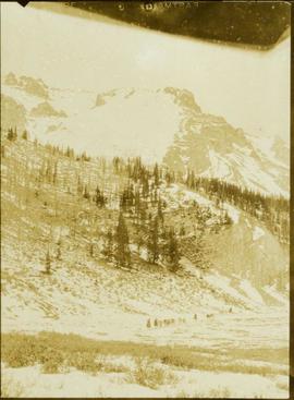
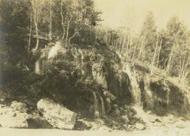
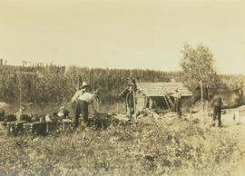
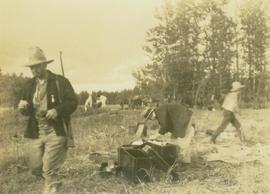
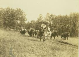
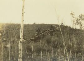
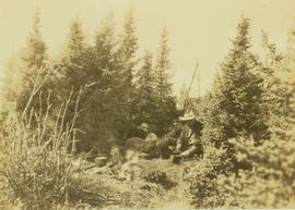
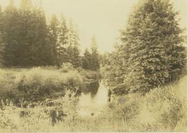
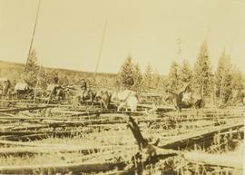
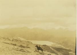
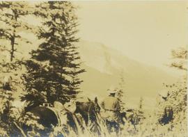
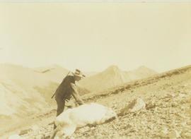
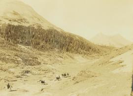
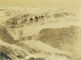
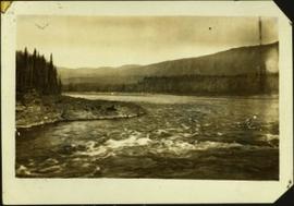
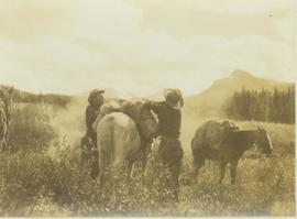
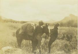
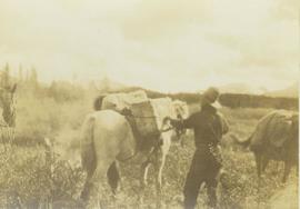
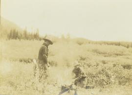
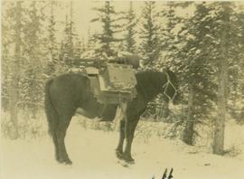
Photograph depicts a profile view of a pack horse laden with Prentiss Gray's camera equipment.
Photograph depicts a train of pack horses walking along a snowy trail across a snow-covered plateau. In the background a tree-covered mountain base is visible with snow-capped peaks rising up in the distance.
Photograph depicts a view of the Peace River leading into a strait flanked by two forested shorelines. In the background a rocky cliffside is visible.
Photograph depicts Mac McGarvey (right) and Frank Dewing (left) sitting in a boat on the Peace River. Mac McGarvey is steering the boat while Frank Dewing is pumping water from the boat. In the background a low mountain range is visible.
Photograph depicts the Peace River Canyon with the Peace River in the foreground and rocky, tree-lined cliffs flanking the river. In the background a forested mountain base is visible.
Photograph depicts Harry Snyder with three wagons and horse teams coming into Hudson's Hope from Portage. In the background three small buildings are visible in front of a forested area.
Photograph depicts natural springs falling down a rocky slope found below Hudson's Hope, upriver from Ferry Landing. In the background of the image a forested area rises above the rocky slope.
Photograph depicts five men in a crew packing up supplies in boxes at Hudson's Hope. Behind the men packing there is a small log building and a forest.
Photograph depicts two unidentified men unloading pack boxes while Carrol Paul walks away to the left while holding a rifle. In the background horses are grazing beside a forested area.
Photograph depicts a pack horse train walking along a grassy trail being led by an unidentified man on horseback. In the background a forested environment is visible.
Photograph depicts a pack horse train walking down a grassy hill with a sparse tree line in the foreground.
Photograph depicts Carrol Paul (left), unidentified man (middle), and Harry Snyder (right) sitting on the ground next to a small camp fire during a tea break. Surrounding the camp set up are several small coniferous trees.
Photograph depicts an unidentified man standing beside a creek with bushes on either side. In the background a forested environment is visible.
Photograph depicts a pack horse train slowly making its way across fallen trees near Kinooaso Falls.
Photograph depicts a man on horseback standing alone on a mountain slope. In the background an alpine lake is visible at the base of a mountain.
Photograph depicts a pack horse train slowly making its way over an area covered with windfall near Kinoosao Falls.
Photograph depicts an alpine lake visible in a distant mountain valley with snow-capped mountains visible in the background.
Photograph depicts an overview of an old burn site with burnt trees lining a hillside.
Photograph depicts two men (possibly Pete Callao and Carrol Paul) standing with two saddled horses. In the background a mountain vista is visible.
Photograph depicts the edge of Kinuseo Falls, also known as Kinoosao Falls, running over a rocky shoreline with burnt trees in the background.
Photograph depicts Carrol Paul (left) and George Bates (right) standing with pack horses loaded with bull moose meat. In the background a burnt forest is visible.
Photograph depicts Carrol Paul standing with rifle on top of felled bull moose. In the background a sparse forest is visible.
Photograph depicts an unidentified man sitting on the top of the plateau of a mountain peak. In the background a mountain range is is visible in the distance.
Photograph depicts Wapiti Lake and an unidentified mountain range as seen behind the trees of a forested slope.
Photograph depicts Prentiss Gray standing with his rifle and horse in a grassy field. In the background a forested valley and snow-covered mountain range is visible.
Photograph depicts Frank Dewing and Joe Callao in a bush covered field loading up a pack horse while another laden pack horse stands to the side. In the background a mountain range is visible.
Photograph depicts Frank Dewing and Joe Callao loading up a pack horse in a grassy field. In the background a mountain range is visible.
Photograph depicts a man loading up pack horse with two other laden pack horses visible in the periphery of the image.
Photograph depicts Frank Dewing and Joe Callao next to a campfire in a bush covered field. In the background the tree line of a forest is visible.
Photograph depicts a mountain goat lying on a rocky mountain slope.
Photograph depicts Prentiss Gray reaching out to a felled mountain goat lying on a rocky slope. In the background a mountain range is visible.
Photograph depicts a pack horse train in the foreground walking through a mountain valley. In the background forested foothills are visible with a mountain peak rising from the background.
Photograph depicts the top of a mountain ridge situated next to an alpine lake. The photograph location is the Mt. Petrie area from the north and northwest.
Handwritten caption below this photo reads: "Finlay River Rapids. - 1930."
A small peninsula extends into river in left midground, rapids in foreground, trees and hills on opposite shore in background.
Close view of bridge built with wooden planks, poles, and wires, braced from below, with triangles built into its frame. The bridge crosses Hagwilget Canyon on the Bulkley River, five kilometres from its confluence with the Skeena River. This is one of the many bridge structures that have crossed this location since at least 1859. Photograph was taken from one side of canyon, near bridge. Opposite canyon wall in background. Typed annotation glued to verso of photograph: "HAGWILGET - 'the gentle or quiet people'."
Photograph depicts two men and a horse on a bridge built with wooden planks, poles, and wires, braced from below, with triangles built into its frame. The bridge crosses Hagwilget Canyon on the Bulkley River, five kilometres from its confluence with the Skeena River. This is one of the many bridge structures that have crossed this location since at least 1859. Photograph was taken from a distance. Rocky riverbank in foreground, opposite shore in background behind bridge. Typed annotation in red ink on verso of photograph: "INDIAN BRIDGE, NEAR HAZELTON, B.C."
Photograph depicts many swallows' nests under eaves of unidentified building, window visible beneath.
Photograph depicts power plant by waterfall. Extensive construction materials and structures can be seen scattered to left of plant. River in foreground, forest and hills in background. Typed annotation on verso of photograph: "Northern B.C. Power Co. Falls River Plant Prince Rupert B.C."
Photograph depicts dry creek bed, tall banks on either side. Hills and lake cross midground, mountains visible in background. Handwritten annotation on verso of photograph: "Looking down McKee Creek across Atlin Lake Towards Taku Glacier 6/27/37."
Photograph depicts the Atlin townsite, forest in foreground, hills in background. Town stands on edge of lake located in left midground. Handwritten annotation on verso of photograph: "Atlin City B.C., Sept. 3rd 1899. Copyrighted by S.A. Smythe Atlin, B.C."
Photograph depicts men and haul trucks visible in distance on snowy road in tree-covered hills.
Photograph depicts an unidentified building in snowy area, trees on hill in background.
Photograph depicts a car, bulldozer, and tractor speculated to be involved in road construction. Rough dirt road runs left of machinery, forest and hills in background.
Photograph depicts lumber and brush piles, forest in background. Crane semi-visible on left, small boat semi-visible on right.
Photograph depicts three men panning in stream, sluiceway behind them. Rocky banks in foreground, forest in background.
Photograph depicts man standing in front of large streams of water spraying from pipe into mining area, hills in background.
Photograph depicts sluice trunk in mining area, men on tall structure in background.
Photograph depicts young fruit trees planted in fenced area with small wind mill, hills in background. Handwritten annotation on recto of photograph: "This is part of the fruit trees if you place it along side of the other one you can see the location the farm buildings are on the other side I didn't get one of them."
Photograph features iceberg floating in water, mountains on shore in background.
Image is one of 65 photos documenting a survey of the Canada-Alaska Boundary, Taku River area, May 23 to Oct. 15, 1906. This particular photo is one of 7 found in original enclosure with the following handwritten annotation: "Around River Taku and main camp on same." See also items 2006.20.3.35 - 2006.20.3.41.
Photograph depicts valley in snowy mountain range. Handwritten annotation visible on negative: "Pan. From Camera Sta no w. looking at [?] Glacier."
Image is one of 65 photos documenting a survey of the Canada-Alaska Boundary, Taku River area, May 23 to Oct. 15, 1906. This particular photo is one of 5 found in original enclosure with the following handwritten annotation: "Boundary No.2 camera Sta. Twin Lake & Glacier.” See also items 2006.20.3.42 - 2006.20.3.46.