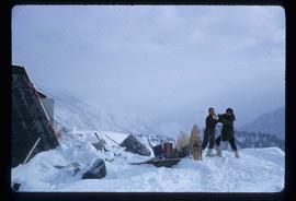
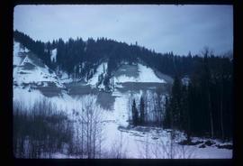
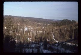
Affichage de 3026 résultats

Archival description
Trip to Birken
2012.13.1.47.02 · Pièce · 1967
Fait partie de J. Kent Sedgwick fonds

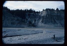
Image depicts a mountain in the distance. It is located somewhere near Birken, B.C.

Place Glacier
2012.13.1.47.10 · Pièce · 1967
Fait partie de J. Kent Sedgwick fonds

Image depicts the Place Glacier. There are two unknown individuals present.

Antler Cabin
2012.13.1.49.02 · Pièce · 2002
Fait partie de J. Kent Sedgwick fonds

Image depicts a wood cabin with antlers and a moose head somewhere in Mud River, B.C.

Watson Mansion - 108 Mile Roadhouse
2012.13.1.50.015 · Pièce · 1974
Fait partie de J. Kent Sedgwick fonds

Image depicts the Watson Mansion at Mile 108 of Highway 97. It was built by Captain Geoffrey Watson in 1904, and was burned down by a chimney fire in 1983.

Near Williams Lake
2012.13.1.50.031 · Pièce · 1974
Fait partie de J. Kent Sedgwick fonds

Image depicts an aerial view of a stretch of power lines somewhere near Williams Lake, B.C.

Fault?
2012.13.1.50.050 · Pièce · 1978
Fait partie de J. Kent Sedgwick fonds

Image depicts an unknown individual standing next to what appears to be a fault at an unknown location.

Fault?
2012.13.1.50.054 · Pièce · 1978
Fait partie de J. Kent Sedgwick fonds

Image depicts what appears to be a fault at an unknown location.

Farm
2012.13.1.50.058 · Pièce · 1978
Fait partie de J. Kent Sedgwick fonds

Image depicts a farm at an unknown location.

Rudi's Bridge
2012.13.1.50.059 · Pièce · 1978
Fait partie de J. Kent Sedgwick fonds

Image depicts a small foot bridge at an unknown location. The slide is simply labelled "Rudi's Bridge."

Irrigation Pipes
2012.13.1.50.074 · Pièce · [1978?]
Fait partie de J. Kent Sedgwick fonds

Image depicts a pile of irrigation pipes on a dairy farm somewhere near Quesnel, B.C.

Open Pit
2012.13.1.50.093 · Pièce · [1978?]
Fait partie de J. Kent Sedgwick fonds

Image depicts an open mining pit at an uncertain location; it is possibly Gibraltar.

Chasm
2012.13.1.50.128 · Pièce · 1981
Fait partie de J. Kent Sedgwick fonds

Image depicts a chasm full of trees at an unknown location.

Dunlevy Creek?
2012.13.1.50.137 · Pièce · 2006
Fait partie de J. Kent Sedgwick fonds

Image depicts the Dunlevy Creek area somewhere near Dawson Creek, B.C. The slide is simply labelled "Dunlevy irrigation" for uncertain reasons.

Old Mill?
2012.13.1.50.157 · Pièce · [1982?]
Fait partie de J. Kent Sedgwick fonds

Image depicts what appears to be an old mill at an unknown location.

'Ksan - Totem Pole
2012.13.1.51.015 · Pièce · Aug. 1971
Fait partie de J. Kent Sedgwick fonds

Image depicts a totem pole in the historical village of 'Ksan near Hazelton, B.C.