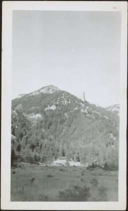
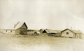
Showing 4134 results

Archival description
3619 results with digital objects Show results with digital objects
2012.13.3.1.03 · File · 1970-2004
Part of J. Kent Sedgwick fonds

File consists of clippings, notes, and reproductions relating to heritage homes in Central Fort George. Includes a "BC Rail" typescript letter from Dick Rowe at BC Rail to Kent Sedgwick (10 Nov. 1987); "Irene Jordan brothel location" handwritten notes by Kent Sedgwick (1990); and "Heritage inventory record" booklet describing heritage buildings in Prince George (1990). Also includes photographs depicting veteran housing on Burden Street in Prince George; a house at the address 510 Douglas Street in Prince George (2003); and Erle's Iron Works shop with a man outside welding the turrets for the Sikh temple (Aug. 1990).

2011.3.3.20 · Item · [ca. 1910]
Part of North Coast & Central BC Postcard Collection

View of fish boat in water, with net spread and smaller boat on opposing side of net. Several gulls can be seen flying in the air. Rail cars town and treed hills in background. Printed annotation on recto reads: “Herring Fishing In Prince Rupert Harbour McRae Bros.” Handwritten message in ink on verso is addressed to “Mr. H. Smart 2550 Blackwood St. Victoria B.C.”

2000.23.1.070.11 · Item · [between 1967 and 1987]
Part of Audrey Smedley L'Heureux fonds

The map is part of an advertising pamphlet that depicts the Yellowhead Highway 16. The map highlights towns and tourist attractions along Highway 16 like Hazelton, Kitimat, Vanderhoof, Fraser Lake, Burns Lake, Fort St. James, Prince George, Terrace, and Smithers.

Highway and Mountains
2012.13.1.98.68 · Item · 1999
Part of J. Kent Sedgwick fonds

Image depicts a van on a highway with mountains in the distance; the location is uncertain, though it is possibly along the Alaska Highway.

Highway and Mountains
2012.13.1.98.70 · Item · 1999
Part of J. Kent Sedgwick fonds

Image depicts a van on a highway with mountains in the distance; the location is uncertain, though it is possibly along the Alaska Highway.

Hiking
2012.13.1.25.02 · Item · 1979
Part of J. Kent Sedgwick fonds

Image depicts four unknown individuals hiking along a path in the woods somewhere near Miworth, B.C.

Hiking
2012.13.1.25.01 · Item · 1979
Part of J. Kent Sedgwick fonds

Image depicts four unknown individuals hiking along a path in the woods somewhere near Miworth, B.C.

Historic trails
2012.13.2.13.03 · File · 1982-1986
Part of J. Kent Sedgwick fonds

File consists of notes, clippings, and reproductions relating to historic trails in British Columbia. Includes material on The Okanagan Brigade Trail; the exploration trails of Jean Caux (better known as Cataline); and Hudson's Bay Company brigade trails. Includes: "The Okanagan Brigade Trail" pamphlet from the Okanagan Historical Society (1986); "The Okanagan Brigade Trail in the South Okanagan" pamphlet by Bob Harris, Harley Hatfield, and Peter Tassie (1989); and "Historic Routes '82" symposium program (1982).

2006.45 · Fonds · [ca. 1897]

Contains photographs generally depicting landscapes, water scenes, and views of towns on British Columbia's north coast. Includes images featuring sternwheelers and other boats, canneries, fisheries, and individuals. Locations depicted include Port Essington and Port Simpson (Lax Kw’alaams) in BC, Fort Wrangell in Alaska, and other unknown towns. Includes one photograph of a man named Max Lohbrunner, and many other images depicting unidentified individuals.

Holts Ranch
2014.10.1.151 · Item · 1911
Part of Arthur Holland Land Surveying Collection

Photograph depicts a cluster of log buildings with fences and corrals. A field in the foreground, trees and low hills in the distance. On the road from Quesnell to Fraser Lake 1911.