Showing 408 results

Archival description
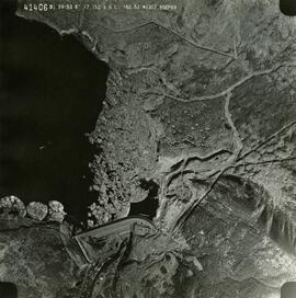
Photo 41406 - W.A.C. Bennett Dam
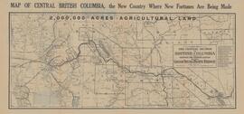
Map of the Central Section of British Columbia shewing the country served by the Grand Trunk Pacific Railway
River crossing exercise, Prince George, B.C.
6410 Bench Plan for 1972
6440 Bench Plan for 1972
5810 Bench Plan for 1972
6320 Bench Plan for October 1972
Aleza Lake Experiment Forest with Working Circle Annotations
Aleza Lake Research Forest annotated to show natural forest and old-growth emphasis areas
Exhibit A Sheet '1' Amendment to Special Use Permit #19070 Bowron Floodplain Addition Aleza Lake Research Forest
Exhibit A Sheet '2' Amendment to Special Use Permit #19070 Bowron Floodplain Addition Aleza Lake Research Forest
Exhibit A Sheet '4' Amendment to Special Use Permit #19070 Bowron Floodplain Addition Aleza Lake Research Forest
Aleza Lake Research Forest - Growth & Yield 59-71-R 99 - Experimental Plot 103 Map
Aleza Lake Research Forest - Growth & Yield 59-71-R 114 - Experimental Plot 116 Map
Aleza Lake Research Forest - Growth & Yield 59-71-R 106 - Experimental Plot 118 Map
Aleza Lake Research Forest - Growth & Yield 59-71-R 107 - Experimental Plot 119 Map
TSX9696, Plot 160 - Sketches Showing Location of Plots, Roads, and Traverse Posts
Timber Sale X9696 Osoyoos District
Timber Sale X9696 Osoyoos District annotated
Aleza Lake Forest
Aleza Lake Forest
Aleza Lake Research Forest S.U.P. 19070 (annotated to show reclamation research areas)
Aleza Lake Experiment Station, Purden P.W.C., and Longworth S.Y.U. annotated
Aleza Lake Research Forest on map 93-I-4-d & J-1-a,b annotated
C.P. 825, 826, 410, 420 - F.L. A18165 - Aleza Lake Forest - P.G.T.S.A.
Aleza Lake Research Forest annotated to show graded roads and parking lots
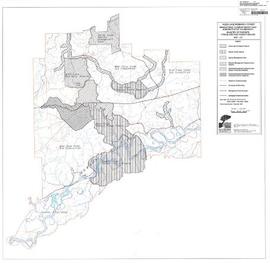
Aleza Lake Research Forest - Management Compartments and Administrative Boundaries
Aleza Lake Research Forest - Research Trials and Permanent Plots
Aleza Lake Research Forest - Terrain Theme Map
Aleza Lake Experiment Forest - Map No. 2
Aleza Lake Experiment Forest - Map No. 3
Aleza Lake Research Forest
Pre-emptor's map of Fort George
British Columbia Mountains
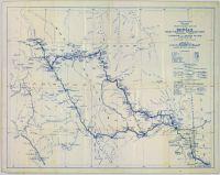
Stuart Lake, Fort St. James, and Fraser Lake area map
Mineral Deposit-Land Use Map
Distribution of Solid Mineral and Petroleum Resources in British Columbia
Trans-Canadian Alaska Railway Proposed Route
Proposed Location of the Northwood Pulp Ltd. Beaver Bridge
Preliminary Plan Showing Travelled Route of the Bedaux Sub-arctic Exploration
Canadian Pulp and Paper Industry 1975 Mill Location Map
The Kohklux map
The Kohklux map
Sketches of Harbours, Queen Charlotte Islands, 1878
Fantail Lake, Cassiar District, British Columbia
Major Oil and Gas Fields and Pipelines in Canada
Beaufort Sea Typical Seismic Section Across Dome Acreage
Location Map of Mining Properties in British Columbia and the Yukon Territory (including part of the Northwest Territories)
Canada: Indian Treaties
British Columbia Freight Routes
Regina, Saskatchewan Complimentary City Guide and Map
XI Commonwealth Games: Edmonton 1978