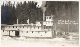
Postcard image of RMSS "BC Express" in Grand Canyon, Fort George
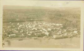
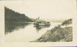
Lofty view of South Fort George, river and treed hills in the background. Printed annotation on verso reads: “South Fort George - 1913.” Handwritten message on recto is addressed to “Ethel M. Heurris Norton Maps Bristol County" reads: "11-1-13 an excellent view of south Fort George taken recently. Power Station at cross near water. This does not give all the south residence view. Population approx 1500”.
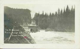
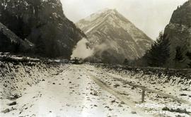
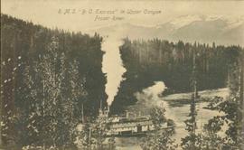
Stern wheeler passing through rapids. Printed annotation on recto reads: “The B.C. Express passing through the Grand Canyon B.C.” Handwritten annotation in red ink on recto adds: “1913”
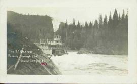
Photograph depicts sternwheeler passing through rapids of the Fraser River, B.C. Printed annotation on recto reads: “The B.C. Express Passing through the Grand Canyon B.C.”, handwritten in red ink: “1913”.
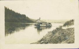
Handwritten annotation in pencil on verso reads: “Prince George to Tete Jaune” Hand written message in ink on verso is addressed to “Mademoiselle Elisabeth Joliet, Terrguy – Les Dijore Cote a Or France”.
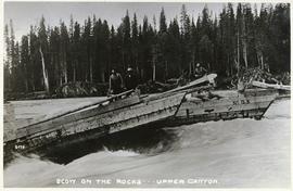
Postcard image of a scow on the rocks in the Upper Canyon, Fort George
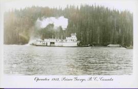
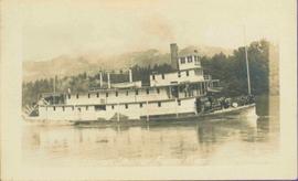
Postcard photograph depicts sternwheeler in river, trees on opposite shore in background.
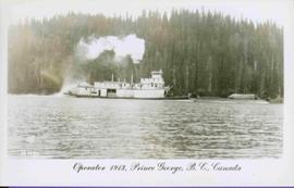
Printed annotation on recto reads: “Operator 1913, Prince George, B.C. Canada”, handwritten in pencil on verso: “Operator 1913”.
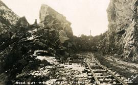
Photograph depicts the making of a rock cut on the Pacific Great Eastern Railway line at the Lillooet end of Seton Lake during railway construction.
Collection consists of photographs and plans relating to the construction of bridges, trestles, and stations of the Canadian Northern Pacific Railway, ca. 1913, collected or created by George W.H. Jackson, a surveyor who worked for the CNPR. The railway, incorporated in 1910, existed in name only as a subsidiary of the Canadian Northern Railway, and began construction around 1913. The materials include:
- 148 photographs showing surveying, worksites, and views along the route. Many of the images are captioned and/or dated, presumably by Jackson.
- 94 blueprint plans detailing work on bridges, trestles, station hours, etc. with elevations, details of construction, and materials; one larger blueprint shows the rail route over Kicking Horse Pass.
Postcard depicts Mt. Stephen and a Hotel at Field, BCin the Canadian Rockies.
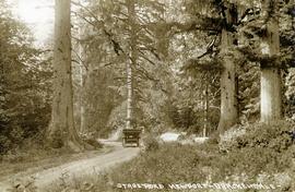
Photograph depicts the stagecoach road between Squamish (Newport) and Brackendale.
This commemorative souvenir was produced by the Prince Rupert Pioneers’ Association in 1914. Its content provides a textual overview of the individual persons who pioneered the establishment of Prince Rupert, as well as, their associated portrait photographs. This publication also provides a brief introduction to the history of Prince Rupert and includes some related historical photographs.
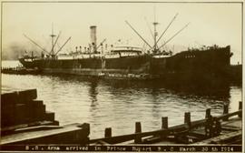
Photograph of ocean liner SS Arna docked in a harbour. Foreground shows two individuals on a dock in the lower right corner and a large pile of lumber in the lower left corner. Annotation on recto reads: "S.S. Arna arrived in Prince Rupert B.C March 30th 1914"
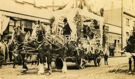
Photograph depicts a team of Clydesdale horses pulling a decorated wagon. Printed annotation on recto reads: “Dominion Day Prince Rupert BC 1914” Handwritten annotation in pencil on verso reads: “1914 Dominion Day Prince Rupert.” Handwritten annotation in ink on verso is addressed to “Mrs. Herbert Hampton New Harvey House Niagara Falls New York” Cancelation mark on Canadian 1 cent stamp is dated: July 22, 14
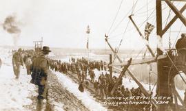
The last spike ceremony was held on April 7, 1914 one mile east of Fort Fraser, BC.
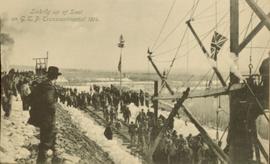
Photograph taken from a small hill looking down on a crowd of men gathered around the Grand Trunk Pacific railway tracks in the winter. Printed annotation on recto reads: "Linking up of Steel on G.T.P. Transcontinental 1914."
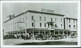
Photograph depicts hotel on corner of street, crowd and cars in foreground.
Handwritten annotation on verso “Albert Johnson’s 'Northern Hotel' South Fort George 1914".
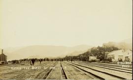
Wide angle photograph of a crowd milling around railroad tracks. A large pile of rubble and various buildings are visible on the right side. Annotation on recto reads: "After the Blast 21 Jan 1914 McRae Bros Photo."
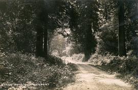
Photograph depicts a stagecoach road near Newport (Squamish).
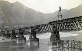
Photograph depicts the Pacific Great Eastern Railway bridge under construction on the original route at Lillooet, which was active 1915 to 1931. Including its approach spans, the bridge was 2,630 ft. long, almost exactly half a mile. The mileage on the PGE's original mileage system was 120.6.
Photograph depicts the Pacific Great Eastern Railway bridge under construction on the original route at Lillooet, which was active 1915 to 1931. Including its approach spans, the bridge was 2,630 ft. long, almost exactly half a mile. The mileage on the PGE's original mileage system was 120.6.
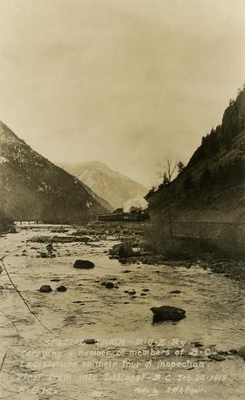
Photograph depicts a Pacific Great Eastern Railway "Special Train" that is "carrying a number of members of B.C. Legislature on their tour of inspection. First train into Lillooet, B.C. Feb. 20, 1915, 5 p.m." The train is depicted on the grade along the Seton River as it leaves Seton Lake.
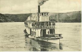
Stern wheeler in river. Printed annotation on recto reads: “S.S. “Charlotte,” Quesnel. B.C.” Handwritten message on verso is addressed to “Mr. O. Winter 1016 V Park St. Victoria B.C.” The dates on the canceled 1 cent Canadian stamp on verso are not readable.
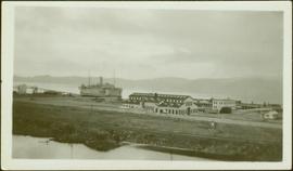
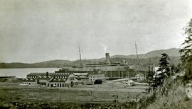
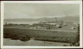
Photograph depicts a large ship behind dock buildings. Railroad crosses foreground, hills visible on shore in background.
Handwritten annotation on verso reads: "Drydock Prince Rupert".
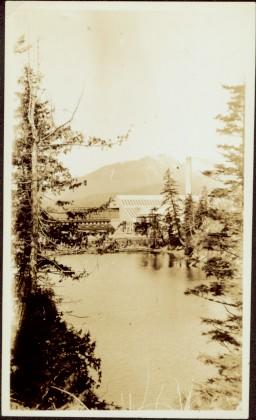
Photograph depicts buildings visible through clearing in trees. Water crosses foreground, hills visible in background.
Handwritten annotation on verso reads: "Dry dock / Prince Rupert B.C."
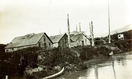
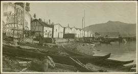
Photograph depicts totem poles (crest poles?) in front of lodge buildings on river shore. Canoes can be seen floating in foreground, hills in background.
Handwritten annotation on verso reads: "Chapter XII. Number 1. Section of Indian Village on Nass River showing lodges and totems".
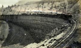
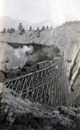
Photograph depicts a Pacific Great Eastern Railway work train on a trestle located near Sallus Creek in the area around Lillooet, Fountain, and Pavilion. The work train appears to be carrying railway ties. Railway workers work on the track behind the train with piles of unused rail ties nearby.
Photographs 2020.08.68, 2020.08.69, and 2020.08.70 are three views of track laying on the Sallus Creek trestle. These form a sequence: 2020.08.68, 2020.08.70, 2020.08.69 in order as track laying proceeds from the South end of the trestle toward the North end. The piece of equipment at the North end of the train in all three images is a track laying machine that lifted a piece of rail and delivered it to the workmen ahead of the machine. "Canadian Railway and Marine World" reported that track had been laid to 14 miles North of Lillooet by July 30, 1915 (CR&MW , Sept 1915, p341, c2). 14 miles North of Lillooet is approximately 20 rail lengths beyond the North end of this trestle, leading to a "best estimate" of late July 1915 as the date for this photograph.
The ca. 1921-1927 “PGE Bridge List” from the notebook of William H. Hewlett (1914-1968) references a Mile 13.7, 14 Mile Creek, frame trestle, 905 ft. long, 182 ft. high, 61 spans of 14.8 feet in the Lillooet Subdivision. A “PGE Track Profile” drawing shows this trestle was on a 1.55% grade and a 12 degree left hand curve. While the drawing had been revised at least twice (with an unknown date for the most recent revision), the pre-“Lillooet Diversion of 1931" mileage figures confirm that the 1915 “Mile 13.7" was in agreement with a more recent hand written note “Sallus Creek”. The trestle appears to have gone by the names "14 Mile" trestle, "13.7 Mile Trestle", and "Sallus Creek" trestle.
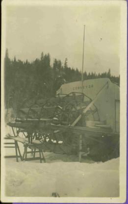
Stern wheeler “Conveyor” on land, snow on ground, treed hills in background. Handwritten annotation on verso in pencil reads: “Tete Jaune B.C.”
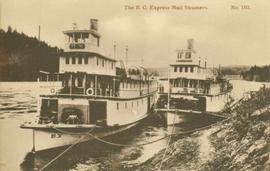
2 Stern wheelers tied to the river bank. Printed annotation on recto reads: “The B.C. Express mail Steamers No. 102.”
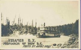
Stern wheeler in river. Printed annotation on recto reads: “Steamer B.X. Monarch of New B.C. Photo by James Heay”
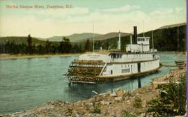
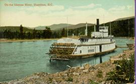
Stern wheeler “Port Simpson” tied to riverbank. Printed annotation on recto reads: “On the Skeena river, Hazelton, B.C.” Handwritten message on verso is addressed to “Mrs. Flossie Strong 6 Nah St. Watermill ME, U.S.A” 1 cent Canadian postage stamp has been canceled with a date of “Dec 24, 5:30 PM 1915 Buffalo N.Y.”
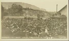
Slightly overhead shot of a large crowd gathered by general store and railroad. Annotation on recto reads: "Overseas contingent leaving Prince Rupert BC Feb 26th 1915. McRae Bros."
Postcard depicts a passenger train near Field, BC
Photograph depicts Pacific Great Eastern Railway track laying near Lillooet during railway construction. In the foreground, the railway grade along the south side of Cayoosh Creek about 1.5 miles before the junction with the Fraser River is depicted.
Photograph depicts a Pacific Great Eastern Railway work train on a trestle located near Sallus Creek in the area around Lillooet, Fountain, and Pavilion. The work train appears to be carrying railway workers and a load of rails.
Photographs 2020.08.68, 2020.08.69, and 2020.08.70 are three views of track laying on the Sallus Creek trestle. These form a sequence: 2020.08.68, 2020.08.70, 2020.08.69 in order as track laying proceeds from the South end of the trestle toward the North end. The piece of equipment at the North end of the train in all three images is a track laying machine that lifted a piece of rail and delivered it to the workmen ahead of the machine. "Canadian Railway and Marine World" reported that track had been laid to 14 miles North of Lillooet by July 30, 1915 (CR&MW , Sept 1915, p341, c2). 14 miles North of Lillooet is approximately 20 rail lengths beyond the North end of this trestle, leading to a "best estimate" of late July 1915 as the date for this photograph.
The ca. 1921-1927 “PGE Bridge List” from the notebook of William H. Hewlett (1914-1968) references a Mile 13.7, 14 Mile Creek, frame trestle, 905 ft. long, 182 ft. high, 61 spans of 14.8 feet in the Lillooet Subdivision. A “PGE Track Profile” drawing shows this trestle was on a 1.55% grade and a 12 degree left hand curve. While the drawing had been revised at least twice (with an unknown date for the most recent revision), the pre-“Lillooet Diversion of 1931" mileage figures confirm that the 1915 “Mile 13.7" was in agreement with a more recent hand written note “Sallus Creek”. The trestle appears to have gone by the names "14 Mile" trestle, "13.7 Mile Trestle", and "Sallus Creek" trestle.
Photographs within this file document stern wheelers operating in Northern BC from ca. 1901 - 1915.
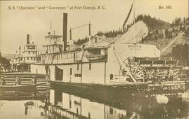
Stern wheelers “Operator” and “Conveyor” in dock. Printed annotation on recto reads: “S.S. “Operator” and “Conveyer” at Fort George, B.C. No. 107.”
B.C. Express Steamer, Fraser River. Trees and mountains in background. Printed annotation on recto reads: “B.C. Express Steamer, Fraser River.” Handwritten annotation in pencil on verso reads: “BC Express Fraser River BC”
Lofty view of stern wheeler in river, snow capped mountains in background. Printed annotation on recto reads: “R.M.S. B.C. Express in Upper Canyon Fraser River.”
Canoes sit on shore in foreground beside village buildings. A dock is visible above water in background.
Handwritten annotation on verso reads: "Alert Bay Indian Ranch No. 14 Alert Bay. To be shown on page 69 or 70, re Alert Bay Mission."
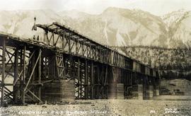
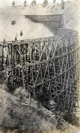
Photograph depicts a partially constructed Pacific Great Eastern Railway trestle located near Sallus Creek in the area around Lillooet, Fountain, and Pavilion. "Canadian Railway and Marine World" reported that track had been laid to 14 miles North of Lillooet by July 30, 1915 (CR&MW , Sept 1915, p341, c2). 14 miles North of Lillooet is approximately 20 rail lengths beyond the North end of this trestle, leading to a "best estimate" of early-mid July 1915 as the latest date for this photograph.
The ca. 1921-1927 “PGE Bridge List” from the notebook of William H. Hewlett (1914-1968) references a Mile 13.7, 14 Mile Creek, frame trestle, 905 ft. long, 182 ft. high, 61 spans of 14.8 feet in the Lillooet Subdivision. A “PGE Track Profile” drawing shows this trestle was on a 1.55% grade and a 12 degree left hand curve. While the drawing had been revised at least twice (with an unknown date for the most recent revision), the pre-“Lillooet Diversion of 1931" mileage figures confirm that the 1915 “Mile 13.7" was in agreement with a more recent hand written note “Sallus Creek”. The trestle appears to have gone by the names "14 Mile" trestle, "13.7 Mile Trestle", and "Sallus Creek" trestle.
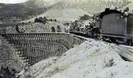
Photograph depicts a Pacific Great Eastern Railway work train on a trestle located near Sallus Creek in the area around Lillooet, Fountain, and Pavilion. The work train appears to be carrying railway ties.
Photographs 2020.08.68, 2020.08.69, and 2020.08.70 are three views of track laying on the Sallus Creek trestle. These form a sequence: 2020.08.68, 2020.08.70, 2020.08.69 in order as track laying proceeds from the South end of the trestle toward the North end. The piece of equipment at the North end of the train in all three images is a track laying machine that lifted a piece of rail and delivered it to the workmen ahead of the machine. In this photograph, the machine is at the current end of track and is ready to advance the next length of rail."Canadian Railway and Marine World" reported that track had been laid to 14 miles North of Lillooet by July 30, 1915 (CR&MW , Sept 1915, p341, c2). 14 miles North of Lillooet is approximately 20 rail lengths beyond the North end of this trestle, leading to a "best estimate" of late July 1915 as the date for this photograph.
The ca. 1921-1927 “PGE Bridge List” from the notebook of William H. Hewlett (1914-1968) references a Mile 13.7, 14 Mile Creek, frame trestle, 905 ft. long, 182 ft. high, 61 spans of 14.8 feet in the Lillooet Subdivision. A “PGE Track Profile” drawing shows this trestle was on a 1.55% grade and a 12 degree left hand curve. While the drawing had been revised at least twice (with an unknown date for the most recent revision), the pre-“Lillooet Diversion of 1931" mileage figures confirm that the 1915 “Mile 13.7" was in agreement with a more recent hand written note “Sallus Creek”. The trestle appears to have gone by the names "14 Mile" trestle, "13.7 Mile Trestle", and "Sallus Creek" trestle.
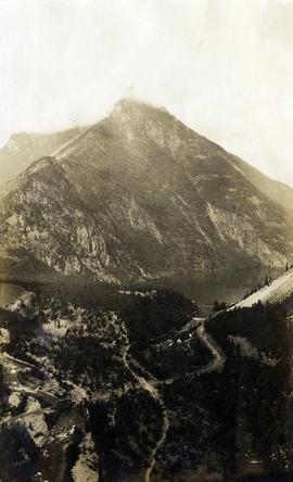
Photograph depicts a view of Seton Lake and the surrounding area, including the Pacific Great Eastern railway line. The railway grade is visible at left. Also visible is the Seton Lake fish hatchery at the east end of the lake and its employee boarding house, superintendent's cottage, and weir at the head of what was then referred to as "Lake Creek". The road seen in the centre foreground travelled from Lillooet to Seton Lake then to Golden Cache Mine.
Postcard photograph depicts sternwheeler tied to riverbank.
Printed annotation on recto reads: “On the Skeena river, Hazelton, B.C.” Handwritten message on verso is addressed to “Mrs. Flossie Strong 6 Nah St. Watermill ME, U.S.A” 1 cent Canadian postage stamp has been canceled with stamp reading “Dec 24, 5:30 PM 1915 Buffalo N.Y.”
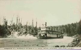
Stern wheeler in river. Printed annotation on recto reads: “Steamer B.X. Monarch of New B.C. Soda Creek, Quesnel and Fort George”
Stern wheeler in river. Printed annotation on recto reads: “Operator 1913, Prince George, B.C. Canada” Handwritten annotation in pencil on verso reads: “Operator 1913”
Stern wheeler in river. Handwritten annotation in pencil on verso reads: “Prince George to Tete Jaune” Hand written message in ink on verso is addressed to “Mademoiselle Elisabeth Joliet, Terrguy – Les Dijore Cote a Or France”
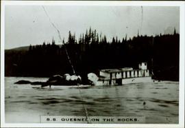
Photograph depicts what appears to be a sternwheeler in distress. Water in foreground, trees on opposite shore in background.
Handwritten annotation on verso: “S. S. Quesnel on rocks in Fort George Canyon. 1911 – 1915".
Photograph depicts a large ship behind dock buildings. Railroad crosses foreground, hills visible on shore in background.
Handwritten annotation on verso reads: "Ship in Pr. Rupert dry dock during Great War 1915?".
Photograph depicts a large ship behind dock buildings. Railroad crosses foreground, hills visible on shore in background.
Handwritten annotation on verso reads: "Pr. Rupert Drydock".
