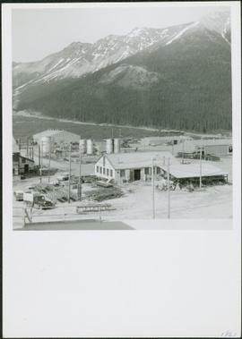
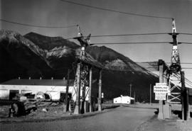
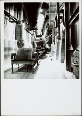
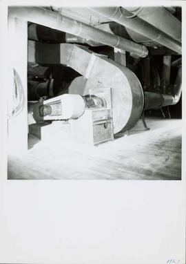
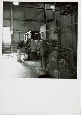
Photograph depicts four construction workers in front of tall wood structure extending to top level of construction area. Building material and supplies cover the ground: lumber, saw horses etc. Barricades against loose rock enclose area in midground (see item 2000.1.1.2.352). Plastic-covered pile sits at top level in background.
Photograph depicts different levels of crusher foundations built into mountainside. Dirt piles and unidentified machinery in foreground, power lines and mountain range in background.
Two men bent over ground (one with a shovel) inside semi-finished wood structure. Mountainside in background.
Handwritten caption beside this photo reads: "Lowering Crusher Base into place." Square crusher base in foreground is being lowered by a traveler crane on wheels. Two construction workers stand watching on left. Crane stands against mountainside in background.
Handwritten caption beside this photo reads: "Moving the sides of Bin into place. Weight nine tons". Two construction workers on right of a large steel bin side. Steel framework and sheeting in background.
Handwritten annotation on recto of photograph: "RETAINING RIBS JUNE 29/64". Photograph depicts construction workers on and near wooden framework structure extending from base of crusher building. Crane in background against mountainside. Miscellaneous construction equipment and materials throughout.
Photograph depicts large square model of the new mill building that was built at the Cassiar plant site in 1970. Model is displayed outdoors on a platform that stands on four saw horses. Machinery modeled inside the structure is colour-coded. Plant buildings and mountains in background.
Photograph depicts extreme close up of colour-coded machinery modeled inside large square model of the new mill building that was built at the Cassiar plant site in 1970.
Photograph depicts large square model of the new mill building that was built at the Cassiar plant site in 1970. Model is displayed on platform draped with green material. Machinery modeled inside the structure is colour-coded.
Photograph depicts the Cassiar townsite behind shadow in foreground. Plantsite can be seen including the mill, dry rock storage building, tailings pile, and many other buildings. Mountains in background. Handwritten annotation on recto: "<- 13 1/2" ->". (This photograph was made into a promotional poster.)
Photograph depicts the North peak of McDame mountain after extensive strip mining, South peak unmined in background. Old mine garage visible on right of West peak in foreground. Crusher plant partially visible on far right. Photograph believed to have been taken just prior to the development of the pit mine between the North and West peak.
Photograph depicts the Cassiar valley: town on left, plant on right, mine valley in background. Photograph was taken from above, facing north east.
Photograph depicts the Cassiar plantsite behind tailings pile in foreground. Mine road runs north though valley bellow mine, strip mining barely visible in background. Photograph was taken from above, facing north.
Photograph depicts the Cassiar valley: town in left foreground, plant and tailings pile in midground, mountains in background. Photograph was taken from the air, portion of plane visible in top left of image.
Photograph depicts the Cassiar valley: town on left, plant and tailings pile on right, mountains in background. Mine road can be seen from plant to mine valley in top left of image.
Photograph depicts the town of Cassiar, mountain base in background. Mine road visible in top right of image.
Photograph depicts the town of Cassiar, mountain base in background.
Photograph depicts the town of Cassiar in foreground, mountain base in background. Photograph was taken from the air, portion of plane visible in top left of image.
Photograph depicts view of pit mine, taken facing east. Town of Cassiar can be seen in distance at foot of south mountain range. Photograph was taken from the air, portion of plane visible in top left of image.
Photograph depicts the Cassiar valley: plant and tailings pile in left foreground, west end of town in right foreground. South mountain range stands in background.
Photograph depicts the Cassiar mine, crusher plant visible in centre foreground in front of West peak. North east mountain range in background.
Photograph depicts a portion of the pit in foreground at the Cassiar mine. Crushing plant visible in centre below base of West peak. Footwall road in midground, mine valley in background. Building near trucks at top of pit was called the "shifter shack," where crews were relieved or dropped off for work.
Photograph depicts a portion of the Cassiar pit in right foreground. Crushing plant visible to left of pit, West peak visible in right background. Mountain range can be seen in distance.
Photograph depicts towers and bucket in foreground, plantsite midground in valley, opposite mountains in background. Handwritten annotation on recto of photograph: "GENERAL VIEW VISIBLE TOWERS ARE IN #1 SECTION PLANT IN BACKGROUND". Photograph was glued to cardboard backing with the annotation: "1962".
Handwritten annotation on recto of photograph: "MINE DRY ON LEFT". Photograph was glued to cardboard backing with the annotation: "1962".
Gravel road in foreground, mountain in background. Sign over road reads: "CAUTION TRAMLINE CROSSING".
Photograph depicts towers and buckets in distance. Gravel road in foreground winding through hills of dirt. Handwritten annotation on recto of photograph: "#1 SECTION". Photograph was glued to cardboard backing with the annotation: "1962".
Photograph depicts large dry rock storage building on left, mill in background, dryer building on far right. Road and power poles cross foreground, mountains stand in background. Photo caption next to printed copy of image in 1953 Annual Report: "Completed dry rock storage and dryer buildings."
Photograph depicts mine area at Cassiar, crushing plant visible on left. Various mine buildings visible midground. Blasthole drills, shovels, dozers, and dump trucks can be seen on bench in foreground at 6430 elevation. Handwritten annotations on recto of photograph: "6"; "View looking NW from top of S. peak 6790 elev. on 6430 stripping bench on it and 6050 ore bench further down on left."; "July 1961".
Photograph depicts various buildings in plantsite, vehicles and electricity lines throughout. Equipment garage stands in left background behind tank farm, carpenter shop in right background, machine and electrical shop in building semi-visible on far right. Mine road can be seen at foot of mountain in background. Handwritten annotation on verso of photograph: "1961".
Photograph depicts a gravel road passing under crossing. Sign posted to pole reads "CAUTION TRAMLINE CROSSING CAUTION AVIOD PASSING UNDER MOVING BUCKETS". Garage stands in left midground, mountains in background. Handwritten annotation on verso of photograph: "1961".
Photograph depicts interior of mill. Handwritten annotation on verso of photograph: "1961".
Photograph depicts fan-driven air system used to transport fibre throughout the mill system. It is believed that this photograph was taken on the top floor of the mill. Handwritten annotation on verso of photograph: "1961".
Photograph depicts a man near the diesel-fired burners of the ore dryers. The large pipes and valves above were part of the fuel supply system fed by Cassiar's fuel tank farm which also supplied the power house generators. The dryer section of the mill received ore from the crushing plant by tramline and truck. These burners blasted the ore with hot air, and dried ore to desired moisture content before it was sent to the dry rock storage building and stored for mill use. Handwritten annotation on verso of photograph: "1961".
Photograph depicts long wood building speculated to be the Community Centre at Cassiar, B.C. Sports net stands in right foreground. Flag pole, barrel, and stand of trees can be seen in front of building. Mountains in background. Handwritten annotation on verso of photograph: "1961".
Photograph depicts four houses in line behind trees and steel drums. Road in foreground, mountains in background. Handwritten annotation on verso of photograph: "1961".
Photograph depicts priest wearing black cassock on front steps of Cassiar Catholic Church. Bell tower and trees in background. Handwritten annotation on recto of photograph: "FATHER POULET".
Photograph depicts man with badminton racket playing to right of net in gymnasium. Stage, doors, chairs, and basketball hoops visible in background. Door to right of stage led to squash court and upper balcony.
Photograph depicts woman with badminton racket playing to right of net in gymnasium. Stage, doors, chairs, and basketball hoops visible in background. Door to right of stage led to squash court and upper balcony.
Photograph depicts two men with badminton rackets in foreground of gymnasium, net visible on far right. Doors, tables, and chairs visible in background.
Photograph depicts group of twenty-four men standing on front steps of main office building. Handwritten annotations on recto of photograph: "OFFICE STEPS APPROX 1965 / TOP L-R / JULIEN ST. GEORGES / GEORGE TROWSDALE / HANS VELTMEYER / BOB LOVETT / KARL SHULTZ / LOTHAR TISCHLER / - "; "2ND / FRANK CLEMENTS [i.e Kliment?] / BILL PLUMB / HEWETT / - "; "3RD - / - / RENE PASIAUD / DICK [Stevens]"; "4TH / DOC NAVIN / VIC SARAKOSKI / - "; "5TH / CHARLIE GANDER / GORDON EDWARDS / AL FLANIGAN [i.e. Flanagan?] / ANDRE BEGUIN / CHARLIE BRONSON / JACK THORNICROFT". Information in above annotation supplemented with insight from individuals who contributed to Northern BC Archives Facebook Photo ID Project, contact archivist for more information in research file pertaining to item 2000.1.1.3.19.75.
Photograph depicts long bunkhouse buildings located between the Cassiar plant and townsite. They were originally used seasonally by university students, or by new employees on waiting lists for the more accommodating panabode "Winter Bunkhouses" (see item 2000.1.1.3.19.113). These buildings are speculated to be bunkhouses number 86, 87, and 88. Trees cross midground; new mill building, tailings pile, and mountains visible in background. Handwritten annotation on verso of photograph: "Cassiar June 15 71".
Photograph depicts woman seated at desk. Chair, bedside lamp and table, and bed also visible in room. Counter area in left foreground, curtains on window in background.
Photograph depicts trees and pickup trucks in front of long building speculated to be an apartment residence.
Photograph depicts unidentified men and women in front of yellow building with the signs "POST OFFCE / BUREAU DE POST / CASSIAR, B.C.", "NO PARKING". Three cars (one with siren on top) can be seen in foreground; forest in background.
Photograph depicts four unidentified individuals walking in front of Cassiar Private Hospital. Sign in foreground reads "VISITING HOURS EVERY DAY / 2 PM - 4 PM / 7 PM - 8 PM".
Photograph depicts group of children standing in front of diving board, watching a peer dive into water below. Group of swimmers visible in background below domed roof of pool.
Photograph depicts two unidentified men playing tennis in foreground. Buildings stand in midground, including what appears to be the All Saints Anglican Community Church. Forest and mountain in background.
Photograph depicts church believed to be the All Saints Anglican Community Church at Cassiar, B.C. Trees and fence in foreground, forest and mountain in background.
Photograph depicts two unidentified men wearing coveralls, hard hats, and headphones, while working at table in garage. Blasthole drill stands behind them in background.