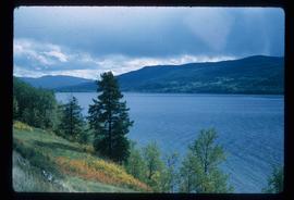
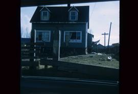
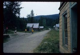
Image depicts the cableway in Willow River, B.C.
Image depicts a view of Francois Lake.
Image depicts the corner of a log house, the slide itself labels the picture as being from Barkerville, B.C. and also indicates the corner is an example of a "round log" dovetail joint.
Image depicts some fallen trees at Island Cache.
Image depicts two dogs and numerous chickens in a yard at Island Cache.
Image depicts the bank of the Nechako River at Island Cache.
Image depicts a few houses and a dog on a porch at Island Cache.
Image depicts a body of water in Island Cache. It is possibly a small section of the Nechako River.
Image depicts what appears to be an animal pen in Island Cache. There are two horses and a chicken in the enclosure, and a rundown building.
Image depicts a backyard filled with various items piled against a shed in Island Cache.
Image depicts a house in Island Cache.
Image depicts a house in disrepair, and possibly abandoned, in Island Cache.
Image depicts the interior of a house that appears to be abandoned and in disrepair in Island Cache.
Image depicts a street in Barkerville, near Wells, B.C.
Image depicts an old log building in Fort St. James; the sign on it reads "Clerk's Living Quarters, Later Used as Fort St. James First School."
Image depicts Stuart Lake in Fort St. James, B.C.
Image depicts an unrestored, collapsing log-house in Barkerville, B.C.
Image depicts several unknown individuals in the China Town of Barkerville, B.C.
Image depicts the Fraser River from Highway 97 near Quesnel, B.C.
Image depicts a couple of salmon in the Stellako River.
Image depicts a view of Francois Lake.
Image depicts a number of small houses at Island Cache.
Image depicts a stand of trees and a shed at Island Cache.
Image depicts what is likely an outhouse at Island Cache.
Image depicts a clearing at Island Cache.
Image depicts a grocery store at Island Cache.
Image depicts a house in Island Cache. There are several cars parked outside it.
Image depicts a boarded up building in Island Cache.
Image depicts two children standing near an old car in Island Cache.
Image depicts a number of sheds in Island Cache.
Image depicts an atmometer. According to the slide, it is being used for measuring the rate of water evaporation "from carborundum stone." The location is uncertain.
Image depicts a snow gauge at an uncertain location.
Image depicts what is possibly an intrusive volcanic landform somewhere near Miworth, B.C.
Image depicts Mt. Robson.
Image depicts an old beehive burner at an uncertain location.
Image depicts an old and abandoned cabin with ivy growing up the side. The location is uncertain.
Image depicts the CN Station in Penny B.C. A woman, possibly Sue Sedgwick, is sitting against the outside wall.
Image depicts the CN Station in Penny B.C.
Image depicts the slopes of Tabor Mountain in Prince George, B.C.
Image depicts the Fraser River in the Lillooet, B.C.
Image depicts the canoe group portaging to Indianpoint Lake.
Image depicts Indianpoint Lake.
Image depicts the foot of Indianpoint Lake.
Image depicts the sunset over Isaac Lake from the Betty Wendle campsite.
Image depicts a camp at the foot of Isaac Lake.
Image depicts the Cariboo Falls.
Image depicts the lower end of the river channel leading to the Spectacle Lakes.
Image depicts a few unknown individuals canoeing in a slough area while on approach to Bowron Lake.
Image depicts a slough area while on approach to Bowron Lake.