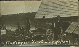
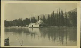
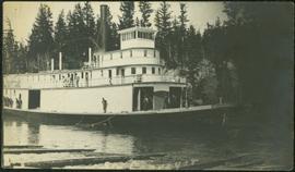
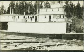
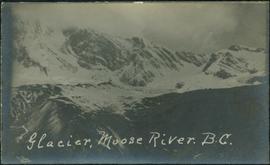
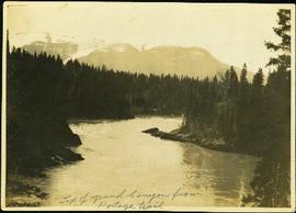
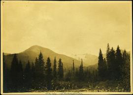
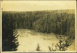
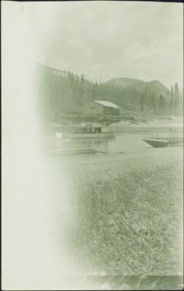
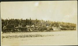
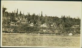
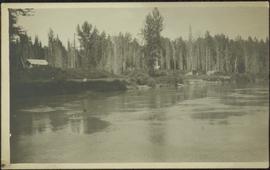
Photograph depicts a small building in low valley, tall hills in background, trees in foreground.
This photograph album consists of photographs of remote police barracks at Mile 47 and Mile 29; early settlements and/or mercantile stores at Tete Jaune Cache, McBride, Sand Creek, Fort George and South Fort George; Grand Trunk Pacific Railway forestry and railway camps; scows and paddlewheel conveyors on the Fraser River; automobiles; community leisure activities; as well as, images of the Bourchier family. The following South Fort George establishments are identifiable within these photographs: Empress Hotel, Ah Yee General Merchant, German Bakery, Northern Hotel, South Fort George Drug Store & Post Office, St. Michael’s Church, Prince George Hotel, Ford Monarch dealership, Astoria Hotel, and King George V Elementary School. Identified geographic locations featured in these photographs include: Tete Jaune, Upper Fraser, Mile 47, Mile 29, Fraser River, Mt. Robson, McBride, Sand Creek, Glacier Mountain, Moose River, Giscome Portage, Pott Falls, Red Deer River, Grand Canyon, Summit Lake, Canoe Pass, Connaught Hill, Nechako Bridge, and Island Cache.
Sem títuloPhotograph depicts mountains in background behind forest trees. River barely visible behind bushes at bottom of photo. Handwritten photo caption on verso and recto of this photograph reads: "On the Clearwater."
Photograph depicts a crew of 13 men on a scow believed to be maneuvering through the Upper Fraser River at Scow's Last Lap (Scow Rapids), downriver from the Grand Canyon of the Fraser. Trees on opposite shore in background, rocky shore in foreground. Handwritten annotation on recto of photograph reads: "the last lap".
Photograph depicts large bridge and dam over a wide river, industrial structures throughout. Hills on opposite shore in background. Handwritten annotation on recto of photograph: "Coulee Dam, This is were[sic] I went this fall. Wished you had of been with me."
Photograph depicts an unidentified person seated on rocks in foreground. River crosses midground, cliffs and trees on opposite shore in background. Unidentified structures believed to be buildings can be seen on opposite shore. Handwritten annotation on verso of photograph: "Grand Canyon. fraser R."
Handwritten annotation on verso of photograph: "Grand Canyon, Nechaco, B.C.", on recto: "Steamer Nechacco in the Grand Canyon 1909." River rapids in foreground, opposite shore in background.
River in foreground, trees and cliffs in background.
River in foreground, trees on shore in background. Handwritten annotation on verso of photograph: "Grand Canyon Fraser R."
River in foreground, trees and rocky shore in background.
Photograph depicts men on river scow, large rock island or peninsula protruding into river behind them. Trees on opposite shore in background, large rock in foreground. Handwritten annotation on verso of photograph: "Grand Canyon. Fraser River. Big Rock.", on recto of copy print: "1911."
Photograph depicts men on river scow in distance. Rocks in foreground, trees and cliffs on opposite shore in background. Handwritten annotation on verso of photograph: "Scow in Upper Grand Canon. Fraser River. B.C.."
Photograph depicts men on a scow near opposite shore of river. Treetops in foreground. Photograph taken from above. Handwritten photo caption on verso and recto of this photo reads: "in the lower Grand Canyon".
Photograph depicts horse and rope in Fraser River. Hill on opposite shore in background.
Photograph depicts two men believed to be North-West Mounted Police officers standing on either side of white packhorse. Forest and mountains in background. Photograph may have been taken in Vanderhoof, B.C.
Officers are mounted on three horses standing in water. Fifth horse stands on right, trees on shore in background. Handwritten annotation on recto of photograph: "Jas Tracey, Vanderhoof. Srg. Birch."
Photograph depicts men on a scow in distance at bend in river. Unidentified objects or structures on opposite shore in background, rocky shore in foreground. Handwritten photo caption on verso and recto of this photo reads: "Scow coming through upper Grand Canyon".
Photograph depicts men on a scow, maneuvering what is believed to be the Upper Fraser River. Opposite shore in background, close shore in foreground. Handwritten photo caption below this photo reads: "1. Turning above the whirlpool where the dog swam across."
Photograph depicts a line of men standing on rocky shore and holding a long rope between them, while men on scow float close to shore in distance. Trees on opposite shore in background. Handwritten photo caption on verso and recto of this photo reads: "in the Grand Canyon."
Photograph depicts the Giscome Rapids. Opposite shore in background, rocky beach in foreground. Handwritten photo caption on verso and recto of this photo reads: "Point where G.T.P. [Grand Trunk Pacific] canoe capsized at Giscome Rapids & where 3 men were drowned."
Photograph depicts people on river shore, and boat and buildings in midground. River bank in foreground, forest in background. Handwritten annotation on verso of photograph: "Giscombe Portage Fraser River", on recto: "Huble & Seaback on Fraser River."
Photograph depicts boats on river and shore. Riverbank in foreground, buildings and forest on opposite shore in background. Mountains can be seen in distance. Illegible handwritten annotation on verso of photograph. Poor image quality, left portion of image is not visible.
Photograph depicts three men guiding canoe through water. Bushes and forest slash in foreground, bushes on swampy shore in background. Handwritten annotation on recto of photograph: "Bill Barnett at stern of canoe."
Photograph depicts Bill and canoe on sandy shore, river and opposite shore in background. Handwritten annotation on recto of photograph: "Billy Barnett at Giscome Portage."
Photograph depicts many buildings among forest trees on hillside of opposite shore. River in foreground.
Photograph depicts men on river boat and small canoe floating just off shore. Men sit and stand on shore among square bales and large cut lumber. Forest in background. Handwritten annotations on recto of photograph: "Fort Fraser wooding up at Giscome Portage", "Chilco at Giscome Portage".
Photograph depicts six men by building on shore. One man sits in small boat that has been loaded onto a wagon. River and opposite shore in background. Handwritten annotation on verso of photograph: "Loading for the Peace River." Photograph believed to have been taken either at Giscome Portage, or the trading post at Summit Lake, BC.
Photograph depicts opposite shore in background behind river, bushes and trees in foreground. Handwritten photo caption on verso and recto of this photograph reads: "Fraser River at the mouth of the Clearwater".
Photograph depicts the early settlement of Fort George. The buildings to the left of the fence are believed to be owned by the Hudson's Bay Company. The land to the right of the fence belonged to the Fort George Reserve, the home of today's Lheidli T'enneh Band who relocated to a reserve at Shelley when this reserve was sold in 1912. Handwritten annotation on verso and recto of this photograph reads: "Fort George from opposite side of Fraser River".
Photograph depicts opposite shore in midground behind river, tree-covered hills in background. Handwritten photo caption on verso and recto of this photograph reads: "On the Clearwater".
Photograph depicts tree-covered cliffs on opposite shore, river in foreground.
Photograph depicts two men standing in front of a short tent. Cooking supplies are scattered throughout campsite. Trees cross midground, and snow-covered mountains stand in background. Handwritten annotation on recto of photograph: "POTT FALLS ON REDDEER RIVER. A Plate of Beans before Lunch. ON THE RIGHT Bob - Potts. Sampling his own Cooking."
Photograph depicts man smoking pipe in area believed to be a mining location, sandy cliffs in background.
Photograph depicts three men standing with oars in small boat, forest slash at their feet. More slash lies in foreground behind bushes and plants on swampy shore. Trees in background. These men are believed to be members of the Bourchier forestry crew.
Photograph depicts one man seated in rear of canoe on still water. Trees on opposite shore in background. This man is believed to be a member of the Bourchier forestry crew.
Photograph depicts opposite shore in background behind river, and close shore in foreground on right. Men can be seen standing and paddling on canoe in distance. Handwritten photo caption on verso and recto of this photograph reads: "On the Clearwater".
Photograph depicts an empty canoe floating directly in front of small white tents on opposite shore. Forest trees in background.
Photograph depicts the rooftops of four wood buildings behind bushes on opposite shore. Forest trees in background. These buildings are speculated to be a Bourchier forestry camp.
Photograph depicts group of men seated on scow carrying unidentified material. One man stands on rocky shore in left foreground, leaning on plank attached to scow. A second scow can be seen behind men. Tree-covered hills on opposite shore in background.
Photograph depicts one woman with her back turned, and four men standing on scow next to chairs and table adorned with food. Trees on shore in background. Handwritten annotation on recto of photograph reads: "Bourchier Scow".
Photograph depicts river between opposite shore and rock landings in foreground. Mountaintops visible in background. Handwritten photo caption on verso and recto of this photograph reads: "Opening of the River above the Grand Canyon".
Photograph depicts settlement across frozen lake. Trees cross midground, mountains stand in background. Handwritten annotation on verso of photograph reads: "Distant view of Tete Jaune B.C.", on recto of photograph: "I marked about where you loaded your boat the telephone pole is down the road toward 53. Tete Jaune Mile 52."
Photograph depicts four men and small cart standing in street, lines of log buildings on either side. Tents can be seen at end of left side of street. First building on left is larger, with the sign "STOPPING PLACE". Trees cross midground, mountains stand in background. Handwritten annotation on verso of photograph reads: "Tete Jaune Cache. B.C."
Photograph depicts men standing on upper deck of conveyor, close to opposite shore, where lumber and buildings can be seen. Canoe in left foreground, trees and mountains in background.
Photograph depicts men standing on different deck levels of conveyor in river. Wood planks built into shore in foreground, trees on opposite shore in background. It is speculated that this photo may have been taken near Tete Jaune Cache shortly after the conveyor was rebuilt. Handwritten annotation on verso of photograph reads: "Str. Conveyor".
Photograph depicts men standing on different deck levels of conveyor on the Fraser River. Wood planks built into shore in foreground, trees on opposite shore in background. Handwritten annotation on verso of photograph reads: "Launching Conveyor", on recto: "Launching the rebuilt steamer Conveyor at Tete Jaune 1912".
Photograph depicts street in McBride, wood buildings and tent buildings on either side. Small businesses and restaurants line the left side of the street. Forest slash stands in newly cleared area in foreground. Railway tracks cross right foreground, hills visible in background. Annotation on verso of photograph reads: "MC.Bride, B.C.", handwritten on recto: "1914 [Bourchier?]"
Photograph depicts glacier and snow in mountains. Handwritten annotation on verso of photograph reads: "Glacier, Moose River. B.C."
Photograph depicts winding river from above, tall trees on either side and mountains in background. Handwritten photo caption on verso and recto of this photograph reads: "Top of Grand Canyon from Portage trail".