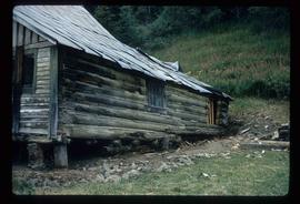
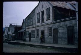
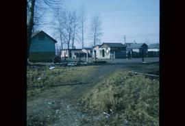
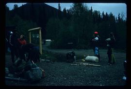
Image depicts a backyard filled with various items piled against a shed in Island Cache.
Image depicts a house in Island Cache.
Image depicts a house in disrepair, and possibly abandoned, in Island Cache.
Image depicts the interior of a house that appears to be abandoned and in disrepair in Island Cache.
Image depicts a street in Barkerville, near Wells, B.C.
Image depicts an old log building in Fort St. James; the sign on it reads "Clerk's Living Quarters, Later Used as Fort St. James First School."
Image depicts Stuart Lake in Fort St. James, B.C.
Image depicts an unrestored, collapsing log-house in Barkerville, B.C.
Image depicts several unknown individuals in the China Town of Barkerville, B.C.
Image depicts the Fraser River from Highway 97 near Quesnel, B.C.
Image depicts a couple of salmon in the Stellako River.
Image depicts a view of Francois Lake.
Image depicts a number of small houses at Island Cache.
Image depicts a stand of trees and a shed at Island Cache.
Image depicts what is likely an outhouse at Island Cache.
Image depicts a clearing at Island Cache.
Image depicts a grocery store at Island Cache.
Image depicts a house in Island Cache. There are several cars parked outside it.
Image depicts a boarded up building in Island Cache.
Image depicts two children standing near an old car in Island Cache.
Image depicts a number of sheds in Island Cache.
Image depicts an atmometer. According to the slide, it is being used for measuring the rate of water evaporation "from carborundum stone." The location is uncertain.
Image depicts a snow gauge at an uncertain location.
Image depicts what is possibly an intrusive volcanic landform somewhere near Miworth, B.C.
Image depicts Mt. Robson.
Image depicts the slopes of Tabor Mountain in Prince George, B.C.
Image depicts the Fraser River in the Lillooet, B.C.
Image depicts the canoe group portaging to Indianpoint Lake.
Image depicts Indianpoint Lake.
Image depicts the foot of Indianpoint Lake.
Image depicts the sunset over Isaac Lake from the Betty Wendle campsite.
Image depicts a camp at the foot of Isaac Lake.
Image depicts the Cariboo Falls.
Image depicts the lower end of the river channel leading to the Spectacle Lakes.
Image depicts a few unknown individuals canoeing in a slough area while on approach to Bowron Lake.
Image depicts a slough area while on approach to Bowron Lake.
Image depicts the river channel leading to the Spectacle Lakes.
Image depicts Spectacle Lake.
Image depicts two unknown individuals canoeing on the lower part of Spectacle Lake.
Image depicts the Bulkley River near Moricetown, B.C.
Image depicts a mountain range located somewhere along the Skeena River.
Image depicts a road leading to Prince Rupert, B.C.
Image depicts the Skeena River.
Image depicts the Fraser River somewhere in the Lillooet area.
Image depicts a group of people preparing to portage their canoe equipment in Bowron Lake Provincial Park.
Image depicts the canoe group around a campfire at the head of Indianpoint Lake.
Image depicts a pair of Rainbow trout from Indianpoint Lake.
Image depicts an unknown individual in a canoe on Indianpoint Lake.
Image depicts Indianpoint Lake.