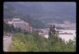
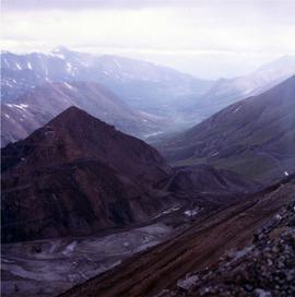
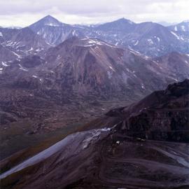
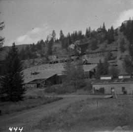
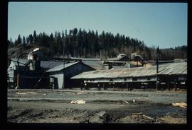
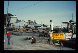
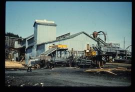
File contains slides depicting Premier Mine in Hyder, Alaska.
Image depicts the Britannia Mine, which closed in 1974 and is now a museum. "Anaconda" was the last operating owner.
File contains images depicting room by room view of a house in Cassiar identified as house 288. Handwritten annotation on verso of photographs: "288 June-9-1992". Photographs originally found in file labeled "TOWN ADMINISTRATION Small Business 1981"; it is likely that these images form part of the process documentation for a small business license.
File contains photographs of a report completed in 1980 depicting the ambulance garage, as well as the interior and exterior of the hospital building in Cassiar, B.C. Each room is captured, as well as medical equipment such as the X-ray, audiometer, lung function apparatus, and autoclave. A doctor, two nurses, and several patients are shown. Accompanying report contains a description of the medical facilities in Cassiar including a detailed budget, description of staffing and utility requirements, and a floor plan of the facilities.
In addition there are two albums of Cassiar Hospital and Pharmacy Staff engaging in social functions. These photographs appear to be informal and depict staff parties, people at work and some of the patients, including their thank you notes to the Cassiar Hospital staff.
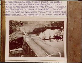
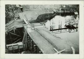
Photograph depicts a dam and spillway obstructing a creek. Photo is adhered to paper backing, upon which handwritten annotation on recto reads: “This is the dam and spillway about nine miles up Hixon Creek belonging to the Hixon Creek Cariboo Gold Co., whose main camp on Hixon Creek was at the falls. A fellow Sterling or Bill Tordiffe & I took a contract to cut the logs for this dam in January 1934. The first few winters Quart [sic] Quesnel Quartz had to shut down for snow”
Photograph depicts a dam and wooden spillway along a creek. Annotation on verso reads: "This is the dam and spillway about 9 miles up Hixon Creek belonging to the Hixon Creek Cariboo Gold Co. Original handwritten annotations on verso of photograph are signed by Tom Marsh and covered by mounting the photo on paper. Photograph is taped to paper. Typed annotation on recto of paper reads: “This is the dam and spillway about nine miles up Hixon Creek belonging to the Hixon Creek Cariboo Gold Co., whose main camp on Hixon Creek was at the falls. A fellow Sterling or (Bill) Tordiffe & I took a contract to cut the logs for this dam in January 1934. The first few winters Quesnel Quartz had to shut down for snow."
Contains photographs generally depicting landscapes, water scenes, and views of towns on British Columbia's north coast. Includes images featuring sternwheelers and other boats, canneries, fisheries, and individuals. Locations depicted include Port Essington and Port Simpson (Lax Kw’alaams) in BC, Fort Wrangell in Alaska, and other unknown towns. Includes one photograph of a man named Max Lohbrunner, and many other images depicting unidentified individuals.
Map depicts historical rail lines in the BC lower mainland, including trackage for the BC Electric Railway, the Canadian Northern Pacific Railway, the Canadian Pacific Railway, the Great Northern Railway, and the Pacific Great Eastern Railway, among others.
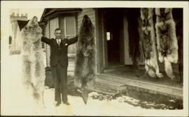
Photograph depicts H.F. Glassey wearing a suit and tie, holding up a wolf pelt in both hands. House stands behind Glassey, pelts hanging from eaves in front of porch. These pelts came from the Teslin Lake area (this region spans Northern British Columbia and the Yukon Territory). Anglican Church partially visible in left background. Typed annotation on recto of photograph: "Come up and do some hunting." Typed caption below this photograph: "Atlin." See also items 2009.5.2.68 & 2009.5.2.69.
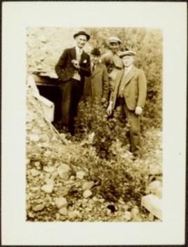
Glassey stands with three men in mine adit, rocky hillside and vegetation in background.
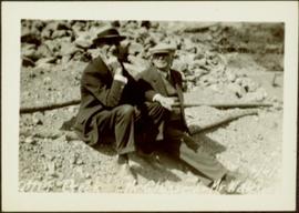
Glassey sits on ground with unknown man in area believed to be a mining location, rocks and logs in background.
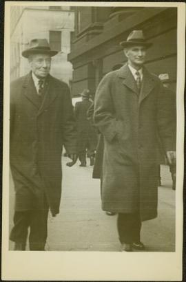
The pair walks on sidewalk, wearing hats and long coats, Glassey on right. Crowd of walking people and tall buildings in background. Photograph taken by street photographer. Stamped annotation on recto of photograph: "SOUVENIR SNAPS 401 W. HASTINGS ST. VANCOUVER, B.C. EXTRA COPIES BY NUMBER."
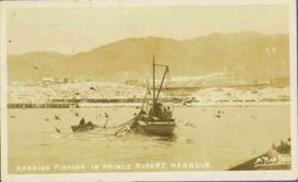
View of fish boat in water, with net spread and smaller boat on opposing side of net. Several gulls can be seen flying in the air. Rail cars town and treed hills in background. Printed annotation on recto reads: “Herring Fishing In Prince Rupert Harbour McRae Bros.” Handwritten message in ink on verso is addressed to “Mr. H. Smart 2550 Blackwood St. Victoria B.C.”
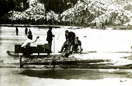
Photographs depict groups of men gathered on ice. Herbert leans over behind two friends seated on ice sled (son of Marion and Archdeacon W.H. Collison). Pile of caught fish can be seen in foreground behind large whole in ice.
Handwritten annotations on verso read: "Oolichan Fishing Fishing Bay Nass River"; "Uncle Herbert with Indian friends fishing for oolichan through the ice."
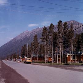
Photograph depicts row of houses behind trees. Power line, road, and vehicles in foreground; mountain in background.
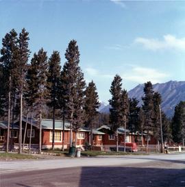
Photograph depicts row of houses behind trees. Road, front yards, and vehicle in foreground, mountains in background.
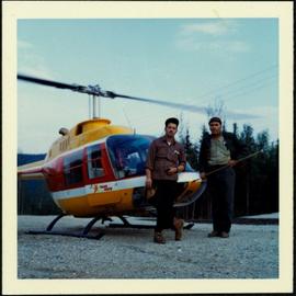
Photograph depicts two unidentified men in front of yellow and red helicopter at unknown location. Power lines and trees in background. It is possible that this photo may have been taken at Clinton Creek, Y.T. rather than Cassiar, B.C.
Photograph depicts tail rotor of helicopter in left foreground, as helicopter ascends or descends. It is possible that this photo may have been taken at Clinton Creek, Y.T. rather than Cassiar, B.C.
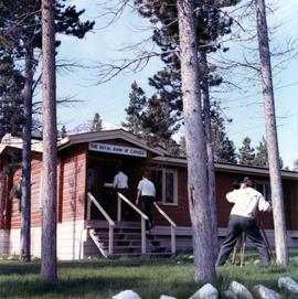
Photograph depicts two unidentified men entering building with the sign "THE ROYAL BANK OF CANADA" above main entrance. Photographer with tripod in foreground.
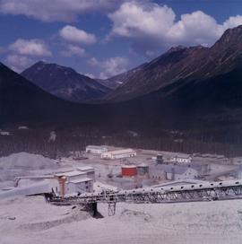
Photograph depicts plant buildings below, tailings pile in foreground. Valley and mountains in background. Handwritten annotation on recto of photograph: "CASSIAR".
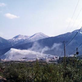
Photograph depicts plant buildings in front of tailings pile in midground. Forest, power line, and tramline in foreground; south mountains in background.
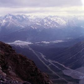
Photograph depicts mine valley and road in foreground. Cassiar plant and tailings pile visible in left midground, townsite in right midground. Mountainside of McDame Mountain in foreground, southern mountain range in background.
Photograph depicts the West Peak of the Cassiar mine on McDame Mountain. Pit area visible between West Peak and road in foreground. Mine valley and north mountain range in background. Photo speculated to have been taken from a point on or near the South or North Peak.
Photograph depicts crusher plant in centre foreground. Shifter shack and vehicles can be seen in front of pit area. West Peak semi-visible in right midground. Mine valley an northwestern mountain range in background.
Photograph depicts the Hedley Gold Mine, 26 miles east of Princeton. Crusher workings.
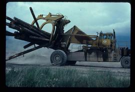
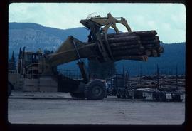
Image depicts a piece of heavy machinery lifting numerous logs. It is likely located in Prince George, B.C.
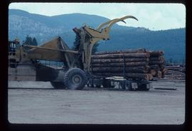
Image depicts a piece of heavy machinery lifting numerous logs off the back of a logging truck. It is likely located in Prince George, B.C.
Image depicts a piece of heavy machinery lifting numerous logs off the back of a logging truck. It is likely located in Prince George, B.C.
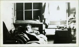
Handwritten annotation on recto of photo reads: "Harry Monson Edmonton Prince George." Harry reclines on bed under window, surrounded by personal effects. Photograph was taken after nightfall. Handwritten caption beside this photo reads: "Harry talked my dad into selling him my boat".
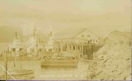
Boats, docks, ships and a large building in waterscape. Printed annotation on recto reads: “Prince Rupert B.C.” Handwritten annotation in pencil on verso reads: “McRae Bros”.
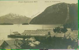
View of building, dock, harbour and small islands with snow peaked mountains in background. Printed caption on verso reads: “Port Essington B.C. Photo by P. E. Fisher”. Handwritten annotation in ink on verso reads: “up the Skeena”, in pencil on verso: “Port Essington, North Coast Commercial Coy”.
File consists of material relating to Guy Lawrence who wrote the autobiographical "Forty Years on the Yukon Telegraph", which details his arrival in Canada in 1898 from England to prospect in the Klondike Gold Fields. While en route, a gold strike was made at Atlin, B.C. that was closer and changed his plans. Spending two years working in various mining camps in Atlin, Lawrence joined the Yukon Telegraph Line, which was just being completed. This line ran 1900 miles from Vancouver, B.C. through Ashcroft to Hazleton, Whitehorse and Dawson City. Up to World War I, Lawrence worked from isolated wilderness cabins, relaying messages and repairing lines. After serving overseas in the war, he ran the telegraph office in Stewart, which ran a branch line along the Portland Canal to the company town of Anyox. He remained in Stewart for 26 years, retiring in 1946. By this time, due to the wireless, most of the line had been abandoned. Materials include reproductions of articles, and a transcribed oral history from Guy Lawrence, copied from the BC Provincial Archives.
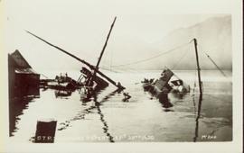
Photograph of a partially sunken sailboat near a harbour. Individuals on debris and in a rowboat are surveying the damage. Annotation on recto reads: "GTP. SS Prince Rupert Sept 28th 1920 McRae." Handwritten annotation on verso reads "CTP "Prince Rupert" Sunk at Prince Rupert BC 1920."
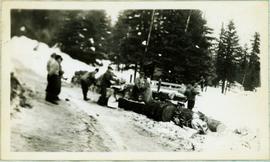
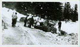
Photograph depicts a group of men working with tools around thick logs, piles of firewood behind them. They are in a snowy area with trees in background.
Handwritten caption above this photo reads: "Making Fire Wood." Photograph depicts a group of men working with tools around thick logs, piles of firewood behind them. They are in a snowy area with trees in background.
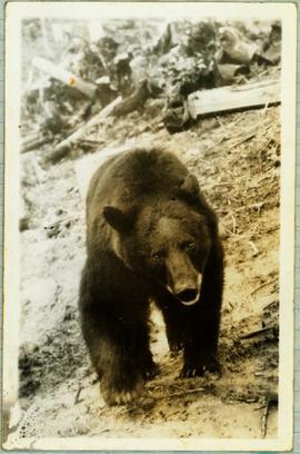
Handwritten caption below this photo reads: "Bought in Picture Prince George". Photograph depicts a grizzly bear walking on all fours in forest area, slash debris in background.
Al Elsey compiled this commercial video using footage he filmed in 1964 and 1965 in the Bella Coola area. The video provides a compilation of film footage shot by Elsey and is narrated by him describing the activities related to the Grease Trail. Description verso of VHS commercial box reads:
"Al Elsey's friendship with Margaret Siwallace with other people of the Nuxalk Nation dates back over fifty years. This, his premier documentary, produced from vintage 16 mm movie film taken in the Bella Coola Valley in 1963, invites us to witness their tradition of making Ooligan Grease. The process, followed for centuries by the Nuxalk and other coastal First Nations people, was of such importance that their trading routes from the Coast to the Interior of British Columbia were called Grease Trails. The Ooligan were netted by the ton each year, returning from the ocean to spawn in early spring. The destruction of the Ooligan runs in the Bella Coola and other coast rivers of Southern B.C. probably resulted from over-fishing by shrimp trawl draggers during the late 1990s. GREASE shows catching the Ooligan with conical nets and dugout canoes, rotting them in "stink boxes," then rendering and purifying the Grease. Elsey's captivating narrative and brilliant footage transport us back to another time on the shores of the Bella Coola River."
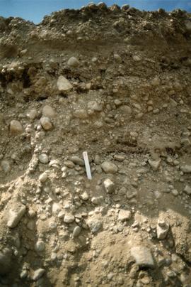
Photograph depicts close up view of gravel pit, ruler displayed for scale. Photograph speculated to have been taken at the plant or near the Cassiar airstrip. Stamped annotation on recto of photograph: "JUN. 1987".
Plan depicts Granville Island industrial sites in False Creek, Vancouver. Shows revised trackage from 1955 annotated in colour by Davies.
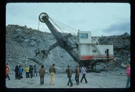
Image depicts a large, electric shovel at a mine site somewhere in Granisle, B.C.
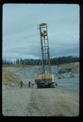
Image depicts a drill for blasting holes at a mine site somewhere in Granisle, B.C.
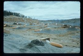
Image depicts numerous bags of blasting powder at a mine site somewhere in Granisle, B.C.
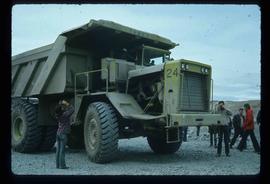
Image depicts an 80 tonne truck at a mine site somewhere in Granisle, B.C.
File consists of collected research materials regarding the Grand Truck Pacific Railway. Materials include brochures, newspaper clippings, a CN supplement, a bibliography, pamphlets, correspondence, photographs, and reproductions of articles. Highlights include:
- Fraser Fort George Museum, "Grand Truck Pacific: The Transcontinental Line", 1983 (exhibit brochure)
- CN Mountain Region Supplement 1 employee time table for June 21, 1978
- CN Headquarters Library, "A Selected Bibliography on Canadian Railways", Special Series No. 25 6th edition, 1968
- Greater Victoria Public Library, "Railroads & Railroading in Canada: A selected booklist", 1988 (pamphlet)
- Stephen Ruttan, "Transportation in British Columbia", 1985 (pamphlet)
- Fort George Regional Museum, "Fort George Railway, Prince George B.C.", [198-?] (pamphlet)
- Bulkley Valley Historical and Museum Society, "Smithers Grand Trunk Pacific Freight and Passenger Division Headquarters", 1978 (booklet)
- Prince George Railway Museum, "On Track" newsletter, Vol. 9 No. 6-7 July, 1991 (newsletter)
- Central British Columbia Railroad Preservation and Museum Society, "On Track" newsletter, Vol.3 No.5 1985 (newsletter)
- BC Provincial Archives of British Columbia Aural History Programme, "The Grand Trunk Pacific", Interviewed by Imbert Orchard, People in Landscape Educational Series, 1969 (booklet)
- Reproduction of BC Archives photograph depicting the Grand Trunk Pacific Railway entitled "Camp near Burns Lake", Aug 1912
- Reproduction of BC Archives photograph depicting the Grand Trunk Pacific Railway entitled "G.T.P. Steel bridge across the Shuswap River, Mile 79, 12 miles east of McBride", [191-?]
- Reproduction of BC Archives photograph depicting the Grand Trunk Pacific Railway entitled "Prairie Creek Bridge nearly completed, 5 miles west of Hilton", [191-?]
- Reproduction of BC Archives photograph depicting the "McKenzie & Blais store", [191-?]
- Reproduction of BC Archives photograph depicting the Grand Trunk Pacific Railway entitled "Linking up of Steel on G.T.P. Transcontinental, Fort Fraser", 1914
This photograph collection consists of 53 photographs featuring primarily Giscome with a few of Prince George. Subjects include the Eagle Lake Sawmill, Eagle Lake, Giscome townsite (including specific buildings and general road perspectives), Giscome School, Division II class photos (1950-51), and the Giscome School teacherage.
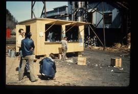
Image depicts a food stand at the mill site at Giscome, B.C. Map coordinates 54°04'19.7"N 122°22'04.7"W
Image depicts the mill site at Giscome, B.C. Map coordinates 54°04'19.7"N 122°22'04.7"W
Image depicts the mill site at Giscome, B.C. A sign in the foreground reads "Maynard's Industrial Auctioneers." Map coordinates 54°04'19.7"N 122°22'04.7"W
Image depicts the mill site at Giscome, B.C. Map coordinates 54°04'19.7"N 122°22'04.7"W
