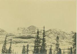
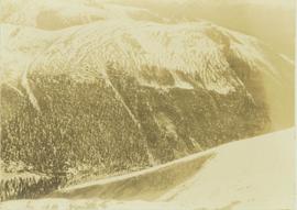
Image depicts an aerial view of Diamond Island, near Quesnel, B.C.
Image depicts a dilapidated house in Sinclair Mills, B.C.
Image depicts two dilapidated houses in Sinclair Mills, B.C.
Image depicts an old house for sale surrounded by overgrown bushes in Upper Fraser, B.C. Map coordinates 54°07'15.0"N 121°57'02.0"W
Image depicts a dirt road leading through numerous trees toward a mountain. The location is uncertain, likely on the way to Longworth, B.C.
Image depicts a dirt road and a possibly abandoned building at an uncertain location.
Image depicts a dirt road leading through a forest.
Image depicts a dirt road leading through a forest with what appears to be an area for turning around at the end.
File contains slides depicting areas around the Discovery Passage.
Photograph features Terrace Gardens.
Photograph depicts a distance view of tree covered mountain slopes in winter.
Photograph depicts a distant mountain range visible over a forested slope. The location of photo is between Wapiti Lake and Red Deer Valley.
Photograph depicts a tree-covered valley with a snow-covered mountain range in the background. The location of photo is between Wapiti Lake and Red Deer Valley.
Photograph depicts a distant river running through a forested mountainous landscape.
Photograph depicts a snowy plateau with a distant snow-covered mountain range in the background and coniferous trees in the foreground.
Photograph depicts a distant snow-covered mountain range with evergreen trees in the foreground.
Photograph depicts settlement across frozen lake. Trees cross midground, mountains stand in background. Handwritten annotation on verso of photograph reads: "Distant view of Tete Jaune B.C.", on recto of photograph: "I marked about where you loaded your boat the telephone pole is down the road toward 53. Tete Jaune Mile 52."
File consists of a photocopy of a draft of a Canadian Manuscript Report of Fisheries and Aquatic Sciences by Brown and Levings entitled "Distribution and Stomach Contents of Potential Fish Predators of Juvenile Chinook Salmon (Oncorhynchus tshawytscha) in the Nechako and Stuart Rivers, B.C.".
Image depicts a section of disturbed ground at an unknown location.
Image depicts an area of disturbed ground, most likely due to a landslide, at an unknown location.
Image depicts a large section of disturbed ground at an unknown location.
Image depicts an area of disturbed ground, most likely due to a landslide, at an unknown location.
Image depicts a ditch of water at an uncertain location.
File consists of a report entitled "Diver Observations of Juvenile Chinook Salmon Overwintering in the Nicola River, British Columbia" prepared for DFO by B. Emmett and H.I. McElderry of Archipelago Marine Research.
Image depicts Divide Lake.
File contains slides depicting images of and around Divide Lake.
Image depicts the "Divides Lake Waterfall."
Image depicts the "Divides Lake Waterfall" as well as a man in front of a helicopter in the foreground.
Image depicts an unidentified individual diving into a pool of water at an uncertain location.
Image depicts a dock on a lake in Carp Lake Provincial Park, possibly War Lake.
Image depicts a dock in Prince Rupert, B.C.
Photograph of a large dock littered evidence of lumber transportation. Small buildings and stumps are on the shoreline. Annotation on recto reads: "Prince Rupert BC, '07."
Image depicts an individual sitting on a dock on a lake somewhere on Haida Gwaii.
Image depicts numerous docked boats in Prince Rupert, B.C.
Image depicts numerous docked boats somewhere in Prince Rupert, B.C.
Image depicts a ferry docked at Haida Gwaii, B.C.
File consists of a draft copy of an Aluminum Company of Canada Kemano Completion Hydroelectric Development Technical Memorandum by Envirocon entitled "Documentation of the Habitat Modelling Process".
File consists of photocopied documents from various sources sent to Shirvell from John Hummel, a researcher for the Cheslatta Band. Includes correspondence from Hummel; internal DFO memoranda copied by Alderdice; a 1981 paper by W.G. Hazelwood entitled "Alcan Environmental Baseline Studies: A Critique"; anti-Kemano material written by Dana Wagg and John Hummel, Cheslatta Band researchers; and the "Story of the Surrender of the Cheslatta Reserves on April 21, 1952" by Mike Robertson".
File consists of a letter from Dilip Mathur with attachments of photocopies of records from the case of the Philadelphia Electric Power Company and the Susquehanna Power Company before the U.S. Federal Energy Regulatory Commission.
Photograph depicts a dog sitting in shoveled walkway in steep snow, snowshoes inserted in the snow banks over dog's head. Unidentified building in background.
Photograph depicts dog seated on grass in foreground. Unidentified individuals visible below with fishing nets in waterfall area at Moricetown Canyon.
Image depicts a dog in a forest, possibly somewhere near Woodpecker, B.C.
Image depicts a dog standing on a path through the woods somewhere in Carp Lake Provincial Park.
Image depicts an unknown individual and a dog on a bridge over what is possibly the Robson River.
A woman stands in distance on a road with high snowbanks and trees on either side. A dog can be seen in foreground, facing woman. A fence and other structures stand in midground. Tree-covered slope in background.
Image depicts two dogs and numerous chickens in a yard at Island Cache.
Image depicts a pair of dogs in a forest, possibly somewhere near Woodpecker, B.C.