2009.7.1.061
·
Item
·
[ca. 1873 - ca. 1920]
Part of Archdeacon W. H. Collison fonds
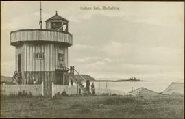
Photograph depicts a man and woman standing on steps to a round tower in fenced area. Roofs of other buildings can be seen below on right; water and shore visible in background.
Printed on image: "Indian Jail, Metlatkla".