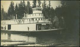
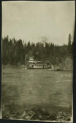
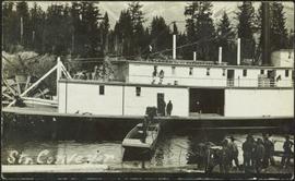
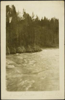
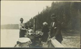
Photograph depicts one woman with her back turned, and four men standing on scow next to chairs and table adorned with food. Trees on shore in background. Handwritten annotation on recto of photograph reads: "Bourchier Scow".
Photograph depicts settlement across frozen lake. Trees cross midground, mountains stand in background. Handwritten annotation on verso of photograph reads: "Distant view of Tete Jaune B.C.", on recto of photograph: "I marked about where you loaded your boat the telephone pole is down the road toward 53. Tete Jaune Mile 52."
Photograph depicts four men and small cart standing in street, lines of log buildings on either side. Tents can be seen at end of left side of street. First building on left is larger, with the sign "STOPPING PLACE". Trees cross midground, mountains stand in background. Handwritten annotation on verso of photograph reads: "Tete Jaune Cache. B.C."
Tree branches in right foreground, and forest above banks on opposite shore in background.
Photograph depicts men standing on different deck levels of conveyor on the Fraser River. Wood planks built into shore in foreground, trees on opposite shore in background. Handwritten annotation on verso of photograph reads: "Launching Conveyor", on recto: "Launching the rebuilt steamer Conveyor at Tete Jaune 1912".
Photograph depicts men standing on different deck levels of conveyor in river. Wood planks built into shore in foreground, trees on opposite shore in background. It is speculated that this photo may have been taken near Tete Jaune Cache shortly after the conveyor was rebuilt. Handwritten annotation on verso of photograph reads: "Str. Conveyor".
Photograph depicts men standing on upper deck of conveyor, close to opposite shore, where lumber and buildings can be seen. Canoe in left foreground, trees and mountains in background.
Photograph depicts glacier and snow in mountains. Handwritten annotation on verso of photograph reads: "Glacier, Moose River. B.C."
Riverboat floats in midground, canoes float by shore. Trees and hillside on opposite shore in background. Poor image quality.
Photograph depicts street in McBride, wood buildings and tent buildings on either side. Small businesses and restaurants line the left side of the street. Forest slash stands in newly cleared area in foreground. Railway tracks cross right foreground, hills visible in background. Annotation on verso of photograph reads: "MC.Bride, B.C.", handwritten on recto: "1914 [Bourchier?]"
Photograph depicts a paddle wheel conveyor believed to be in distress in the Fort George Canyon on the Fraser River. Rocky bank in foreground, trees on opposite shore in background.
Photograph depicts a paddle wheel conveyor believed to be in distress in the Fort George Canyon on the Fraser River. Trees on opposite shore in background.
Photograph depicts log buildings and tents on left shore. Fraser river in foreground, forest and hillside in background.
Photograph depicts a paddle wheel conveyor believed to be in the Fort George Canyon on the Fraser River. Rocky shore in foreground, trees on opposite shore in background.
Photograph depicts small log buildings and loaded wagons in cleared dirt area. Building on far left has the sign "POOL HALL" posted on front . Treetops, lumber piles, and hills in background. Mountains can be seen in distance. Handwritten annotation on verso of photograph reads: "Sand Creek. B.C."
Photograph depicts four men on conveyor, and clear view of paddle wheel. A small boat is docked to the conveyor with men and equipment. Crowd of men on shore in foreground on right, trees on opposite shore in background. Mountains visible in distance. Handwritten annotation on verso of photograph reads: "Str. Conveyor".
Photograph depicts crowd of people in foreground near log fence. More crowds can be seen in distance at base of ski jump on either sides of the run. Jump visible at top of tree-covered hill in background. It is believed that this photograph was taken near the current location of City Hall.
Photograph depicts large bridge and dam over a wide river, industrial structures throughout. Hills on opposite shore in background. Handwritten annotation on recto of photograph: "Coulee Dam, This is were[sic] I went this fall. Wished you had of been with me."
Photograph depicts an unidentified person seated on rocks in foreground. River crosses midground, cliffs and trees on opposite shore in background. Unidentified structures believed to be buildings can be seen on opposite shore. Handwritten annotation on verso of photograph: "Grand Canyon. fraser R."
Handwritten annotation on verso of photograph: "Grand Canyon, Nechaco, B.C.", on recto: "Steamer Nechacco in the Grand Canyon 1909." River rapids in foreground, opposite shore in background.
River in foreground, trees and cliffs in background.
River in foreground, trees on shore in background. Handwritten annotation on verso of photograph: "Grand Canyon Fraser R."
River in foreground, trees and rocky shore in background.
Photograph depicts men on river scow, large rock island or peninsula protruding into river behind them. Trees on opposite shore in background, large rock in foreground. Handwritten annotation on verso of photograph: "Grand Canyon. Fraser River. Big Rock.", on recto of copy print: "1911."
Photograph depicts men on river scow in distance. Rocks in foreground, trees and cliffs on opposite shore in background. Handwritten annotation on verso of photograph: "Scow in Upper Grand Canon. Fraser River. B.C.."
Photograph depicts horse and rope in Fraser River. Hill on opposite shore in background.
Photograph depicts two men believed to be North-West Mounted Police officers standing on either side of white packhorse. Forest and mountains in background. Photograph may have been taken in Vanderhoof, B.C.
Officers are mounted on three horses standing in water. Fifth horse stands on right, trees on shore in background. Handwritten annotation on recto of photograph: "Jas Tracey, Vanderhoof. Srg. Birch."
Photograph depicts creek barely visible at bottom of steep valley in cliffs. Trees and underbrush in foreground. It is believed that this photograph may have been taken near Mt. Robson. Handwritten annotation on recto of photograph reads: "Sand Creek."
Photograph depicts people on river shore, and boat and buildings in midground. River bank in foreground, forest in background. Handwritten annotation on verso of photograph: "Giscombe Portage Fraser River", on recto: "Huble & Seaback on Fraser River."
Photograph depicts boats on river and shore. Riverbank in foreground, buildings and forest on opposite shore in background. Mountains can be seen in distance. Illegible handwritten annotation on verso of photograph. Poor image quality, left portion of image is not visible.
Photograph depicts three men standing with oars in small boat, forest slash at their feet. More slash lies in foreground behind bushes and plants on swampy shore. Trees in background. These men are believed to be members of the Bourchier forestry crew.
Photograph depicts Bill and canoe on sandy shore, river and opposite shore in background. Handwritten annotation on recto of photograph: "Billy Barnett at Giscome Portage."
Photograph depicts six men by building on shore. One man sits in small boat that has been loaded onto a wagon. River and opposite shore in background. Handwritten annotation on verso of photograph: "Loading for the Peace River." Photograph believed to have been taken either at Giscome Portage, or the trading post at Summit Lake, BC.
Photograph depicts three men guiding canoe through water. Bushes and forest slash in foreground, bushes on swampy shore in background. Handwritten annotation on recto of photograph: "Bill Barnett at stern of canoe."
This photograph album consists of photographs of remote police barracks at Mile 47 and Mile 29; early settlements and/or mercantile stores at Tete Jaune Cache, McBride, Sand Creek, Fort George and South Fort George; Grand Trunk Pacific Railway forestry and railway camps; scows and paddlewheel conveyors on the Fraser River; automobiles; community leisure activities; as well as, images of the Bourchier family. The following South Fort George establishments are identifiable within these photographs: Empress Hotel, Ah Yee General Merchant, German Bakery, Northern Hotel, South Fort George Drug Store & Post Office, St. Michael’s Church, Prince George Hotel, Ford Monarch dealership, Astoria Hotel, and King George V Elementary School. Identified geographic locations featured in these photographs include: Tete Jaune, Upper Fraser, Mile 47, Mile 29, Fraser River, Mt. Robson, McBride, Sand Creek, Glacier Mountain, Moose River, Giscome Portage, Pott Falls, Red Deer River, Grand Canyon, Summit Lake, Canoe Pass, Connaught Hill, Nechako Bridge, and Island Cache.
Sin títuloHandwritten annotation on verso of photograph: "Early Days on the Cariboo Road. No. 8." Photograph depicts man driving two covered wagons pulled by team of six horses on gravel road. Valley crosses midground, hills in background. Handwritten annotation on recto of photograph: "H. F. Glassey Esq. P.O Box 950 Prince Rupert B.C. Dear Bert: We have been kept very busy have been on committee work all through the convention but it was wonderful will write you a long letter from Vancouver. Mrs Earley wants me to stay until Monday morning train. Met Mr. [Colley?] everything going fine here. I am sure you are busy [...?] Love from Sadie. Mr & Mrs. [Graif?] are living here."
Photograph depicts farmstead in cleared area of forest. Plowed and fenced area on left, buildings and firewood on right.
Grass area in foreground, forest and hills in background.
Photograph depicts a man cooking over campfire, log building and forest in background.
Man standing on far left believed to be H.F. Glassey. One mam stands in military uniform. Hauling truck parked close behind plane, hill in left background.
Photograph depicts man smoking pipe in area believed to be a mining location, sandy cliffs in background.
Photograph depicts three men wearing suits and ties, posed in front of car in gravel area believed to be at a mining location. Hauling truck crosses road in midground, cliffs and hills in background.
Photograph depicts four men wearing suits and ties, standing in front of mine adit in rocky area, bushes in background. Handwritten annotation on recto of photograph: "1939 H.F. (Bert) Glassey with black hit in middle" (information regarding Glassey believed to be incorrect).
Photograph depicts a miner spraying enclosed area of river bed with water at high velocity. Cliffs in background.
Photograph depicts water being sprayed from a pipe at high velocity over edge in mining area. Man's leg in foreground, cliffs in background.
Photograph depicts water being sprayed from pipes at high velocity in mining area. Unidentified man in midground, cliffs in background.
Photograph depicts a large structure in center of mining area in riverbed, equipment and supplies scattered throughout. Buildings and forest in background. Handwritten annotation on verso of photograph: "Spruce Creek, Lower Shovel Workings 6/25/39.", on recto: "Atlin".
Photograph depicts two unidentified men standing on wood walkway extended high above water. Cliffs in background. Photograph speculated to have been taken at Sayer Creek, B.C.
Photograph depicts two miners standing on either side of wooden sluicing trough in rocky area. Man on left pans for gold. Hills in background. Handwritten annotations on verso of photograph: "PLACER MINERS AT WORK INGINECA RIVER BC", "PHOTO WWW".