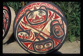
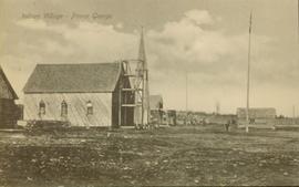
Image depicts a woman, wearing clothes reminiscent of traditional First Nations, who appears to be dancing in the street outside of a Native Friendship Centre in Prince George, B.C. A large crowd is looking on.
Image depicts what appears to be a teepee at an uncertain location.
Image depicts a totem pole at an uncertain location, possibly in Gitwinksihlkw, B.C.
Image depicts an intricately painted drum. The location is uncertain.
Image depicts several unidentified individuals standing outside a building and holding intricately painted drums; Kent Sedgwick is standing the middle of the group with Sue Sedgwick beside him. The location is uncertain.
Image depicts several unidentified individuals standing outside a building, and holding intricately painted drums. The location is uncertain.
Image depicts several unidentified individuals standing outside a building, and holding intricately painted drums; the woman on the right is Sue Sedgwick. The location is uncertain.
Image depicts several unidentified individuals inside a building, one of which is carving a totem pole. The location is uncertain.
Image depicts a house with some Firts Nations' art painted on the front, somewhere on Haida Gwaii, B.C.
Image depicts Metlakatla, located near Prince Rupert, B.C.
Image depicts a faded First Nations' rock painting.
Image depicts an unknown woman pointing towards some faded First Nations' rock paintings.
Image depicts an old Hudson Bay Company house, with a totem pole in the foreground, in Kitwanga, B.C.
Image depicts a totem pole in Kitwancool, B.C.
Image depicts several old totem poles on their sides in Kitwancool, B.c.
Image depicts a row of totem poles in Kitwancool, B.C.
Image depicts numerous houses in Kitwancool, B.C.
Image depicts a totem pole in Kitwanga, B.C.
Image depicts a row of totem poles in Kitwanga, B.C.
Image depicts the old Kamloops Residential School which operated until either 1977 or 1978 before becoming part of the Secwepemc Musem in 1982.
Image depicts a building painted with First Nations art in New Aiyansh.
Image depicts the First Nations village of Pavilion, B.C.
Image depicts the Battle Hill National Historic Site in Kitwanga, B.C.. The sign located there says: "The small knoll in the valley was a native fortress. Legends maintain that it was man-made: built to repel marauding coastal tribes. The hill was the scene of local tribal battles, and at one time was crowned with the defenders' buildings. Known as Dhawdezp, the unique mound is a prominent feature in the legends and history of the Indian people."
Image depicts the historical village of 'Ksan in Hazelton, B.C.
Image depicts the entrance to the historical village of 'Ksan in Hazelton, B.C.
Image depicts a totem pole beside the grave marker of the Chief Lu-dal-da-zuatz, in Kispiox, B.C.
Image depicts numerous totem poles in Kispiox, B.C.
Image depicts the 'Ksan historical village in Hazelton, B.C.
Image depicts an old, partially burnt totem pole in Kispiox, B.C.
Image depicts a large gathering of people in the interior of a First Nations' longhouse located in the historical village of 'Ksan in Hazelton, B.C.
Image depicts numerous totem poles in Kispiox, B.C.
Image depicts two totem poles in Skeena Crossing, B.C.
Image depicts a group of people in the historical village of 'Ksan near Hazelton, B.C.
Image depicts a totem pole in the historical village of 'Ksan near Hazelton, B.C.
Image depicts the historical village of 'Ksan near Hazelton, B.C.
File contains slides that reproduce historical photographs of Indigenous peoples of Central Interior, as well as maps.
Crews of sure-footed boom men in the Nass area, largely composed of Indigenous locals, work throughout the year on logging operations of Twinriver Timber Limited. Their homes are located near Nass River in the towns of Aiyansh, New Aiyansh, Greenville, and Canyon City.
Item consists of the panel on "Applying Traditional Knowledge to Future Initiatives: First Nations Historical and Future Relationships with the Forests" at the the "Exploring Our Roots: Forest History in Our Communities Annual Conference of the Forest History Association of BC" at UNBC in Prince George, September 19, 2009.
Collection consists of eight interviews with experts reviewing A Guidebook for Improving Aboriginal Participation in Forest Management Decision-Making, later published with the title The Aboriginal Forest Planning Process: A Guidebook for Identifying Community-Level Criteria and Indicators by Melanie Karjala, Erin Sherry, and Stephen Dewhurst in 2003. The reviewers were chosen based on their expertise and interest in Aboriginal participation in forest management decision-making. They were asked to provide their opinions on issues related to Aboriginal participation in decision-making processes in BC, as well as feedback on the Aboriginal Forest Planning Process (AFPP) Guidebook. Reviewers had the option to make their review confidential resulting in the return or destruction of the interview. Eight of the original twenty-nine interviews are archived in this collection; the remainder are no longer extant.
The Aboriginal Forest Planning Process: A Guidebook for Identifying Community-Level Criteria and Indicators can be found:
- Online at www.for.gov.bc.ca/hfd/library/documents/bib95274.pdf
- UNBC Library, call number: SD146.B8 K37 2003.
Side view of a wooden church, possibly under construction, and other buildings. Printed annotation on recto reads: "Indian Village- Prince George."
Photograph of the dirt road leading to Hagwilget Village. Residential buildings and a church are visible in the background. Printed annotation on recto reads: "W.W.W. Hagwilget Village."