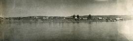
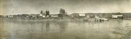
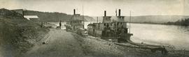
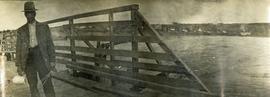
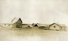
Mostrando 79 resultados

Archival description
62 resultados con objetos digitales Muestra los resultados con objetos digitales
Holts Ranch
2014.10.1.151 · Item · 1911
Parte de Arthur Holland Land Surveying Collection

Photograph depicts a cluster of log buildings with fences and corrals. A field in the foreground, trees and low hills in the distance. On the road from Quesnell to Fraser Lake 1911.

2007.17 · Colección · 1920-01-01 - 1982-12-31

Collection consists of 140 photographs pertaining to the life and pursuits of James Joseph Claxton over the course of sixty years. Subject areas identified within this collection include: quartz and placer mining in the Cariboo; Kingcome Village; the Royal Irish Contabulary; Roderick's Jewelers, New Westminster; the "M.S. Columbia III"; Kwakiutl petrographs in Fort Rupert; totem poles at Alert Bay; and the Salmon Arm Boy Scouts of Canada group.

Sin título
2008.3.1.19.3 · Item · March 1992
Parte de Bridget Moran fonds

Photograph depicts Bridget Moran standing behind Mary John in unknown room. Unidentified woman semi-visible on far right (see item 2008.3.1.19.2). Accompanying photo caption: "Caribou College, Quesnel, March /92".

2009.5 · Colección · 1899-1959

This Collection consists of photographs documenting early development of the Central Interior including such subjects as: homesteading, railway construction, packing & freighting, modes and routes of transportation, schools, mercantile development, leisurely activities, sports, natural resource development and exploitation, political movements, town-site development and policing. This collection also provides a look at history of the Taylor-Baxter Family - a long time pioneering family of this region, including: A.K. & Lillian Bourchier; Hugh & Hermina "Minnie" (nee Wessel) Taylor and family; Herbert & Sarah (nee Wessel) Glassey; and Bob & Violet (nee Taylor) Baxter and family.

Gordon Wyness Album
2020.05 · Colección · 1936

In 1936, Gordon Young Wyness was employed by Philip M. Monckton, a B.C. Land Surveyor. Between June 5 and October 8, Wyness joined Monckton and a group of others on a land survey expedition in northwestern BC. The survey crew travelled to various locations in the area including Telkwa, Hazelton, Burns Lake, Francoise Lake, Vanderhoof, Prince George, Quesnel, Lytton, and Hope. Wyness documented their journey in this photograph album. Based on the photographs, it appears that the crew led by Philip Monckton consisted of Jack Lee and Gordon Wyness; Mrs. Lavender Monckton (nee O'Hara) also accompanied the group.

In addition to the 50 photographs included in the album, this collection also includes five additional unique photographs that accompanied the album.

Sin título
2020.05.44 · Item · 1936
Parte de Gordon Wyness Album

Photograph depicts Gordon Wyness sitting on a historic boat, which he described as built ca. 1860 and could carry "7 Indians" and 5000 lbs of freight up the river. Located nearby is a telegraph cairn erected to commemorate the Collins Overland Telegraph lines that began in Quesnel in 1865. Until 1907, Quesnel was the terminus for the telegraph line. Behind Wyness is a replica of a Cornish water wheel that was originally located at Williams Creek in Barkerville. This location is now called Ceal Tingley Memorial Park-Heritage Corner and is located along Front Street in Quesnel, near the Fraser River Bridge. The cairn and water wheel still stand in this location, however the boat was removed around 1941.

According to additional information from Quesnel & District Museum & Archives, Wyness may have been provided with inaccurate information about the canoe depicted. The canoe believed to have been located at that spot was actually created in 1905 to pack out the Grand Trunk Preliminary Survey Team, which was led by J.M. Rolston.

Quesnel Quartz Mine Camp
2007.17.1.2 · Item · [ca. 1935]
Parte de James Joseph Claxton Photograph Collection

Annotated overview of the Quesnel Quartz Mine Camp, with buildings numbered and a corresponding legend provided. Annotation on recto of photograph states: "1. BRIDGE OVER CREEK 2. BLACKSMITH SHOP 3. POWEROUSE 4. HEADFRAME OVER 200' SHAFT 5. OFFICE 6. WATER TANKS FROM POWERHOUSE 7. BUNKHOUSE 8. TRUCK 9. COOKHOUSE BEHIND #6 CANNOT BE SEEN" Additional annotation associated with photograph states: "We were always able to find the cookhouse even though hidden in this picture. Taken about 1935 by Russell Ross Supt. Quesnel Quartz Mine"

2007.17.1.4 · Item · 1935
Parte de James Joseph Claxton Photograph Collection

Photograph depicts a snow-covered forest clearing with six structures and a truck. Buildings have been numbered 1-8 with pen. Original handwritten annotations on verso of photograph are signed by Tom Marsh. Photograph is taped to paper. Typed annotation on recto of paper reads: “1. Bridge over creek. 2. Blacksmith shop. 3. Powerhouse. 4. Headframe over 200’ shaft. 5. Office 6. Water tanks from powerhouse. 7. Bunkhouse. 8. Truck. 9. Cookhouse behind #6 cannot be seen. We were always able to find the cookhouse even though hidden in this picture. Taken about 1935 by Russell Ross, supt. Quesnel Quarts Mine. Tom Marsh, Box 156, Squamish B. C.”

Oral History: Bea Dezell
2014.6.1.14 · Dossiê · 2004
Parte de Rustad & Dezell Family fonds

File consists of an electronic oral history transcript documenting the life of Bea Dezell from approximately 189? to 2004. Interview conducted in May and June 2004 by Denise Torgerson and transcript prepared by Elaine Hauck, both of Prince George Oral History Group.

BC and Alberta Locations and Topics
2012.13.2.19 · Sub-séries · 1955-2011
Parte de J. Kent Sedgwick fonds

Subseries contains material collected and created by Kent Sedgwick for research on various areas in British Columbia and Alberta. Includes written notes by Kent Sedgwick, pamphlets, and newspaper clippings relating to towns and settlements. These areas include Quesnel, Likely, the Yukon Telegraph Trail, Barkerville, Wells, the Cariboo region, Fort Alexandria, Soda Creek, the Chilcotin region, Jasper, the Rocky Mountains, Mackenzie, Tumbler Ridge, the Peace River region, Fort St. James, the Omineca region, Kitimat, Lethbridge, the Bulkley Valley, and Fort Mcleod. These files cover a variety of topics including Chinese people in British Columbia, land settlement, tourism, and historic information on the regions.

2012.13.2.21.01 · Dossiê · 1983-1991
Parte de J. Kent Sedgwick fonds

File consists of records created or collected by Kent Sedgwick relating to various community projects associated with river parks. Example projects included in the file are a proposed Carrier village at Hudson Bay Slough, a Cottonwood Island park, proposed commercial boat tours on the Nechako and Fraser River, and the Quesnel Paddlewheel Park. Includes a project proposal document by the Fort George Band entitled "Establishing a Permanent Carrier Village in Prince George" (1990); a 1991 meeting package of the Nechako and Fraser River Valleys Committee (regarding the Cottonwood Island property and development of the Heritage River Trails System); a 1991 memorandum entitled "Prince George River Runners - Proposed commercial boat tours on the Nechako and Fraser River"; a 1983 "Submission to Rivers Committee Public Hearings by Heritage Advisory Committee, City of Prince George" describing the various river-adjacent heritage sites in Prince George; and documentation from the Quesnel Paddlewheel Association.