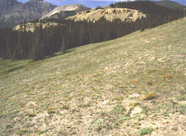
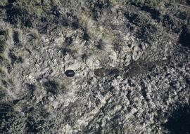
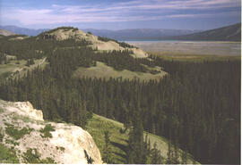
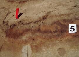
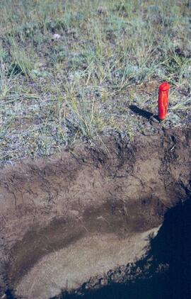
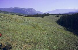
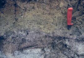
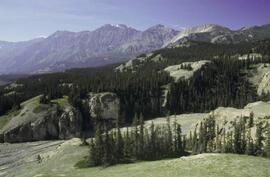
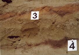
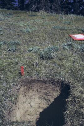
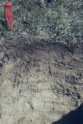
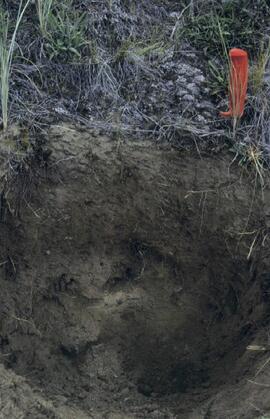
This map depicts the location of the Archie Creek site, annotated on a photocopied 93I.011 BC government map (undated).
File consists of reports and documents relating to resource inventory.
Includes the following items:
E.L.U.C. Secretariat. 1976. Terrain classification system (May 1976; 2nd printing). [Original version, as adapted from work by R. Fulton, Geological Survey of Canada. Version 2 was updated in 1988 & reprinted 1997]
Jones, C. (compiler). 1997. Predictive ecosystem mapping (PEM) workshop, Prince Rupert Forest Region, April 25, 1997, Minutes.
Jones, K. et al. 1999. Towards the establishment of predictive ecosystem mapping standards: a white paper. 1st approximation. March, 1999. Prepared for: Terrestrial Ecosystem Mapping Alternatives Task Force, Resources Inventory Committee.
Kistritz, R.U. and G.L. Porter. 1993. Proposed wetland classification system for British Columbia: a discussion paper. Prepared for: B.C. Ministry of Forests, Ministry of Environment, Lands and Parks, B.C. Conservation Data Centre.
Louie, R.H. 1992. Soil surveys in British Columbia, 1928-1992: a listing of soil survey reports and maps for the Province of British Columbia. Soil Conservation Service, Integrated Management Branch, Ministry of Environment, Lands and Parks, Victoria.
Maxwell, R. and T. Lea. 1993. Bioterrain mapping guidelines: a supplement to the ecological mapping methodology (September 1993) (Working Document; First Draft). Habitat Inventory Section, Wildlife Branch, Ministry of Environment, Victoria.
Maxwell, R. and T. Lea. 1993. Soils data collection for ecological mapping – the next twenty years. [Presented at: B.C. Soil Science Workshop 1993?]
Meidinger, D. 2000. Protocol for quality assurance and accuracy assessment of ecosystem maps. July, 2000. Prepared for: TEM Alternatives Task Force. Research Branch, Ministry of Forests, Victoria. [Draft version; later revision (2003) issued as Technical Report 011, Forest Science Program, Ministry of Forests. https://www.for.gov.bc.ca/hfd/pubs/docs/Tr/Tr011.pdf ]
Map depicts range reference area exclosure locations for livestock and wildlife in the Fort St. John Forest District.
While at the Ministry of Forests, Dr. Paul Sanborn carried out two retrospective studies which examined soil chemical properties at long-term silvicultural research sites where different vegetation types had been created, either as planned or unplanned experiments. These studies were Experimental Project (EP) 660 and a research project at the Archie Creek site.
The Archie Creek site is the informal name used for a research installation established in 1971 east of Prince George by the Canadian Forest Service, and subsequently abandoned by the end of that decade. Dr. Paul Sanborn revisited the site in 1995, and sampled forest floors and mineral soils across a range of conifer-broadleaf mixtures established by natural establishment of broadleaf trees among planted lodgepole pines.
Details of the site conditions, sampling methods, and results were published in:
Sanborn, P. 2001. Influence of broadleaf trees on soil chemical properties: A retrospective study in the Sub-Boreal Spruce Zone, British Columbia, Canada. Plant and Soil 236: 75–82. https://doi.org/10.1023/A:1011973402414
Research on the ecological functions of coarse woody debris (CWD) in forests, and techniques for inventorying CWD, were major topics for forest ecologists and soil scientists during Paul Sanborn's years with BC Forest Service research program (1991-2002).
File of documents consists mostly of unpublished internal and consultant reports, workshop summaries & handouts, and government publications (BC, Canada, USA). Methods-related documents may have been drafts which were superseded later by published manuals. In some cases, the document has a memo or email attached which provides some additional context.
Includes the following items:
BIOFOR Resource Consultants. (n.d.) Methodology for developing coarse woody debris photo guides. [consultant report to Ministry of Forests, Research Branch]
Brown, J.K., T.E. See. 1981. Downed dead woody fuel and biomass in the northern Rocky Mountains. General Technical Report INT-117. USDA Forest Service.
Clark, D.F., P.J. Burton, J.A. Antos. 1995. A comparative study employing different methods for inventory of coarse woody debris. Symbios Research and Restoration, Smithers, BC. September 30, 1995.
Ellis, R. 1996. Summary of the coarse woody debris workshop, Cowichan Lake Research Station, April 11-12, 1996. [Incl. handouts by A. Mackinnon, S.W. Taylor & J.V. Parminter]
Ember Research Services Ltd. 1997. CWD/Fuel calculator user’s guide. October 1997.
Hermanek, H. 2001. The distribution and description of CWD in the SBSmk1 and IDFdm2 zones of British Columbia. Work term report, Biology Co-op Program, University of Victoria.
Lajzerowicz, C. 2000. Coarse woody debris: what are we leaving in British Columbia. Examining TRENDS. ET2000-02. Northern Interior Vegetation Management Association.
Lajzerowicz, C. 2000. Coarse woody debris: what are the changes following harvesting in Alberta. Examining TRENDS. ET2000-03. Northern Interior Vegetation Management Association.
Lloyd, R. 2001. A comparison of coarse woody debris in harvested and unharvested sites in the SBSmc2: First-year report, March 2001. Prepared for: Houston Forest Products.
Mackinnon, A. 1996. What kind of CWD measurements are MOF research ecologists using? [handout at CWD Workshop, April 11-12, 1996]
Mackinnon, A., J. Parminter. 1996. Natural landscape patterns and processes. Notes from a meeting at Cowichan Lake Research Station, April 10, 1996.
Marshall, P.L. 1999. Using line intersect sampling to determine the volume of odd-shaped pieces of coarse woody debris: an explanation of the Vegetation Resources Inventory formula. Contract report to: Ministry of Forest, Vancouver Region. February 1999.
Marshall, P.L., G. Davis, V.M. LeMay. 2000. Using line intersect sampling for coarse woody debris. Forest Research Technical Report, TR-003. Vancouver Forest Region.
Ministry of Forests, Resources Inventory Branch 1999. Pilot study for dead tree information on growth and yield permanent sample plots.
Parminter, J. 1994. Correction factors and the measurement of coarse woody debris. Research Branch, Ministry of Forests. March 11, 1994.
Parminter, J. 2001. Natural disturbance research and project summaries. Cowichan Lake Research Station meeting, April 10, 1996.
Parminter, J. 2001. Procedures for measuring CWD volume in spot accumulations, landing piles and strip accumulations.
Parminter, J. 2001. CWD extensive pilot program – sampling of CWD in cutblocks.
Robson Valley Enhanced Forest Management Pilot Project. 2001. Field data collection protocol manual: coarse woody debris survey 2001. [attached covering email from B. Rogers]
Rogers, B. 2001. Robson Valley Enhanced Forest Management Pilot Project, Coarse Woody Debris Assessment Phase I: Working Plan 2001. Prepared for: Ministry of Environment, Lands and Parks. March 3, 2001.
Snag Protocol Team. 2000. Northern region snag management protocol: January 2000. USDA Forest Service, Northern Region.
Taylor, S.W., J.V. Parminter. 1996. Effects of broadcast burning on coarse woody debris in British Columbia. [handout at CWD Workshop, April 11-12, 1996]
Graham, R.T. et al. 1994. Managing coarse woody debris in forests of the Rocky Mountains. Research Paper INT-RP-477. Intermountain Research Station, USDA Forest Service. Available online at: https://www.fs.usda.gov/research/treesearch/24829 (accessed March 2023)
Harmon, M.E., J. Sexton. 1996. Guidelines for measurements of woody debris in forest ecosystems. Publ. No. 20. U.S. LTER Network Office. Available online at: https://andrewsforest.oregonstate.edu/pubs/webdocs/reports/detritus/publications/Guidelines%20for%20Measurements%20of%20Woody%20Detritus%20in%20Forest%20Ecosystems.pdf (accessed March 2023)
Rogers, B. 2002. Robson Valley Enhanced Forest Management Pilot Project, Coarse Woody Debris Assessment Phase III: Final Report. Prepared for: Ministry of Environment, Lands and Parks. Available online at: https://www.env.gov.bc.ca/omineca/documents/cwd_2002_reportf.pdf (accessed March 2023)
Stevenson, Susan K. (March 1999). Biodiversity assessments at silvicultural systems sites, summer 1998. Prepared for: Prince George Forest Region, BC Ministry of Forests, Prince George BC. 16 p. + 16 p. graphs
Taylor, S.W. 1997. A field estimation procedure for downed coarse woody debris. Technology Transfer Notes. No. 2, August, 1997. Available online at: https://publications.gc.ca/site/eng/409169/publication.html (accessed March 2023)
This born-digital "Lucille Mountain soils" document provides a description and basic data for the Lucille Mt. pedon.
Document prepared by P. Grilz contains species lists and UTM coordinates for 10 sampling locations for the M-K-2001-2002-81 Seed Project.
File contains the following data sets:
- Phytolith contents.xls [phytolith content in 5-20 µm silt, tallied by morphological categories; also summarized as % of total soil fine (< 2 mm) fraction]
- M-K (2001) soil LOI data.pdf [LOI (loss-on-ignition) data for sampled soil horizons – proxy measurement for organic matter content]
Unpublished results for the Sulphur stable isotope tracer study (E.P. 886.15) were presented in annual reports to the funding agencies, including this FRBC 2001 Preliminary Final Report from April 2002.
This 2002 Sanborn & Grilz phytolith report to the M-K Trust Fund presents research results, compiles data, and includes site descriptions and photographs.
Unpublished results for the Sulphur stable isotope tracer study (E.P. 886.15) were presented in annual reports to the funding agencies, including this FII Final Report from April 2003.
This file contains the following photographs in both print photograph and negative format:
Slims River delta
Date: August 11, 2003
(location not recorded)
Print roll 5, #1-3 (Corresponding slides: Slides roll 3, #15-14)
Grizzly bear
Date: August 12, 2003
(beside Cultus Bay Rd.; location not recorded)
Print roll 5, #6-7
Y03-08 (Cultus Bay Rd. – at top of switchbacks)
Date: August 12, 2003
Location Coordinates: 61° 3’ 43.1” N, 138° 21’ 4.0” W, 833.8 m asl (± 5.1 m)
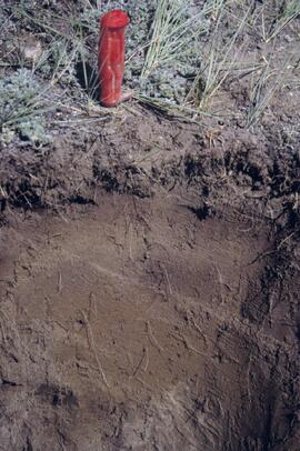
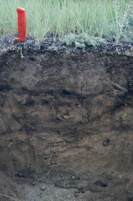
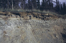
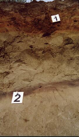
Site Description: good exposure of loess (35 cm) with Slims Soil over glaciofluvial terrace – pinches out downslope [note: this site was sampled because of development of buried paleosol, and was not part of biological crust study by Marsh et al. (2006)]
Sample Depths & Descriptions:
- Y03-08-01 - 45-48 cm - Ahkb (7.5YR 3/3 d; strongly effervescent)
- Y03-08-02 - 48-56 cm - Bmkb (7.5YR 4/3 d; strongly effervescent)
- Y03-08-03 - 56-70 cm - Ccab (2.5Y 5/2 d; strongly effervescent)
- (not sampled) - 70 cm+ - IICca (glaciofluvial; strongly effervescent)
- Intact sample: 56-36 cm - depth (including Slims Soil)
Print roll 5, #8-10, 17-18 (Corresponding slides: Slides roll 3, #13-11, 5-4)
Y03-09 (cliff top on E. shore of Kluane L. at Christmas Bay)
Date: August 12, 2003
Location Coordinates: 61° 4’ 0.0” N, 138° 22’ 35.3” W, 828.3 m asl (± 7.3 m)
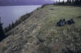
Site Description: ~ 60 cm loess over glaciofluvial gravels
Sample Depths & Descriptions:
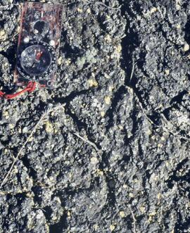
- Y03-09-01 - Nostoc crust
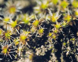
- Y03-09-02 - Tortula ruralis – Cetraria crust
- Y03-09-03 - 0-14 cm - ACk (10YR 3\2 d)
- Y03-09-04 - 14-16 cm - Ahkb1 (10YR 2/2 d)
- Y03-09-05 - 16-18 cm - Ck1 (10YR 4/3 d)
- Y03-09-06 - 18-20 cm - Ahkb2 (10YR 3/2 d; discontinuous)
- Y03-09-07 - 20-27 cm - Bmkb1 (10YR 4/3 d)
- Y03-09-08 - 27-33 cm - Bmkb2 (7.5YR 4/3 d)
- Y03-09-09 - 33-46 cm - Bmkb3 (10YR 4/3 d)
- Y03-09-10 - 46-55 cm - Ck2 (2.5Y 5/3 d)
- (not sampled) - 55-60 cm+ - IICk (glaciofluvial gravels)
Print roll 5, #11-15 (Corresponding slides: Slide roll 3, #10-6)
Y03-10 (shore bluff N. of Silver City)
Date: August 12, 2003
Location Coordinates: 61° 2’ 55.0” N, 138° 23’ 17.2” W, 806.7 m asl (± 7.3 m)
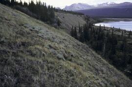
Site Description: 70% slope, SW aspect; vegetation: Elymus, Carex, Artemisia, Erigeron
Sample Depths & Descriptions:
- Y03-10-01 - Crust
- Y03-10-02 - 0-18 cm - ACk (10YR 4/2 m; strongly effervescent)
- Y03-10-03 - 18-25 cm - Ahkb(?) (10YR 4/2 m; strongly effervescent)
- Y03-10-04 - 25-40 cm - Ck (2.5Y 5/2.5 m; strongly effervescent)
- (not sampled) - 40 cm+ - IICk (glaciofluvial gravels; strongly effervescent)
Print roll 5, #19-22 (Corresponding slides: Slide roll 3, #3-1)
Silver City ghost town (location not recorded)
Date: August 12, 2003
Print roll 5, #23-24
Y03-11 (Silver City road section)
Date: August 12, 2003
Location Coordinates: 61° 2’ 3.6” N, 138° 22’ 48.8” W, 806.7 m asl (± 8.7 m)
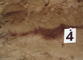
Site Description: roadcut through SW-facing hill exposes loess over glaciofluvial gravel, with 4 paleosols in colluviated loess
Sample Depths & Descriptions:
- Y03-11-01 - 0-18 cm - ACk (fresh loess)
- Y03-11-02 - 18-47 cm - Soil 1 – Bmk
- Y03-11-03 - 47-100 cm - Loess
- Y03-11-04 - 100-110 cm - Soil 2 – includes charcoal
- Y03-11-05 - 110-160 cm - Loess with secondary carbonate in root channel
- Y03-11-06 - 160-170 cm - Soil 3 – Ahk with charcoal
- Y03-11-07 - 160-170 cm - Soil 3 – Bmk
- Y03-11-08 - 170-198 cm - Loess with secondary carbonate in root channel
- Y03-11-09 - 198-202 cm - Soil 4 – Ahk – laterally continuous for ~ 1.5 m
- Y03-11-10 - 202-230 cm - Loess with secondary carbonates in roots
- Y03-11-11 - 230-255 cm - Soil 5 – Ahk – includes abundant charcoal bands
- Y03-11-12 - 230-255 cm - Soil 5 – Bmk – infilled squirrel burrows immediately below
- Y03-11-13 - 255-300 cm+ - Loess
Additional notes on modern soil & paleosols:
Soil 1 - consists of Bmk horizon material with 2 distinct colours: 7.5YR 4/3 d & 10YR 4/3 d
- loess between Soils 1 & 3 is sandier
Soil 2 - 90% Ahk material, 2-10 cm thick
- Ahk – 10YR 3/2 d
- Bmk – 7.5YR 4/2 d
- less abundant carbonate than in paleosols & loess below
Soil 3 - most of exposure has Ahk (2-5 cm thick) over Bmk (4-10 cm thick), with carbonates as for Soil 5
Soil 4 - mostly Ahk (10YR 3/2 d) material 2-8 cm thick, some Bmk (10YR 4/2 d) < 2 cm thick, with carbonates as for Soil 5
Soil 5 - complex intermixing of Ahk & Bmk material, charcoal most abundant in Ahk
- individual colour bands 2-10 cm thick
- overall dip of horizons (10° to W) is parallel to surface
- similar size & density of secondary carbonates as in loess above & below; associated with root channels, < 5 mm diameter, covering ~ 5% of surface
Print roll 5, #26-30 (Corresponding slides: Slide roll 4, #36-32)
Slide roll contains the following photographs:
Y03-06
Date: August 10, 2003
Location Coordinates: 61° 4’ 1.5” N, 138° 21’ 57.4” W, 825.3 m asl (± 9.5 m)
Site Description: top of slope, E aspect
Sample Depths & Descriptions:
- Y03-06-01 - Crust
- Y03-06-02 - 0-6 cm - Ahk (10YR 3/2 m; strongly effervescent)
- Y03-06-03 - 6-14 cm - Bmk (2.5Y 3/3 m; strongly effervescent)
- Y03-06-04 - 14 cm+ - IICk (strongly effervescent)
Slide roll 3 #36-35 (corresponding prints and negatives: Print roll 4, #1-2)
Y03-07 (peninsula near Kluane visitor centre, Sheep Mt.)
Date: August 11, 2003
Location Coordinates: 61° 1’ 42.8” N, 138° 29’ 36.2” W, 786.7 m asl (± 5.7 m)
Site Description:
- recent (?) landslide with loess accumulation in pockets, thinner on boulder surfaces, dominated by dark cyanobacteria crusts
- limited loess accumulation due to exposure of site
- crust is calcareous at surface
Sample Depths & Descriptions: - Y03-07-01 - Crust
- Y03-07-02 - 0-6 cm - Ck
- Y03-07-03 - 6-9 cm - Ahkb
- Y03-07-03 - 9 cm+ - Rock
Slide roll 3 #34-30 (corresponding prints and negatives: Print roll 4, #3-10)
Lower Slims River (lookout knoll at parking lot N of visitor centre)
Date: August 11, 2003
Location Coordinates: 60° 59’ 56.4” N, 138° 33’ 36.4” W, 844.8 m asl (± 7.3 m)
Site Description: some fire disturbance, but lower slopes have more intact crusts on loess (calcareous to surface)
Slide roll 3 #29-26 (corresponding prints and negatives: Print roll 4, #11-17)
Lower Slims R (lowest bench below lookout knoll)
Date: August 11, 2003
Location Coordinates: 60° 59’ 51.8” N, 138° 33’ 36.2” W, 814.3 m asl (± 7.9 m)
Site Description: not burned; good intact crust; vegetation: A. frigida, Calamogrostis purpurea, Erigeron caespitosus, Linnaea, Carex filifolia (sparse cover ~ 50%)
Slide roll 3, #25-23 (corresponding prints and negatives: Print roll 4, #18-20)
Slims Soil
(Holocene paleosol with well-developed B horizon under Neoglacial calcareous loess – location not recorded, but likely from roadcut exposure along main Slims R trail)
Slides roll 3, #22 (corresponding prints and negatives: Print roll 4, #21)
Lower end of Sheep Creek
Date: August 11, 2003
Misc. views of grassland vegetation and landscape (locations not recorded)
Slides roll 3, #21-18 (corresponding prints and negatives: Print roll 4, #26-33)
Overlook at lower end of Sheep Creek canyon
Date: August 11, 2003
Location Coordinates: 60° 59’ 42.2” N, 138° 34’ 38.1” W, 878.0 m asl (± 9.5 m)
Site Description: heavy use by sheep (abundant droppings) but still has ~ 50% crust coverage
Slides roll 3, #17-16 (corresponding prints and negatives: Print roll 4, #34-35)
Slims River delta
Date: August 11, 2003
(location not recorded)
Slides roll 3, #15-14: salt efflorescences (corresponding prints and negatives: Print roll 5, #1-3)
Y03-08 (Cultus Bay Rd. – at top of switchbacks)
Date: August 12, 2003
Location Coordinates: 61° 3’ 43.1” N, 138° 21’ 4.0” W, 833.8 m asl (± 5.1 m)
Site Description: good exposure of loess (35 cm) with Slims Soil over glaciofluvial terrace – pinches out downslope [note: this site was sampled because of development of buried paleosol, and was not part of biological crust study by Marsh et al. (2006)]
Sample Depths & Descriptions:
- Y03-08-01 - 45-48 cm - Ahkb (7.5YR 3/3 d; strongly effervescent)
- Y03-08-02 - 48-56 cm - Bmkb (7.5YR 4/3 d; strongly effervescent)
- Y03-08-03 - 56-70 cm - Ccab (2.5Y 5/2 d; strongly effervescent)
- (not sampled) - 70 cm+ - IICca (glaciofluvial; strongly effervescent)
- Intact sample: 56-36 cm - depth (including Slims Soil)
Slides roll 3, #13-11, 5-4 (corresponding prints and negatives: Print roll 5, #8-10, 17-18)
Y03-09 (cliff top on E. shore of Kluane L. at Christmas Bay)
Date: August 12, 2003
Location Coordinates: 61° 4’ 0.0” N, 138° 22’ 35.3” W, 828.3 m asl (± 7.3 m)
Site Description: ~ 60 cm loess over glaciofluvial gravels
Sample Depths & Descriptions:
- Y03-09-01 - Nostoc crust
- Y03-09-02 - Tortula ruralis – Cetraria crust
- Y03-09-03 - 0-14 cm - ACk (10YR 3\2 d)
- Y03-09-04 - 14-16 cm - Ahkb1 (10YR 2/2 d)
- Y03-09-05 - 16-18 cm - Ck1 (10YR 4/3 d)
- Y03-09-06 - 18-20 cm - Ahkb2 (10YR 3/2 d; discontinuous)
- Y03-09-07 - 20-27 cm - Bmkb1 (10YR 4/3 d)
- Y03-09-08 - 27-33 cm - Bmkb2 (7.5YR 4/3 d)
- Y03-09-09 - 33-46 cm - Bmkb3 (10YR 4/3 d)
- Y03-09-10 - 46-55 cm - Ck2 (2.5Y 5/3 d)
- (not sampled) - 55-60 cm+ - IICk (glaciofluvial gravels)
Slide roll 3, #10-6 (corresponding prints and negatives: Print roll 5, #11-15)
Y03-10 (shore bluff N. of Silver City)
Date: August 12, 2003
Location Coordinates: 61° 2’ 55.0” N, 138° 23’ 17.2” W, 806.7 m asl (± 7.3 m)
Site Description: 70% slope, SW aspect; vegetation: Elymus, Carex, Artemisia, Erigeron
Sample Depths & Descriptions:
- Y03-10-01 - Crust
- Y03-10-02 - 0-18 cm - ACk (10YR 4/2 m; strongly effervescent)
- Y03-10-03 - 18-25 cm - Ahkb(?) (10YR 4/2 m; strongly effervescent)
- Y03-10-04 - 25-40 cm - Ck (2.5Y 5/2.5 m; strongly effervescent)
- (not sampled) - 40 cm+ - IICk (glaciofluvial gravels; strongly effervescent)
Slide roll 3, #3-1 (corresponding prints and negatives: Print roll 5, #19-22)
