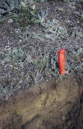
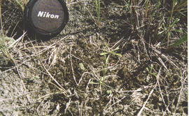
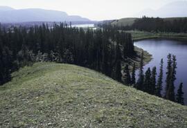
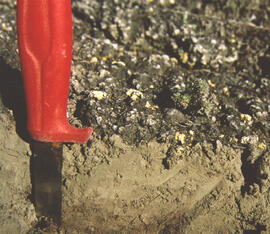
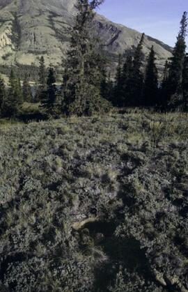
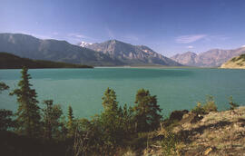
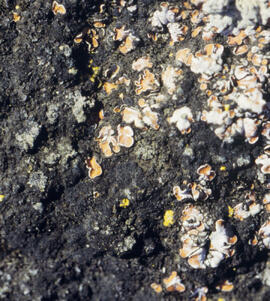
File consists of Kluane Lake photographs from 2003 in digital format.
Slide roll contains the following photographs:
Cultus Bay / Rat Lake
Date: August 10, 2003
Location Coordinates: 61° 09’ 57.1” N, 138° 25’ 25.5” W, 806 m asl (± 6.2 m)
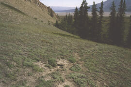
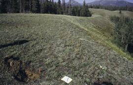
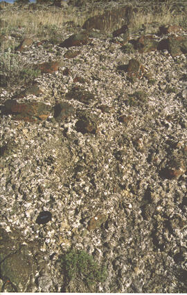
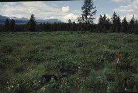
Slides #17-15: Rat Lake area (corresponding prints and negatives: Print roll 3, #13A-16A)
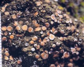
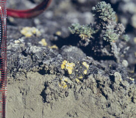
Slides #14-13: Collema & Psora crusts on exposed ridge on coarser substrate where loess has blown off (Corresponding prints and negatives: Print roll 3, #17A-19A)
Y03-03 (Rat Lake)
Date: August 10, 2003
Location Coordinates: 61° 10’ 3.5” N, 138° 25’ 37.2” W, 798.3 m asl (± 13.0 m)
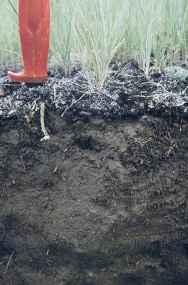
Site Description: SW aspect, 45% slope; vegetation: Carex filifolia, A. frigida, Elymus trachycaulis
Sample Depths & Descriptions:
- Y03-03-01 - Crust
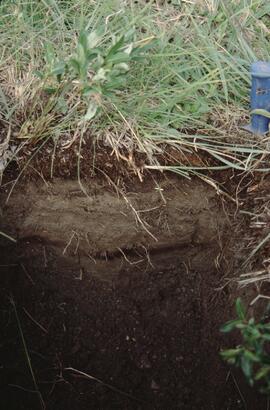
- Y03-03-02 - 0-9 cm - Ahk (10YR 4/2 m; weak-moderate, fine granular)
- Y03-03-03 - 9-53 cm+ - Ck (2.5Y 6/3 m; massive)
Slides #12-10 (corresponding prints and negatives: Print roll 3, #20A-22A)
Y03-04 (Rat Lake)
Date: August 10, 2003
Location Coordinates: 61° 10’ 10.5” N, 138° 26’ 3.7” W, 800.2 m asl (± 8.7 m)
Site Description: S aspect, 40% slope; vegetation: Elymus, Artemisia, flax, Penstemon, Linum lewisii
Sample Depths & Descriptions:
- Y03-04-01 - Crust
- Y03-04-02 - 0-6 cm - Ck (strongly effervescent)
- Y03-04-03 - 6-16 cm - Ahkb
- Y03-04-04 -16-75 cm+ - Ck (strongly effervescent; includes Bmk pockets)
Slides #9-7 (corresponding prints and negatives: Print roll 3, #25A-28A)
Y03-05 (SE of Rat Lake)
Date: August 10, 2003
Location Coordinates: 61° 9’ 43.2” N, 138° 25’ 34.8” W, 811.5 m asl (± 8.9 m)
Site Description: upper slope / crest; recent local sandy eolian veneer over older loess; vegetation: Carex, Elymus, Poa, Erigeron
Sample Depths & Descriptions:
- Y03-05-01 - Crust
- Y03-05-02 - 0-5 cm - Ahk
- Y03-05-03 - 5-19 cm - Ck1
- Y03-05-04 - 19-31 cm - Ahkb (siltier)
- Y03-05-05 - 31-50 cm+ - Ck2
Slides #6-1 (corresponding prints and negatives: Print roll 3, #34A-#E)
Slide roll contains the following photographs:
Y03-11 (Silver City road section)
Date: August 12, 2003
Location Coordinates: 61° 2’ 3.6” N, 138° 22’ 48.8” W, 806.7 m asl (± 8.7 m)
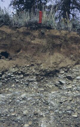
Site Description: roadcut through SW-facing hill exposes loess over glaciofluvial gravel, with 4 paleosols in colluviated loess
Sample Depths & Descriptions:
- Y03-11-01 - 0-18 cm - ACk (fresh loess)
- Y03-11-02 - 18-47 cm - Soil 1 – Bmk
- Y03-11-03 - 47-100 cm - Loess
- Y03-11-04 - 100-110 cm - Soil 2 – includes charcoal
- Y03-11-05 - 110-160 cm - Loess with secondary carbonate in root channel
- Y03-11-06 - 160-170 cm - Soil 3 – Ahk with charcoal
- Y03-11-07 - 160-170 cm - Soil 3 – Bmk
- Y03-11-08 - 170-198 cm - Loess with secondary carbonate in root channel
- Y03-11-09 - 198-202 cm - Soil 4 – Ahk – laterally continuous for ~ 1.5 m
- Y03-11-10 - 202-230 cm - Loess with secondary carbonates in roots
- Y03-11-11 - 230-255 cm - Soil 5 – Ahk – includes abundant charcoal bands
- Y03-11-12 - 230-255 cm - Soil 5 – Bmk – infilled squirrel burrows immediately below
- Y03-11-13 - 255-300 cm+ - Loess
Additional notes on modern soil & paleosols:
Soil 1 - consists of Bmk horizon material with 2 distinct colours: 7.5YR 4/3 d & 10YR 4/3 d
- loess between Soils 1 & 3 is sandier
Soil 2 - 90% Ahk material, 2-10 cm thick
- Ahk – 10YR 3/2 d
- Bmk – 7.5YR 4/2 d
- less abundant carbonate than in paleosols & loess below
Soil 3 - most of exposure has Ahk (2-5 cm thick) over Bmk (4-10 cm thick), with carbonates as for Soil 5
Soil 4 - mostly Ahk (10YR 3/2 d) material 2-8 cm thick, some Bmk (10YR 4/2 d) < 2 cm thick, with carbonates as for Soil 5
Soil 5 - complex intermixing of Ahk & Bmk material, charcoal most abundant in Ahk
- individual colour bands 2-10 cm thick
- overall dip of horizons (10° to W) is parallel to surface
- similar size & density of secondary carbonates as in loess above & below; associated with root channels, < 5 mm diameter, covering ~ 5% of surface
Slide roll 4, #36-32 (corresponding prints and negatives: Print roll 5, #26-30)
Y03-12 (island off Slims River delta)
Date: August 13, 2003
Location Coordinates: 61° 1’ 9.1” N, 138° 29’ 27.9” W, 819 m asl (± 6.0 m)
Site Description: good grassland development on undulating aeolian veneer over bedrock, SW aspect; vegetation: A. frigida, C. purpurescens, P. glauca, Erigeron, Plantago, Oxytropis; good crust cover, mossy on more northerly aspects
Sample Depths & Descriptions:
- Y03-12-01 - Crust
- Y03-12-02 - 0-10 cm - ACk
Slide roll 4, #31-10 (miscellaneous site views of Y03-12 & Slims R delta island)
This file contains the following photographs in both print photograph and negative format:
Slims River delta
Date: August 10, 2003
Location Coordinates: 61° 00’ 16.5” N, 138° 30’ 45.6” W, 790 m asl (± 11.0 m)
Print roll 3, #5A-6A: delta surface with salt efflorescences (Deschampsia caespitosa, Puchinella nuttalli, Aster siberica, Triglauca palustre); Juncus & Ranunculus on more active surface near river.
7A-9A: moister Deschampsia site, polygonal cracking patterns (W side of highway)
10A-12A: closeups of efflorescences
Cultus Bay / Rat Lake
Date: August 10, 2003
Location Coordinates: 61° 09’ 57.1” N, 138° 25’ 25.5” W, 806 m asl (± 6.2 m)
Slides #17-15: Rat Lake area (corresponding prints and negatives: Print roll 3, #13A-16A)
Print roll 3, #17A-19A: Collema & Psora crusts on exposed ridge on coarser substrate where loess has blown off (Corresponding slides: Slide Roll 2 #14-13)
Y03-03 (Rat Lake)
Date: August 10, 2003
Location Coordinates: 61° 10’ 3.5” N, 138° 25’ 37.2” W, 798.3 m asl (± 13.0 m)
Site Description: SW aspect, 45% slope; vegetation: Carex filifolia, A. frigida, Elymus trachycaulis
Sample Depths & Descriptions:
- Y03-03-01 - Crust
- Y03-03-02 - 0-9 cm - Ahk (10YR 4/2 m; weak-moderate, fine granular)
- Y03-03-03 - 9-53 cm+ - Ck (2.5Y 6/3 m; massive)
Print roll 3, #20A-22A (Corresponding slides: Slide Roll 2: #12-10)
Y03-04 (Rat Lake)
Date: August 10, 2003
Location Coordinates: 61° 10’ 10.5” N, 138° 26’ 3.7” W, 800.2 m asl (± 8.7 m)
Site Description: S aspect, 40% slope; vegetation: Elymus, Artemisia, flax, Penstemon, Linum lewisii
Sample Depths & Descriptions:
- Y03-04-01 - Crust
- Y03-04-02 - 0-6 cm - Ck (strongly effervescent)
- Y03-04-03 - 6-16 cm - Ahkb
- Y03-04-04 -16-75 cm+ - Ck (strongly effervescent; includes Bmk pockets)
Print roll 3, #25A-28A (Corresponding Slides: Slide Roll 2: #9-7)
Y03-05 (SE of Rat Lake)
Date: August 10, 2003
Location Coordinates: 61° 9’ 43.2” N, 138° 25’ 34.8” W, 811.5 m asl (± 8.9 m)
Site Description: upper slope / crest; recent local sandy eolian veneer over older loess; vegetation: Carex, Elymus, Poa, Erigeron
Sample Depths & Descriptions:
- Y03-05-01 - Crust
- Y03-05-02 - 0-5 cm - Ahk
- Y03-05-03 - 5-19 cm - Ck1
- Y03-05-04 - 19-31 cm - Ahkb (siltier)
- Y03-05-05 - 31-50 cm+ - Ck2
Print roll 3, #34A-#E (Corresponding Slides: Slide Roll 2: Slides #6-1)
This file contains the following photographs in both print photograph and negative format:
Y03-06
Date: August 10, 2003
Location Coordinates: 61° 4’ 1.5” N, 138° 21’ 57.4” W, 825.3 m asl (± 9.5 m)
Site Description: top of slope, E aspect
Sample Depths & Descriptions:
- Y03-06-01 - Crust
- Y03-06-02 - 0-6 cm - Ahk (10YR 3/2 m; strongly effervescent)
- Y03-06-03 - 6-14 cm - Bmk (2.5Y 3/3 m; strongly effervescent)
- Y03-06-04 - 14 cm+ - IICk (strongly effervescent)
Print roll 4, #1-2 (Corresponding slides: Slide roll 3 #36-35)
Y03-07 (peninsula near Kluane visitor centre, Sheep Mt.)
Date: August 11, 2003
Location Coordinates: 61° 1’ 42.8” N, 138° 29’ 36.2” W, 786.7 m asl (± 5.7 m)
Site Description:
- recent (?) landslide with loess accumulation in pockets, thinner on boulder surfaces, dominated by dark cyanobacteria crusts
- limited loess accumulation due to exposure of site
- crust is calcareous at surface
Sample Depths & Descriptions: - Y03-07-01 - Crust
- Y03-07-02 - 0-6 cm - Ck
- Y03-07-03 - 6-9 cm - Ahkb
- Y03-07-03 - 9 cm+ - Rock
Print roll 4, #3-10 (Corresponding slides: Slide roll 3 #34-30)
Lower Slims River (lookout knoll at parking lot N of visitor centre)
Date: August 11, 2003
Location Coordinates: 60° 59’ 56.4” N, 138° 33’ 36.4” W, 844.8 m asl (± 7.3 m)
Site Description: some fire disturbance, but lower slopes have more intact crusts on loess (calcareous to surface)
Print roll 4, #11-17 (Corresponding slides: Slide roll 3 #29-26)
Lower Slims R (lowest bench below lookout knoll)
Date: August 11, 2003
Location Coordinates: 60° 59’ 51.8” N, 138° 33’ 36.2” W, 814.3 m asl (± 7.9 m)
Site Description: not burned; good intact crust; vegetation: A. frigida, Calamogrostis purpurea, Erigeron caespitosus, Linnaea, Carex filifolia (sparse cover ~ 50%)
Print roll 4, #18-20 (Corresponding slides: Slide roll 3, #25-23)
Slims Soil
(Holocene paleosol with well-developed B horizon under Neoglacial calcareous loess – location not recorded, but likely from roadcut exposure along main Slims R trail)
Print roll 4, #21 (Corresponding slides: Slides roll 3, #22)
S-facing opening above main trail
Date: August 11, 2003
Location Coordinates: 60° 59’ 53.1” N, 138° 34’ 9.0” W, 822.9 m asl (± 15.0 m)
Site Description:
- Nostoc crust, also with Collema
- calcareous to surface
- site has later successional stage, with Arctostaphylos & Juniperus starting to move in
Print roll 4, # 22-25
Lower end of Sheep Creek
Date: August 11, 2003
Misc. views of grassland vegetation and landscape (locations not recorded)
Print roll 4, #26-33 (Corresponding slides: Slides roll 3, #21-18)
Overlook at lower end of Sheep Creek canyon
Date: August 11, 2003
Location Coordinates: 60° 59’ 42.2” N, 138° 34’ 38.1” W, 878.0 m asl (± 9.5 m)
Site Description: heavy use by sheep (abundant droppings) but still has ~ 50% crust coverage
Print roll 4, #34-35 (Corresponding slides: Slides roll 3, #17-16)
Downvalley view toward Slims R delta, near Sheep Creek (?)
Date: August 11, 2003
(location not recorded)
Print roll 4, #36-E
Unpublished results for the Sulphur stable isotope tracer study (E.P. 886.15) were presented in annual reports to the funding agencies, including this FRBC 2001 Preliminary Final Report from April 2002.
This 2002 Sanborn & Grilz phytolith report to the M-K Trust Fund presents research results, compiles data, and includes site descriptions and photographs.
This document file "Cluculz Creek Fertilization Research Site.pdf" contains a field description and basic characterization data for a representative pedon at the E.P. 886.10 site.
Data sets associated with the Cluculz retrospective study (E.P. 886.10):
- 082036.xls -- Elemental analysis (XRF) for mineral horizon samples from profile at Cluculz EP 886.10 site
- CLUCINC.xls -- Summary chemical properties for composite samples in aerobic incubation
- Cluculz Ck 2002 Foliar Analysis.xls -- Analyzed for individual single-tree plots
- Cluculz Ck 2002 Forest Floor.xls -- Forest floor mass data
- Cluculz composite list (2003 samples).xls -- Composite groups (3 original samples in each) used for organic & mineral soils
- Cluculz composite list (incubation experiment).xls -- Composite groups (3 original samples in each) used for organic & mineral soils
- Cluculz composite list for incubations (2003 samples).xls -- Composite groups (3 original samples in each) used for organic & mineral soils
- Cluculz Creek S mineralization - initial fractions (2).xls -- S fractions - organic & mineral soil composites
- Cluculz Creek S mineralization - initial S fractions.xls -- S fractions - organic & mineral soil composites
- Cluculz Creek S mineralization (IC).xls -- S mineralization data for aerobic incubation - organic & mineral soils
- Cluculz foliar and soil data.xls -- Chemical properties of foliage, composite forest floors, composite mineral soils
- Cluculz pH.xls -- pH - organic & mineral soil composites
- Cluculz S fraction graphs.xls -- S fractions - organic & mineral soil composites
- Elemental Analysis of Standard by XRF (2005).xls -- Published & XRF analysis of CANMET TILL-1 soil standard (used in Cluculz XRF analysis)
During Dr. Sanborn's years with the Ministry of Forests research program (1991-2002), he worked on forest fertilization research with silviculturist Rob Brockley (retired; formerly at Kalamalka Research Station, Vernon, BC). Brockley’s work in the 1980s and early 1990s had documented the widespread pattern of sulphur deficiencies across the BC interior, and the superior response of managed stands to fertilization treatments involving sulphur (S) and nitrogen (N) rather than nitrogen alone.
To progress farther, different methods for understanding the fate of sulphur fertilizers in forests and soils were needed. Sanborn contacted the stable isotope group at the University of Calgary which had done important work on the fate of pollutant sulphur emitted by oil and gas extraction and processing in Alberta, using natural abundances of sulphur stable isotopes as a tracer. This was the beginning of a collaboration with Dr. Bernhard Mayer of the University of Calgary, and also with his German soil scientist colleague, Dr. Joerg Prietzel (Munich Technical University).
The research team engaged in the Cluculz retrospective study (E.P. 886.10) for the BC Ministry of Forests.
An ancillary project involved resampling (2002 - foliage, 2003 - soil) of a previously fertilized (1990) installation (E.P. 886.10) south of Cluculz Lake in order to compare the longer-term effects of different fertilizer sulphur forms on soil and foliage chemical properties. Results were published as a journal article and a Ministry of Forests Extension Note:
Sanborn, P.T., J. Prietzel, R.P. Brockley. 2005. Soil and lodgepole pine foliar responses to two fertilizer sulphur forms in the Sub-Boreal Spruce zone, central interior British Columbia. Can. J. For. Res. 35 (10): 2316-2322. https://cdnsciencepub.com/doi/abs/10.1139/x05-138
Sanborn, P. and R. Brockley. 2005. Sulphur deficiencies in lodgepole pine: occurrence, diagnosis, and treatment. Ext. Note 71. B.C. Min. For., Res. Br., Victoria, B.C. https://www.for.gov.bc.ca/hfd/pubs/docs/en/En71.pdf
File consists of reports and documents relating to British Columbia grasslands.
Includes the following items:
B.A. Blackwell & Associates Ltd. 2007. Cariboo-Chilcotin ecosystem restoration plan: grassland benchmark.
Cariboo-Chilcotin Grasslands Strategy Working Group. 2001. Cariboo-Chilcotin grasslands strategy: forest encroachment onto grasslands and establishment of a grassland benchmark area. Prepared for Cariboo-Mid Coast Interagency Management Committee.
Grasslands Conservation Council of British Columbia. 2003. Changes in the grassland-forest interface: A BC grasslands conservation risk assessment communication tool.
Ross, T.J. 2008. Becher Prairie range unit ecosystem restoration strategic plan. Prepared for British Columbia Ministry of Forests and Range Central Cariboo Forest District.
This born-digital "Lucille Mountain soils" document provides a description and basic data for the Lucille Mt. pedon.
Document prepared by P. Grilz contains species lists and UTM coordinates for 10 sampling locations for the M-K-2001-2002-81 Seed Project.
File contains the following data sets:
- Phytolith contents.xls [phytolith content in 5-20 µm silt, tallied by morphological categories; also summarized as % of total soil fine (< 2 mm) fraction]
- M-K (2001) soil LOI data.pdf [LOI (loss-on-ignition) data for sampled soil horizons – proxy measurement for organic matter content]
With support from the Muskwa-Kechika Trust Fund as a Seed Grant, Dr. Paul Sanborn carried out a pilot study of soils in relation to prescribed burning in the Northern Rocky Mountains, in collaboration with Perry Grilz, then a Range Officer in the Ministry of Forests. Sanborn and Grilz conducted 3 days of field work in July 2001. Sanborn wanted to test the utility of plant-derived opal (phytoliths) as a soil indicator of vegetation history, in the hope of distinguishing natural grasslands from those created by anthropogenic burning.
Map depicts range reference area exclosure locations for livestock and wildlife in the Fort St. John Forest District.
Document is a BC Ministry of Forests update on proposed research for the Sulphur stable isotope tracer study (E.P. 886.15) from March 1998.
The Sulphur stable isotope tracer study (E.P. 886.15) field experiment was installed in young lodgepole pine stands at two sites in the Prince George Forest Region in 2001, with fertilizer treatments applied in late 2002. These sites are designated as Kenneth Creek (east of Prince George) and Holy Cross (south of Fraser Lake). (The Kenneth Creek installation was established near plots of the older E.P. 886.13 in the same stand.) Full experimental details, including pretreatment soil and foliar date, were given in:
Sanborn, P., R.P. Brockley, B. Mayer, M. Yun, J. Prietzel. 2005. Sulphur fertilization of lodgepole pine: a stable isotope tracer study (E.P. 886.15): Establishment report. Tech. Rep. 020. B.C. Min. For., Res. Br., Victoria, BC. http://www.for.gov.bc.ca/hfd/pubs/Docs/Tr/Tr020.htm
The Kenneth Creek site was attacked by mountain pine beetle in 2006, resulting in at least 80% tree mortality. In 2013, the stand was levelled in order to enable replanting, and due to poor communications within the Ministry of Forests, the opportunity to salvage this installation was lost. The Holy Cross site was hit by a wildfire in 2010, and most of the research plots were destroyed.
Preliminary results from foliar analysis, sufficient to demonstrate that our stable isotope tracer approach could detect fertilizer uptake, were published in:
Sanborn, P.T., R.P. Brockley, and B. Mayer. 2011. Stable isotope tracing of fertilizer uptake by lodgepole pine: foliar responses. Can. J. For. Res. 41: 493-500. https://cdnsciencepub.com/doi/full/10.1139/X10-222
This "Soil Profile Description: Kiskatinaw LTSP Site" document provides a description of Kiskatinaw pedon.
The key results from the regional soil mineralogy study were later published as:
J.M. Arocena and P. Sanborn. 1999. Mineralogy and genesis of selected soils and their implications for forest management in central and northeastern British Columbia. Canadian Journal of Soil Science 79: 571-592. https://doi.org/10.4141/S98-07
File consists of miscellaneous reports relating to forests and silviculture.
This digital document is a born-digital PDF containing details of forest floor sample collection & handling for the EP 660 Buckhorn Ridge installation.
EP 660 was a conventional silvicultural trial established in 1967 which involved single species plantings of lodgepole pine (Pl), white spruce (Sw), and Douglas-fir (Fd) at different spacings. Three installations were established in the Prince George - Vanderhoof area: Buckhorn Ridge, Bobtail Road, and Chilco Creek.
General details on EP 660 are given by:
Coopersmith, D., M. McLellan, and J. Stork. 1997a. Experimental Project 660 overview of three experimental installations – a 30-year progress report. B.C. Min. For., Prince George For. Reg., Res. Note #PG-12.
Details on the Buckhorn installation are given by:
Coopersmith, D., M. McLellan, and J. Stork. 1997b. Experimental Project 660 30-year progress report: Buckhorn Installation. B.C. Min. For., Prince George For. Reg., Res. Note #PG-12-1.
This digital document is a scanned PDF of a Prince George Forest Region Forest Research Note #PG-12: "Experimental Project 660 - Overview of Three Experimental Installations - A 30-year Progress Report".
File contains 8 slides from 2 rolls, taken August 1997:
Roll 1 - Buckhorn Ridge:
- Slide 31 – Fd (2 x 2 m) – stand view
- Slide 32 – Fd (2 x 2 m) – forest floor view
- Slide 33 – Pl (2x 2 m) – stand view
- Slide 34 – Pl (2 x 2 m) – forest floor view
Roll 2 – Bobtail Road: - Slide 20 – Pl (2 x 2 m) – east plot, stand view
- Slide 21 – Pl (2 x 2 m) – east plot, stand view
- Slide 22 – Fd (2 x 2 m) – east plot, stand view
- Slide 23 – Sw (2 x 2 m) – stand view
This paper by Brad Hawkes describes, from a newspaper media's perspective, changes in how fires were fought, reported, and described from 1912-1961 for significant fire years in the Prince George area.
Sans titreThis Ministry of Forests internal memorandum of 30 June 1997 from Paul Sanborn to Regional & Research Branch soil scientists provides comparison of Morgan's extractant and BaCl₂ for cations, using the 57 samples from the regional soil mineralogy study.
The key results from the study were later published as:
J.M. Arocena and P. Sanborn. 1999. Mineralogy and genesis of selected soils and their implications for forest management in central and northeastern British Columbia. Canadian Journal of Soil Science 79: 571-592. https://doi.org/10.4141/S98-07
This digital document is a scanned PDF of a Prince George Forest Region Forest Research Note #PG-12-1: "Experimental Project 660 - 30-year Progress Report - Buckhorn Installation".
File contains the following data sets:
- S300FINL.XLS [Ministry of Forests lab data report: non-woody forest floor components]
- S301FINL.XLS [Ministry of Forests lab data report: woody forest floor components]
- 660FF97.xls [non-woody and woody forest floor components: mass / unit area (corrected to oven-dry basis)]
- BUCKLIST.xls [table showing internal sample numbers corresponding to lab sample numbers used in MoF lab reports]
"Mineralogy of clay and sand fractions of soils developed from till, glaciofluvial and glaciolacustrine deposits in central interior British Columbia" was a preliminary internal report that provides some background to Arocena and Sanborn's regional soil mineralogy study, as well as a compilation of the mineralogical data.
The key results from this work were later published as:
J.M. Arocena and P. Sanborn. 1999. Mineralogy and genesis of selected soils and their implications for forest management in central and northeastern British Columbia. Canadian Journal of Soil Science 79: 571-592. https://doi.org/10.4141/S98-07
Data sets associated with the Arocena & Sanborn 1999 regional soil mineralogy study:
- S234FINL.XLS [data report for mineral horizons from MoF Analytical Chemistry Laboratory, June 20 1996]
- S235FINL.XLS [data report for organic horizons from MoF Analytical Chemistry Laboratory, June 20 1996]
- SAMPLIST.XLS [conversion table for sample numbers used in MoF lab data reports]
- Fe Al extractions.xlsx [assembled from lab data report by L. Arocena for oxalate & dithionite extractions; pyrophosphate extraction data from MoF lab]
- MINSTUDY.XLS [consolidated lab data for organic & mineral horizons, except for BaCl2 exchangeable cations]
- MINCEC.XLS [BaCl2 exchangeable cations & Morgan’s extraction for organic & mineral horizons]
This born-digital "Profile Descriptions" document provides descriptions of Williams Lake (Skulow Lake), Aleza 1 & 2, Log Lake, and Lucille Mountain pedons.
